
Maryland Route 638
Encyclopedia
Maryland Route 638 is a state highway
in the U.S. state
of Maryland
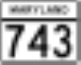
. Known as Parkersburg Road, the state highway runs 2.34 miles (3.8 km) from MD 743
in Eckhart Mines
north to MD 36
near Mount Savage
in northwestern Allegany County
. MD 638 was constructed in the late 1930s.
MD 743 (Old National Pike) in Eckhart Mines. The state highway crosses Porter Run on a narrow bridge before meeting U.S. Route 40 Alternate (National Pike). MD 638 continues north as a two-lane road and ascends the side of Federal Hill. At Porter Cemetery Hill, the state highway turns northwest and descends into the valley of Jennings Run
. MD 638 passes through two sharp S-curves on either side of a 15 feet (4.6 m) wide bridge over the Western Maryland Scenic Railroad
. The state highway reaches its northern terminus at MD 36 (Mount Savage Road) between Mount Savage and Zihlman
near the hamlets of Morantown and Slabtown.
.
{| class=wikitable
!Location
!Mile
!Destinations
!Notes
|-
|rowspan=2|Eckhart Mines
|0.00
|
|Southern terminus; MD 743 is unsigned
|-
|0.21
|
|
|-
|
|2.34
|
|Northern terminus
State highway
State highway, state road or state route can refer to one of three related concepts, two of them related to a state or provincial government in a country that is divided into states or provinces :#A...
in the U.S. state
U.S. state
A U.S. state is any one of the 50 federated states of the United States of America that share sovereignty with the federal government. Because of this shared sovereignty, an American is a citizen both of the federal entity and of his or her state of domicile. Four states use the official title of...
of Maryland
Maryland
Maryland is a U.S. state located in the Mid Atlantic region of the United States, bordering Virginia, West Virginia, and the District of Columbia to its south and west; Pennsylvania to its north; and Delaware to its east...
. Known as Parkersburg Road, the state highway runs 2.34 miles (3.8 km) from MD 743
Maryland Route 743
Maryland Route 743 is a state highway in the U.S. state of Maryland. The state highway runs from MD 36 in Frostburg east to U.S. Route 40 Alternate in Eckhart Mines. MD 743 is the original alignment of US 40 through Eckhart Mines...
in Eckhart Mines
Eckhart Mines, Maryland
Eckhart Mines is an unincorporated town in Allegany County, Maryland, USA. Eckhart Mines lies at the southwestern base of Federal Hill, 2.9 km east of Frostburg and 1.3 km northwest of Clarysville. The town was originally founded as a company town for the nearby Eckhart Mines. The...
north to MD 36
Maryland Route 36
Maryland Route 36 is a state highway located in Allegany County, Maryland, United States. MD 36's southern terminus is at the WV 46 bridge in Westernport and its northern terminus at U.S. Route 40 Alternate near Cumberland...
near Mount Savage
Mount Savage, Maryland
Mount Savage is an unincorporated community in Allegany County, Maryland, United States. A small blue-collar community, Mount Savage lies at the base of Big Savage Mountain in the Allegheny Mountains, between the cities of Frostburg and Cumberland...
in northwestern Allegany County
Allegany County, Maryland
Allegany County is a county located in the northwestern part of the US state of Maryland. It is part of the Cumberland, MD-WV Metropolitan Statistical Area. As of 2010, the population was 75,087. Its county seat is Cumberland...
. MD 638 was constructed in the late 1930s.
Route description
MD 638 begins at an oblique intersection with unsignedUnsigned highway
An unsigned highway is a highway that has been assigned a route number, but does not bear conventional road markings that would normally be used to identify the route with that number...
MD 743 (Old National Pike) in Eckhart Mines. The state highway crosses Porter Run on a narrow bridge before meeting U.S. Route 40 Alternate (National Pike). MD 638 continues north as a two-lane road and ascends the side of Federal Hill. At Porter Cemetery Hill, the state highway turns northwest and descends into the valley of Jennings Run
Jennings Run
Jennings Run & Jennings Run are Maryland tributaries to Three Forks Run & Wills Creek , respectively....
. MD 638 passes through two sharp S-curves on either side of a 15 feet (4.6 m) wide bridge over the Western Maryland Scenic Railroad
Western Maryland Scenic Railroad
The Western Maryland Scenic Railroad is a heritage railroad based in Cumberland, Maryland. It operates over ex-Western Maryland Railway trackage to Frostburg, Maryland and back using both steam and diesel locomotives....
. The state highway reaches its northern terminus at MD 36 (Mount Savage Road) between Mount Savage and Zihlman
Zihlman, Maryland
Zihlman is an unincorporated community in Allegany County, Maryland, United States....
near the hamlets of Morantown and Slabtown.
Junction list
The entire route is in Allegany CountyAllegany County, Maryland
Allegany County is a county located in the northwestern part of the US state of Maryland. It is part of the Cumberland, MD-WV Metropolitan Statistical Area. As of 2010, the population was 75,087. Its county seat is Cumberland...
.
{| class=wikitable
!Location
!Mile
!Destinations
!Notes
|-
|rowspan=2|Eckhart Mines
Eckhart Mines, Maryland
Eckhart Mines is an unincorporated town in Allegany County, Maryland, USA. Eckhart Mines lies at the southwestern base of Federal Hill, 2.9 km east of Frostburg and 1.3 km northwest of Clarysville. The town was originally founded as a company town for the nearby Eckhart Mines. The...
|0.00
|
|Southern terminus; MD 743 is unsigned
|-
|0.21
|
|
|-
|
|2.34
|
|Northern terminus