
Maryland Route 552
Encyclopedia
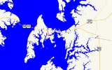
Maryland Route 552 is a state highway
in the U.S. state
of Maryland
. The state highway runs 2.2 mi (3.5 km) from Dominion north to U.S. Route 50
and US 301
in Chester
. MD 552 was constructed south of Maryland Route 18
(MD 18) in the early 1930s. The state highway was extended north to US 50 and US 301 in the early 1990s.
interchange with US 50 / US 301 (Blue Star Memorial Highway) at Exit 39B.
.
{|class=wikitable
!Location
!Mile
!Destinations
!Notes
|-
|rowspan=2|Dominion
|0.00
|Little Creek Road south
|Southern terminus
|-
|0.34
|Parson Island Road
|MD 552 turns north at this intersection
|-
|rowspan=2|Chester
|2.11
|
|Officially MD 18B
|-
|2.20
|
|Northern terminus; right-in/right-out interchange with eastbound US 50 / US 301
0.08 mile (0.1287472 km) along the same line as MD 552 on the north side of US 50 and US 301. The state highway runs from a right-in/right-out interchange with westbound US 50 / US 301 at Exit 39B north to Piney Creek Road, which is unsigned MD 18T west of the intersection to the signed mainline of MD 18.
State highway
State highway, state road or state route can refer to one of three related concepts, two of them related to a state or provincial government in a country that is divided into states or provinces :#A...
in the U.S. state
U.S. state
A U.S. state is any one of the 50 federated states of the United States of America that share sovereignty with the federal government. Because of this shared sovereignty, an American is a citizen both of the federal entity and of his or her state of domicile. Four states use the official title of...
of Maryland
Maryland
Maryland is a U.S. state located in the Mid Atlantic region of the United States, bordering Virginia, West Virginia, and the District of Columbia to its south and west; Pennsylvania to its north; and Delaware to its east...
. The state highway runs 2.2 mi (3.5 km) from Dominion north to U.S. Route 50
U.S. Route 50 in Maryland
U.S. Route 50 is a major east–west route of the U.S. Highway system, stretching just over from Ocean City, Maryland on the Atlantic Ocean to West Sacramento, California. In the U.S. state of Maryland, US 50 exists in two sections. The longer of these serves as a major route connecting...
and US 301
U.S. Route 301 in Maryland
U.S. Route 301 in Maryland is a major highway that runs from Delaware to the Governor Harry W. Nice Memorial Bridge into Virginia. It passes through three of Maryland's four main regions: the Eastern Shore, the Baltimore-Washington Metropolitan Area, and Southern Maryland...
in Chester
Chester, Maryland
Chester is a census-designated place on Kent Island in Queen Anne's County, Maryland, United States. The population was 3,723 at the 2000 census.-Geography:Chester is located at ....
. MD 552 was constructed south of Maryland Route 18
Maryland Route 18
Maryland Route 18 is a state highway in the U.S. state of Maryland. The state highway runs from the beginning of state maintenance at Love Point east to MD 213 in Centreville...
(MD 18) in the early 1930s. The state highway was extended north to US 50 and US 301 in the early 1990s.
Route description
MD 552 begins at a point between First Street and Church Street in the unincorporated village of Dominion. The highway continues south as county-maintained Little Creek Road. MD 552 heads east to an intersection with Parson Island Road, where the state highway turns north. The state highway passes through farmland and becomes lined with residences as it approaches an intersection with MD 18 (Main Street) in Chester. MD 552 continues a short distance between shopping centers to its northern terminus at a right-in/right-outRight-in/right-out
Right-in/right-out and left-in/left-out refer to a type of road intersection where turning movements of vehicles are restricted. A RIRO permits only right turns and a LILO permits only left turns. RIRO is usual where vehicles drive on the right, and LILO is usual where vehicles drive on the left...
interchange with US 50 / US 301 (Blue Star Memorial Highway) at Exit 39B.
History
MD 552 was paved starting from MD 18 toward Dominion in two sections that opened in 1933 and 1935, respectively. MD 552 was extended north to connect with the ramps for Exit 39B of US 50 and US 301 when that highway was upgraded to a freeway around 1991.Junction list
The entire route is in Queen Anne's CountyQueen Anne's County, Maryland
Queen Anne's County is a county located on the Eastern Shore of the U.S. state of Maryland.As of 2010, the population was 47,798. Its county seat and most populous municipality is Centreville. The census-designated place of Stevensville is the county's most populous place...
.
{|class=wikitable
!Location
!Mile
!Destinations
!Notes
|-
|rowspan=2|Dominion
|0.00
|Little Creek Road south
|Southern terminus
|-
|0.34
|Parson Island Road
|MD 552 turns north at this intersection
|-
|rowspan=2|Chester
Chester, Maryland
Chester is a census-designated place on Kent Island in Queen Anne's County, Maryland, United States. The population was 3,723 at the 2000 census.-Geography:Chester is located at ....
|2.11
|
|Officially MD 18B
|-
|2.20
|
|Northern terminus; right-in/right-out interchange with eastbound US 50 / US 301
Auxiliary route
MD 552A is the designation for Chester Station Road, an unsignedUnsigned highway
An unsigned highway is a highway that has been assigned a route number, but does not bear conventional road markings that would normally be used to identify the route with that number...
0.08 mile (0.1287472 km) along the same line as MD 552 on the north side of US 50 and US 301. The state highway runs from a right-in/right-out interchange with westbound US 50 / US 301 at Exit 39B north to Piney Creek Road, which is unsigned MD 18T west of the intersection to the signed mainline of MD 18.