
Maryland Route 157
Encyclopedia
Maryland Route 157 is a state highway
in the U.S. state of Maryland
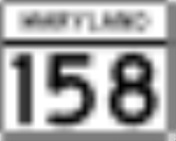
. The state highway runs 4.79 miles (7.7 km) from MD 158
in Sparrows Point north to North Point Road in Dundalk
. MD 157 is an L-shaped highway serves as the primary highway through Dundalk and from Dundalk to Interstate 695
(I-695). The two highways to which MD 157 is assigned, Merritt Boulevard and Peninsula Expressway, were constructed as a four-lane divided county highway in the early 1960s. In the late 1960s, Merritt Boulevard was extended as ramps to I-695 that also serve MD 151
and MD 150
. MD 157 was assigned to the highway in Sparrows Point in the early 1990s and extended through Dundalk to its present northern terminus in the late 1990s.
complex in Sparrows Point. MD 158 is used to access northbound I-695 (Baltimore Beltway. MD 157 heads north as Peninsula Expressway, a four-lane divided highway that crosses over I-695 and has a half-cloverleaf interchange with southbound I-695 in the direction of the Francis Scott Key Bridge
. The state highway veers northwest and reduces to a four-lane undivided highway at Reservoir Road. MD 157 crosses Bear Creek on a drawbridge and expands to a four-lane divided highway that enters Dundalk. The state highway crosses over the CSX
rail spur between Baltimore and Sparrows Point before reaching Merritt Boulevard. MD 157 turns northeast onto Merritt Boulevard; the roadway continues straight as Merritt Avenue toward Sollers Point Road. The state highway passes through the Dundalk communities of Stanbrook and Eastfield, through which the highway passes several shopping centers. From the intersection of Holabird Avenue and Wise Avenue north to German Hill Road, the highway has six lanes. After crossing Bread and Cheese Creek
, MD 157 reaches its northern terminus at North Point Road. The roadway continues through a partial interchange with MD 151
(North Point Boulevard) and has ramps to and from MD 150
(Eastern Avenue) in the direction of Essex
before merging with I-695 in the direction of Essex.
near Webster to Havre de Grace
in Harford County
, which was removed from the state highway system in 1956. Meritt Boulevard was constructed as a four-lane divided highway from North Point Road, which was then part of MD 20
, to the center of Dundalk in 1960. Peninsula Expressway was built from the center of Dundalk to Sparrows Point, including a new bridge over Bear Creek, in 1960 and 1961. Like the pre-existing drawbridge to the west that carried Dundalk Avenue over Bear Creek, the Peninsula Expressway bridge carried a toll from its completion through 1977. The Dundalk Avenue bridge was removed around 1985.
In 1963, the existing road north from the Merritt Boulevard – North Point Road intersection was expanded to a divided highway through its junction with MD 151. This section of highway was reconstructed in 1968 and 1969 as the ramps between North Point Road and I-695 that also serve MD 151 and MD 150. The portion of Peninsula Expressway south of the Bear Creek bridge was brought into the state highway system as MD 157 around 1991. When I-695 was transformed from a two-lane viaduct to a four-lane surface freeway between 1995 and 1999, MD 157's interchange with MD 158 was transformed into an interchange with I-695. The remainder of Peninsula Expressway and Merritt Boulevard to North Point Boulevard became part of MD 157 around 1999.
.
{|class=wikitable
!Location
!Mile
!Destinations
!Notes
|-
|rowspan=2|Sparrows Point
|0.00
|
|Southern terminus
|-
|0.18
|
|I-695 Exit 43
|-
|rowspan=2|Dundalk
|2.73
|Merritt Boulevard south / Merritt Avenue north to Sollers Point Road
|MD 157 turns northeast onto Merritt Boulevard
|-
|4.79
|
|Northern terminus at intersection with North Point Road; I-695 Exit 39; roadway continues straight as ramps to I-695, MD 151, and MD 150
State highway
State highway, state road or state route can refer to one of three related concepts, two of them related to a state or provincial government in a country that is divided into states or provinces :#A...
in the U.S. state of Maryland
Maryland
Maryland is a U.S. state located in the Mid Atlantic region of the United States, bordering Virginia, West Virginia, and the District of Columbia to its south and west; Pennsylvania to its north; and Delaware to its east...
. The state highway runs 4.79 miles (7.7 km) from MD 158
Maryland Route 158
Maryland Route 158 is a state highway in the U.S. state of Maryland. Known as Bethlehem Boulevard, the state highway runs from Riverside Drive in Sparrows Point east to North Point Road in Edgemere. MD 158 parallels Interstate 695 along the northern edge of the former Bethlehem Steel complex...
in Sparrows Point north to North Point Road in Dundalk
Dundalk, Maryland
-Demographics:As of the census of 2000, there were 62,306 people, 24,772 households, and 16,968 families residing in the CDP. The population density was 4,689.5 people per square mile . There were 26,385 housing units at an average density of 1,985.9 per square mile...
. MD 157 is an L-shaped highway serves as the primary highway through Dundalk and from Dundalk to Interstate 695
Interstate 695 (Maryland)
Interstate 695 is a -long full beltway Interstate Highway extending around Baltimore, Maryland, USA. I-695 is officially designated the McKeldin Beltway, but is colloquially referred to as either the Baltimore Beltway or 695...
(I-695). The two highways to which MD 157 is assigned, Merritt Boulevard and Peninsula Expressway, were constructed as a four-lane divided county highway in the early 1960s. In the late 1960s, Merritt Boulevard was extended as ramps to I-695 that also serve MD 151
Maryland Route 151
Maryland Route 151 is a state highway in the U.S. state of Maryland. Known for most of its length as North Point Boulevard, the state highway runs from 7th Street in Sparrows Point north to U.S. Route 1 in Baltimore...
and MD 150
Maryland Route 150
Maryland Route 150 is a state highway in the U.S. state of Maryland. Known for most of its length as either Eastern Avenue or Eastern Boulevard, the state highway runs from U.S. Route 40 in Baltimore east to Graces Quarters Road in Chase in eastern Baltimore County. MD 150 connects Baltimore...
. MD 157 was assigned to the highway in Sparrows Point in the early 1990s and extended through Dundalk to its present northern terminus in the late 1990s.
Route description
MD 157 begins at an intersection with MD 158 (Bethlehem Boulevard) just north of the former Bethlehem SteelBethlehem Steel
The Bethlehem Steel Corporation , based in Bethlehem, Pennsylvania, was once the second-largest steel producer in the United States, after Pittsburgh, Pennsylvania-based U.S. Steel. After a decline in the U.S...
complex in Sparrows Point. MD 158 is used to access northbound I-695 (Baltimore Beltway. MD 157 heads north as Peninsula Expressway, a four-lane divided highway that crosses over I-695 and has a half-cloverleaf interchange with southbound I-695 in the direction of the Francis Scott Key Bridge
Francis Scott Key Bridge (Baltimore)
The Francis Scott Key Bridge, also known as the Outer Harbor Bridge or simply the Key Bridge, is a continuous truss bridge spanning the Patapsco River in Baltimore, Maryland, USA. The main span of is the third longest span of any continuous truss in the world.The bridge was opened in March 1977...
. The state highway veers northwest and reduces to a four-lane undivided highway at Reservoir Road. MD 157 crosses Bear Creek on a drawbridge and expands to a four-lane divided highway that enters Dundalk. The state highway crosses over the CSX
CSX Transportation
CSX Transportation operates a Class I railroad in the United States known as the CSX Railroad. It is the main subsidiary of the CSX Corporation. The company is headquartered in Jacksonville, Florida, and owns approximately 21,000 route miles...
rail spur between Baltimore and Sparrows Point before reaching Merritt Boulevard. MD 157 turns northeast onto Merritt Boulevard; the roadway continues straight as Merritt Avenue toward Sollers Point Road. The state highway passes through the Dundalk communities of Stanbrook and Eastfield, through which the highway passes several shopping centers. From the intersection of Holabird Avenue and Wise Avenue north to German Hill Road, the highway has six lanes. After crossing Bread and Cheese Creek
Bread and Cheese Creek
Bread and Cheese Creek is a tributary of the Back River in Baltimore County, Maryland. The creek is long, with headwaters just east of the Baltimore city line. It flows east through Baltimore County before emptying into the Back River, which flows into the Chesapeake Bay...
, MD 157 reaches its northern terminus at North Point Road. The roadway continues through a partial interchange with MD 151
Maryland Route 151
Maryland Route 151 is a state highway in the U.S. state of Maryland. Known for most of its length as North Point Boulevard, the state highway runs from 7th Street in Sparrows Point north to U.S. Route 1 in Baltimore...
(North Point Boulevard) and has ramps to and from MD 150
Maryland Route 150
Maryland Route 150 is a state highway in the U.S. state of Maryland. Known for most of its length as either Eastern Avenue or Eastern Boulevard, the state highway runs from U.S. Route 40 in Baltimore east to Graces Quarters Road in Chase in eastern Baltimore County. MD 150 connects Baltimore...
(Eastern Avenue) in the direction of Essex
Essex, Maryland
-Demographics:As of the census of 2000, there were 39,078 people, 15,952 households, and 10,336 families residing in the CDP. The population density was 4,104.1 people per square mile . There were 16,997 housing units at an average density of 1,785.1 per square mile...
before merging with I-695 in the direction of Essex.
History
The original MD 157 was Chapel Road from MD 462Maryland Route 462
Maryland Route 462 is a state highway in the U.S. state of Maryland. Known as Paradise Road, the route runs from MD 132 in Aberdeen north to MD 155 in Webster. MD 462 was built in the early 1930s.-Route description:...
near Webster to Havre de Grace
Havre de Grace, Maryland
Havre de Grace is a city in Harford County, Maryland, United States. Located at the mouth of the Susquehanna River and the head of the Chesapeake Bay, Havre de Grace is named after the port city of Le Havre, France, which was first named Le Havre de Grâce, meaning in French "Harbor of Grace." As...
in Harford County
Harford County, Maryland
Harford County is a county in the U.S. state of Maryland. In 2010, its population was 244,826. Its county seat is Bel Air. Harford County forms part of the Baltimore-Washington Metropolitan Area.-History:...
, which was removed from the state highway system in 1956. Meritt Boulevard was constructed as a four-lane divided highway from North Point Road, which was then part of MD 20
Maryland Route 20
Maryland Route 20 is a state highway in the U.S. state of Maryland. The state highway runs from Beach Road and Lawton Avenue in Rock Hall east to MD 291 in Chestertown. MD 20, which connects Chestertown with several villages in western Kent County, was designated one of the original state roads...
, to the center of Dundalk in 1960. Peninsula Expressway was built from the center of Dundalk to Sparrows Point, including a new bridge over Bear Creek, in 1960 and 1961. Like the pre-existing drawbridge to the west that carried Dundalk Avenue over Bear Creek, the Peninsula Expressway bridge carried a toll from its completion through 1977. The Dundalk Avenue bridge was removed around 1985.
In 1963, the existing road north from the Merritt Boulevard – North Point Road intersection was expanded to a divided highway through its junction with MD 151. This section of highway was reconstructed in 1968 and 1969 as the ramps between North Point Road and I-695 that also serve MD 151 and MD 150. The portion of Peninsula Expressway south of the Bear Creek bridge was brought into the state highway system as MD 157 around 1991. When I-695 was transformed from a two-lane viaduct to a four-lane surface freeway between 1995 and 1999, MD 157's interchange with MD 158 was transformed into an interchange with I-695. The remainder of Peninsula Expressway and Merritt Boulevard to North Point Boulevard became part of MD 157 around 1999.
Junction list
The entire route is in Baltimore CountyBaltimore County, Maryland
Baltimore County is a county located in the northern part of the US state of Maryland. In 2010, its population was 805,029. It is part of the Baltimore-Washington Metropolitan Area. Its county seat is Towson. The name of the county was derived from the barony of the Proprietor of the Maryland...
.
{|class=wikitable
!Location
!Mile
!Destinations
!Notes
|-
|rowspan=2|Sparrows Point
|0.00
|
|Southern terminus
|-
|0.18
|
|I-695 Exit 43
|-
|rowspan=2|Dundalk
Dundalk, Maryland
-Demographics:As of the census of 2000, there were 62,306 people, 24,772 households, and 16,968 families residing in the CDP. The population density was 4,689.5 people per square mile . There were 26,385 housing units at an average density of 1,985.9 per square mile...
|2.73
|Merritt Boulevard south / Merritt Avenue north to Sollers Point Road
|MD 157 turns northeast onto Merritt Boulevard
|-
|4.79
|
|Northern terminus at intersection with North Point Road; I-695 Exit 39; roadway continues straight as ramps to I-695, MD 151, and MD 150