Maryhill, Washington
Encyclopedia
Maryhill is a census-designated place
(CDP) in Klickitat County, Washington, United States
. The population was 98 at the 2000 census.
, who purchased land and envisioned a community there shortly after the turn of the 20th century. Earlier the area was known as "Columbia" or "Columbus".
Hill used his Maryhill property to build the first paved roads in the Pacific Northwest
, the Maryhill Museum of Art
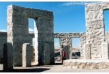
(originally intended as a grand residence for the Hills), Maryhill Stonehenge
, a monument to the World War I
dead of Klickitat County in the form of a Stonehenge replica
, and a planned community
. Born a Quaker, Hill hoped to attract a Quaker community to eastern Washington. His plans never materialized, and the town buildings he constructed burned down several years later.
Hill intended the Stonehenge replica to express that modern warfare (like Druid sacrifices as he understood them) was a form of needless human sacrifice.
 Maryhill is located at 45°41′8"N 120°49′2"W (45.685649, -120.817232).
According to the United States Census Bureau
, the CDP has a total area of 2.8 square miles (7.3 km²), all of it land.
of 2000, there were 98 people, 40 households, and 26 families residing in the CDP. The population density
was 35.0 people per square mile (13.5/km²). There were 49 housing units at an average density of 17.5/sq mi (6.8/km²). The racial makeup of the CDP was 77.55% White, 9.18% African American, 2.04% Native American, 1.02% Pacific Islander, 1.02% from other races
, and 9.18% from two or more races. Hispanic or Latino of any race were 9.18% of the population.
There were 40 households out of which 30.0% had children under the age of 18 living with them, 57.5% were married couples
living together, 5.0% had a female householder with no husband present, and 35.0% were non-families. 22.5% of all households were made up of individuals and 10.0% had someone living alone who was 65 years of age or older. The average household size was 2.45 and the average family size was 2.92.
In the CDP the population was spread out with 22.4% under the age of 18, 4.1% from 18 to 24, 27.6% from 25 to 44, 29.6% from 45 to 64, and 16.3% who were 65 years of age or older. The median age was 40 years. For every 100 females there were 113.0 males. For every 100 females age 18 and over, there were 123.5 males.
The median income for a household in the CDP was $37,250, and the median income for a family was $48,529. Males had a median income of $36,103 versus $28,750 for females. The per capita income
for the CDP was $18,939. None of the population or families were below the poverty line.
Census-designated place
A census-designated place is a concentration of population identified by the United States Census Bureau for statistical purposes. CDPs are delineated for each decennial census as the statistical counterparts of incorporated places such as cities, towns and villages...
(CDP) in Klickitat County, Washington, United States
United States
The United States of America is a federal constitutional republic comprising fifty states and a federal district...
. The population was 98 at the 2000 census.
History
Maryhill is named after the wife and daughter of regional icon Sam HillSamuel Hill
Samuel Hill , usually known as Sam Hill, was a businessman, lawyer, railroad executive and advocate of good roads in the Pacific Northwest...
, who purchased land and envisioned a community there shortly after the turn of the 20th century. Earlier the area was known as "Columbia" or "Columbus".
Hill used his Maryhill property to build the first paved roads in the Pacific Northwest
Pacific Northwest
The Pacific Northwest is a region in northwestern North America, bounded by the Pacific Ocean to the west and, loosely, by the Rocky Mountains on the east. Definitions of the region vary and there is no commonly agreed upon boundary, even among Pacific Northwesterners. A common concept of the...
, the Maryhill Museum of Art
Maryhill Museum of Art
The Maryhill Museum of Art is a small museum with an eclectic collection, located near Maryhill in the U.S. state of Washington.The structure was built as a mansion by entrepreneur Samuel Hill...
(originally intended as a grand residence for the Hills), Maryhill Stonehenge
Maryhill Stonehenge
The Maryhill Stonehenge is a full-size, astronomically-aligned replica of Stonehenge located in Maryhill, Washington. It was commissioned in the early 20th century by businessman Samuel Hill and dedicated on July 4, 1918 as a memorial to those that died in World War I...
, a monument to the World War I
World War I
World War I , which was predominantly called the World War or the Great War from its occurrence until 1939, and the First World War or World War I thereafter, was a major war centred in Europe that began on 28 July 1914 and lasted until 11 November 1918...
dead of Klickitat County in the form of a Stonehenge replica
Stonehenge replicas and derivatives
This is list of Stonehenge replicas and derivatives that seeks to collect all the non-ephemeral examples together. The fame of the prehistoric monument of Stonehenge has led to numerous efforts to recreate it, using a variety of different materials, around the world...
, and a planned community
Planned community
A planned community, or planned city, is any community that was carefully planned from its inception and is typically constructed in a previously undeveloped area. This contrasts with settlements that evolve in a more ad hoc fashion. Land use conflicts are less frequent in planned communities since...
. Born a Quaker, Hill hoped to attract a Quaker community to eastern Washington. His plans never materialized, and the town buildings he constructed burned down several years later.
Hill intended the Stonehenge replica to express that modern warfare (like Druid sacrifices as he understood them) was a form of needless human sacrifice.
Geography

According to the United States Census Bureau
United States Census Bureau
The United States Census Bureau is the government agency that is responsible for the United States Census. It also gathers other national demographic and economic data...
, the CDP has a total area of 2.8 square miles (7.3 km²), all of it land.
Demographics
As of the censusCensus
A census is the procedure of systematically acquiring and recording information about the members of a given population. It is a regularly occurring and official count of a particular population. The term is used mostly in connection with national population and housing censuses; other common...
of 2000, there were 98 people, 40 households, and 26 families residing in the CDP. The population density
Population density
Population density is a measurement of population per unit area or unit volume. It is frequently applied to living organisms, and particularly to humans...
was 35.0 people per square mile (13.5/km²). There were 49 housing units at an average density of 17.5/sq mi (6.8/km²). The racial makeup of the CDP was 77.55% White, 9.18% African American, 2.04% Native American, 1.02% Pacific Islander, 1.02% from other races
Race (United States Census)
Race and ethnicity in the United States Census, as defined by the Federal Office of Management and Budget and the United States Census Bureau, are self-identification data items in which residents choose the race or races with which they most closely identify, and indicate whether or not they are...
, and 9.18% from two or more races. Hispanic or Latino of any race were 9.18% of the population.
There were 40 households out of which 30.0% had children under the age of 18 living with them, 57.5% were married couples
Marriage
Marriage is a social union or legal contract between people that creates kinship. It is an institution in which interpersonal relationships, usually intimate and sexual, are acknowledged in a variety of ways, depending on the culture or subculture in which it is found...
living together, 5.0% had a female householder with no husband present, and 35.0% were non-families. 22.5% of all households were made up of individuals and 10.0% had someone living alone who was 65 years of age or older. The average household size was 2.45 and the average family size was 2.92.
In the CDP the population was spread out with 22.4% under the age of 18, 4.1% from 18 to 24, 27.6% from 25 to 44, 29.6% from 45 to 64, and 16.3% who were 65 years of age or older. The median age was 40 years. For every 100 females there were 113.0 males. For every 100 females age 18 and over, there were 123.5 males.
The median income for a household in the CDP was $37,250, and the median income for a family was $48,529. Males had a median income of $36,103 versus $28,750 for females. The per capita income
Per capita income
Per capita income or income per person is a measure of mean income within an economic aggregate, such as a country or city. It is calculated by taking a measure of all sources of income in the aggregate and dividing it by the total population...
for the CDP was $18,939. None of the population or families were below the poverty line.

