
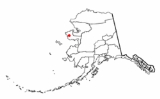
Mary's Igloo, Alaska
Encyclopedia
Mary's Igloo is an abandoned village located in Nome Census Area
in the U.S. state
of Alaska
.
 Mary's Igloo is located at 65°09′N 165°04′W .
Mary's Igloo is located on the northwest bank of the Kuzitrin River
, on the Seward Peninsula
. It is northeast of Nome
and 65 km (40 mi) southeast of Teller
.
According to the United States Census Bureau
, the city has a total area of 2.1 square miles (5.5 km²), of which, 1.9 square miles (5.0 km²) of it is land and 0.2 square miles (0.5 km²) of it is water. The total area is 9.00% water.
During the gold prospecting period of the early 1900s, non-Natives
named the village "Mary's Igloo," after an Inupiat woman named Mary, who welcomed miners, trappers and others into her home for coffee. During that period, Mary's Igloo was a transfer point for supplies for the gold fields upriver on the Kuzitrin
and Kougarok
rivers. The supplies were offloaded from ocean boats onto barges, which were towed to their destinations. A post office and store were opened at Mary's Igloo in 1901. By 1910, Mary's Igloo was a large community of Inupiat and Anglo-Americans, who were miners, innkeepers, missionaries and support crews for the barges. It had schools, a post office and other services.
The flu epidemic of 1918 and 1919 and a tuberculosis epidemic, two years later, decimated the community's population. Catholic
and Lutheran orphanages opened in the area to care for children left without parents.
The schools closed in 1948 and 1950 for lack of students and the post office and store also closed in 1952. Most of the residents moved to Nome or Teller.
The site of Mary's Igloo presently has no permanent population. It is used as a seasonal fish camp by some residents of Teller.
Nome Census Area, Alaska
Nome Census Area is a census area located in the state of Alaska, United States. As of the 2000 census, the population was 9,196. It is part of the unorganized borough and therefore has no borough seat. Its largest community by far is the city of Nome....
in the U.S. state
U.S. state
A U.S. state is any one of the 50 federated states of the United States of America that share sovereignty with the federal government. Because of this shared sovereignty, an American is a citizen both of the federal entity and of his or her state of domicile. Four states use the official title of...
of Alaska
Alaska
Alaska is the largest state in the United States by area. It is situated in the northwest extremity of the North American continent, with Canada to the east, the Arctic Ocean to the north, and the Pacific Ocean to the west and south, with Russia further west across the Bering Strait...
.
Geography
Mary's Igloo is located on the northwest bank of the Kuzitrin River
Kuzitrin River
The Kuzitrin River is a river found on the Seward Peninsula of Northwest Alaska. The river headwaters are at the Lost Jim Lava Flow in the central region of the peninsula, and flows 95 miles west into the Imuruk Basin, which eventually feeds the Bering Sea. Kuzitrin tribuatries include the...
, on the Seward Peninsula
Seward Peninsula
The Seward Peninsula is a large peninsula on the western coast of the U.S. state of Alaska. It projects about into the Bering Sea between Norton Sound, the Bering Strait, the Chukchi Sea, and Kotzebue Sound, just below the Arctic Circle...
. It is northeast of Nome
Nome, Alaska
Nome is a city in the Nome Census Area in the Unorganized Borough of the U.S. state of Alaska, located on the southern Seward Peninsula coast on Norton Sound of the Bering Sea. According to the 2010 Census, the city population was 3,598. Nome was incorporated on April 9, 1901, and was once the...
and 65 km (40 mi) southeast of Teller
Teller, Alaska
Teller is a city in Nome Census Area, Alaska, United States. At the 2000 census the population was 268. According to a 2009 estimate, the population had increased by exactly one person....
.
According to the United States Census Bureau
United States Census Bureau
The United States Census Bureau is the government agency that is responsible for the United States Census. It also gathers other national demographic and economic data...
, the city has a total area of 2.1 square miles (5.5 km²), of which, 1.9 square miles (5.0 km²) of it is land and 0.2 square miles (0.5 km²) of it is water. The total area is 9.00% water.
History
The Inupiat village of Kauwerak was located about 25 km (15 mi) downriver from Mary's Igloo. By 1900, Kauwerak was abandoned and most of its residents moved to Teller or Nome because of schools and employment opportunities. A few settled at the site of Mary's Igloo, which they called Aukvaunlook, meaning "black whale."During the gold prospecting period of the early 1900s, non-Natives
Alaska Natives
Alaska Natives are the indigenous peoples of Alaska. They include: Aleut, Inuit, Tlingit, Haida, Tsimshian, Eyak, and a number of Northern Athabaskan cultures.-History:In 1912 the Alaska Native Brotherhood was founded...
named the village "Mary's Igloo," after an Inupiat woman named Mary, who welcomed miners, trappers and others into her home for coffee. During that period, Mary's Igloo was a transfer point for supplies for the gold fields upriver on the Kuzitrin
Kuzitrin River
The Kuzitrin River is a river found on the Seward Peninsula of Northwest Alaska. The river headwaters are at the Lost Jim Lava Flow in the central region of the peninsula, and flows 95 miles west into the Imuruk Basin, which eventually feeds the Bering Sea. Kuzitrin tribuatries include the...
and Kougarok
Kougarok River
The Kougarok River is a river on the Seward Peninsula in Alaska. It is formed by a merger of smaller creeks in the area; the result is about 45 miles long. It flows into the Kuzitrin River, eventually emptying into the Bering Sea....
rivers. The supplies were offloaded from ocean boats onto barges, which were towed to their destinations. A post office and store were opened at Mary's Igloo in 1901. By 1910, Mary's Igloo was a large community of Inupiat and Anglo-Americans, who were miners, innkeepers, missionaries and support crews for the barges. It had schools, a post office and other services.
The flu epidemic of 1918 and 1919 and a tuberculosis epidemic, two years later, decimated the community's population. Catholic
Catholic
The word catholic comes from the Greek phrase , meaning "on the whole," "according to the whole" or "in general", and is a combination of the Greek words meaning "about" and meaning "whole"...
and Lutheran orphanages opened in the area to care for children left without parents.
The schools closed in 1948 and 1950 for lack of students and the post office and store also closed in 1952. Most of the residents moved to Nome or Teller.
The site of Mary's Igloo presently has no permanent population. It is used as a seasonal fish camp by some residents of Teller.