
Marshall County, Alabama
Encyclopedia
Marshall County is a county
of the U.S. state
of Alabama
, and is included in the Huntsville-Decatur Combined Statistical Area
. Its name is in honor of John Marshall
, famous Chief Justice of the United States
. As of 2010 the population was 93,019. Its county seat
is Guntersville
.
Marshall County is a dry county
, with the exception of three cities within the county, Albertville
, Arab
, and Guntersville
.
According to the 2000 census, the county has a total area of 623.16 square miles (1,614 km²), of which 567.06 square miles (1,468.7 km²) (or 91.00%) is land and 56.1 square miles (145.3 km²) (or 9.00%) is water. The Tennessee river runs both north and south within the county.
of 2000, there were 82,231 people, 32,547 households, and 23,531 families residing in the county. The population density
was 145 people per square mile (56/km2). There were 36,331 housing units at an average density of 64 per square mile (25/km2). The racial makeup of the county was 93.38% White
, 1.47% Black
or African American
, 0.53% Native American
, 0.24% Asian
, 0.04% Pacific Islander
, 3.24% from other races
, and 1.09% from two or more races. 5.66% of the population were Hispanic
or Latino
of any race.
There were 32,547 households out of which 32.40% had children under the age of 18 living with them, 57.80% were married couples
living together, 10.70% had a female householder with no husband present, and 27.70% were non-families. 24.60% of all households were made up of individuals and 10.90% had someone living alone who was 65 years of age or older. The average household size was 2.50 and the average family size was 2.96.
In the county the population was spread out with 24.90% under the age of 18, 8.50% from 18 to 24, 29.00% from 25 to 44, 23.40% from 45 to 64, and 14.20% who were 65 years of age or older. The median age was 37 years. For every 100 females there were 94.80 males. For every 100 females age 18 and over, there were 91.50 males.
The median income for a household in the county was $32,167, and the median income for a family was $38,788. Males had a median income of $30,500 versus $20,807 for females. The per capita income
for the county was $17,089. About 11.70% of families and 14.70% of the population were below the poverty line, including 17.90% of those under age 18 and 19.30% of those age 65 or over.
, Cathedral Caverns State Park
, and Buck's Pocket State Park
.
County (United States)
In the United States, a county is a geographic subdivision of a state , usually assigned some governmental authority. The term "county" is used in 48 of the 50 states; Louisiana is divided into parishes and Alaska into boroughs. Parishes and boroughs are called "county-equivalents" by the U.S...
of the U.S. state
U.S. state
A U.S. state is any one of the 50 federated states of the United States of America that share sovereignty with the federal government. Because of this shared sovereignty, an American is a citizen both of the federal entity and of his or her state of domicile. Four states use the official title of...
of Alabama
Alabama
Alabama is a state located in the southeastern region of the United States. It is bordered by Tennessee to the north, Georgia to the east, Florida and the Gulf of Mexico to the south, and Mississippi to the west. Alabama ranks 30th in total land area and ranks second in the size of its inland...
, and is included in the Huntsville-Decatur Combined Statistical Area
Huntsville-Decatur Combined Statistical Area
The Huntsville-Decatur Combined Statistical Area is the most populated sub-region of North Alabama, and is the second fastest growing region in the State of Alabama, with 510,088 living within the CSA...
. Its name is in honor of John Marshall
John Marshall
John Marshall was the Chief Justice of the United States whose court opinions helped lay the basis for American constitutional law and made the Supreme Court of the United States a coequal branch of government along with the legislative and executive branches...
, famous Chief Justice of the United States
Chief Justice of the United States
The Chief Justice of the United States is the head of the United States federal court system and the chief judge of the Supreme Court of the United States. The Chief Justice is one of nine Supreme Court justices; the other eight are the Associate Justices of the Supreme Court of the United States...
. As of 2010 the population was 93,019. Its county seat
County seat
A county seat is an administrative center, or seat of government, for a county or civil parish. The term is primarily used in the United States....
is Guntersville
Guntersville, Alabama
Guntersville is a city in Marshall County, Alabama, United States and is included in the Huntsville-Decatur Combined Statistical Area. At the 2010 census, the population of the city was 8,197. The city is the county seat of Marshall County. Guntersville is located in a HUBZone as identified by the...
.
Marshall County is a dry county
Dry county
A dry county is a county in the United States whose government forbids the sale of alcoholic beverages. Some prohibit off-premises sale, some prohibit on-premises sale, and some prohibit both. Hundreds of dry counties exist across the United States, almost all of them in the South...
, with the exception of three cities within the county, Albertville
Albertville, Alabama
Albertville is a city in Marshall County, Alabama, United States, and is included in the Huntsville-Decatur Combined Statistical Area. As of the 2010 census, the population of the city was 21,160.- History :...
, Arab
Arab, Alabama
Arab is a city in both Cullman County, Alabama and Marshall County, Alabama in the northeastern part of the U.S. state of Alabama, located ten miles from Guntersville Lake and Guntersville Dam, and is included in the Huntsville-Decatur Combined Statistical Area...
, and Guntersville
Guntersville, Alabama
Guntersville is a city in Marshall County, Alabama, United States and is included in the Huntsville-Decatur Combined Statistical Area. At the 2010 census, the population of the city was 8,197. The city is the county seat of Marshall County. Guntersville is located in a HUBZone as identified by the...
.
History & Geography
Marshall County was established on January 9, 1836.According to the 2000 census, the county has a total area of 623.16 square miles (1,614 km²), of which 567.06 square miles (1,468.7 km²) (or 91.00%) is land and 56.1 square miles (145.3 km²) (or 9.00%) is water. The Tennessee river runs both north and south within the county.
Major highways
-
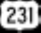
 U.S. Highway 231
 -
 U.S. Highway 431
 -
 State Route 68
 -
 State Route 69State Route 69 (Alabama)State Route 69 is a long route that extends from the southwestern to the northeastern parts of the state. The southern terminus of the route is at a junction with State Route 177 at Jackson. The northern terminus of the route is at its junction with U.S...
 -
 State Route 75State Route 75 (Alabama)State Route 75 is a state highway in Alabama that extends northeastward from Birmingham to the Georgia state line. The route runs west of U.S. Highway 11 and roughly parallels that route as well as Interstate 59...
 -
 State Route 79State Route 79 (Alabama)State Route 79 is a route that extends northeastward from Birmingham to the Tennessee state line. Prior to the completion of Interstate 65, SR-79 was the southern part of the route that connected Birmingham and Huntsville....
 -
 State Route 168
 -
 State Route 179
 -
 State Route 205
 -
 State Route 227
Adjacent counties
- Jackson County, AlabamaJackson County, AlabamaJackson County is a county of the U.S. state of Alabama. Its name is in honor of Andrew Jackson, general in the United States Army and President of the United States of America. As of 2010, the population was 53,227. The county seat is Scottsboro. Jackson County is a prohibition or dry county,...
- northeast - DeKalb County, AlabamaDeKalb County, AlabamaAs of the 2010 Census DeKalb County had a population of 71,109. The median age was 37.5. The racial and ethnic makeup of the population was 81.6% non-Hispanic white, 1.5% African American, 1.4% Native American, 0.3% Asian, 0.2% Pacific Islander , 9.9% from some other race, 2.2% reporting two or...
- east - Etowah County, AlabamaEtowah County, AlabamaEtowah County is a county of the U.S. state of Alabama. Its name is from the Cherokee language, which means "edible tree". It is the center of the Gadsden Metropolitan Area which includes Etowah and Cherokee Counties. As of 2010 the population was 104,430. Its county seat is Gadsden...
- southeast - Blount County, AlabamaBlount County, AlabamaBlount County is a county located in the U.S. state of Alabama. As of the 2010 United States Census, the population was 57,322. Its county seat is Oneonta.Blount County is a dry county.-History:...
- south - Cullman County, AlabamaCullman County, AlabamaCullman County is a county of the U.S. state of Alabama. Its name is in honor of Colonel John G. Cullmann. As of 2010, the population was 80,406. Its county seat is the town of the same name, Cullman, Alabama. It is a "moist" county in terms of availablity of alcoholic beverages, which means...
- southwest - Morgan County, AlabamaMorgan County, AlabamaMorgan County is the most populous county in the Decatur Metropolitan Area, and the second most populous county in the Huntsville-Decatur Combined Statistical Area in the U.S. State of Alabama. It was created by the Alabama Territorial legislature on February 6, 1818 from land acquired from the...
- west - Madison County, AlabamaMadison County, AlabamaMadison County is a county of the U.S. state of Alabama, and is a major part of the Huntsville Metropolitan Area.It is also included in the merged Huntsville-Decatur Combined Statistical Area. The county is named in honor of James Madison, fourth President of the United States of America, and the...
- northwest
Demographics
As of the censusCensus
A census is the procedure of systematically acquiring and recording information about the members of a given population. It is a regularly occurring and official count of a particular population. The term is used mostly in connection with national population and housing censuses; other common...
of 2000, there were 82,231 people, 32,547 households, and 23,531 families residing in the county. The population density
Population density
Population density is a measurement of population per unit area or unit volume. It is frequently applied to living organisms, and particularly to humans...
was 145 people per square mile (56/km2). There were 36,331 housing units at an average density of 64 per square mile (25/km2). The racial makeup of the county was 93.38% White
Race (United States Census)
Race and ethnicity in the United States Census, as defined by the Federal Office of Management and Budget and the United States Census Bureau, are self-identification data items in which residents choose the race or races with which they most closely identify, and indicate whether or not they are...
, 1.47% Black
Race (United States Census)
Race and ethnicity in the United States Census, as defined by the Federal Office of Management and Budget and the United States Census Bureau, are self-identification data items in which residents choose the race or races with which they most closely identify, and indicate whether or not they are...
or African American
Race (United States Census)
Race and ethnicity in the United States Census, as defined by the Federal Office of Management and Budget and the United States Census Bureau, are self-identification data items in which residents choose the race or races with which they most closely identify, and indicate whether or not they are...
, 0.53% Native American
Race (United States Census)
Race and ethnicity in the United States Census, as defined by the Federal Office of Management and Budget and the United States Census Bureau, are self-identification data items in which residents choose the race or races with which they most closely identify, and indicate whether or not they are...
, 0.24% Asian
Race (United States Census)
Race and ethnicity in the United States Census, as defined by the Federal Office of Management and Budget and the United States Census Bureau, are self-identification data items in which residents choose the race or races with which they most closely identify, and indicate whether or not they are...
, 0.04% Pacific Islander
Race (United States Census)
Race and ethnicity in the United States Census, as defined by the Federal Office of Management and Budget and the United States Census Bureau, are self-identification data items in which residents choose the race or races with which they most closely identify, and indicate whether or not they are...
, 3.24% from other races
Race (United States Census)
Race and ethnicity in the United States Census, as defined by the Federal Office of Management and Budget and the United States Census Bureau, are self-identification data items in which residents choose the race or races with which they most closely identify, and indicate whether or not they are...
, and 1.09% from two or more races. 5.66% of the population were Hispanic
Race (United States Census)
Race and ethnicity in the United States Census, as defined by the Federal Office of Management and Budget and the United States Census Bureau, are self-identification data items in which residents choose the race or races with which they most closely identify, and indicate whether or not they are...
or Latino
Race (United States Census)
Race and ethnicity in the United States Census, as defined by the Federal Office of Management and Budget and the United States Census Bureau, are self-identification data items in which residents choose the race or races with which they most closely identify, and indicate whether or not they are...
of any race.
There were 32,547 households out of which 32.40% had children under the age of 18 living with them, 57.80% were married couples
Marriage
Marriage is a social union or legal contract between people that creates kinship. It is an institution in which interpersonal relationships, usually intimate and sexual, are acknowledged in a variety of ways, depending on the culture or subculture in which it is found...
living together, 10.70% had a female householder with no husband present, and 27.70% were non-families. 24.60% of all households were made up of individuals and 10.90% had someone living alone who was 65 years of age or older. The average household size was 2.50 and the average family size was 2.96.
In the county the population was spread out with 24.90% under the age of 18, 8.50% from 18 to 24, 29.00% from 25 to 44, 23.40% from 45 to 64, and 14.20% who were 65 years of age or older. The median age was 37 years. For every 100 females there were 94.80 males. For every 100 females age 18 and over, there were 91.50 males.
The median income for a household in the county was $32,167, and the median income for a family was $38,788. Males had a median income of $30,500 versus $20,807 for females. The per capita income
Per capita income
Per capita income or income per person is a measure of mean income within an economic aggregate, such as a country or city. It is calculated by taking a measure of all sources of income in the aggregate and dividing it by the total population...
for the county was $17,089. About 11.70% of families and 14.70% of the population were below the poverty line, including 17.90% of those under age 18 and 19.30% of those age 65 or over.
Cities and towns
- AlbertvilleAlbertville, AlabamaAlbertville is a city in Marshall County, Alabama, United States, and is included in the Huntsville-Decatur Combined Statistical Area. As of the 2010 census, the population of the city was 21,160.- History :...
- ArabArab, AlabamaArab is a city in both Cullman County, Alabama and Marshall County, Alabama in the northeastern part of the U.S. state of Alabama, located ten miles from Guntersville Lake and Guntersville Dam, and is included in the Huntsville-Decatur Combined Statistical Area...
(part of Arab is in Cullman CountyCullman County, AlabamaCullman County is a county of the U.S. state of Alabama. Its name is in honor of Colonel John G. Cullmann. As of 2010, the population was 80,406. Its county seat is the town of the same name, Cullman, Alabama. It is a "moist" county in terms of availablity of alcoholic beverages, which means...
) - BoazBoaz, AlabamaBoaz is a city in Etowah and Marshall Counties in the U.S. state of Alabama. It is part of the 'Gadsden, Alabama Metropolitan Statistical Area'. As of the 2010 census, the population of the city is 9,551. Boaz is known mainly for its outlet shops....
(part of Boaz is in Etowah CountyEtowah County, AlabamaEtowah County is a county of the U.S. state of Alabama. Its name is from the Cherokee language, which means "edible tree". It is the center of the Gadsden Metropolitan Area which includes Etowah and Cherokee Counties. As of 2010 the population was 104,430. Its county seat is Gadsden...
) - DouglasDouglas, AlabamaDouglas is a town in Marshall County, Alabama, in the United States. Douglas, a part of the Huntsville-Decatur Combined Statistical Area, reported a population of 744 in the 2010 census.-Geography:Douglas is located at ....
- GrantGrant, AlabamaGrant is a town in Marshall County, in the northeast of Alabama. As of the 2010 census, the population of Grant is 896; it is included in the Huntsville-Decatur Combined Statistical Area.-Geography:...
- HortonHorton, AlabamaHorton is an unincorporated town in Marshall County, Alabama, United States. Its ZIP code is 35980. The average income is $250,000. The area has about 1,800 households, with the average home value being $450,000....
- GuntersvilleGuntersville, AlabamaGuntersville is a city in Marshall County, Alabama, United States and is included in the Huntsville-Decatur Combined Statistical Area. At the 2010 census, the population of the city was 8,197. The city is the county seat of Marshall County. Guntersville is located in a HUBZone as identified by the...
- Union GroveUnion Grove, AlabamaUnion Grove is a town in Marshall County, Alabama, United States, and is included in the Huntsville-Decatur Combined Statistical Area. Union Grove is located approximately three miles from Guntersville Lake and six miles from Arab. Electricity service in Union Grove is provided through Arab...
Places of interest
Marshall County is home to numerous outdoor recreation areas including Lake Guntersville State ParkLake Guntersville State Park
Lake Guntersville State Park is located in Northeast Alabama, just outside Guntersville in Marshall County, Alabama.The park overlooks the 66,500 acre Guntersville Lake, and contains 5,600 acres of natural woodlands. It includes a resort inn, restaurant and convention complex on the pinnacle of...
, Cathedral Caverns State Park
Cathedral Caverns State Park
Cathedral Caverns State Park is located in northern Marshall County, Alabama, southeast of the town of Woodville. The cave is located in Kennamer Cove. The cave is also just from Grant. The cave was originally named Bats Cave. The cave was first developed as an attraction by Jay Gurley in the late...
, and Buck's Pocket State Park
Buck's Pocket State Park
Buck's Pocket State Park is located on Sand Mountain in the northeast of the U.S. state of Alabama near Grove Oak, Alabama and Guntersville Lake. This secluded 2,000 acre park is in a natural pocket of the Appalachian Mountain chain, on an upstream tributary of Lake Guntersville...
.
See also
- National Register of Historic Places listings in Marshall County, Alabama
- Properties on the Alabama Register of Landmarks and Heritage in Marshall County, Alabama