

Lovell, Maine
Encyclopedia
Lovell is a town
in Oxford County
, Maine
, United States
. The population was 974 at the 2000 census. Lovell is the site of Kezar Lake, a resort area.
 In 1774, the Massachusetts General Court
granted New Suncook Plantation to the officers and soldiers (or their heirs) who fought on May 8, 1725 during Dummer's War
against the Sokokis Abenaki Indians
at Pequawket (now Fryeburg). First settled in 1777, the community had 85 inhabitants by 1790. New Suncook Plantation would be incorporated as a town on November 15, 1800, renamed after Captain John Lovewell
, the fallen expedition leader.
The Kezar River provided water power for industry. In the 19th century, mills produced spool
s, long lumber
, shooks, axe handle
s, ox goads, carriage
s, sleighs, harness, cabinet work and coffin
s, and boots and shoes
. Good soil helped farms prosper. Following the Civil War
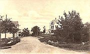
, the Portland and Ogdensburg Railroad connected to Fryeburg, and tourists discovered the beauty of Kezar Lake. Inns and hotels opened, and the town remains a summer resort.
, the town has a total area of 47.9 square miles (124.1 km²), of which, 43.2 square miles (111.9 km²) of it is land and 4.7 square miles (12.2 km²) of it (9.82%) is water. Lovell is drained by the Kezar River, a tributary of the Saco River
. Kezar Lake is a significant lake within the town.
Lovell is crossed by State Route 5
. It borders the towns of Stoneham
to the north, Waterford
to the east, Sweden
to the southeast, Fryeburg to the southwest, and Stow
to the west.
 As of the census
of 2000, there were 974 people, 393 households, and 275 families residing in the town. The population density
was 22.6 people per square mile (8.7/km²). There were 1,218 housing units at an average density of 28.2 per square mile (10.9/km²). The racial makeup of the town was 98.97% White, 0.10% African American, 0.21% Asian, 0.10% from other races
, and 0.62% from two or more races. Hispanic or Latino of any race were 0.92% of the population.
There were 393 households out of which 29.0% had children under the age of 18 living with them, 58.5% were married couples
living together, 6.4% had a female householder with no husband present, and 29.8% were non-families. 23.2% of all households were made up of individuals and 8.4% had someone living alone who was 65 years of age or older. The average household size was 2.48 and the average family size was 2.92.
In the town the population was spread out with 24.0% under the age of 18, 5.0% from 18 to 24, 25.8% from 25 to 44, 29.7% from 45 to 64, and 15.5% who were 65 years of age or older. The median age was 43 years. For every 100 females there were 102.5 males. For every 100 females age 18 and over, there were 107.9 males.
The median income for a household in the town was $33,365, and the median income for a family was $40,833. Males had a median income of $29,375 versus $22,279 for females. The per capita income
for the town was $17,089. About 8.7% of families and 12.4% of the population were below the poverty line, including 13.1% of those under age 18 and 9.8% of those age 65 or over.
New England town
The New England town is the basic unit of local government in each of the six New England states. Without a direct counterpart in most other U.S. states, New England towns are conceptually similar to civil townships in other states, but are incorporated, possessing powers like cities in other...
in Oxford County
Oxford County, Maine
Oxford County is a county located in the U.S. state of Maine with a population of 57,833 as of the 2010 U.S. census. Its county seat is Paris.Part of Oxford County is included in the Lewiston-Auburn, Maine, metropolitan New England City and Town Area while a different part of Oxford County is...
, Maine
Maine
Maine is a state in the New England region of the northeastern United States, bordered by the Atlantic Ocean to the east and south, New Hampshire to the west, and the Canadian provinces of Quebec to the northwest and New Brunswick to the northeast. Maine is both the northernmost and easternmost...
, United States
United States
The United States of America is a federal constitutional republic comprising fifty states and a federal district...
. The population was 974 at the 2000 census. Lovell is the site of Kezar Lake, a resort area.
History
Massachusetts General Court
The Massachusetts General Court is the state legislature of the Commonwealth of Massachusetts. The name "General Court" is a hold-over from the Colonial Era, when this body also sat in judgment of judicial appeals cases...
granted New Suncook Plantation to the officers and soldiers (or their heirs) who fought on May 8, 1725 during Dummer's War
Dummer's War
Dummer's War , also known as Lovewell's War, Father Rale's War, Greylock's War, the Three Years War, the 4th Indian War or the Wabanaki-New England War of 1722–1725, was a series of battles between British settlers of the three northernmost British colonies of North America of the time and the...
against the Sokokis Abenaki Indians
Indigenous peoples of the Americas
The indigenous peoples of the Americas are the pre-Columbian inhabitants of North and South America, their descendants and other ethnic groups who are identified with those peoples. Indigenous peoples are known in Canada as Aboriginal peoples, and in the United States as Native Americans...
at Pequawket (now Fryeburg). First settled in 1777, the community had 85 inhabitants by 1790. New Suncook Plantation would be incorporated as a town on November 15, 1800, renamed after Captain John Lovewell
John Lovewell (Junior)
John Lovewell was a famous Ranger in the 18th century who fought during Dummer's War . He lived in present-day Nashua, New Hampshire...
, the fallen expedition leader.
The Kezar River provided water power for industry. In the 19th century, mills produced spool
Bobbin
A bobbin is a spindle or cylinder, with or without flanges, on which wire, yarn, thread or film is wound. Bobbins are typically found in sewing machines, cameras, and within electronic equipment....
s, long lumber
Lumber
Lumber or timber is wood in any of its stages from felling through readiness for use as structural material for construction, or wood pulp for paper production....
, shooks, axe handle
Axe
The axe, or ax, is an implement that has been used for millennia to shape, split and cut wood; to harvest timber; as a weapon; and as a ceremonial or heraldic symbol...
s, ox goads, carriage
Carriage
A carriage is a wheeled vehicle for people, usually horse-drawn; litters and sedan chairs are excluded, since they are wheelless vehicles. The carriage is especially designed for private passenger use and for comfort or elegance, though some are also used to transport goods. It may be light,...
s, sleighs, harness, cabinet work and coffin
Coffin
A coffin is a funerary box used in the display and containment of dead people – either for burial or cremation.Contemporary North American English makes a distinction between "coffin", which is generally understood to denote a funerary box having six sides in plan view, and "casket", which...
s, and boots and shoes
Shoemaking
Shoemaking is the process of making footwear. Originally, shoes were made one at a time by hand. Traditional handicraft shoemaking has now been largely superseded in volume of shoes produced by industrial mass production of footwear, but not necessarily in quality, attention to detail, or...
. Good soil helped farms prosper. Following the Civil War
American Civil War
The American Civil War was a civil war fought in the United States of America. In response to the election of Abraham Lincoln as President of the United States, 11 southern slave states declared their secession from the United States and formed the Confederate States of America ; the other 25...
, the Portland and Ogdensburg Railroad connected to Fryeburg, and tourists discovered the beauty of Kezar Lake. Inns and hotels opened, and the town remains a summer resort.
Geography
According to the United States Census BureauUnited States Census Bureau
The United States Census Bureau is the government agency that is responsible for the United States Census. It also gathers other national demographic and economic data...
, the town has a total area of 47.9 square miles (124.1 km²), of which, 43.2 square miles (111.9 km²) of it is land and 4.7 square miles (12.2 km²) of it (9.82%) is water. Lovell is drained by the Kezar River, a tributary of the Saco River
Saco River
The Saco River is a river in northeastern New Hampshire and southwestern Maine in the United States. It drains a rural area of of forests and farmlands west and southwest of Portland, emptying into the Atlantic Ocean at Saco Bay, from its source. It supplies drinking water to roughly 250,000...
. Kezar Lake is a significant lake within the town.
Lovell is crossed by State Route 5
Maine State Route 5
State Route 5 is part of Maine's system of numbered state highways, running from the an intersection with Route 9 in Old Orchard Beach, to an intersection with Route 120 in Andover. Route 5 is long....
. It borders the towns of Stoneham
Stoneham, Maine
Stoneham is a town in Oxford County, Maine, United States. The population was 255 at the 2000 census.-Geography:According to the United States Census Bureau, the town has a total area of , of which, of it is land and of it is water.-Demographics:...
to the north, Waterford
Waterford, Maine
Waterford is a town in Oxford County, Maine, United States. The population was 1,455 at the 2000 census. It is a recreation area noted for historic architecture and scenic beauty.-History:...
to the east, Sweden
Sweden, Maine
Sweden is a town in Oxford County, Maine, United States. The population was 324 at the 2000 census. Set among hills, forests and ponds, Sweden includes the village of East Sweden.-History:...
to the southeast, Fryeburg to the southwest, and Stow
Stow, Maine
Stow is a town in Oxford County, Maine, United States. The population was 288 at the 2000 census.-Geography:According to the United States Census Bureau, the town has a total area of , of which, of it is land and of it is water.-Demographics:...
to the west.
Demographics
Census
A census is the procedure of systematically acquiring and recording information about the members of a given population. It is a regularly occurring and official count of a particular population. The term is used mostly in connection with national population and housing censuses; other common...
of 2000, there were 974 people, 393 households, and 275 families residing in the town. The population density
Population density
Population density is a measurement of population per unit area or unit volume. It is frequently applied to living organisms, and particularly to humans...
was 22.6 people per square mile (8.7/km²). There were 1,218 housing units at an average density of 28.2 per square mile (10.9/km²). The racial makeup of the town was 98.97% White, 0.10% African American, 0.21% Asian, 0.10% from other races
Race (United States Census)
Race and ethnicity in the United States Census, as defined by the Federal Office of Management and Budget and the United States Census Bureau, are self-identification data items in which residents choose the race or races with which they most closely identify, and indicate whether or not they are...
, and 0.62% from two or more races. Hispanic or Latino of any race were 0.92% of the population.
There were 393 households out of which 29.0% had children under the age of 18 living with them, 58.5% were married couples
Marriage
Marriage is a social union or legal contract between people that creates kinship. It is an institution in which interpersonal relationships, usually intimate and sexual, are acknowledged in a variety of ways, depending on the culture or subculture in which it is found...
living together, 6.4% had a female householder with no husband present, and 29.8% were non-families. 23.2% of all households were made up of individuals and 8.4% had someone living alone who was 65 years of age or older. The average household size was 2.48 and the average family size was 2.92.
In the town the population was spread out with 24.0% under the age of 18, 5.0% from 18 to 24, 25.8% from 25 to 44, 29.7% from 45 to 64, and 15.5% who were 65 years of age or older. The median age was 43 years. For every 100 females there were 102.5 males. For every 100 females age 18 and over, there were 107.9 males.
The median income for a household in the town was $33,365, and the median income for a family was $40,833. Males had a median income of $29,375 versus $22,279 for females. The per capita income
Per capita income
Per capita income or income per person is a measure of mean income within an economic aggregate, such as a country or city. It is calculated by taking a measure of all sources of income in the aggregate and dividing it by the total population...
for the town was $17,089. About 8.7% of families and 12.4% of the population were below the poverty line, including 13.1% of those under age 18 and 9.8% of those age 65 or over.
Sites of interest
- The Brick Church for the Performing Arts
- Lovell Historical Society & Museum
- Sucker Brook Preserve
Notable people
- Abraham A. BarkerAbraham Andrews BarkerAbraham Andrews Barker served as a soldier during the American Civil War, and was a Republican member of the U.S. House of Representatives from Pennsylvania.-Early life and career:...
, congressman - Eastman JohnsonEastman JohnsonEastman Johnson was an American painter, and Co-Founder of the Metropolitan Museum of Art, New York City, with his name inscribed at its entrance...
, artist - Stephen KingStephen KingStephen Edwin King is an American author of contemporary horror, suspense, science fiction and fantasy fiction. His books have sold more than 350 million copies and have been adapted into a number of feature films, television movies and comic books...
, writer - Marcellus StearnsMarcellus StearnsMarcellus Lovejoy Stearns was an American politician. He served as the 11th Governor of Florida, from 1874 to 1877.Born in Lovell, Maine on April 29, 1839, he attended Colby College and in 1861 left to join the Union Army. He lost an arm during the war, after which he was sent by the army to...
, 11th governor of Florida (buried in Center Lovell Cemetery) - Rudy ValleeRudy ValléeRudy Vallée was an American singer, actor, bandleader, and entertainer.-Early life:Born Hubert Prior Vallée in Island Pond, Vermont, the son of Charles Alphonse and Catherine Lynch Vallée...
, singer
Further reading
- Pauline W. Moore, Blueberries and Pusley Weed - The Story of Lovell, Maine, 2002, Conway Lithograph, Inc., Albany, New Hampshire
- Robert C. Williams, Lovewell's Town - From Howling Wilderness to Vacationland in Trust, 2007, Just Write Books, Topsham, Maine