

List of tripoints
Encyclopedia
This is a list of all three-country tripoint
s on land or internal waters
. Please note that many of the coordinates listed below are only approximate.
Tripoint
A tripoint, or trijunction , is a geographical point at which the borders of three countries or subnational entities meet....
s on land or internal waters
Internal waters
A nation's internal waters covers all water and waterways on the landward side of the baseline from which a nation's territorial waters is defined. It includes waterways such as rivers and canals, and sometimes the water within small bays. According to the United Nations Convention on the Law of...
. Please note that many of the coordinates listed below are only approximate.
| Name / description | Country 1 | Country 2 | Country 3 | Coordinates | Region | Image |
|---|---|---|---|---|---|---|
| 37°2′N 74°34′E | Asia - East/Central | |||||
| 37°14′N 74°53′E | Asia - East/Central | |||||
| west of the Godzareh depression Godzareh depression The Godzareh depression is the lowest part of an inland drainage basin covering large parts of southern Afghanistan and Iran known as the Sistan Basin. The Sistan Basin is an endorheic basin and encompasses a complex system of rivers, shallow lakes, marshes and wetlands as its watershed, draining... |
29.8610°N 60.8828°E | Asia - West | ||||
| 35°37′N 61°17′E | Asia - West | |||||
| 37°10′N 67°47′E | Asia - East/Central | |||||
| 37°21′N 66°33′E | Asia - East/Central | |||||
| in Lake Prespa Lake Prespa Prespa is the name of two freshwater lakes in southeast Europe, shared by Greece, Albania, and Macedonia. Of the total surface area, belongs to Macedonia, to Greece and to Albania... |
40°51′06"N 20°59′00"E | Europe - Central | ||||
/ Republic of Kosovox Republic of Kosovox |
41°52′39"N 20°35′40"E | Europe - Central | ||||
| Tromedja | / Republic of Kosovox |
42°33′22"N 20°04′43"E | Europe - Central | |||
| 23°31′N 12°00′E | Africa - North | |||||
| 30°14′N 9°32′E | Africa - North | |||||
| 25°00′N 4°50′W | Africa - North | |||||
| 19°9′N 4°16′E | Africa - North | |||||
| 27°18′N 8°40′W | Africa - North | |||||
| 27°40′N 8°40′W | Africa - North | |||||
| Pic de Médécourbe Pic de Médécourbe Pic de Médécourbe is a mountain in Europe that sits on the western tripoint boundary of Andorra, France and Spain. It is tall. It overlooks Étang de Soulcem, a large artificial lake used for hydroelectricity, and the Vicdessos valley.There is also an eastern tripoint of Andorra, France, and Spain... (west) |
east: 42°30′09"N 01°43′28"E west: 42°36′07"N 01°26′32"E |
Europe - West | ||||
| 4°41′S 13°6′E | Africa - West/Central | |||||
| 10°53′S 23°59′E | Africa - South/East | |||||
| 17°38′S 23°28′E | Africa - South/East | |||||
| Zapaleri Zapaleri Cerro Zapaleri is an extint volcano whose summit is the tripoint of the borders of Argentina, Bolivia and Chile. It is part of Potosí Department , Jujuy Province , and Antofagasta Region .... |
22°48′30"S 67°10′40"W | America | ||||
| 22°14′S 62°39′W | America | |||||
| Triple Frontier Triple Frontier The Triple Frontier is a tri-border area along the junction of Paraguay, Argentina, and Brazil, where the Iguazú and Paraná rivers converge. Near the convergence are the cities of Ciudad del Este, Alto Paraná; Puerto Iguazú, Misiones and Foz do Iguaçu, Paraná... |
25°35′33"S 54°35′37"W | America |  |
|||
| Brazilian Island Brazilian Island Brazilian Island is a small fluvial island situated at the confluence of the Uruguay River and the Quarai River, between the borders of Brazil, Argentina and Uruguay.... |
30°11′S 57°36′W | America | ||||
| 41°18′07"N 45°00′14"E | Asia - West | |||||
| east: 38°52′N 46°32′E west: 38°51′N 46°9′E |
Asia - West | |||||
| 39°43′N 44°46′E | Asia - West | |||||
| 41°8′N 43°28′E | Asia - West | |||||
| Šumava National Park Šumava National Park Šumava National Park is a National Park in the Plzeň and South Bohemian Regions of the Czech Republic along the border with Germany and Austria... / near Nová Pec Nová Pec Nová Pec is a village and municipality in Prachatice District in the South Bohemian Region of the Czech Republic.The municipality covers an area of , and has a population of 582 .... |
48°46′16"N 13°50′22"E | Europe - West | ||||
| near Hohenau an der March Hohenau an der March Hohenau an der March is a town in the district of Gänserndorf in the Austrian state of Lower Austria, close to Vienna and the borders with the Czech Republic and Slovakia. The town lies on the river Morava . A 2005 census gives the population of the town as 2,768.... , in the river Morava |
48°36′59"N 16°56′24"E | Europe - Central | ||||
| in Lake Constance Lake Constance Lake Constance is a lake on the Rhine at the northern foot of the Alps, and consists of three bodies of water: the Obersee , the Untersee , and a connecting stretch of the Rhine, called the Seerhein.The lake is situated in Germany, Switzerland and Austria near the Alps... |
47°31′45"N 09°36′41"E | Europe - West | ||||
| near Rajka Rajka Rajka is a village in Győr-Moson-Sopron county, Hungary.The European motorway E65/E75, as well as national roads, cross into Slovakia near Rajka. The Slovak border crossings are known as Rusovce and Čunovo... |
48°00′24"N 17°09′38"E | Europe - Central | ||||
| near Trdkova Trdkova Trdkova is a village in the Kuzma Municipality in the Prekmurje region of Slovenia. It lies right on the border between Slovenia, Austria and Hungary.There is a small chapel with a belfry in the village. It is dedicated to Saints Cyril and Methodius.... |
46°52′9"N 16°6′49"E | Europe - Central | ||||
| Ofen Mountain, near Arnoldstein Arnoldstein Arnoldstein is a market town in the district of Villach-Land in the Austrian state of Carinthia.-Location:Arnoldstein is located at Austria's southern border between the Carnic Alps and the Karawanken mountain range, near the confluence of the Gailitz and the Gail River... , or Tromeja |
46°31′22"N 13°42′51"E | Europe - Central | 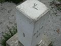 |
|||
| near Reschenpass and Piz Lad Piz Lad Piz Lad is a mountain in the Sesvenna Range , located on the border between Italy and Switzerland. The tripoint between Austria, Italy and Switzerland is located 800 m north of the summit.-External links:*... |
46°51′16"N 10°28′08"E | Europe - West | ||||
| Feldkirch Feldkirch, Vorarlberg - Schools :* Bundesgymnasium und Bundesrealgymnasium Feldkirch * Bundeshandelsakademie und Bundeshandelsschule Feldkirch* Bundesoberstufenrealgymnasium und Bundesrealgymnasium Schillerstrasse... , in river Rhine |
north: 47°16′11"N 09°31′49"E | Europe - West | ||||
| Naafkopf Naafkopf The Naakkopf is a mountain in the Rätikon mountain range , located at the border between Austria, Liechtenstein and Switzerland.-External links:*... |
south: 47°3′35"N 09°36′24"E | Europe - West | 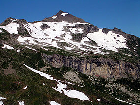 |
|||
| 41°54′00"N 46°24′07"E | Asia - West | |||||
| 39°38′N 44°49′E | Asia - West | |||||
| Caspian Sea Caspian Sea The Caspian Sea is the largest enclosed body of water on Earth by area, variously classed as the world's largest lake or a full-fledged sea. The sea has a surface area of and a volume of... |
38.7°N 51.4°E (disputed) | Asia - West | ||||
| Caspian Sea Caspian Sea The Caspian Sea is the largest enclosed body of water on Earth by area, variously classed as the world's largest lake or a full-fledged sea. The sea has a surface area of and a volume of... |
42.8°N 49.9°E (disputed) | Asia - West | ||||
| Caspian Sea Caspian Sea The Caspian Sea is the largest enclosed body of water on Earth by area, variously classed as the world's largest lake or a full-fledged sea. The sea has a surface area of and a volume of... |
41.5°N 51°E (disputed) | Asia - West | ||||
| 21°59′N 92°36′E | Asia - East/Central | |||||
| 55°40′45"N 26°38′0"E | Europe - North/East | |||||
| 56°09′43"N 28°09′26"E | Europe - North/East | |||||
| 53°57′17"N 23°31′00"E | Europe - North/East | |||||
| 51°30′17"N 23°37′29"E | Europe - North/East | |||||
| 52°06′58"N 31°46′50"E | Europe - North/East | |||||
| 49°32′46"N 05°49′05"E | Europe - West | |||||
| 50°07′47"N 06°08′15"E | Europe - West | 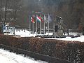 |
||||
| Vaalserberg Vaalserberg The Vaalserberg is a hill 322.7 metres in height and the highest point in the European part of the Netherlands. The Vaalserberg is located in the province of Limburg, at the south-easternmost edge of the country in the municipality of Vaals, near the eponymous town, some three kilometres west of... |
50°45′16"N 06°01′15"E | Europe - West | 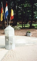 |
|||
| 17°48′47"N 89°8′54"W | America | |||||
| 11°54′N 2°24′E | Africa - West/Central | |||||
| 11°0′N 0°55′E | Africa - West/Central | |||||
| 11°42′N 3°36′E | Africa - West/Central | |||||
| east: 27°46′N 91°39′E (disputed) west: 27°20′N 88°55′E |
Asia - East/Central | |||||
| 20°10′S 58°10′W | America | |||||
| Assis Brasil Assis Brasil Assis Brasil is a municipality located in the south of the Brazilian state of Acre. Its population is 5351 and its area is 2,876 km².-Towns and villages:*Abismo*Assis Brasil - capital*Maloca*Reserva Extrema*São Francisco, Acre... / Iñapari Iñapari District Iñapari District is one of three districts of the Province Tahuamanu in Peru.The Acre river marks the border. The 210 km long trip between Iñapari and Puerto Maldonado will last approximately 3 hours by car. This road is being paved nowadays. It is also the Customs, Point-of-Entry and bordertown on... / Bolpebra Bolpebra Bolpebra is a small Bolivian town on the border tripoint with Peru and Brazil, in the Pando Department on the banks of the Acre River. The name of the town is actually a portmanteau of the three countries’ names, Bolivia, Peru and Brazil. The population of Bolpebra is about 400 inhabitants.... |
10°56′27"S 69°34′1"W | America | ||||
| near Visviri Visviri Visviri is a Chilean hamlet at the northern end of the country and the capital of the General Lagos commune in Parinacota Province, Arica and Parinacota Region. It is notable for being Chile's northernmost populated area. Pop. 265 , and for being near border of three countries of Bolivia, Peru and... |
17°30′S 69°29′W | America | ||||
| 42°33′44"N 18°27′00"E | Europe - Central | |||||
| 44°51′09"N 19°00′38"E | Europe - Central | |||||
| 43°31′N 19°13′E | Europe - Central | |||||
| 24°46′S 20°0′E | Africa - South/East | |||||
| near Kasane Kasane Kasane is a town in Botswana, close to Africa's 'Four Corners', where four countries almost meet: Botswana, Namibia, Zambia and Zimbabwe. It is at the far north-eastern corner of Botswana where it serves as the administrative center of the Chobe District... (four corners) |
17°47′16"S 25°15′24"E | Africa - South/East | ||||
| 22°12′S 29°22′E | Africa - South/East | |||||
| Kasane Kasane Kasane is a town in Botswana, close to Africa's 'Four Corners', where four countries almost meet: Botswana, Namibia, Zambia and Zimbabwe. It is at the far north-eastern corner of Botswana where it serves as the administrative center of the Chobe District... (Four corners) |
17°47′56"S 25°16′13"E | Africa - South/East | ||||
| Tres Fronteras Tres Fronteras Tres Fronteras is the Spanish name for an area of the Amazon Rainforest, noted for its natural beauty, where Brazil, Peru, and Colombia meet... |
04°13′00"S 69°56′00"W | America | ||||
| 1°14′N 66°51′W | America | |||||
| 2°20′N 54°33′W | America | |||||
| 1°57′N 56°29′W | America | |||||
| Monte Roraima Monte Roraima Mount Roraima is the highest of the Pakaraima chain of tepui plateau in South America. First described by the English explorer Sir Walter Raleigh in 1596, its summit area is defended by 400-metre-tall cliffs on all sides... |
5°11′N 60°46′W | America | 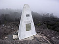 |
|||
| Tumba Peak (Belasica) Tumba Peak (Belasica) Tumba is a peak in the Belasica mountains in the region of Macedonia. The peak, in height, lies on Belasica's main ridge, west of Lozen Peak and east of Sechena Skala Peak. A dome-shaped mountain with steep southern and northern slopes, Tumba is covered with low subalpine vegetation and is made... |
41°20′37"N 22°56′40"E | Europe - Central | ||||
| On the Maritsa Maritsa The Maritsa or Evros , ) is, with a length of 480 km, the longest river that runs solely in the interior of the Balkans. It has its origin in the Rila Mountains in Western Bulgaria, flowing southeast between the Balkan and Rhodope Mountains, past Plovdiv and Parvomay to Edirne, Turkey... south of Kapitan Andreevo Kapitan Andreevo Kapitan Andreevo is a village in Svilengrad municipality, Haskovo Province, southern Bulgaria. As of 2005 it has 948 inhabitants and the mayor is Dimitar Shiderov. Due to the proximity with Turkey, there is a major border checkpoint built there, with the Turkish side of the checkpoint being called... –Kapıkule Kapikule Kapıkule is the Turkish frontier town in Edirne Province on the border of Turkey and Bulgaria. Its counterpart on the Bulgarian side is Kapitan Andreevo. Together, they are the busiest land border crossing point in the world and the busiest in Europe.... |
41°42′43"N 26°21′03"E | Europe - Central | ||||
| Shulep Kamak Peak | 42°19′N 22°22′E | Europe - Central | ||||
| Timok Mouth Timok River The Timok is a river in eastern Serbia and for the last 15 km of its run a border between eastern Serbia and western Bulgaria.It derives the names in all these from the name it had in antiquity, Latin: Timacus.... |
44°13′N 22°41′E | Europe - Central | ||||
| 9°29′N 2°41′W | Africa - West/Central | |||||
| 10°26′N 5°31′W | Africa - West/Central | |||||
| west of Senkase Senkase Senkase is a settlement in the Savanes Region of northern Togo. It is a few kilometres away from the Togo – Burkina Faso – Ghana tripoint and the village is a border checkpoint between Togo and Burkina Faso and between Togo and Ghana .... |
11°7′N 0°0′W | Africa - West/Central | ||||
| 15°0′N 0°14′E | Africa - West/Central | |||||
| Ruzizi River Ruzizi River The Ruzizi , is a river which flows from Lake Kivu to Lake Tanganyika in Central Africa, descending rapidly from about 1,500 metres above sea level to about 770 metres above sea level over its length... |
2°45′S 29°2′E | Africa - South/East | ||||
| Lake Tanganyika Lake Tanganyika Lake Tanganyika is an African Great Lake. It is estimated to be the second largest freshwater lake in the world by volume, and the second deepest, after Lake Baikal in Siberia; it is also the world's longest freshwater lake... |
4°27′S 29°25′E | Africa - South/East | ||||
| 2°24′S 30°34′E | Africa - South/East | |||||
| 14°20′N 105°13′E | Asia - East/Central | |||||
| 14°41′N 107°33′E | Asia - East/Central | |||||
| 7°32′N 15°30′E | Africa - West/Central | |||||
| 2°13′N 16°12′E | Africa - West/Central | |||||
| Lake Tchad | 13°5′N 14°5′E | Africa - West/Central | ||||
| 2°10′N 13°18′E | Africa - West/Central | |||||
| 2°10′N 11°20′E | Africa - West/Central | |||||
| 10°56′N 22°52′E | Africa - West/Central | |||||
| near Betoukoumba Betoukoumba Betoukoumba is a village in the Republic of the Congo. It sits on the border of the Central African Republic and is less than one kilometre from the geographical tripoint between the Republic of the Congo, the Central African Republic, and the Democratic Republic of the Congo.... |
3°28′N 18°37′E | Africa - West/Central | ||||
| 5°1′N 27°27′E | Africa - West/Central | |||||
| 8°38.75′N 24°14.15′E | Africa - West/Central | |||||
| 23°N 15°E | Africa - North | |||||
| 19.5°N 24°E | Africa - North | |||||
| Lake Tchad | 13°42′N 13°38′E | Africa - West/Central | ||||
| 0°7′S 75°15′W | America | |||||
| 7°34′N 8°28′W | Africa - West/Central | |||||
| 10°10′N 7°58′W | Africa - West/Central | |||||
| 45°55′N 18°54′E | Europe - Central | |||||
| 46°28′N 16°37′E | Europe - Central | |||||
| UN Buffer Zone United Nations Buffer Zone in Cyprus The United Nations Buffer Zone in Cyprus runs for more than along what is known as the Green Line and has an area of . The zone partitions the island of Cyprus into a southern area effectively controlled by the government of the Republic of Cyprus , and the northern area... (de facto) |
Dhekelia | east: 35°4′N 33°54′E west: 35°1′N 33°41′E |
Asia - West | |||
| Hrádek nad Nisou Hrádek nad Nisou Hrádek nad Nisou is a town in the Czech Republic.-External links:*... / Zittau Zittau Zittau is a city in the south east of the Free State of Saxony, Germany, close to the border tripoint of Germany, Poland, and the Czech Republic. , there are 28,638 people in the city. It is part of the Görlitz district.... / Porajów Porajów Porajów is a village in the administrative district of Gmina Bogatynia, within Zgorzelec County, Lower Silesian Voivodeship, in south-western Poland, close to the Czech and German borders... |
50°52′13"N 14°49′22"E | Europe - West | ||||
| 49°31′03"N 18°50′56"E | Europe - Central | |||||
| 12°28′N 42°24′E | Africa - North | |||||
| 10°59′N 42°58′E | Africa - North | |||||
| 1°23′S 29°36′E | Africa - South/East | |||||
| near Oraba Oraba -Location:The town is located in the northwestern corner of Uganda, close to the International borders with the Republic of South Sudan and the Democratic Republic of the Congo . It is located a few kilometres , northeast of the precise South Sudan–Uganda–DRC tripoint. Oraba lies in Koboko... |
3°30′N 30°52′E | Africa - South/East | ||||
| Lake Tanganyika Lake Tanganyika Lake Tanganyika is an African Great Lake. It is estimated to be the second largest freshwater lake in the world by volume, and the second deepest, after Lake Baikal in Siberia; it is also the world's longest freshwater lake... |
8°12′S 30°46′E | Africa - South/East | ||||
| near Kerem Shalom Kerem Shalom Kerem Shalom is a kibbutz in the Eshkol Regional Council and a border crossing near the meeting of the Gaza Strip-Israel-Egypt borders.- Kibbutz :The kibbutz was founded in 1966 adjacent to the triborder area by members of Hashomer Hatzair... , Gaza Strip Gaza Strip thumb|Gaza city skylineThe Gaza Strip lies on the Eastern coast of the Mediterranean Sea. The Strip borders Egypt on the southwest and Israel on the south, east and north. It is about long, and between 6 and 12 kilometres wide, with a total area of... |
31°13′N 34°16′E | Asia - West | ||||
| 22°N 25°E | Africa - North | |||||
| 14°25′18"N 89°21′2"W | America | |||||
| 14°15′N 36°34′E | Africa - North | |||||
| Võru Võru County Võrumaa or Võru maakond officially, is a county in Southern Estonia. It is bordered to the north by the Põlva County and the Lake Pihkva; to the west by Valga County; to the south by Latvia; and to the east by the Russian Federation.... /Alūksne Aluksne District Alūksne district was an administrative division of Latvia, located in Vidzeme region, in the country's north-east, from the capital city Riga... /Pskov Pskov Oblast Pskov Oblast is a federal subject of Russia . Pskov Oblast borders the countries of Estonia and Latvia, as well as Belarus. It is the westernmost federal subject of contiguous Russia . Its major cities are the administrative center Pskov and Velikiye Luki . Area: 55,300 km²... |
57°31′30"N 27°21′07"E | Europe - North/East | ||||
| 3°59′N 41°54′E | Africa - South/East | |||||
| Ilemi Triangle Ilemi Triangle The Ilemi Triangle is an area of disputed land in East Africa. Arbitrarily defined, it measures between 10,320 and 14,000 square kilometers . Named after Anuak chief Ilemi Akwon, the territory is claimed by South Sudan and Kenya and borders Ethiopia... |
5.4°N 35.3°E (disputed) | Africa - South/East | ||||
| 9°30′N 34°6.4′E | Africa - North | |||||
| south end of Øvre Pasvik National Park Øvre Pasvik National Park Øvre Pasvik National Park lies in Sør-Varanger municipality in Finnmark county, Norway. The park was opened in 1970 and was originally 63 km². In 2003 the park size was increased to 119 km², at the same time that the adjacent Øvre Pasvik landskapsvernområde, a national protected area, was opened... |
69°3′10"N 28°56′00"E | Europe - North/East | ||||
| Treriksröset Treriksröset Treriksröset , Treriksrøysa , Kolmen valtakunnan rajapyykki is the point at which the borders of Sweden, Norway and Finland meet.... |
69°03′35"N 20°32′49"E | Europe - North/East | 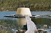 |
|||
| near Schengen | 49°28′10"N 06°22′02"E | Europe - West | ||||
| Basel Basel Basel or Basle In the national languages of Switzerland the city is also known as Bâle , Basilea and Basilea is Switzerland's third most populous city with about 166,000 inhabitants. Located where the Swiss, French and German borders meet, Basel also has suburbs in France and Germany... |
47°35′23"N 07°35′20"E | Europe - West | .jpg) |
|||
| Mont Dolent Mont Dolent Mont Dolent is a mountain in the Mont Blanc massif that lies on the border of Italy and Switzerland.It is generally considered the tripoint between France, Italy and Switzerland, although the point itself lies at 3,749 metres, north-west of the summit of Mont Dolent.The first ascent of the... |
45°55′21"N 07°02′39"E | Europe - West | ||||
| 12°41′N 13°43′W | Africa - West/Central | |||||
| 8°29′N 10°16′W | Africa - West/Central | |||||
| 12°25′N 11°22′W | Africa - West/Central | |||||
| 46°7′N 20°15′E | Europe - Central | |||||
| 47°57′16"N 22°53′50"E | Europe - North/East | |||||
| 48°24′18"N 22°08′24"E | Europe - North/East | |||||
| 28°13′N 97°21′E (disputed) | Asia - East/Central | |||||
| Jongsong Peak Jongsong Peak Jongsong Peak is a mountain in the Janak section of the Himalaya. At it is 57th highest in the world, although it is dominated by 3rd highest Kangchenjunga 20 km to the south.... |
east: 27°53′N 88°8′E west: 30°12′N 81°2′E |
Asia - East/Central | ||||
| Siachen Glacier Siachen Glacier The Siachen Glacier is located in the eastern Karakoram range in the Himalaya Mountains at about , just east of the Line of Control between India-Pakistan. India controls all of the Siachen Glacier itself, including all tributary glaciers. At long, it is the longest glacier in the Karakoram and... (de facto) |
35.6°N 76.8°E (disputed Kashmir conflict The Kashmir conflict is a territorial dispute between India and Pakistan over the Kashmir region, the northwesternmost region of South Asia.... ) |
Asia - East/Central | ||||
| 37°9′N 44°47′E | Asia - West | |||||
| 32°9′N 39°12′E | Asia - West | |||||
| 33°22′N 38°48′E | Asia - West | |||||
| 29°6′N 46°33′E | Asia - West | |||||
| 37.1116°N 42.3633°E | Asia - West | |||||
| Golan Heights | 32°45′N 35°45′E (disputed) | Asia - West | ||||
 West Bank West BankWest Bank The West Bank ) of the Jordan River is the landlocked geographical eastern part of the Palestinian territories located in Western Asia. To the west, north, and south, the West Bank shares borders with the state of Israel. To the east, across the Jordan River, lies the Hashemite Kingdom of Jordan... |
north: 32°23′N 35°33′E south: 31°30′N 35°29′E |
Asia - West | ||||
| Golan Heights | 33°20′N 35°46′E (disputed) | Asia - West | ||||
| 42°13′N 80°15′E | Asia - East/Central | |||||
| 42°16′N 70°57′E | Asia - East/Central | |||||
| 49.0998°N 87.3123°E | Asia - East/Central | |||||
| 41°19′N 56°0′E | Asia - West | |||||
| 4°13′N 34°0′E | Africa - South/East | |||||
| Lake Victoria Lake Victoria Lake Victoria is one of the African Great Lakes. The lake was named for Queen Victoria of the United Kingdom, by John Hanning Speke, the first European to discover this lake.... |
1°0′S 33°55′E | Africa - South/East | ||||
| Republic of Kosovo |
42°16′N 21°35′E | Europe - Central | ||||
| Republic of Kosovo |
42°50′N 20°21′E | Europe - Central | ||||
| 39°28′N 73°36′E | Asia - East/Central | |||||
| 40°14′N 70°59′E | Asia - East/Central | |||||
| 21°34′N 101°9′E | Asia - East/Central | |||||
| 20°21′N 100°5′E | Asia - East/Central | |||||
| 22°24′N 102°9′E | Asia - East/Central | |||||
| 54°21′45"N 22°47′26"E | Europe - North/East | |||||
| 11°34′S 34°58′E (disputed) | Africa - South/East | |||||
| 14°1′S 33°13′E | Africa - South/East | |||||
| 9°24′S 32°58′E | Africa - South/East | |||||
| 14°46′N 12°15′W | Africa - West/Central | |||||
| north: 48°15′50"N 26°37′31"E south: 45°28′00"N 28°12′48"E |
Europe - North/East | |||||
| east: 49°51′N 116°43′E west: 49°10′N 87°49′E |
Asia - East/Central | |||||
| Mpundweni Beacon / Abercorn Drift | north: 25°57′S 31°58′E south: 26°50′S 32°8′E |
Africa - South/East | ||||
| Crook's Corner, Pafuri Triangle Makuleke The Makuleke Contractual Park or Pafuri Triangle constitutes the northernmost section of the Kruger National Park, South Africa, and comprises approximately 240 square kilometres of land. The “triangle” is a wedge of land created by the confluence of the Limpopo and Luvuvhu Rivers at the tripoint... |
22°25′17"S 31°18′32"E | Africa - South/East | ||||
| 15°37′S 30°25′E | Africa - South/East | |||||
| 42°26′N 130°37′E | Asia - East/Central | |||||
| 22°42′N 55°13′E | Asia - West | |||||
| 19°N 52°E | Asia - West | |||||
| 49°05′14"N 22°33′47"E | Europe - North/East | |||||
| 1°4′S 30°29′E | Africa - South/East |