

List of trails of Montana
Encyclopedia
Montana
Montana is a state in the Western United States. The western third of Montana contains numerous mountain ranges. Smaller, "island ranges" are found in the central third of the state, for a total of 77 named ranges of the Rocky Mountains. This geographical fact is reflected in the state's name,...
according to the U.S. Geological Survey, Board of Geographic Names. A trail is defined as: "Route for passage from one point to another; does not include roads or highways (jeep trail, path, ski trail)."
- List of trails of Beaverhead County, Montana
- Big Horn County, MontanaBig Horn County, Montana- National protected areas :* Bighorn Canyon National Recreation Area * Little Bighorn Battlefield National Monument- Economy :Coal Mining and Agriculture both play major roles in Big Horn County’s economy...
- Soldier Trail, 45°14′00"N 107°56′43"W, el. 4455 feet (1,357.9 m)
- Three Springs Trail, 45°11′23"N 107°54′23"W, el. 5469 feet (1,667 m)
- Blaine County, MontanaBlaine County, Montana-National protected areas:* Black Coulee National Wildlife Refuge* Nez Perce National Historical Park * Upper Missouri River Breaks National Monument -Economy:The main industry in Blaine County is Agriculture...
- Cow Island Trail, 47°57′47"N 109°09′44"W, el. 3402 feet (1,036.9 m)
- Broadwater County, MontanaBroadwater County, Montana-Economy:Agriculture is one of the primary industries in Broadwater County. RY Timber and Wheat Montana Bakery were the largest private employers according to the 2000 Census.-Demographics:...
- Divide Trail, 46°28′08"N 111°15′07"W, el. 8576 feet (2,614 m)
- Flathead Indian Trail, 46°17′25"N 111°12′18"W, el. 6457 feet (1,968.1 m)
- List of trails of Carbon County, Montana
- Chouteau County, MontanaChouteau County, Montana-National protected areas:* Lewis and Clark National Forest * Upper Missouri River Breaks National Monument -Economy:Chouteau County is the largest winter wheat producer for the state of Montana...
- Hole in the Wall Trail, 47°48′51"N 110°03′24"W, el. 2644 feet (805.9 m)
- Clearwater County, IdahoClearwater County, IdahoClearwater County is a county located in the U.S. state of Idaho. Established in 1911, the county was named after the Clearwater River. As of the 2000 Census the county had a population of 8,930 . The county seat is Orofino....
- Lolo Trail, 46°38′10"N 114°36′26"W, el. 6424 feet (1,958 m)
- State Line Trail, 46°43′55"N 114°38′59"W, el. 7087 feet (2,160.1 m)
- Dawson County, MontanaDawson County, Montana-Economy:Dawson County is known for its dryland grain, coal mines and gas and oil wells. There are 522 current farms and ranches, and 296 commercial businesses.-Demographics:...
- Cap Rock Nature Trail, 47°03′08"N 104°40′48"W, el. 2615 feet (797.1 m)
- Deer Lodge County, MontanaDeer Lodge County, Montana-National protected areas:*Beaverhead National Forest *Deerlodge National Forest -Demographics:As of the census of 2000, there were 9,417 people, 3,995 households, and 2,524 families residing in the county. The population density was 13 people per square mile . There were 4,958 housing units at an...
- Long Canyon Trail, 46°02′11"N 112°53′59"W, el. 6201 feet (1,890.1 m)
- Fergus County, MontanaFergus County, Montana-National protected areas:* Charles M. Russell National Wildlife Refuge * Lewis and Clark National Forest * Upper Missouri River Breaks National Monument -Demographics:...
- Crystal Lake National Recreation Trail, 46°47′48"N 109°31′11"W, el. 6227 feet (1,898 m)
- Old Musselshell Trail, 47°30′19"N 108°23′42"W, el. 2887 feet (880 m)
- Skyline Trail, 47°32′11"N 108°21′40"W, el. 2743 feet (836.1 m)
- Wagon Wheel Trail, 47°41′45"N 109°42′02"W, el. 3094 feet (943.1 m)
- Wilder Trail, 47°34′21"N 108°26′38"W, el. 2887 feet (880 m)
- List of trails of Flathead County, Montana
- List of trails of Gallatin County, Montana
- List of trails of Glacier County, Montana
- List of trails of Granite County, Montana
- Hill County, MontanaHill County, Montana-National protected areas:*Creedman Coulee National Wildlife Refuge*Lake Thibadeau National Wildlife Refuge-Demographics:As of the census of 2000, there were 16,673 people, 6,457 households, and 4,255 families residing in the county. The population density was 6 people per square mile . There were...
- Mogul Alley Ski Trail, 48°10′40"N 109°38′03"W, el. 4767 feet (1,453 m)
- North Bowl Ski Trail, 48°10′40"N 109°38′03"W, el. 4767 feet (1,453 m)
- Screaming Eagle Ski Trail, 48°10′40"N 109°38′03"W, el. 4767 feet (1,453 m)
- Teacup Ski Trail, 48°10′40"N 109°38′03"W, el. 4767 feet (1,453 m)
- The Face Ski Trail, 48°10′40"N 109°38′03"W, el. 4767 feet (1,453 m)
- Towering Heights Ski Trail, 48°10′40"N 109°38′03"W, el. 4767 feet (1,453 m)
- Jefferson County, MontanaJefferson County, Montana-National protected areas:*Deerlodge National Forest *Helena National Forest -Demographics:As of the census of 2000, there were 10,049 people, 3,747 households, and 2,847 families residing in the county. The population density was 6 people per square mile . There were 4,199 housing units at an...
- Fetters Trail, 46°04′28"N 112°00′29"W, el. 6719 feet (2,048 m)
- Upper Whitetail Park Trail, 46°02′11"N 112°13′43"W, el. 6434 feet (1,961.1 m)
- Lake County, MontanaLake County, Montana-National protected areas:*Flathead National Forest *National Bison Range *Ninepipe National Wildlife Refuge*Pablo National Wildlife Refuge*Swan River National Wildlife Refuge-Demographics:...
- Crow Creek Trail, 47°34′51"N 113°57′56"W, el. 4800 feet (1,463 m)
- Crow Creek Trail, 47°38′05"N 113°50′15"W, el. 3917 feet (1,193.9 m)
- Peterson Creek Trail, 48°02′31"N 113°53′15"W, el. 5873 feet (1,790.1 m)
- Wire Trail, 47°54′34"N 113°46′28"W, el. 5807 feet (1,770 m)
- Lemhi County, IdahoLemhi County, IdahoLemhi County is a county located in the U.S. state of Idaho. The county was established in 1869, named after Fort Lemhi , a remote Mormon missionary settlement from 1855-58 in Bannock and Shoshone territory. As of the 2000 Census the county had a population of 7,806...
- Divide Trail, 45°34′55"N 114°07′00"W, el. 7677 feet (2,339.9 m)
- List of trails of Lewis and Clark County, Montana
- List of trails of Lincoln County, Montana
- List of trails of Madison County, Montana
- List of trails of Meagher County, Montana
- Mineral County, MontanaMineral County, Montana-Demographics:As of the census of 2000, there were 3,884 people, 1,584 households, and 1,067 families residing in the county. The population density was 3 people per square mile . There were 1,961 housing units at an average density of 2 per square mile...
- Cedar Creek Stock Driveway, 47°08′41"N 115°02′45"W, el. 5741 feet (1,749.9 m)
- Oriole Creek Trail, 46°47′15"N 114°37′14"W, el. 5423 feet (1,652.9 m)
- Storm Peak Trail, 47°23′13"N 115°28′20"W, el. 5098 feet (1,553.9 m)
- Trout Creek Stock Driveway, 47°06′29"N 114°57′25"W, el. 6457 feet (1,968.1 m)
- List of trails of Missoula County, Montana
- List of trails of Park County, Montana
- Petroleum County, MontanaPetroleum County, Montana-National protected areas:*Charles M. Russell National Wildlife Refuge *War Horse National Wildlife Refuge-Demographics:At the 2000 census, there were 493 people, 211 households and 136 families residing in the county. The population density was 0.29 per square mile . There were 292 housing units...
- Horse Camp Trail, 47°30′23"N 108°18′16"W, el. 2844 feet (866.9 m)
- Pondera County, MontanaPondera County, Montana-National protected area:*Lewis and Clark National Forest *Rocky Mountain Front Conservation Area -Demographics:As of the census of 2000, there were 6,424 people, 2,410 households, and 1,740 families residing in the county. The population density was 4 people per square mile . There were 2,834...
- North Badger-Elbow Creek Trail, 48°11′16"N 113°09′17"W, el. 5909 feet (1,801.1 m)
- List of trails of Powell County, Montana
- Prairie County, MontanaPrairie County, Montana-Demographics:As of the census of 2000, there were 1,199 people, 537 households, and 354 families residing in the county. The population density was -Demographics:...
- Calypso Trail, 46°47′38"N 105°28′07"W, el. 2434 feet (741.9 m)
- List of trails of Ravalli County, Montana
- Richland County, MontanaRichland County, Montana-Demographics:As of the census of 2000, there were 9,667 people, 3,878 households, and 2,652 families residing in the county. The population density was 5 people per square mile . There were 4,557 housing units at an average density of 2 per square mile...
- Lewis and Clark National Historic TrailLewis and Clark National Historic TrailThe Lewis and Clark National Historic Trail is a route across the United States commemorating the Lewis and Clark Expedition of 1804 to 1806. It is part of the National Trails System of the United States...
, 48°07′35"N 104°51′17"W, el. 1916 feet (584 m) - Lewis and Clark Trail, 47°45′30"N 104°07′02"W, el. 1916 feet (584 m)
- Lewis and Clark National Historic Trail
- List of trails of Sanders County, Montana
- Sweet Grass County, MontanaSweet Grass County, Montana-National protected areas:*Custer National Forest *Gallatin National Forest *Lewis and Clark National Forest -Demographics:As of the census of 2000, there were 3,609 people, 1,476 households, and 987 families residing in the county. The population density was 2 people per square mile...
- Black Butte Trail, 45°37′51"N 109°51′54"W, el. 5643 feet (1,720 m)
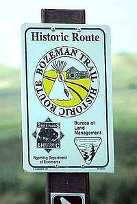
- Bozeman TrailBozeman TrailThe Bozeman Trail was an overland route connecting the gold rush territory of Montana to the Oregon Trail. Its most important period was from 1863-1868. The flow of pioneers and settlers through territory of American Indians provoked their resentment and caused attacks. The U.S. Army undertook...
, 45°39′30"N 109°42′43"W, el. 4764 feet (1,452.1 m) - Lodgepole Trail, 45°33′01"N 109°57′58"W, el. 7195 feet (2,193 m)
- Teton County, MontanaTeton County, Montana-National protected area:*Lewis and Clark National Forest *Rocky Mountain Front Conservation Area -Demographics:As of the census of 2000, there were 6,445 people, 2,538 households, and 1,761 families residing in the county. The population density was 3 people per square mile . There were 2,910...
- Jones Creek National Recreation Trail, 47°56′56"N 112°44′37"W, el. 5833 feet (1,777.9 m)
- Mortimer Gulch National Recreation Trail, 47°38′21"N 112°46′28"W, el. 5712 feet (1,741 m)
- South Fork Teton-Blacktail National Recreation Trail, 47°43′46"N 112°45′21"W, el. 6165 feet (1,879.1 m)
- West Fork Jones Creek National Recreation Trail, 47°56′33"N 112°45′32"W, el. 6092 feet (1,856.8 m)
- Toole County, MontanaToole County, Montana-Demographics:As of the census of 2000, there were 5,267 people, 1,962 households, and 1,308 families residing in the county. The population density was 3 people per square mile . There were 2,300 housing units at an average density of 1 per square mile...
- Bootlegger Trail, 48°14′11"N 111°19′09"W, el. 3212 feet (979 m)
- Yellowstone County, MontanaYellowstone County, Montana-National protected areas:* Nez Perce National Historical Park * Pompeys Pillar National Monument-Demographics:As of the census of 2000, there were 129,352 people, 52,084 households, and 34,219 families residing in the county. The population density was 49 people per square mile . There were...
- Bill Bartley Trail, 45°43′56"N 108°49′50"W, el. 3970 feet (1,210.1 m)
- John Dunn Trail, 45°44′16"N 108°49′07"W, el. 3674 feet (1,119.8 m)