

List of highways in Guam
Encyclopedia
United States
The United States of America is a federal constitutional republic comprising fifty states and a federal district...
territory of Guam
Guam
Guam is an organized, unincorporated territory of the United States located in the western Pacific Ocean. It is one of five U.S. territories with an established civilian government. Guam is listed as one of 16 Non-Self-Governing Territories by the Special Committee on Decolonization of the United...
.
| Number | South/West terminus | North/East terminus |
|---|---|---|
| Guam Highway 1 Guam Highway 1 Guam Highway 1, also known as Marine Corps Drive, is one of the primary automobile routes in the United States territory of Guam. It runs in a southwest to northeast direction, from the main gate of Naval Base Guam in the western community of Santa Rita in a general northeasterly direction to the... |
Santa Rita Santa Rita, Guam Santa Rita is a village located on the southwest coast of the United States territory of Guam with hills overlooking Apra Harbor. According to the 2000 census it has a population of 7,500, down from 11,857 in 1990.... |
Yigo Yigo, Guam Yigo is the northernmost village of the United States territory of Guam, and is the location of Andersen Air Force Base. The municipality of Yigo is larger than any other village on the island in terms of area.... |
| Guam Highway 2 Guam Highway 2 Guam Highway 2 is one of the primary automobile routes in the United States territory of Guam.-Route description:It runs in a south to north direction, from the Magellan Monument in the southern community of Umatac in a general northward direction to the community of Santa Rita, where it meets... |
Umatac Umatac, Guam Umatac is a village on the south-western coast of the island of Guam. The month of March in Chamorro is "Umatalaf," or "to catch guatafi," which is believed to be the root word of Umatac. The village's population has decreased since the island's 2000 census... |
Santa Rita Santa Rita, Guam Santa Rita is a village located on the southwest coast of the United States territory of Guam with hills overlooking Apra Harbor. According to the 2000 census it has a population of 7,500, down from 11,857 in 1990.... |
| Guam Highway 2A | Santa Rita Santa Rita, Guam Santa Rita is a village located on the southwest coast of the United States territory of Guam with hills overlooking Apra Harbor. According to the 2000 census it has a population of 7,500, down from 11,857 in 1990.... |
Santa Rita Santa Rita, Guam Santa Rita is a village located on the southwest coast of the United States territory of Guam with hills overlooking Apra Harbor. According to the 2000 census it has a population of 7,500, down from 11,857 in 1990.... |
| Guam Highway 3 Guam Highway 3 Guam Highway 3 is one of the primary automobile highways in the United States territory of Guam.-Route description:It runs in a south to north direction, from a junction with GH-1 near the Micronesia Mall in the southern community of Tamuning in a general northeasterly direction to the community... |
Dededo Dededo, Guam Dededo is the most populated village of the United States territory of Guam. According to the U.S. Census Bureau, Dededo's population was just under 45,000 in 2010. The village is located on the coral plateau of Northern Guam.- Etymology :... |
Dededo Dededo, Guam Dededo is the most populated village of the United States territory of Guam. According to the U.S. Census Bureau, Dededo's population was just under 45,000 in 2010. The village is located on the coral plateau of Northern Guam.- Etymology :... |
| Guam Highway 3A | Dededo Dededo, Guam Dededo is the most populated village of the United States territory of Guam. According to the U.S. Census Bureau, Dededo's population was just under 45,000 in 2010. The village is located on the coral plateau of Northern Guam.- Etymology :... |
Yigo Yigo, Guam Yigo is the northernmost village of the United States territory of Guam, and is the location of Andersen Air Force Base. The municipality of Yigo is larger than any other village on the island in terms of area.... |
| Guam Highway 4 Guam Highway 4 Guam Highway 4 is one of the primary automobile highways in the United States territory of Guam.-Route description:GH-4 is the major highway along the southeastern coast of Guam, comprising the majority of a loop around the southern half of the island... |
Umatac Umatac, Guam Umatac is a village on the south-western coast of the island of Guam. The month of March in Chamorro is "Umatalaf," or "to catch guatafi," which is believed to be the root word of Umatac. The village's population has decreased since the island's 2000 census... |
Hagåtña Hagåtña, Guam Hagåtña , formerly English Agana and in Spanish Agaña, is the capital of the United States island territory of Guam. It is the island's second smallest village in both area and population. From the 18th through mid 20th century, it was Guam's population center... |
| Guam Highway 4A | Talofofo Talofofo, Guam Talofofo is a village located in the southern part of the United States territory of Guam, on the east coast. The village center is located in the hills above the coast, while the smaller coastal community below the cliff is known as Ipan.... |
Talofofo Talofofo, Guam Talofofo is a village located in the southern part of the United States territory of Guam, on the east coast. The village center is located in the hills above the coast, while the smaller coastal community below the cliff is known as Ipan.... |
| Guam Highway 5 Guam Highway 5 Guam Highway 5 is one of the primary automobile highways in the United States territory of Guam.-Route description:The western end of GH-5 is in Santa Rita at a junction with GH-2A. The roadway runs east and then turns south through Apra Heights, intersecting with the western terminus of GH-17... |
Agat Agat, Guam Agat is a village on the island of Guam, an unincorporated territory of the United States. It is located south of Apra Harbor on the island's western shore. The village's population has decreased since the island's 2000 census.... |
Santa Rita Santa Rita, Guam Santa Rita is a village located on the southwest coast of the United States territory of Guam with hills overlooking Apra Harbor. According to the 2000 census it has a population of 7,500, down from 11,857 in 1990.... |
| Guam Highway 6 Guam Highway 6 Guam Highway 6 is one of the primary automobile highways in the United States territory of Guam.-Route description:The route creates a diversion along part of GH-1 between Piti and Asan and is the primary means of reaching Nimitz Hill... |
Piti Piti, Guam Piti is a village located on the western shore of Guam. It contains the commercial port of Guam at Apra Harbor as well as several of the island’s largest power plants.- Education :Guam Public School System serves the island.... |
Asan Asan, Guam Asan is a village located on the western shore of the U.S. territory of Guam. The municipality of Asan-Maina combines Asan with Maina, a community in the hills to the east. It was a primary landing site for United States Marines during Guam's liberation from the Japanese in World War II. Asan... |
| Guam Highway 7 Guam Highway 7 Guam Highway 7 is one of the primary automobile highways in the United States territory of Guam.-Route description:The route provides access to two primary locations: US Naval Hospital, Guam, on the north side of the road, and the community of Agana Heights, on the south side... |
Asan Asan, Guam Asan is a village located on the western shore of the U.S. territory of Guam. The municipality of Asan-Maina combines Asan with Maina, a community in the hills to the east. It was a primary landing site for United States Marines during Guam's liberation from the Japanese in World War II. Asan... |
Hagåtña Hagåtña, Guam Hagåtña , formerly English Agana and in Spanish Agaña, is the capital of the United States island territory of Guam. It is the island's second smallest village in both area and population. From the 18th through mid 20th century, it was Guam's population center... |
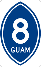
| Guam Highway 8 Guam Highway 8 Guam Highway 8 is one of the primary automobile highways in the United States territory of Guam.-Route description:The route is one of the more important highways in the island and is designated the Purple Heart Highway... |
Hagåtña Hagåtña, Guam Hagåtña , formerly English Agana and in Spanish Agaña, is the capital of the United States island territory of Guam. It is the island's second smallest village in both area and population. From the 18th through mid 20th century, it was Guam's population center... |
Barrigada Barrigada, Guam Barrigada is a village in central Guam. A largely residential municipality, its main village is located south of the Antonio B. Won Pat International Airport near the intersections of Routes 8, 10, and 16... |
| Guam Highway 9 Guam Highway 9 Guam Highway 9 is one of the primary automobile highways in the United States territory of Guam.-Route description:This northern route is a relatively short connector between GH-3 and GH-1, skirting the southern reaches of Andersen Air Force Base... |
Dededo Dededo, Guam Dededo is the most populated village of the United States territory of Guam. According to the U.S. Census Bureau, Dededo's population was just under 45,000 in 2010. The village is located on the coral plateau of Northern Guam.- Etymology :... |
Yigo Yigo, Guam Yigo is the northernmost village of the United States territory of Guam, and is the location of Andersen Air Force Base. The municipality of Yigo is larger than any other village on the island in terms of area.... |
| Guam Highway 10 Guam Highway 10 Guam Highway 10 is one of the primary automobile highways in the United States territory of Guam.-Route description:GH-10 begins at a junction off GH-4 a little in from Pago Bay. It trends eastward into the coastal village of Mangilao. GH-32 then spurs off the route towards the University of Guam... |
Chalan-Pago-Ordot | Barrigada Barrigada, Guam Barrigada is a village in central Guam. A largely residential municipality, its main village is located south of the Antonio B. Won Pat International Airport near the intersections of Routes 8, 10, and 16... |
| Guam Highway 10A Guam Highway 10A Guam Highway 10A is one of the primary automobile highways in the United States territory of Guam.-Route description:GH-10A is one of a number of orphaned suffixed routes on Guam; it bears no physical connection to its supposed parent, GH-10: located elsewhere in Barrigada... |
Tamuning Tamuning, Guam Tamuning, also known as Tamuning-Tumon-Harmon is a municipality or "village" located on the western shore of the island of Guam. The village of Tamuning can be viewed as the economic center of Guam, containing Tumon , Harmon Industrial Park, and commercial districts in other parts of the... |
Barrigada Barrigada, Guam Barrigada is a village in central Guam. A largely residential municipality, its main village is located south of the Antonio B. Won Pat International Airport near the intersections of Routes 8, 10, and 16... |
| Guam Highway 11 Guam Highway 11 Guam Highway 11 is one of the primary automobile highways in the United States territory of Guam.-Route description:This spur route from GH-1 runs westward along Cabras Island, a narrow peninsula which forms the northern edge of Apra Harbor. This area houses Guam's commercial port facilities,... |
Piti Piti, Guam Piti is a village located on the western shore of Guam. It contains the commercial port of Guam at Apra Harbor as well as several of the island’s largest power plants.- Education :Guam Public School System serves the island.... |
Piti Piti, Guam Piti is a village located on the western shore of Guam. It contains the commercial port of Guam at Apra Harbor as well as several of the island’s largest power plants.- Education :Guam Public School System serves the island.... |
| Guam Highway 12 Guam Highway 12 Guam Highway 12 is one of the primary automobile highways in the United States territory of Guam.-Route description:GH-12 is a short connector route that runs eastward from GH-2 through the northern part of residential Agat towards the Ordnance Annex Naval facility in Santa Rita... |
Agat Agat, Guam Agat is a village on the island of Guam, an unincorporated territory of the United States. It is located south of Apra Harbor on the island's western shore. The village's population has decreased since the island's 2000 census.... |
Santa Rita Santa Rita, Guam Santa Rita is a village located on the southwest coast of the United States territory of Guam with hills overlooking Apra Harbor. According to the 2000 census it has a population of 7,500, down from 11,857 in 1990.... |
| Guam Highway 14 Guam Highway 14 Guam Highway 14 is one of the primary automobile highways in the United States territory of Guam.-Route description:GH-14, a diversion route off GH-1, is the resort road of Guam. It and its suffixed child routes are the means to reach the resorts and beaches of Tumon Bay, Guam's primary resort area... |
Tamuning Tamuning, Guam Tamuning, also known as Tamuning-Tumon-Harmon is a municipality or "village" located on the western shore of the island of Guam. The village of Tamuning can be viewed as the economic center of Guam, containing Tumon , Harmon Industrial Park, and commercial districts in other parts of the... |
Tamuning Tamuning, Guam Tamuning, also known as Tamuning-Tumon-Harmon is a municipality or "village" located on the western shore of the island of Guam. The village of Tamuning can be viewed as the economic center of Guam, containing Tumon , Harmon Industrial Park, and commercial districts in other parts of the... |
| Guam Highway 14A | Tamuning Tamuning, Guam Tamuning, also known as Tamuning-Tumon-Harmon is a municipality or "village" located on the western shore of the island of Guam. The village of Tamuning can be viewed as the economic center of Guam, containing Tumon , Harmon Industrial Park, and commercial districts in other parts of the... |
Tamuning Tamuning, Guam Tamuning, also known as Tamuning-Tumon-Harmon is a municipality or "village" located on the western shore of the island of Guam. The village of Tamuning can be viewed as the economic center of Guam, containing Tumon , Harmon Industrial Park, and commercial districts in other parts of the... |
| Guam Highway 14B | Tamuning Tamuning, Guam Tamuning, also known as Tamuning-Tumon-Harmon is a municipality or "village" located on the western shore of the island of Guam. The village of Tamuning can be viewed as the economic center of Guam, containing Tumon , Harmon Industrial Park, and commercial districts in other parts of the... |
Tamuning Tamuning, Guam Tamuning, also known as Tamuning-Tumon-Harmon is a municipality or "village" located on the western shore of the island of Guam. The village of Tamuning can be viewed as the economic center of Guam, containing Tumon , Harmon Industrial Park, and commercial districts in other parts of the... |
| Guam Highway 15 Guam Highway 15 Guam Highway 15 is one of the primary automobile highways in the United States territory of Guam.-Route description:GH-15's route covers mainly the northeast coast of Guam. Beginning off of GH-4 in Chalan Pago-Ordot, GH-15 proceeds eastward into Mangilao, where it intersects GH-10. GH-15 continues... |
Chalan-Pago-Ordot | Yigo Yigo, Guam Yigo is the northernmost village of the United States territory of Guam, and is the location of Andersen Air Force Base. The municipality of Yigo is larger than any other village on the island in terms of area.... |
| Guam Highway 16 Guam Highway 16 Guam Highway 16 is one of the primary automobile highways in the United States territory of Guam.-Route description:GH-16 serves as one of the chief routes of the island's central plateau , splitting off from GH-8 in Barrigada and turning northeast, skirting around the eastern reaches of Tiyan ... |
Barrigada Barrigada, Guam Barrigada is a village in central Guam. A largely residential municipality, its main village is located south of the Antonio B. Won Pat International Airport near the intersections of Routes 8, 10, and 16... |
Dededo Dededo, Guam Dededo is the most populated village of the United States territory of Guam. According to the U.S. Census Bureau, Dededo's population was just under 45,000 in 2010. The village is located on the coral plateau of Northern Guam.- Etymology :... |
| Guam Highway 17 Guam Highway 17 Guam Highway 17 is one of the primary automobile highways in the United States territory of Guam.-Route description:GH-17 provides a more–direct route across the southern part of the island, running from GH-5 in the western village of Santa Rita to GH-4 along the east coast in Yona... |
Santa Rita Santa Rita, Guam Santa Rita is a village located on the southwest coast of the United States territory of Guam with hills overlooking Apra Harbor. According to the 2000 census it has a population of 7,500, down from 11,857 in 1990.... |
Yona Yona, Guam - History :The village was historically a farming community but today is mostly residential. During World War II, the Japanese forced the indigenous Chamorros to march from camps in northern Guam to prison camps in the Manenggon area in Yona shortly before the Americans liberated the island... |
| Guam Highway 18 Guam Highway 18 Guam Highway 18 is one of the primary automobile highways in the United States territory of Guam.-Route description:In spite of its main highway designation, GH-18 is a short spur route, running westward from GH-1 across from the Guam Veterans Cemetery and along onto Drydock Island, a small... |
Piti Piti, Guam Piti is a village located on the western shore of Guam. It contains the commercial port of Guam at Apra Harbor as well as several of the island’s largest power plants.- Education :Guam Public School System serves the island.... |
Piti Piti, Guam Piti is a village located on the western shore of Guam. It contains the commercial port of Guam at Apra Harbor as well as several of the island’s largest power plants.- Education :Guam Public School System serves the island.... |
| Guam Highway 26 | Mangilao Mangilao, Guam Mangilao is a village on the eastern shore of the United States territory of Guam. The village's population has increased slightly following the island's 2000 census.... |
Dededo Dededo, Guam Dededo is the most populated village of the United States territory of Guam. According to the U.S. Census Bureau, Dededo's population was just under 45,000 in 2010. The village is located on the coral plateau of Northern Guam.- Etymology :... |
| Guam Highway 27 | Dededo Dededo, Guam Dededo is the most populated village of the United States territory of Guam. According to the U.S. Census Bureau, Dededo's population was just under 45,000 in 2010. The village is located on the coral plateau of Northern Guam.- Etymology :... |
Dededo Dededo, Guam Dededo is the most populated village of the United States territory of Guam. According to the U.S. Census Bureau, Dededo's population was just under 45,000 in 2010. The village is located on the coral plateau of Northern Guam.- Etymology :... |
| Guam Highway 27A | Dededo Dededo, Guam Dededo is the most populated village of the United States territory of Guam. According to the U.S. Census Bureau, Dededo's population was just under 45,000 in 2010. The village is located on the coral plateau of Northern Guam.- Etymology :... |
Dededo Dededo, Guam Dededo is the most populated village of the United States territory of Guam. According to the U.S. Census Bureau, Dededo's population was just under 45,000 in 2010. The village is located on the coral plateau of Northern Guam.- Etymology :... |
| Guam Highway 28 | Dededo Dededo, Guam Dededo is the most populated village of the United States territory of Guam. According to the U.S. Census Bureau, Dededo's population was just under 45,000 in 2010. The village is located on the coral plateau of Northern Guam.- Etymology :... |
Dededo Dededo, Guam Dededo is the most populated village of the United States territory of Guam. According to the U.S. Census Bureau, Dededo's population was just under 45,000 in 2010. The village is located on the coral plateau of Northern Guam.- Etymology :... |
| Guam Highway 29 | Yigo Yigo, Guam Yigo is the northernmost village of the United States territory of Guam, and is the location of Andersen Air Force Base. The municipality of Yigo is larger than any other village on the island in terms of area.... |
Yigo Yigo, Guam Yigo is the northernmost village of the United States territory of Guam, and is the location of Andersen Air Force Base. The municipality of Yigo is larger than any other village on the island in terms of area.... |
| Guam Highway 30 | Tamuning Tamuning, Guam Tamuning, also known as Tamuning-Tumon-Harmon is a municipality or "village" located on the western shore of the island of Guam. The village of Tamuning can be viewed as the economic center of Guam, containing Tumon , Harmon Industrial Park, and commercial districts in other parts of the... |
Tamuning Tamuning, Guam Tamuning, also known as Tamuning-Tumon-Harmon is a municipality or "village" located on the western shore of the island of Guam. The village of Tamuning can be viewed as the economic center of Guam, containing Tumon , Harmon Industrial Park, and commercial districts in other parts of the... |
| Guam Highway 30A | Tamuning Tamuning, Guam Tamuning, also known as Tamuning-Tumon-Harmon is a municipality or "village" located on the western shore of the island of Guam. The village of Tamuning can be viewed as the economic center of Guam, containing Tumon , Harmon Industrial Park, and commercial districts in other parts of the... |
Tamuning Tamuning, Guam Tamuning, also known as Tamuning-Tumon-Harmon is a municipality or "village" located on the western shore of the island of Guam. The village of Tamuning can be viewed as the economic center of Guam, containing Tumon , Harmon Industrial Park, and commercial districts in other parts of the... |
| Guam Highway 32 | Mangilao Mangilao, Guam Mangilao is a village on the eastern shore of the United States territory of Guam. The village's population has increased slightly following the island's 2000 census.... |
Mangilao Mangilao, Guam Mangilao is a village on the eastern shore of the United States territory of Guam. The village's population has increased slightly following the island's 2000 census.... |
| Guam Highway 33 | Hagåtña Hagåtña, Guam Hagåtña , formerly English Agana and in Spanish Agaña, is the capital of the United States island territory of Guam. It is the island's second smallest village in both area and population. From the 18th through mid 20th century, it was Guam's population center... |
Mongmong-Toto-Maite Mongmong-Toto-Maite, Guam Mongmong-Toto-Maite is a municipality in Guam composed of three separate villages east of Hagåtña that experienced development after World War II. Mongmong is adjacent to the Hagåtña Swamp. Toto is situated to the northeast near Barrigada. Maite is located on the cliffs over Agana Bay. The... |
| Guam Highway 34 | Dededo Dededo, Guam Dededo is the most populated village of the United States territory of Guam. According to the U.S. Census Bureau, Dededo's population was just under 45,000 in 2010. The village is located on the coral plateau of Northern Guam.- Etymology :... |
Dededo Dededo, Guam Dededo is the most populated village of the United States territory of Guam. According to the U.S. Census Bureau, Dededo's population was just under 45,000 in 2010. The village is located on the coral plateau of Northern Guam.- Etymology :... |