
List of counties in South Dakota
Encyclopedia
There are 66 counties in the U.S. state
of South Dakota
with FIPS codes, and includes an outline map of the state and a map showing the population density of the counties.
Todd County and Shannon County are two counties in South Dakota that do not have their own county seat
. Hot Springs in Fall River County serves as the administrative center of Shannon County. Winner in Tripp County serves as the administrative center of Todd County. It is also one of five South Dakota counties that lie entirely within an Indian reservation
. (The others are Corson County, Dewey County, Shannon County, and Ziebach County.)
South Dakota's postal abbreviation is SD and its FIPS state code
is 46.
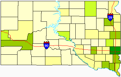 Darker colors indicate heavier density.
U.S. state
A U.S. state is any one of the 50 federated states of the United States of America that share sovereignty with the federal government. Because of this shared sovereignty, an American is a citizen both of the federal entity and of his or her state of domicile. Four states use the official title of...
of South Dakota
South Dakota
South Dakota is a state located in the Midwestern region of the United States. It is named after the Lakota and Dakota Sioux American Indian tribes. Once a part of Dakota Territory, South Dakota became a state on November 2, 1889. The state has an area of and an estimated population of just over...
with FIPS codes, and includes an outline map of the state and a map showing the population density of the counties.
Todd County and Shannon County are two counties in South Dakota that do not have their own county seat
County seat
A county seat is an administrative center, or seat of government, for a county or civil parish. The term is primarily used in the United States....
. Hot Springs in Fall River County serves as the administrative center of Shannon County. Winner in Tripp County serves as the administrative center of Todd County. It is also one of five South Dakota counties that lie entirely within an Indian reservation
Indian reservation
An American Indian reservation is an area of land managed by a Native American tribe under the United States Department of the Interior's Bureau of Indian Affairs...
. (The others are Corson County, Dewey County, Shannon County, and Ziebach County.)
South Dakota's postal abbreviation is SD and its FIPS state code
FIPS state code
FIPS state codes were numeric and two-letter alphabetic codes defined in U.S. Federal Information Processing Standard Publication 5-2 to identify U.S. states and certain other associated areas...
is 46.
Table of counties
|}Former counties
- Armstrong CountyArmstrong County, South DakotaArmstrong County is the name shared by two defunct counties that existed in Dakota Territory and South Dakota from 1873 to 1879 and again from 1883 to 1952.-Armstrong County :...
(1883–1952): Created by Dakota Territory as Pyatt County in 1883 from Cheyenne, Rusk (Dewey), and Stanely Counties. Renamed Armstrong in 1895. Dissolved into Dewey in 1952. - Boreman County (1873–1909): Created by Dakota Territory from unorganized lands in 1873. Lost territory to North Dakota when South Dakota became a state in 1889. Abolished in 1909 when it became part of Corson County.
- Lugenbeel County (1875–1909): Created by Dakota Territory from unorganized lands and Meyer and Pratt Counties in 1875. Abolished in 1909 when it became part of Bennett and Todd Counties.
- Nowlin County (1883–1898): Created by Dakota Territory in 1883 from Cheyenne and White River Counties. Abolished in 1898 when it became part of Lyman and Stanley Counties.
- Pyatt County (1883–1895): Created by Dakota Territory from unorganized lands in 1883. Renamed Armstrong in 1895.
- Schnasse County (1883–1911): Created by Dakota Territory from unorganized lands and part of Boreman County in 1883. Lost territory to North Dakota when South Dakota became a state. Abolished in 1911 when it became part of Ziebach County.
- Sterling County (1883–1911): Created by Dakota Territory from Cheyenne County. Abolished in 1911 when it became part of Ziebach County.
- Washabaugh CountyWashabaugh County, South DakotaWashabaugh County is a former county in South Dakota. The county was named after Frank Washabaugh, a prominent South Dakota politician.-History:...
(1883–1983): South Dakota's most recent county to be eliminated. Created by Dakota Territory in 1883. Abolished in 1983 when it was merged with Jackson County. - Washington County (1888-1943): Abolished in 1943 when it was merged into Jackson, Pennington and Shannon Counties.
Population density map