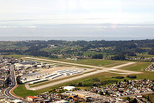
List of airports of Santa Cruz County, California
Encyclopedia

Santa Cruz, California
Santa Cruz is the county seat and largest city of Santa Cruz County, California in the US. As of the 2010 U.S. Census, Santa Cruz had a total population of 59,946...
, once had several active public airports, of which all but one have closed.
Public use airports
- Watsonville Municipal AirportWatsonville Municipal AirportWatsonville Municipal Airport is a public airport located three miles northwest of the central business district of Watsonville, a city in Santa Cruz County, California, USA. The airport covers and has two runways...
, Watsonville, CaliforniaWatsonville, CaliforniaWatsonville is a city in Santa Cruz County, California, United States. The population was 51,199 according to the 2010 census.Located on the central coast of California, the economy centers predominantly around the farming industry. It is known for growing strawberries, apples, lettuce and a host...
(ICAO airport codeICAO airport codeThe ICAO airport code or location indicator is a four-character alphanumeric code designating each airport around the world. These codes are defined by the International Civil Aviation Organization, and published in ICAO Document 7910: Location Indicators.The ICAO codes are used by air traffic...
: KWVI)
Notable private use airports
- Monterey Bay Academy AirportMonterey Bay Academy AirportMonterey Bay Academy Airport is located near the city of Watsonville in Santa Cruz County, California, USA. This private use airport is owned by the Seventh-day Adventist Church and located on the campus of the Monterey Bay Academy, site of the former Camp McQuaide.-History:In the 1940s, a small...
, Watsonville, CaliforniaWatsonville, CaliforniaWatsonville is a city in Santa Cruz County, California, United States. The population was 51,199 according to the 2010 census.Located on the central coast of California, the economy centers predominantly around the farming industry. It is known for growing strawberries, apples, lettuce and a host...
(FAA identifier: CA66)
Former airports
- Capitola Airport (1920s-1954), Capitola, CaliforniaCapitola, CaliforniaCapitola is a city in Santa Cruz County, California, United States, on the coast of Monterey Bay. The population was 9,918 at the 2010 census.-History:...
- Santa Cruz Sky ParkSanta Cruz Sky ParkSanta Cruz Sky Park was an airport located in Scotts Valley, California, within Santa Cruz County.-Historical Timeline:-Sources:* 1 Appendix A Santa Cruz Sky Park was an airport located in Scotts Valley, California, within Santa Cruz County.-Historical Timeline:-Sources:* 1 Appendix A Santa Cruz...
(1947–1983), Scotts Valley, CaliforniaScotts Valley, CaliforniaScotts Valley is a small city in Santa Cruz County, California, United States, about thirty miles south of downtown San Jose and six miles north of Monterey Bay, in the upland slope of the Santa Cruz Mountains. As of the 2010 census, the city population was 11,580... - Olympia Airport, Olympia, CaliforniaCaliforniaCalifornia is a state located on the West Coast of the United States. It is by far the most populous U.S. state, and the third-largest by land area...
- (Original) Watsonville Airport (1931–1946), Watsonville, CaliforniaCaliforniaCalifornia is a state located on the West Coast of the United States. It is by far the most populous U.S. state, and the third-largest by land area...

