

List of Pennsylvania state historical markers in York County
Encyclopedia
This is intended to be a complete list of the official state historical markers placed in York County, Pennsylvania
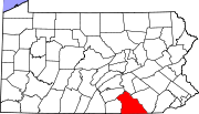
York County, Pennsylvania
York County is a county in the U.S. state of Pennsylvania. As of 2010, the population was 434,972. It is in the Susquehanna Valley, a large fertile agricultural region in South Central Pennsylvania....
by the Pennsylvania Historical and Museum Commission
Pennsylvania Historical and Museum Commission
The Pennsylvania Historical and Museum Commission is the governmental agency of the Commonwealth of Pennsylvania responsible for the collection, conservation and interpretation of Pennsylvania's historic heritage...
(PHMC). The locations of the historical markers, as well as the latitude and longitude coordinates as provided by the PHMC's database, are included below when available. There are 62 historical markers located in York County.
Historical markers
| Marker title | Image | Date dedicated | Location | Marker type | Topics |
|---|---|---|---|---|---|
| Abraham Lincoln Abraham Lincoln Abraham Lincoln was the 16th President of the United States, serving from March 1861 until his assassination in April 1865. He successfully led his country through a great constitutional, military and moral crisis – the American Civil War – preserving the Union, while ending slavery, and... |
 |
PA 94 (Carlisle St.) & Park Ave., Hanover 39.80283°N 76.98579°W |
City | Abraham Lincoln, Government & Politics, Government & Politics 19th Century | |
| Amanda Berry Smith | 108 S. Main St., Grace U.M. Church, Shrewsbury 39.76704°N 76.67964°W |
Roadside | African American, Education, Music & Theater, Publishing, Religion, Women | ||
| America's First Iron Steamboat | Pa. 462 (old U.S. 30), .3 mile W of Wrightsville 40.02154°N 76.54821°W |
Roadside | Business & Industry, Transportation | ||
| Articles of Confederation Articles of Confederation The Articles of Confederation, formally the Articles of Confederation and Perpetual Union, was an agreement among the 13 founding states that legally established the United States of America as a confederation of sovereign states and served as its first constitution... |
NE Corner of Continental Square (Market & George Sts.), York 39.962671°N 76.72756°W |
City | Government & Politics, Government & Politics 18th Century | ||
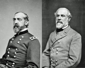
| Battle of Hanover Battle of Hanover The Battle of Hanover took place on June 30, 1863, in Hanover in southwestern York County, Pennsylvania, as part of the Gettysburg Campaign of the American Civil War.... |
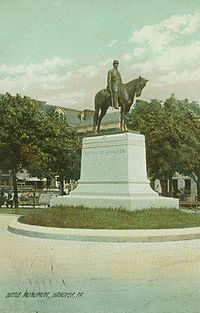 |
SW section of square, Hanover 39.80052°N 76.98354°W |
City | American Revolution, Military | |
| Black Horse Tavern | NW section of square, York 39.96269°N 76.72818°W |
City | Business & Industry, Inns & Taverns, William Penn | ||
| Bob Hoffman Bob Hoffman Wayne Robert Hoffman was a U.S. American football running back in the NFL for the Washington Redskins and Los Angeles Rams. He also played in the All-America Football Conference for the Los Angeles Dons and in the Pacific Coast Professional Football League for the Hollywood Bears... |
3300 Board Rd. (SR 1031) W of Emigsville, just off I-83 exit, York 40.02343°N 76.74147°W |
Roadside | Government & Politics, Sports | ||
| Camp Security | E Market St (PA 462/old US 30), 3 miles E of York at Stonybrook 39.98382°N 76.64833°W |
Roadside | American Revolution, Military | ||
| Captain Thomas Cresap (1703-1790) (PLAQUE) Thomas Cresap Colonel Thomas Cresap was an English-born pioneer settler in the state of Maryland, and an agent of Lord Baltimore in the Maryland-Pennsylvania boundary dispute. During the dispute, Cresap became a notorious figure in the Conejohela Flats areathe Susquehanna Valley in the area south of Wright's... |
 |
PA 624 at Bank Hill Rd., 2.4 NE of Craley 39.97296°N 76.49993°W |
Plaque | Early Settlement, Government & Politics 17th Century, Houses & Homesteads, Military, Native American | |
| Codorus Furnace | PA 24 at SR 1008, Starview 40.04842°N 76.68839°W |
Roadside | Business & Industry, Coal, Furnaces, Iron | ||
| Colonel Thomas Hartley Thomas Hartley Thomas Hartley was an American lawyer, soldier, and politician from York, Pennsylvania.He was born in Reading, Pennsylvania and practiced law in York... |
W. Market St. between Beaver & George Sts., York 39.96196°N 76.72888°W |
City | Government & Politics, Government & Politics 18th Century | ||
| Cresap's Fort Cresap's War Cresap's War was a border conflict between Pennsylvania and Maryland, fought in the 1730s... |
|
Pa. 624, 2.4 miles NE of Craley 39.97359°N 76.49425°W |
Roadside | Buildings, Forts | |
| First Pinchot Road | PA 177 (Rossville Rd.) & Bull Rd., 1.5 miles S of Lewisberry 40.116114°N 76.86717°W |
Roadside | Roads, Transportation | ||
| Gen. Horatio Gates Horatio Gates Horatio Lloyd Gates was a retired British soldier who served as an American general during the Revolutionary War. He took credit for the American victory at the Battle of Saratoga – Benedict Arnold, who led the attack, was finally forced from the field when he was shot in the leg – and... |
W. Market St. between Pershing Ave. & Beaver St., York 39.961144°N 76.73135°W |
City | American Revolution, George Washington, Military | ||
| Gen. Wayne Headquarters Anthony Wayne Anthony Wayne was a United States Army general and statesman. Wayne adopted a military career at the outset of the American Revolutionary War, where his military exploits and fiery personality quickly earned him a promotion to the rank of brigadier general and the sobriquet of Mad Anthony.-Early... |
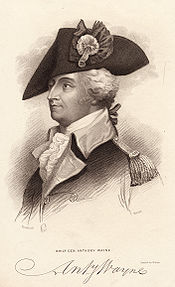 |
NW corner, Market & Beaver Sts., York 39.96175°N 76.72975°W |
City | American Revolution, Military | |
| Gettysburg Campaign Gettysburg Campaign The Gettysburg Campaign was a series of battles fought in June and July 1863, during the American Civil War. After his victory in the Battle of Chancellorsville, Confederate General Robert E. Lee's Army of Northern Virginia moved north for offensive operations in Maryland and Pennsylvania. The... |
 |
PA 74 (Carlisle Rd.) & Davidsburg Rd., Weiglestown, S of Dover 39.98382°N 76.82382°W |
Roadside | Civil War, Military, Roads | |
| Gettysburg Campaign Gettysburg Campaign The Gettysburg Campaign was a series of battles fought in June and July 1863, during the American Civil War. After his victory in the Battle of Chancellorsville, Confederate General Robert E. Lee's Army of Northern Virginia moved north for offensive operations in Maryland and Pennsylvania. The... |
|
PA 462 (old US 30), John & W Market Sts., W of York 39.94873°N 76.77977°W |
Roadside | Civil War, Military | |
| Gettysburg Campaign Gettysburg Campaign The Gettysburg Campaign was a series of battles fought in June and July 1863, during the American Civil War. After his victory in the Battle of Chancellorsville, Confederate General Robert E. Lee's Army of Northern Virginia moved north for offensive operations in Maryland and Pennsylvania. The... |
|
PA 116 near PA 216, just E of Hanover (at Snyder's of Hanover) 39.80301°N 76.95273°W |
Roadside | Civil War, Military | |
| Gettysburg Campaign Gettysburg Campaign The Gettysburg Campaign was a series of battles fought in June and July 1863, during the American Civil War. After his victory in the Battle of Chancellorsville, Confederate General Robert E. Lee's Army of Northern Virginia moved north for offensive operations in Maryland and Pennsylvania. The... |
|
PA 194, just SW of Hanover 39.793384°N 76.99142°W |
Roadside | Civil War, Military | |
| Gettysburg Campaign Gettysburg Campaign The Gettysburg Campaign was a series of battles fought in June and July 1863, during the American Civil War. After his victory in the Battle of Chancellorsville, Confederate General Robert E. Lee's Army of Northern Virginia moved north for offensive operations in Maryland and Pennsylvania. The... |
|
PA 462 (old US 30) at Susquehanna River Bridge, Wrightsville 39.94744°N 76.78095°W |
Roadside | Civil War, Military | |
| Gettysburg Campaign - Raid on Jefferson | |
Town Sq. @ York St. (SR 3041) & Baltimore St. (Rt. 516), Jefferson 39.8171°N 76.8416°W |
Roadside | Cities & Towns, Civil War, Military | |
| Globe Inn | SW section of Square, York 39.96235°N 76.72807°W |
City | Buildings, Business & Industry, Inns & Taverns | ||
| Golden Plough Tavern Golden Plough Tavern The Golden Plough Tavern, built in 1741 on the same site as the General Horatio Gates House and the Barnett Bobb Log House , is a historic building in downtown York, Pennsylvania and is the oldest surviving building there.-External links:* http://www.yorkheritage.org... |
462 (W Market St.), just E of Pershing Ave., York 39.96129°N 76.73148°W |
City | Buildings, Business & Industry, Inns & Taverns | ||
| Hall & Sellers Press | SW corner, Market & Beaver Sts., York 39.96186°N 76.72992°W |
City | Business & Industry | ||
| Hanover Junction | PA 616, 4 miles S of New Salem at Hanover Junction (off rd. at train station/museum) 39.84329°N 76.77706°W |
Roadside | Abraham Lincoln, Civil War, Military, Railroads, Transportation | ||
| Jacob L. Devers Jacob L. Devers General Jacob "Jake" Loucks Devers , commander of the 6th Army Group in Europe during World War II. He was the first United States military officer to reach the Rhine after D-Day.-Biography:... |
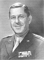 |
254 Roosevelt Avenue, York 39.963°N 76.74134°W |
City | Military, Military Post-Civil War | |
| James Smallwood Schoolhouse | 200 Block of South Pershing Avenue, York 39.95749°N 76.72982°W |
City | African American, Civil Rights, Education | ||
| James Smith | E. Market St., Presbyterian churchyard, York 39.96386°N 76.72331°W |
City | Government & Politics, Government & Politics 18th Century, Iron, Professions & Vocations | ||
| Kilpatrick Headquarters | NW section of Square, Hanover 39.80047°N 76.98377°W |
City | Civil War, Military | ||
| Major John Clark John Clark (spy) Maj. John Clark was an American spy for George Washington, primarily responsible for running the intelligence network in and around Philadelphia during the British occupation of that city during the American Revolutionary War.... |
S. Beaver St. near W. Market St., York 39.96149°N 76.72989°W |
City | American Revolution, Military | ||
| Market House | NE section of Square, Rt. 94 (Baltimore St.) & Frederick St./Broadway, Hanover 39.80046°N 76.98284°W |
City | Buildings, Business & Industry, Houses & Homesteads, Police and Safety | ||
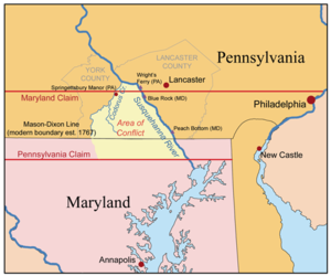
| Mason-Dixon Line Mason-Dixon line The Mason–Dixon Line was surveyed between 1763 and 1767 by Charles Mason and Jeremiah Dixon in the resolution of a border dispute between British colonies in Colonial America. It forms a demarcation line among four U.S. states, forming part of the borders of Pennsylvania, Maryland, Delaware, and... |
 |
Rt. 94 at state line 39.72042°N 76.91578°W |
Roadside | Early Settlement, Government & Politics 18th Century | |
| Mason-Dixon Line Mason-Dixon line The Mason–Dixon Line was surveyed between 1763 and 1767 by Charles Mason and Jeremiah Dixon in the resolution of a border dispute between British colonies in Colonial America. It forms a demarcation line among four U.S. states, forming part of the borders of Pennsylvania, Maryland, Delaware, and... |
|
PA 74 (MD 165) at State Line 39.92182°N 76.34297°W |
Roadside | Government & Politics, Government & Politics 18th Century | |
| McAllister Tavern | Baltimore (PA 94) & Middle Sts., Hanover 39.78949°N 76.79809°W |
City | Buildings, Business & Industry, Inns & Taverns | ||
| McClean House | NE section of Square, George & Market Sts., York 39.96269°N 76.72763°W |
City | Buildings, Government & Politics, Government & Politics 18th Century, Houses & Homesteads, Professions & Vocations | ||
| Penn Common | College Ave. at Penn Park, York (MISSING) °N °W |
City | Government & Politics, Government & Politics 19th Century, William Penn | ||
| Philip Livingston Philip Livingston Philip Livingston was an American merchant and statesman from New York City. He was a delegate for New York to the Continental Congress from 1775 to 1778, and signed the Declaration of Independence.-Family history:... |
 |
N. George St. (Bus. I83) at Prospect Hill Cemetery, York 39.97297°N 76.73182°W |
City | Government & Politics, Government & Politics 18th Century | |
| Phineas Davis Phineas Davis Phineas Davis was a well-known clockmaker and inventor who designed and built the first practical American coal-burning railroad locomotive.... |
.jpg) |
NW corner, King & Newberry Sts., York 39.95887°N 76.73416°W |
City | Business & Industry, Transportation | |
| Provincial Courthouse | Market & George Sts., SE section of Square, York 39.9623°N 76.7274°W |
City | American Revolution, Government & Politics, Government & Politics 18th Century | ||
| Springetsbury Manor | PA 624, .1 mile S of Wrightsville 40.02468°N 76.52708°W |
Roadside | Buildings, Government & Politics 17th Century, Mansions & Manors, William Penn | ||
| Spurgeon Milton Keeny (1893-1988) | 155 South Main St., Shrewsbury 39.76524°N 76.67917°W |
City | Ethnic & Immigration, Government & Politics, Government & Politics 20th Century | ||
| Susquehanna and Tidewater Canal Susquehanna and Tidewater Canal The Susquehanna and Tidewater Canal between Wrightsville, Pennsylvania, and Havre de Grace, Maryland, at the head of Chesapeake Bay, provided an interstate shipping alternative to 19th-century arks, rafts, and boats plying the difficult waters of the lower Susquehanna River... |
Long Level Rd.(PA 624), .1 mile S of Wrightsville 40.02457°N 76.5267°W |
Roadside | Canals, Navigation, Railroads, Transportation | ||
| Susquehanna and Tidewater Canal Susquehanna and Tidewater Canal The Susquehanna and Tidewater Canal between Wrightsville, Pennsylvania, and Havre de Grace, Maryland, at the head of Chesapeake Bay, provided an interstate shipping alternative to 19th-century arks, rafts, and boats plying the difficult waters of the lower Susquehanna River... |
Furnace Rd. (PA 425) at York Furnace 39.84501°N 76.38181°W |
Roadside | Canals, Navigation, Railroads, Transportation | ||
| Susquehanna and Tidewater Canal Susquehanna and Tidewater Canal The Susquehanna and Tidewater Canal between Wrightsville, Pennsylvania, and Havre de Grace, Maryland, at the head of Chesapeake Bay, provided an interstate shipping alternative to 19th-century arks, rafts, and boats plying the difficult waters of the lower Susquehanna River... |
PA 624, 1.8 miles NE of Craley 39.96592°N 76.49015°W |
Roadside | Canals, Navigation, Railroads, Transportation | ||
| Susquehanna Canal | PA 624, 1.8 miles NE of Craley 39.96592°N 76.4903°W |
Roadside | Canals, Navigation, Transportation | ||
| Susquehanna Canal | Long Level Rd. (PA 624), .1 mile S of Wrightsville (MISSING) °N °W |
Roadside | Canals, Navigation, Transportation | ||
| Susquehanna Canal | Furnace Rd. (PA 425) at York Furnace 39.87516°N 76.38225°W |
Roadside | Canals, Navigation, Transportation | ||
| Warrington Meeting House | York St. / Carlisle Rd. (PA 74) at Quaker Meeting Rd., E of Wellsville 40.05317°N 76.93008°W |
Roadside | Houses & Homesteads, Religion | ||
| William C. Goodridge | 123 E. Philadelphia St. (PA 74 & 462), York 39.96458°N 76.72583°W |
City | African American, Business & Industry, Professions & Vocations, Underground Railroad | ||
| York York, Pennsylvania York, known as the White Rose City , is a city located in York County, Pennsylvania, United States which is in the South Central region of the state. The population within the city limits was 43,718 at the 2010 census, which was a 7.0% increase from the 2000 count of 40,862... |
1415 E Market St. (PA 462), just W of I-83, York (MISSING) 39.84324°N 76.77706°W |
Roadside | Cities & Towns, Government & Politics 18th Century | ||
| York York, Pennsylvania York, known as the White Rose City , is a city located in York County, Pennsylvania, United States which is in the South Central region of the state. The population within the city limits was 43,718 at the 2010 census, which was a 7.0% increase from the 2000 count of 40,862... |
US 30 (westbound), just west of I-83, York °N °W |
Roadside | Cities & Towns, Government & Politics 18th Century | ||
| York York, Pennsylvania York, known as the White Rose City , is a city located in York County, Pennsylvania, United States which is in the South Central region of the state. The population within the city limits was 43,718 at the 2010 census, which was a 7.0% increase from the 2000 count of 40,862... |
PA 462 (W Market St.), W of York (MISSING) °N °W |
Roadside | Cities & Towns, Government & Politics 18th Century | ||
| York York, Pennsylvania York, known as the White Rose City , is a city located in York County, Pennsylvania, United States which is in the South Central region of the state. The population within the city limits was 43,718 at the 2010 census, which was a 7.0% increase from the 2000 count of 40,862... |
US 111 (S George St.) & Rathton St., at hospital, York 39.9452°N 76.72095°W |
Roadside | Cities & Towns, Early Settlement, Government & Politics, Government & Politics 18th Century | ||
| York County York County, Pennsylvania York County is a county in the U.S. state of Pennsylvania. As of 2010, the population was 434,972. It is in the Susquehanna Valley, a large fertile agricultural region in South Central Pennsylvania.... |
Colonial Courthouse, 205 W. Market St., York 39.96131°N 76.73176°W |
City | Government & Politics, Government & Politics 18th Century | ||
| York County Academy | N. Beaver St. at building (Missing) °N °W |
Roadside | Education, Religion | ||
| York County Prison | NE corner, King & George Sts., York 39.95887°N 76.3416°W |
City | American Revolution, Government & Politics, Government & Politics 18th Century, Military | ||
| York House | 225 E. Market St., York 39.96397°N 76.72299°W |
City | Buildings, Houses & Homesteads, Mansions & Manors, Railroads | ||
| York Imperial Apple | S. George St. (SR 3001 / old US 111), just S of intersection w/ Old Baltimore Pk. & Monument Rd., ~2 miles S of York 39.92337°N 76.71844°W |
Roadside | Agriculture, Business & Industry | ||
| York Inter-State Fair | Pa. 462 (W. Market St.) at fairgrounds, York 39.95424°N 76.75471°W |
Roadside | Agriculture, Business & Industry, Sports | ||
| York Iron Company Mine | n/a | Hoff Rd., N of Green Valley Rd. (SR 3041) between Seven Valleys & Jefferson, at mine entrance 39.84841°N 76.81222°W |
Roadside | Business & Industry, Ethnic & Immigration, Iron, Labor | |
| York Liberty Bell | N. Beaver St. near W Gay Ave., in Episcopal Churchyard, York 39.96919°N 76.73095°W |
City | Government & Politics, Government & Politics 18th Century | ||
| York Meeting | 135 W Philadelphia St. (Rts. 74/462) near N Pershing Ave., at meetinghouse, York 39.96293°N 76.73164°W |
City | Buildings, Religion |
See also
- List of Pennsylvania state historical markers
- National Register of Historic Places listings in York County, Pennsylvania