

List of Pennsylvania state historical markers in Sullivan County
Encyclopedia
This is intended to be a complete list of the official state historical markers placed in Sullivan County, Pennsylvania
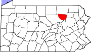
Sullivan County, Pennsylvania
Sullivan County is a county located in the U.S. state of Pennsylvania. As of 2010, the population is 6,428. Sullivan County was created on March 15, 1847, from part of Lycoming County and named for Charles Sullivan, leader of the Pennsylvania Senate...
by the Pennsylvania Historical and Museum Commission
Pennsylvania Historical and Museum Commission
The Pennsylvania Historical and Museum Commission is the governmental agency of the Commonwealth of Pennsylvania responsible for the collection, conservation and interpretation of Pennsylvania's historic heritage...
(PHMC). The locations of the historical markers, as well as the latitude and longitude coordinates as provided by the PHMC's database, are included below when available. There are seven historical markers located in Sullivan County.
Historical markers
| Marker title | Image | Date dedicated | Location | Marker type | Topics |
|---|---|---|---|---|---|
| Celestia | Pa. 42 1½ miles west of Laporte 41.42221°N 76.52493°W |
Roadside | Early Settlement, Religion | ||
| Celestia | U.S. 220 just NE of Laporte 41.42454°N 76.48858°W |
Roadside | Religion | ||
| Harold "Red" Grange Red Grange Harold Edward "Red" Grange, nicknamed "The Galloping Ghost", was a college and professional American football halfback for the University of Illinois, the Chicago Bears, and for the short-lived New York Yankees. His signing with the Bears helped legitimize the National Football League... |
Rte. 154 off of Rte 87, Forksville 41.4911°N 76.60104°W |
Roadside | Agriculture, Business & Industry, Football, Sports | ||
| Old Woolen Factory | Junction Pa. 87 & 154, Forksville 41.49184°N 76.60112°W |
Roadside | Buildings, Business & Industry | ||
| Rural Electrification Rural electrification Rural electrification is the process of bringing electrical power to rural and remote areas. Electricity is used not only for lighting and household purposes, but it also allows for mechanization of many farming operations, such as threshing, milking, and hoisting grain for storage; in areas... |
Pa. 87 just SW of Pa. 154, Forksville 41.48829°N 76.61235°W |
Roadside | Business & Industry, Electricity | ||
| Sullivan County Sullivan County, Pennsylvania Sullivan County is a county located in the U.S. state of Pennsylvania. As of 2010, the population is 6,428. Sullivan County was created on March 15, 1847, from part of Lycoming County and named for Charles Sullivan, leader of the Pennsylvania Senate... |
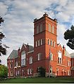 |
Courthouse, Main & Muncy Sts., Laporte 41.42398°N 76.49326°W |
City | Government & Politics, Government & Politics 19th Century | |
| Wyalusing Path Wyalusing Path The Wyalusing Path or trail was a historical trace that ran from what is now Wyalusing to the Native American village of Canaserage in Pennsylvania in the United States... |
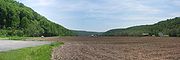 |
U.S. 220 at Neech Glen, 1 miles S of Muncy Valley 41.334°N 76.58798°W |
Roadside | Native American, Paths & Trails, Transportation |
See also
- List of Pennsylvania state historical markers
- National Register of Historic Places listings in Sullivan County, PennsylvaniaNational Register of Historic Places listings in Sullivan County, PennsylvaniaThis is a list of the National Register of Historic Places listings in Sullivan County, Pennsylvania.This is intended to be a complete list of the properties and districts on National Register of Historic Places in Sullivan County, Pennsylvania...