

List of Pennsylvania state historical markers in Mifflin County
Encyclopedia
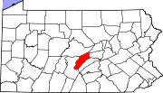
This is intended to be a complete list of the official state historical markers placed in Mifflin County, Pennsylvania
Mifflin County, Pennsylvania
Mifflin County is a county located in the U.S. state of Pennsylvania. As of 2010, the population was 46,682. Its county seat is Lewistown. It is named after Thomas Mifflin, the first Governor of Pennsylvania.-Geography:...
by the Pennsylvania Historical and Museum Commission
Pennsylvania Historical and Museum Commission
The Pennsylvania Historical and Museum Commission is the governmental agency of the Commonwealth of Pennsylvania responsible for the collection, conservation and interpretation of Pennsylvania's historic heritage...
(PHMC). The locations of the historical markers, as well as the latitude and longitude coordinates as provided by the PHMC's database, are included below when available. There are 12 historical markers located in Mifflin County.
Historical markers
| Marker title | Image | Date dedicated | Location | Marker type | Topics |
|---|---|---|---|---|---|
| Chief Logan Logan Logan was a Native American leader.Logan may also refer to:- Australia :* Logan City, a local government area in Queensland* Electoral district of Logan, an electoral district in the Queensland Legislative Assembly... |
SR 1005 (old U.S. 322), .5 mile N of Reedsville 40.67548°N 77.60004°W |
Roadside | Native American | ||
| Fort Granville Fort Granville Fort Granville was a militia stockade located in the colonial Province of Pennsylvania. Its site was in what is now Granville Township near Lewistown... |
1200 W. 4th St. (U.S. 22 & 522), Lewistown 40.58839°N 77.6016°W |
Roadside | Forts, French & Indian War, Military | ||
| Fort Granville - PLAQUE Fort Granville Fort Granville was a militia stockade located in the colonial Province of Pennsylvania. Its site was in what is now Granville Township near Lewistown... |
1200 W. 4th St. (US 22 & 522), Lewistown 40.58837°N 77.60164°W |
Plaque | Forts, French & Indian War, Military, Native American | ||
| Freedom Forge | SR 1005 (old U.S. 322) at Burnham 40.62918°N 77.56736°W |
Roadside | Business & Industry, Iron, Steel | ||
| Joseph T. Rothrock Joseph Rothrock Joseph Trimbel Rothrock was an American environmentalist, recognized as the "Father of Forestry" in Pennsylvania. In 1895, Rothrock was appointed the first forestry commissioner to lead the newly formed Division of Forestry in the Pennsylvania Department of Agriculture... |
 |
U.S. 22 & 522 at McVeytown 40.49956°N 77.74042°W |
Roadside | Environment, Professions & Vocations | |
| Juniata Iron | U.S. 22 & 522 at Strodes Mills, 4.9 miles SW of Lewistown 40.5482°N 77.67725°W |
Roadside | Business & Industry, Coal, Iron | ||
| Lewistown Station | Jct. Pa. 103 & Helen St., S end of Lewistown °N °W |
Roadside | Business & Industry, Railroads, Transportation | ||
| McCoy Home | 17 N. Main St., Lewistown 40.59805°N 77.57505°W |
City | Military, Military Post-Civil War | ||
| Mifflin County Mifflin County, Pennsylvania Mifflin County is a county located in the U.S. state of Pennsylvania. As of 2010, the population was 46,682. Its county seat is Lewistown. It is named after Thomas Mifflin, the first Governor of Pennsylvania.-Geography:... |
Old Courthouse, Monument Square, Market & Main Sts., Lewistown 40.59761°N 77.57488°W |
City | Canals, Government & Politics, Government & Politics 18th Century, Governors, Iron | ||
| Old Arch Bridge | Bus. 22, just E of Lewistown 40.58467°N 77.55741°W |
Roadside | Bridges, Transportation | ||
| Three Locks | US 22/522 near Strouds Run Rd./Middle Rd., at Strodes Mills, 4.6 miles SW of Lewistown 40.55132°N 77.67265°W |
Roadside | Canals, Navigation, Transportation | ||
| Travel History | US 22/322 westbound at Bus. 22 exit, near Lewistown °N °W |
Roadside | Bridges, Canals, Navigation, Roads, Transportation |
See also
- List of Pennsylvania state historical markers
- National Register of Historic Places listings in Mifflin County, PennsylvaniaNational Register of Historic Places listings in Mifflin County, PennsylvaniaThis is a list of the National Register of Historic Places listings in Mifflin County, Pennsylvania.This is intended to be a complete list of the properties on the National Register of Historic Places in Mifflin County, Pennsylvania, United States...