

List of Pennsylvania state historical markers in Lycoming County
Encyclopedia
This is intended to be a complete list of the official state historical markers placed in Lycoming County, Pennsylvania
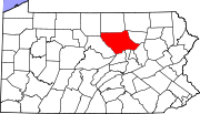
Lycoming County, Pennsylvania
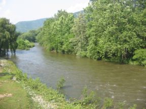
-Appalachian Mountains and Allegheny Plateau:Lycoming County is divided between the Appalachian Mountains in the south, the dissected Allegheny Plateau in the north and east, and the valley of the West Branch Susquehanna River between these.-West Branch Susquehanna River:The West Branch of the...
by the Pennsylvania Historical and Museum Commission
Pennsylvania Historical and Museum Commission
The Pennsylvania Historical and Museum Commission is the governmental agency of the Commonwealth of Pennsylvania responsible for the collection, conservation and interpretation of Pennsylvania's historic heritage...
(PHMC). The locations of the historical markers, as well as the latitude and longitude coordinates as provided by the PHMC's database, are included below when available. There are 30 historical markers located in Lycoming County.
Historical markers
| Marker title | Image | Date dedicated | Location | Marker type | Topics |
|---|---|---|---|---|---|
| Antes Fort - PLAQUE Fort Antes Fort Antes was a stockade surrounding the home of Colonel John Henry Antes, built circa 1778 in Revolutionary Pennsylvania in the United States. The fort was built under the direction of Colonel Antes, who was a member of the Pennsylvania militia... |
PA44, 1 mi. E of Jersey Shore 41.1988°N 77.236°W |
Plaque | American Revolution, Forts, Military, Native American | ||
| Blooming Grove Dunkard Meeting House - PLAQUE | 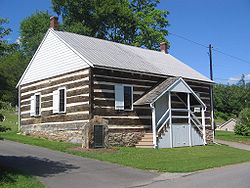 |
Meetinghouse, 2 miles E of Balls Mills, .7 mile S of PA 973 41.324°N 77.0042°W |
Plaque | Buildings, Ethnic & Immigration, Religion | |
| Bowman Field | 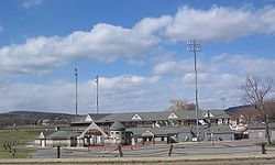 |
1700 West Fourth St., Williamsport 41.2417°N 77.0471°W |
Roadside | African American, Baseball, Sports | |
| Capt. John Brady | SR 2014 (old Pa. 147), .8 mile N of Muncy 41.2182°N 76.7881°W |
Roadside | American Revolution, Military, Native American | ||
| Carl E. Stotz Carl Stotz Carl E. Stotz is the American founder of Little League Baseball. He is honored in Williamsport by having the Carl E. Stotz Memorial Little League Bridge which carries U.S. Route 15 across the West Branch Susquehanna River between Williamsport and South WilliamsportStotz was born in Williamsport,... |
Original Little League Field, W. 4th St., Williamsport 41.2407°N 77.0444°W |
Roadside | Baseball, Sports | ||
| Civilian Conservation Corps Civilian Conservation Corps The Civilian Conservation Corps was a public work relief program that operated from 1933 to 1942 in the United States for unemployed, unmarried men from relief families, ages 18–25. A part of the New Deal of President Franklin D... |
Rt. 14 N of Trout Run 41.3709°N 77.0714°W |
Roadside | Environment, Government & Politics, Government & Politics 20th Century, Labor | ||
| Dietrick Lamade | W. 3rd. & Williams Sts., Williamsport 41.2396°N 77.0042°W |
City | Business & Industry, Ethnic & Immigration, Publishing | ||
| Eagle Grange No. 1 Eagle Grange No. 1 Eagle Grange No. 1 was organized on March 4, 1871 by a group of rural farmers who had become concerned about the rising costs of farming in the post Civil War economy. It is in Clinton Township, Lycoming County, Pennsylvania in the United States. Eagle Grange No... |
 |
Rte. 15 and E. Blind Road, Montgomery 41.1788°N 76.9111°W |
Roadside | Agriculture, Business & Industry, Government & Politics, Railroads, Women | |
| Fort Antes Fort Antes Fort Antes was a stockade surrounding the home of Colonel John Henry Antes, built circa 1778 in Revolutionary Pennsylvania in the United States. The fort was built under the direction of Colonel Antes, who was a member of the Pennsylvania militia... |
Main & Seminary Sts., Jersey Shore 41.204°N 77.2532°W |
Roadside | American Revolution, Forts, Military, Mills, Native American | ||
| Fort Muncy | U.S. 220, 3.5 miles N of Muncy (Missing) °N °W |
Roadside | American Revolution, Forts, Military | ||
| Freedom Road Cemetery | T-456 in Loyalsock Twp. 41.2622°N 77.0102°W |
Roadside | African American, Civil War, Religion, Underground Railroad | ||
| Julia C. Collins (? - 1865) | Susq. River Walk & Timber Heritage TRail, near Market St. Bridge, Williamsport 41.2358°N 77.0045°W |
Roadside | African American, Education, Women, Writers | ||
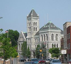
| Lycoming County Lycoming County, Pennsylvania -Appalachian Mountains and Allegheny Plateau:Lycoming County is divided between the Appalachian Mountains in the south, the dissected Allegheny Plateau in the north and east, and the valley of the West Branch Susquehanna River between these.-West Branch Susquehanna River:The West Branch of the... |
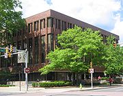 |
Lycoming County Courthouse, Williamsport 41.2407°N 77.0021°W |
City | Baseball, Business & Industry, Cities & Towns, Government & Politics, Native American, Sports | |
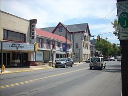
| Muncy Muncy, Pennsylvania For other places named 'Muncy', please see Muncy .Muncy is a borough in Lycoming County, Pennsylvania, in the United States. The name Muncy comes from the Munsee Indians who once lived in the area. The population was 2,663 at the 2000 census. It is part of the Williamsport, Pennsylvania... |
 |
40 N Main St., Muncy 41.215°N 76.2361°W |
Roadside | Cities & Towns, Native American, Paths & Trails | |
| Muncy Muncy, Pennsylvania For other places named 'Muncy', please see Muncy .Muncy is a borough in Lycoming County, Pennsylvania, in the United States. The name Muncy comes from the Munsee Indians who once lived in the area. The population was 2,663 at the 2000 census. It is part of the Williamsport, Pennsylvania... |
|
260 E Water St., Muncy 41.2093°N 76.77494°W |
Roadside | Cities & Towns, Native American, Paths & Trails | |
| Muncy Mills | Junction Pa. 405 & 442 E of Muncy 41.2117°N 76.7581°W |
Roadside | Business & Industry, Mills, Native American | ||
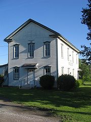
| Pennsdale Meeting | Junction SR 2051 (former LR 41054) & township road (former LR 41154) near Pennsdale 41.2432°N 76.7979°W |
Roadside | Buildings, Religion | ||
| Pennsdale Meeting | Junction LR 41154 & LR 41054 near Pennsdale (Missing) °N °W |
Roadside | Religion | ||
| Pennsylvania Canal (West Branch Division) Pennsylvania Canal (West Branch Division) The West Branch Division of the Pennsylvania Canal ran from the canal basin at Northumberland, Pennsylvania, at the confluence of the West Branch Susquehanna River with the main stem of the Susquehanna River, north through Muncy, then west through Williamsport, Jersey Shore, and Lock Haven to its... |
Near junction SR 2014 (old Pa. 147) and SR 2036 (old U.S. 220), Halls (MISSING) °N °W |
Roadside | Canals, Navigation, Transportation | ||
| Peter Herdic Peter Herdic Peter Herdic was a lumber baron, entrepreneur, inventor, politician, and philanthropist in Victorian era Williamsport, Lycoming County, Pennsylvania in the United States. He was the youngest of seven children born to Henry and Elizabeth Herdic on December 14, 1824 in Fort Plain, New York. Herdic's... |
 |
407 W. 4th St., Williamsport 41.24°N 77.009°W |
City | Buildings, Business & Industry, Entrepreneurs, Invention, Professions & Vocations | |
| Pine Creek Presbyterian Church | Allegheny St. (SR 3028 / old US 220), Jersey Shore 41.2042°N 77.2659°W |
Roadside | Religion | ||
| Sheshequin Path Sheshequin Path The Sheshequin Path was a major Native American trail in the U.S. State of Pennsylvania that ran between two Native American villages: "French Margaret's Town" on the West Branch Susquehanna River and "Sheshequin" on the North Branch of the Susquehanna River... |
 |
U.S. 15, 2.2 miles S of Trout Run 41.3707°N 77.0717°W |
Roadside | Environment, Native American, Paths & Trails, Transportation | |
| Sheshequin Path Sheshequin Path The Sheshequin Path was a major Native American trail in the U.S. State of Pennsylvania that ran between two Native American villages: "French Margaret's Town" on the West Branch Susquehanna River and "Sheshequin" on the North Branch of the Susquehanna River... |
|
Pa. 14, 1.4 mile NE of Trout Run (Missing) 41.4019°N 77.0454°W |
Roadside | Early Settlement, Native American, Paths & Trails, Transportation | |
| Sheshequin Path Sheshequin Path The Sheshequin Path was a major Native American trail in the U.S. State of Pennsylvania that ran between two Native American villages: "French Margaret's Town" on the West Branch Susquehanna River and "Sheshequin" on the North Branch of the Susquehanna River... |
Pa. 14 at Marsh Hill 41.4237°N 77.0178°W |
Roadside | Early Settlement, Paths & Trails, Transportation | ||
| Susquehanna Log Boom Susquehanna Boom The Susquehanna Boom was a system of cribs and chained logs in the West Branch Susquehanna River, designed to catch and hold floating timber until it could be processed at one of the nearly 60 sawmills along the river between Lycoming and Loyalsock Creeks in Lycoming County, Pennsylvania in the... |
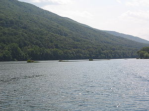 |
US 15, just S of Williamsport 41.22776°N 76.98532°W |
Roadside | Business & Industry | |
| W. D. Crooks & Sons Door Plant | One College Ave. Williamsport, outside the Alvin Bush Campus Center 41.2352°N 77.0232°W |
Roadside | Business & Industry | ||
| Williamson Road | Main St. (US 15), Trout Run 41.2862°N 77.0559°W |
Roadside | Early Settlement, Roads, Transportation | ||
| Williamsport Williamsport, Pennsylvania Williamsport is a city in and the county seat of Lycoming County, Pennsylvania in the United States. In 2009, the population was estimated at 29,304... |
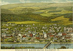 |
U.S. 220 E at Williamsport 41.2538°N 76.9816°W |
Roadside | Business & Industry, Cities & Towns, Government & Politics | |
| Williamsport Williamsport, Pennsylvania Williamsport is a city in and the county seat of Lycoming County, Pennsylvania in the United States. In 2009, the population was estimated at 29,304... |
 |
US 15 at LLWS, S end of Williamsport 41.22806°N 76.98387°W |
Roadside | Business & Industry, Cities & Towns, Transportation | |
| Williamsport Williamsport, Pennsylvania Williamsport is a city in and the county seat of Lycoming County, Pennsylvania in the United States. In 2009, the population was estimated at 29,304... |
 |
U.S. 220 W of Williamsport (Missing) °N °W |
Roadside | Business & Industry, Cities & Towns, Transportation |
See also
- List of Pennsylvania state historical markers
- National Register of Historic Places listings in Lycoming County, Pennsylvania