

List of Pennsylvania state historical markers in Franklin County
Encyclopedia

This is intended to be a complete list of the official state historical markers placed in Franklin County, Pennsylvania
Franklin County, Pennsylvania
As of the census of 2000, there were 129,313 people, 50,633 households, and 36,405 families residing in the county. The population density was 168 people per square mile . There were 53,803 housing units at an average density of 70 per square mile...
by the Pennsylvania Historical and Museum Commission
Pennsylvania Historical and Museum Commission
The Pennsylvania Historical and Museum Commission is the governmental agency of the Commonwealth of Pennsylvania responsible for the collection, conservation and interpretation of Pennsylvania's historic heritage...
(PHMC). The locations of the historical markers, as well as the latitude and longitude coordinates as provided by the PHMC's database, are included below when available. There are 70 historical markers located in Franklin County.
Historical markers
| Marker title | Image | Date dedicated | Location | Marker type | Topics | |
|---|---|---|---|---|---|---|
| 54th Mass. Infantry Regiment, US Colored Troops (The) 54th Massachusetts Volunteer Infantry The 54th Regiment Massachusetts Volunteer Infantry was an infantry regiment that saw extensive service in the Union Army during the American Civil War. The regiment was one of the first official black units in the United States during the Civil War... |
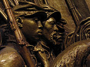 |
Zion Union Cemetery, Bennette Ave., Mercersburg 39.82031°N 77.90564°W |
Roadside | African American, Civil War, Military | ||
| Brown's Mill School | At site - off Rt. 11 via Kaufman Rd., at Angle & Brown's Mill Rds., SE of Marion 39.8307°N 77.702°W |
Roadside | Buildings, Education | |||
| Buchanan House | 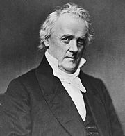 |
17 N Main St., Mercersburg 39.8288°N 77.0963°W |
City | Exploration, Government & Politics, Government & Politics 19th Century, Professions & Vocations | ||
| Burning of Chambersburg | 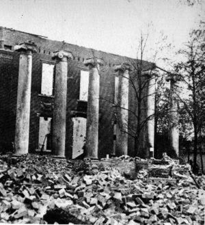 |
SE corner of square at Rts. 30 & 11, Chambersburg 39.9375°N 76.3389°W |
Roadside | Civil War, Military | ||
| Burning of Chambersburg | |
Pa. 416, 200 yards N of state line 39.7222°N 76.1963°W |
Roadside | Civil War, Military | ||
| Caledonia Furnace | US 30 & PA 233, Caledonia State Park, east end of Fayetteville °N °W |
Roadside | African American, Business & Industry, Civil War, Furnaces, Military | |||
| Captain Ulric Dahlgren Ulric Dahlgren Ulric Dahlgren served as a Union Army colonel. He was in command of an unsuccessful 1864 raid on the Confederate capital of Richmond, Virginia, and was killed in the raid.-Early life:... |
SE section of Square, Greencastle 39.79°N 77.7275°W |
City | Civil War, Military | |||
| Chambersburg | 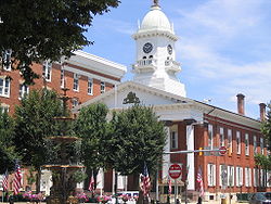 |
U.S. 11, .3 mile S of borough line °N °W |
Roadside | Cities & Towns, Civil War, Early Settlement, Government & Politics | ||
| Chambersburg | n/a | US 11 & Roland Ave., 1.5 miles N of Chambersburg, near borough line 39.9559°N 77.64507°W |
Roadside | Cities & Towns, Civil War, Early Settlement, Government & Politics | ||
| Chambersburg | US 30 W end of Chambersburg °N °W |
Roadside | Cities & Towns, Civil War, Early Settlement, Government & Politics | |||
| Chambersburg | |
n/a | US 30 at I-81, west side of intersection, E end of Chambersburg 39.9294°N 76.3631°W |
Roadside | Cities & Towns, Civil War, Government & Politics | |
| Confederate Conference | SW quadrant of public square, Chambersburg 39.9372°N 76.3384°W |
City | Civil War, Military | |||
| Dr. Henry Harbaugh | 14301 Harbaugh Church Rd., (@ church), off Midvale Rd. south of Midvale 39.7214°N 76.4664°W |
Roadside | Education, Ethnic & Immigration, Professions & Vocations, Religion | |||
| Falling Spring Church | US 11 at church, 2 blocks N of Square, Chambersburg °N °W |
City | Buildings, Ethnic & Immigration, Religion | |||
| First Lutheran Church (Chambersburg, Pennsylvania) | First Lutheran Church | W. Washington St. at church (near Black St.), Chambersburg 39.9344°N 76.3366°W |
City | Buildings, Religion | ||
| Fort Chambers | W. King St., 1 block W of US 11, Chambersburg 39.9391°N 76.3378°W |
City | Early Settlement, Forts, French & Indian War, Military, Mills, Native American | |||
| Fort Davis | PA 995 & Bain Rd. (near Church of Brethren at Welsh Run) 39.75952°N 77.86262°W |
Roadside | Forts, French & Indian War, Military | |||
| Fort Davis - PLAQUE | on private farm, W side of Bain Rd., 1.3 mi. S of PA 995 at Welsh Run 39.744°N 76.1239°W |
Plaque | Forts, French & Indian War, Government & Politics 18th Century, Military | |||
| Fort Loudon Fort Loudoun (Pennsylvania) Fort Loudoun was a fort in colonial Pennsylvania, one of several forts in colonial America named after John Campbell, 4th Earl of Loudoun... |
US 30 & Brooklyn Rd., ~1 mile E of Fort Loudon (Missing) 39.9063°N 76.119°W |
Roadside | Forts, French & Indian War, Military | |||
| Fort Loudon - PLAQUE Fort Loudoun (Pennsylvania) Fort Loudoun was a fort in colonial Pennsylvania, one of several forts in colonial America named after John Campbell, 4th Earl of Loudoun... |
US 30 (Old Lincoln Hwy.), in center of Fort Loudon 39.9148°N 76.0951°W |
Plaque | Forts, French & Indian War, Military | |||
| Fort Marshall | Valley Rd. & Shimpstown Rd., S of Mercersburg °N °W |
Roadside | Forts, French & Indian War, Military | |||
| Fort McCord | ~2.5 miles NE of Edenville on SR 4008 at Rumler Rd. 39.986°N 76.2277°W |
Roadside | Forts, French & Indian War, Military, Native American | |||
| Fort McCord - PLAQUE | ~2.5 mi. NE of Edenville up SR 4008 to Rumler Rd., ~.5 mi. south to barn, plaque within fence on left 39.985°N 76.2266°W |
Plaque | Early Settlement, Forts, French & Indian War, Military, Native American | |||
| Fort McDowell | Pa. 416 at Markes, junction of Mercersburg & Lamar Rds. 39.8747°N 76.1284°W |
Roadside | Forts, French & Indian War, Military, Mills | |||
| Fort McDowell - PLAQUE | PA 416 at Markes, junction of Mercersburg & Lamar Rds. 39.8747°N 76.1284°W |
Plaque | Forts, French & Indian War, Military, Mills, Roads | |||
| Fort Waddell | U.S. 30, near junction Pa. 416, 1 mile W of St. Thomas (MISSING) 39.9612°N 76.1793°W |
Roadside | Early Settlement, Forts, French & Indian War, Military, Native American | |||
| Fort Waddell (1754) - PLAQUE | n/a | Route 30, W of Chambersburg, near PA416 junction, 1 mi W of St. Thomas (N side) 39.9112°N 76.1795°W |
Plaque | Forts, French & Indian War, Military | ||
| Franklin County Franklin County, Pennsylvania As of the census of 2000, there were 129,313 people, 50,633 households, and 36,405 families residing in the county. The population density was 168 people per square mile . There were 53,803 housing units at an average density of 70 per square mile... |
|
County Courthouse, Memorial Square (N. Main St.), corner of U.S. 11 & 30, Chambersburg 39.9376°N 76.3389°W |
City | Cities & Towns, Government & Politics, Government & Politics 18th Century | ||
| Frederick Douglass and John Brown | West Washington St., behind Southgate Mall, Chambersburg 39.935°N 76.3333°W |
Roadside | African American, Government & Politics 19th Century, Military | |||
| George H. Wirt (1880 - 1961) | near PSU Mont Alto campus, approx. 120 yds. E of Slabtown Rd. on south side of PA 233 °N °W |
Roadside | Environment, Government & Politics 20th Century | |||
| Gettysburg Campaign Gettysburg Campaign The Gettysburg Campaign was a series of battles fought in June and July 1863, during the American Civil War. After his victory in the Battle of Chancellorsville, Confederate General Robert E. Lee's Army of Northern Virginia moved north for offensive operations in Maryland and Pennsylvania. The... |
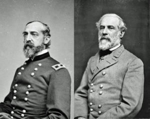 |
PA 16 at Roadside Ave., E of square in Waynesboro 39.7516°N 76.4296°W |
Roadside | Civil War, Military | ||
| Gettysburg Campaign Gettysburg Campaign The Gettysburg Campaign was a series of battles fought in June and July 1863, during the American Civil War. After his victory in the Battle of Chancellorsville, Confederate General Robert E. Lee's Army of Northern Virginia moved north for offensive operations in Maryland and Pennsylvania. The... |
US 11, just N of Greencastle 39.8041°N 76.2775°W |
Roadside | Civil War, Military | |||
| Gettysburg Campaign Gettysburg Campaign The Gettysburg Campaign was a series of battles fought in June and July 1863, during the American Civil War. After his victory in the Battle of Chancellorsville, Confederate General Robert E. Lee's Army of Northern Virginia moved north for offensive operations in Maryland and Pennsylvania. The... |
US 11, 1 mile N of State Line 39.7321°N 76.2751°W |
Roadside | Civil War, Military | |||
| Gettysburg Campaign Gettysburg Campaign The Gettysburg Campaign was a series of battles fought in June and July 1863, during the American Civil War. After his victory in the Battle of Chancellorsville, Confederate General Robert E. Lee's Army of Northern Virginia moved north for offensive operations in Maryland and Pennsylvania. The... |
US 30E near intersection w/ Willowbrook Dr., just E of Chambersburg, ~.5 mi past I81 (at veterinary clinic) 39.9268°N 76.3734°W |
Roadside | Civil War, Military | |||
| Gettysburg Campaign Gettysburg Campaign The Gettysburg Campaign was a series of battles fought in June and July 1863, during the American Civil War. After his victory in the Battle of Chancellorsville, Confederate General Robert E. Lee's Army of Northern Virginia moved north for offensive operations in Maryland and Pennsylvania. The... |
US 11 near Roland Ave., 1.5 mi. N of Chambersburg 39.9569°N 76.3557°W |
Roadside | Civil War, Military | |||
| Gettysburg Campaign Gettysburg Campaign The Gettysburg Campaign was a series of battles fought in June and July 1863, during the American Civil War. After his victory in the Battle of Chancellorsville, Confederate General Robert E. Lee's Army of Northern Virginia moved north for offensive operations in Maryland and Pennsylvania. The... |
|
US 11 at Kriner, at Trickling Spgs. Creamery, S of Chambersburg 39.90486°N 77.67223°W |
Roadside | Civil War, Military | ||
| Israel Benevolent Society Cemetery Old Jewish cemetery, Chambersburg The Old Jewish Cemetery of Chambersburg, Pennsylvania is believed to be the earliest Jewish burial ground west of the Susquehanna River. The oldest headstone refers to a burial in July 1840... |
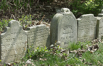 |
361 East Washington Street, Chambersburg 39.9336°N 76.3441°W |
Roadside | Civil War, Military, Religion | ||
| Jacob Nelson "Nellie" Fox | 7417 Lincoln Hwy. (US 30), at Schoolhouse Road (square), St. Thomas 39.9174°N 76.2016°W |
City | Baseball, Sports | |||
| James Buchanan James Buchanan James Buchanan, Jr. was the 15th President of the United States . He is the only president from Pennsylvania, the only president who remained a lifelong bachelor and the last to be born in the 18th century.... |
|
PA 16W, @ fork of Stoney Batter & Buchanan Sts., at Buchanan State Park entrance, Cove Gap 39.8665°N 76.0553°W |
Roadside | Buildings, Education, Government & Politics, Government & Politics 18th Century | ||
| John Brown John Brown (abolitionist) John Brown was an American revolutionary abolitionist, who in the 1850s advocated and practiced armed insurrection as a means to abolish slavery in the United States. He led the Pottawatomie Massacre during which five men were killed, in 1856 in Bleeding Kansas, and made his name in the... |
n/a | 225 E. King St., Chambersburg 39.93881°N 77.65831°W |
City | African American, Government & Politics 19th Century, Military | ||
| John Brown Raid | 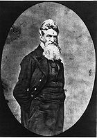 |
PA 233, 1 mile E of Mont Alto, across from PSU campus 39.8404°N 76.4553°W |
Roadside | African American, Government & Politics 19th Century, Military | ||
| John Wallace Jr. | E. Main & Enterprise Sts., Waynesboro 39.751°N 76.4317°W |
City | Professions & Vocations | |||
| Joseph G. Armstrong Joseph G. Armstrong Joseph G. Armstrong was born in what is today the Northside neighborhood of the U.S. city of Pittsburgh. He became a glassmaker and eventually participated in the glass union and labor movement. From his labor connections he was elected to City Council and then ran successfully for County Coroner... |
SR 4010 at Coble Rd. near Edenville 39.9631°N 76.2139°W |
Roadside | Early Settlement, French & Indian War, Government & Politics 18th Century, Military, Native American | |||
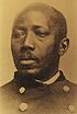
| Joseph Winters Joseph Winters Joseph Winters was an African-American abolitionist and inventor who patented a wagon-mounted fire escape ladder for the city of Chambersburg, PA. in 1878. It is often falsely cited that Winters was the original inventor of the wagon mounted fire escape... |
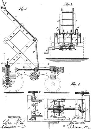 |
Junior Hose and Truck Company #2, 130 N Second St., Chambersburg °N °W |
City | African American, Entrepreneurs, Invention, Native American, Police and Safety, Underground Railroad | ||
| Lane House | 16 N. Main St., Mercersburg 39.8287°N 76.0962°W |
City | Government & Politics, Government & Politics 19th Century | |||
| Margaret Cochran Corbin | US 11 near Roand Ave., 1.5 miles N of Chambersburg 39.9572°N 76.356°W |
Roadside | American Revolution, Military, Women | |||
| Marshall College Franklin & Marshall College Franklin & Marshall College is a four-year private co-educational residential national liberal arts college in the Northwest Corridor neighborhood of Lancaster, Pennsylvania, United States.... |
PA 16 at entrance to Mercersburg Academy, Mercersburg 39.8283°N 76.1005°W |
Roadside | Education, Religion | |||
| Martin Delany (1812-1885) Martin Delany Martin Robinson Delany was an African-American abolitionist, journalist, physician, and writer, arguably the first proponent of American black nationalism. He was one of the first three blacks admitted to Harvard Medical School. He became the first African-American field officer in the United... |
 |
566 S. Main St., Chambersburg °N °W |
Roadside | African American, Civil Rights, Military, Professions & Vocations, Publishing, Underground Railroad | ||
| Masonic Temple Masonic Temple Masonic Temple is a term commonly used in Freemasonry with multiple but related meanings. It is used to describe an abstract spiritual goal, the conceptual ritualistic space formed when a Masonic Lodge meets, and the physical rooms and structures in which a Lodge meets... |
S. 2nd St. near E. Queen St., Chambersburg 39.9359°N 76.3406°W |
City | Buildings, Civil War, Military | |||
| Masonic Temple Masonic Temple Masonic Temple is a term commonly used in Freemasonry with multiple but related meanings. It is used to describe an abstract spiritual goal, the conceptual ritualistic space formed when a Masonic Lodge meets, and the physical rooms and structures in which a Lodge meets... |
S 2nd St. (northbound) near E. Queen St., Chambersburg (Missing) °N °W |
City | Religion | |||
| Messersmith's Wood | Lincoln Hwy. (US 30) near Colbrook Ave., Chambersburg 39.9318°N 76.3555°W |
City | Civil War, Military | |||
| Morrow Tavern | 37 S. Main St., Chambersburg 39.9368°N 76.3385°W |
City | Buildings, Business & Industry, George Washington, Military, Inns & Taverns, Whiskey Rebellion | |||
| Old Franklin County Jail | N. 2nd St. at E. King St. (US 11), Chambersburg 39.939°N 76.341°W |
Roadside | Government & Politics, Government & Politics 19th Century | |||
| Old Log Building | E. Main St. & Roadside Ave., Waynesboro 39.752°N 76.4294°W |
City | Buildings, Education | |||
| Patrick Gass (1771-1870) Patrick Gass Patrick Gass served as sergeant in the Lewis and Clark Expedition . He was important to the expedition because of his service as carpenter and he published the first journal of the expedition in 1807, seven years before the first publication based on Lewis and Clark's journals.-Early life:Gass... |
181 Franklin Farm Lane, Chambersburg, off Rt. 30 at Sheetz °N °W |
Roadside | Environment, Exploration, Military, War of 1812 | |||
| Pennsylvania Pennsylvania The Commonwealth of Pennsylvania is a U.S. state that is located in the Northeastern and Mid-Atlantic regions of the United States. The state borders Delaware and Maryland to the south, West Virginia to the southwest, Ohio to the west, New York and Ontario, Canada, to the north, and New Jersey to... |
 |
US 11 at Mason Dixon Rd., Middleburg, near MD state line °N °W |
Roadside | Early Settlement, Government & Politics 17th Century, William Penn | ||
| Pennsylvania State Forest Academy | just off Park St. (Rt. 233) on Campus Dr., at entrance of PSU, Mont Alto °N °W |
Roadside | Education, Environment, Government & Politics 20th Century | |||
| Philip Berlin | 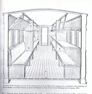 |
W. Washington St. & Black Ave. at Lutheran Church, Chambersburg 39.9345°N 76.3369°W |
City | Invention, Professions & Vocations, Railroads, Transportation | ||
| Ralph Elwood Brock | Park St. (Rt. 233) at Slabtown Rd., entrance to PSU, Mont Alto °N °W |
Roadside | African American, Education, Environment, Professions & Vocations | |||
| Reformed Theological Seminary Reformed Theological Seminary Reformed Theological Seminary is a non-denominational, evangelical Protestant seminary. RTS's first campus remains in Jackson, Mississippi, United States though the school has expanded to include several additional campuses.-Founding:... |
PA 16 at entrance to Mercersburg Academy, Mercersburg 39.8284°N 76.1006°W |
Roadside | Education, Religion | |||
| Rev. Steel's Fort | Buchanan Trail (PA 16) at Findley Rd., 2.3 miles SE of Mercersburg 39.804°N 76.1302°W |
Roadside | French & Indian War, Military, Native American | |||
| Shippensburg |  |
W King St. (US 11) at Park Heights Ave., W end of Shippensburg 40.0425°N 76.4648°W |
Roadside | Cities & Towns | ||
| Snow Hill Cloister | PA 997 just S of Quincy 39.7898°N 76.425°W |
Roadside | Religion | |||
| Stuart's Raid | 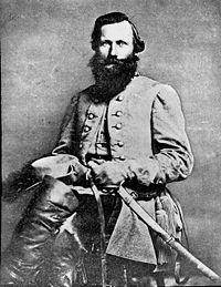 |
Blair's Valley Rd., about 100 yds. N of state line °N °W |
Roadside | Civil War, Military | ||
| Suesserott House | SW corner of Main & Washington Sts., Chambersburg 39.9342°N 76.3377°W |
City | Buildings, Civil War, Houses & Homesteads, Military, Professions & Vocations | |||
| Thompson's Rifle Battalion: Capt. James Chambers' Company | W King St., 1 block W of US 11, in Ft. Chambers Park, Chambersburg 39.9388°N 76.3377°W |
Roadside | American Revolution, Military | |||
| Underground Railroad Activity in Chambersburg | Main St. & Lincoln Hwy. (Rt. 30), on NE quadrant of the "diamond," Chambersburg °N °W |
Roadside | African American, Underground Railroad | |||
| Widow Barr Place | PA 75, 1.4 miles S of Fort Loudon (Missing) 39.8944°N 76.1023°W |
Roadside | American Revolution, Buildings, Early Settlement, Native American | |||
| William Findlay | N. Main St. at Mill Rd., Mercersburg 39.8303°N 76.096°W |
City | Government & Politics, Government & Politics 18th Century, Governors | |||
| Wilson College Wilson College (Pennsylvania) Wilson College, founded 1869, is a private, Presbyterian-related, liberal arts women's college located on a campus in Chambersburg, Pennsylvania, United States. It was founded by two Presbyterian ministers, but named for its first major donor, Sarah Wilson of nearby St. Thomas Township,... |
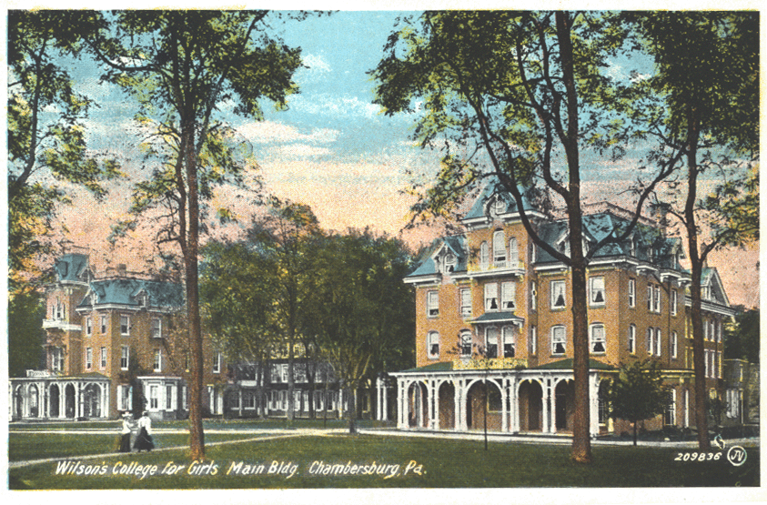 |
Edgar Ave. near Ramsey Ave., off US 11 at campus, Chambersburg 39.9499°N 76.3515°W |
Roadside | Education, Women |
See also
- List of Pennsylvania state historical markers
- National Register of Historic Places listings in Franklin County, PennsylvaniaNational Register of Historic Places listings in Franklin County, PennsylvaniaThis is a list of the National Register of Historic Places listings in Franklin County, Pennsylvania.This is intended to be a complete list of the properties and districts on the National Register of Historic Places in Franklin County, Pennsylvania, United States...