

List of Pennsylvania state historical markers in Dauphin County
Encyclopedia

This is intended to be a complete list of the official state historical markers placed in Dauphin County, Pennsylvania
Dauphin County, Pennsylvania
Dauphin County is a county in the U.S. state of Pennsylvania and is one of the three counties comprising the Harrisburg–Carlisle Metropolitan Statistical Area. As of 2010 census, the population was 268,100. The county includes the city of Harrisburg, which has served as the state capital...
by the Pennsylvania Historical and Museum Commission
Pennsylvania Historical and Museum Commission
The Pennsylvania Historical and Museum Commission is the governmental agency of the Commonwealth of Pennsylvania responsible for the collection, conservation and interpretation of Pennsylvania's historic heritage...
(PHMC). The locations of the historical markers, as well as the latitude and longitude coordinates as provided by the PHMC's database, are included below when available. There are 81 historical markers located in Dauphin County.
Historical markers
| Marker title | Image | Date dedicated | Location | Marker type | Topics |
|---|---|---|---|---|---|
| Abraham Lincoln Abraham Lincoln Abraham Lincoln was the 16th President of the United States, serving from March 1861 until his assassination in April 1865. He successfully led his country through a great constitutional, military and moral crisis – the American Civil War – preserving the Union, while ending slavery, and... |
S. Market Square (E side), Harrisburg 40.2595°N 76.8817°W |
City | Abraham Lincoln, Government & Politics, Government & Politics 19th Century | ||
| Barnett's Fort | Pa. 39, 1.3 miles E of Linglestown near intersection with Piketown Rd. 40.3517°N 76.765 °W |
Roadside | Early Settlement, Forts, French & Indian War, Military, Native American | ||
| Burd Tombs | Pa. 441, N. Union St. at Park Circle Rd., Middletown 40.2032°N 76.733 °W |
Roadside | French & Indian War, Military | ||
| C. DeLores Tucker (1927-2005) | North St. between 3rd & Commonwealth, Harrisburg °N °W |
Roadside | African American, Civil Rights, Government & Politics 20th Century, Women | ||
| Camel Back Bridge | Riverfront Park, Front & Market Sts., Harrisburg 40.2588°N 76.8837°W |
City | Bridges, Transportation | ||
| Camp Curtin Camp Curtin Camp Curtin was a military training camp in Harrisburg, Pennsylvania, during the American Civil War.When news of the bombardment and subsequent surrender of Fort Sumter in Charleston, South Carolina reached Washington, D.C. on April 14, 1861, President Abraham Lincoln called for 75,000 volunteers... |
6th & Woodbine Sts., in the park, Harrisburg 40.2823°N 76.8915°W |
City | Civil War, Military | ||
| Camp George Gordon Meade | Pa. 441 at Middletown Area High School near Pa. Turnpike overpass 40.2113°N 76.7362°W |
Roadside | Civil War, Military | ||
| Chocolate Workers' Sit-down Strike | Cocoa Ave. near Caracas Ave., Hershey 40.284617°N 76.64923°W |
Roadside | Business & Industry, Government & Politics 20th Century, Labor | ||
| Col. James Burd | Pa. 230 in Highspire 40.20467°N 76.77868°W |
Roadside | American Revolution, Forts, French & Indian War, Military | ||
| Col. Timothy Green | Claster Blvd., east side, just N of Hemlock, Dauphin 40.37193°N 76.93183°W |
Roadside | American Revolution, French & Indian War, Military | ||
| Dauphin County | Courthouse, Front & Market Sts., Harrisburg 40.2587°N 76.883 °W |
City | Government & Politics, Government & Politics 18th Century | ||
| Derry Church | At church, 248 E. Derry Rd., Hershey 40.2925°N 76.6462°W |
Roadside | Buildings, Early Settlement, Religion, William Penn | ||
| Derry Churchyard | U.S. 422 (E. Chocolate Ave.) at E. Mansion Rd., Hershey 40.2922°N 76.6415°W |
Roadside | American Revolution, Early Settlement, French & Indian War, Military, Religion | ||
| Eagle Hotel | At former 21 N. 2nd St., Harrisburg (MISSING) °N °W |
City | Buildings, Business & Industry, Inns & Taverns | ||
| Executive Mansion | 101 S. 2nd St. (at Chestnut), Harrisburg 40.2588°N 76.8803°W |
City | Government & Politics, Government & Politics 19th Century, Governors, Mansions & Manors | ||
| Executive Mansion | Riverfront Park, opposite former 311-313 N. Front St., at Barbara St., Harrisburg 40.2612°N 76.8873°W |
Roadside | Government & Politics, Government & Politics 19th Century, Mansions & Manors | ||
| Fort Halifax | Pa. 147, .5 mile N of Halifax 40.4788°N 76.9317°W |
Roadside | Forts, French & Indian War, Military | ||
| Fort Halifax - PLAQUE | Route 147, 1/2 mile N of Halifax, W side 40.4788°N 76.9312 °W |
Plaque | Forts, French & Indian War, Military | ||
| Fort Hunter | 5300 N. Front St. (old U.S. 22 & 322), .5 mile N of Rockville Bridge, Harrisburg 40.3422°N 76.9097°W |
Roadside | Forts, French & Indian War, Military | ||
| Fort Hunter - PLAQUE | N. Front St. (W side) opposite Fort Hunter Rd. N of Rockville °N °W |
Plaque | Forts, French & Indian War, Military | ||
| Fort Manada | Pa. 443 between Manada Gap and Penn National Race Course 40.395°N 76.6837°W |
Roadside | American Revolution, Forts, Military | ||
| Genevieve Blatt | Riverfront Park at Liberty Street (one block north of State St.), Harrisburg 40.2628°N 76.8893°W |
Roadside | Government & Politics, Government & Politics 20th Century, Women | ||
| Governor's Residence Governor's Residence The Governor's Residence Hotel is a Victorian-style hotel located in Dagon Township, Yangon, Myanmar , located in a teak mansion from the 1920s... |
n/a | Front St. (Riverfront Park) near Maclay St., Harrisburg 40.2773°N 76.8997°W |
Roadside | Buildings, Government & Politics, Government & Politics 20th Century, Governors, Mansions & Manors | |
| Governor's Residence Governor's Residence The Governor's Residence Hotel is a Victorian-style hotel located in Dagon Township, Yangon, Myanmar , located in a teak mansion from the 1920s... |
n/a | Second St. near Maclay St., Harrisburg 40.2778°N 76.8987°W |
City | Buildings, Government & Politics, Government & Politics 20th Century, Governors, Mansions & Manors | |
| Grace Methodist Church | State St. between 2nd & 3rd Sts., Harrisburg 40.2637°N 76.8862°W |
City | Religion | ||
| Hanover Church | U.S. 22 at Pa. 743, 13.4 miles NE of Harrisburg 40.372°N 76.6507°W |
Roadside | American Revolution, Early Settlement, French & Indian War, Religion | ||
| Hanover Resolves | U.S. 22, at 10105 Allentown Blvd., 14 miles NE of Harrisburg 40.3767°N 76.6422°W |
Roadside | American Revolution, Military | ||
| Harris' Ferry | Riverfront Park (opposite Harris/Cameron Mansion), S. Front St., Harrisburg (Missing) 40.2558°N 76.8787°W |
Roadside | Transportation | ||
| Harrisburg | U.S. 230 S of Harrisburg at Steelton line 40.2418°N 76.8565°W |
Roadside | Cities & Towns, Government & Politics, Government & Politics 19th Century, Transportation | ||
| Harrisburg | U.S. 22 E of Harrisburg at city line, opposite entrance to Reservoir Park 40.274°N 76.8593°W |
Roadside | Cities & Towns, Government & Politics, Government & Politics 19th Century, Transportation | ||
| Harrisburg | Paxton St. at 29th St., Harrisburg 40.2558°N 76.8392°W |
Roadside | Cities & Towns, Government & Politics, Government & Politics 19th Century, Transportation | ||
| Harrisburg | U.S. 22 (Front St. at Vaughn), Harrisburg 40.3003°N 76.9042°W |
Roadside | Cities & Towns, Early Settlement, Government & Politics, Government & Politics 19th Century, Transportation | ||
| Harrisburg | Front St. and Vaughn St., Harrisburg °N °W |
Roadside | Cities & Towns, Government & Politics, Government & Politics 19th Century, Transportation | ||
| Harrisburg Cemetery Harrisburg Cemetery Harrisburg Cemetery, formerly known as Mount Kalmia Cemetery, is a prominent cemetery and national historic district in Harrisburg, Pennsylvania, located at 13th and Liberty streets in the Allison Hill/East Harrisburg neighborhoods of the city. It was officially founded in 1845, although... |
NE corner, 13th & State Sts., Harrisburg 40.2695°N 76.8722°W |
Roadside | American Revolution, Buildings, Government & Politics, Military, Religion | ||
| Harrisburg Giants Harrisburg Giants The Harrisburg Giants were a U.S. professional baseball team in the Negro Leagues, based in Harrisburg, Pennsylvania. They joined the Eastern Colored League for the 1924 season with Hall of Fame center fielder Oscar Charleston as playing manager... |
Roadway between Walnut St. Bridge and Commerce Bank Park, City Island, Harrisburg °N °W |
Roadside | African American, Baseball, Sports | ||
| Harrisburg State Hospital Harrisburg State Hospital Harrisburg State Hospital, formerly known as Pennsylvania State Lunatic Hospital from 1851 to 1937, in Harrisburg, Pennsylvania, Dauphin County, on Cameron and McClay Streets, was Pennsylvania’s first public facility to house the mentally ill and disabled.... |
N. Cameron St. (U.S. 22/230) at hospital entrance, Harrisburg 40.2848°N 76.8815°W |
Roadside | Medicine & Science, Professions & Vocations | ||
| Hershey The Hershey Company The Hershey Company, known until April 2005 as the Hershey Foods Corporation and commonly called Hershey's, is the largest chocolate manufacturer in North America. Its headquarters are in Hershey, Pennsylvania, which is also home to Hershey's Chocolate World. It was founded by Milton S... |
Rte. 422 (on north side, near 19 E. Chocolate Ave.), Hershey 40.2865°N 76.6487°W |
Roadside | Business & Industry, Cities & Towns, Education, Government & Politics 20th Century, Transportation | ||
| Hummelstown Brownstone Quarries | 104 E Main St., Hummelstown 40.26553°N 76.7056°W |
City | Business & Industry, Ethnic & Immigration, Labor | ||
| J. Donald Cameron J. Donald Cameron James Donald Cameron was an American politician from Pennsylvania who served as Secretary of War under Ulysses S. Grant and in the United States Senate for twenty years.... |
Front and State Sts., Harrisburg 40.2622°N 76.8887°W |
City | Government & Politics, Government & Politics 19th Century, Mansions & Manors | ||
| J. Horace McFarland J. Horace McFarland J. Horace McFarland from McAlisterville, Pennsylvania was a leading proponent of the "City Beautiful Movement" in the United States.... |
Sunken Garden in Riverfront Park, Front & Verbeke Sts., Harrisburg 40.268°N 76.8932°W |
Roadside | Environment, Government & Politics, Government & Politics 20th Century, Professions & Vocations, Writers | ||
| John Harris' Gift | Capitol Park, 3rd & Walnut Sts., Harrisburg 40.262°N 76.8823°W |
City | Government & Politics, Government & Politics 18th Century | ||
| John Harris Mansion | 219 S. Front St. at mansion, Harrisburg 40.2563°N 76.8792°W |
Roadside | Buildings, Mansions & Manors | ||
| Lincoln Cemetery | 30th Street & Booser Ave., Penbrook 40.28°N 76.8447°W |
City | African American, Civil War, Religion | ||
| Market Square | S. Market Square (east side, near Market St.), Harrisburg 40.2595°N 76.8815°W |
City | Agriculture, Business & Industry, Inns & Taverns | ||
| Middletown Middletown, Dauphin County, Pennsylvania Middletown is a borough in Dauphin County, Pennsylvania, on the Susquehanna River, nine miles southeast of Harrisburg. It is part of the Harrisburg–Carlisle Metropolitan Statistical Area.-History:... |
351 N Union St. at Main (center square), Middletown 40.1978°N 76.7362°W |
Roadside | Cities & Towns | ||
| Millersburg Ferry Millersburg Ferry Joseph Kramer, son of David Kramer, was granted by the Act of March 21, 1866 P.L. 358, the right to operate the ferry at his own expense. Part of the act stipulated that Kramer build and maintain landings on both shores of the river.... |
 |
Pa. 147 at Market & North Sts., Millersburg 40.5412°N 76.9623°W |
Roadside | Oil & Gas, Transportation | |
| Milton S. Hershey Milton S. Hershey Milton Snavely Hershey was an American confectioner, philanthropist, and founder of The Hershey Chocolate Company and the "company town" of Hershey, Pennsylvania.... |
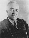 |
Homestead Lane, 20 feet north of U.S. 322, Hershey 40.2758°N 76.6338°W |
Roadside | Business & Industry, Education, Entrepreneurs | |
| Mira Lloyd Dock | North Front Street near Reily St., Harrisburg 40.2698°N 76.8947°W |
City | Education, Environment, Government & Politics, Government & Politics 20th Century, Women, Writers | ||
| Nuclear Accident at Three Mile Island | River Rd. (PA 441), S of Royalton (1 mile S of the main gate to Three Mile Island) 40.1527°N 76.7177°W |
Roadside | Business & Industry, Environment, Government & Politics | ||
| Old Brick Capitol | Main entrance to Capitol (in lawn north of steps), Third and State Streets, Harrisburg 40.2642°N 76.8843°W |
City | Government & Politics, Government & Politics 19th Century | ||
| Old Courthouses | Market St. between 2nd & 3rd Sts., Harrisburg (Missing) 40.2605°N 76.8813°W |
City | Government & Politics, Government & Politics 18th Century | ||
| Old Salem Church | Chestnut St. between 2nd & 3rd Sts., Harrisburg 40.2593°N 76.8797°W |
City | Religion | ||
| Patton's Fort | Linglestown Rd. (PA 39) at Patton Rd., 1.4 miles W of Linglestown 40.33661°N 76.82052°W |
Roadside | Forts, French & Indian War, Military, Native American | ||
| Paxtang Manor | Riverfront Park, Front & Calder Sts., Harrisburg 40.2688°N 76.894 °W |
City | Cities & Towns | ||
| Paxton Church | At church on Paxtang Ave., near Sharon St., Paxtang 40.263°N 76.8317°W |
Roadside | Buildings, Early Settlement, Religion | ||
| Paxton Church | 3700 block Derry St. near Wilhelm Rd., Paxtang 40.2587°N 76.8273°W |
Roadside | Buildings, Religion | ||
| Paxton Riflemen | U.S. 22, 5.7 miles NE of Harrisburg 40.3243°N 76.7807°W |
Roadside | American Revolution, Military | ||
| Pennsylvania Canal Pennsylvania Canal Pennsylvania Canal refers generally to a complex system of canals, dams, locks, tow paths, aqueducts, and other infrastructure including, in some cases, railroads in Pennsylvania... |
At Forum Building, Walnut St. at 5th St., Harrisburg, 40.2638°N 76.8807°W |
City | Canals, Navigation, Transportation | ||
| Pennsylvania Canal (Eastern Division) | Rt. 147, just off exit from US 22/322 (east side of Clarks Ferry Bridge), Dauphin °N °W |
Roadside | Bridges, Business & Industry, Canals, Coal, Iron, Navigation, Transportation | ||
| Pennsylvania Canal (Juniata Division) | U.S. 11 & 15 (E side), SW of Amity Hall and NE of Duncannon °N °W |
Roadside | Canals, Navigation, Transportation | ||
| Pennsylvania Farm Show Pennsylvania Farm Show The Pennsylvania Farm Show is held every January at the Pennsylvania Farm Show Complex & Expo Center located in Harrisburg, Pennsylvania, just off Exit 67 of Interstate 81. The event, considered Pennsylvania's state fair, first began in 1917. It is the largest indoor agricultural event held in the... |
Maclay St. near Cameron (U.S. 22 and 230), at Farm Show Complex, Harrisburg 40.283°N 77.0988°W |
Roadside | Agriculture, Business & Industry, Sports | ||
| Pennsylvania State Archives Pennsylvania State Archives The Pennsylvania State Archives is the official archive for the Commonwealth of Pennsylvania, administered as part of the Pennsylvania Historical and Museum Commission. It is located in the state capitol of Harrisburg and is a part of the Pennsylvania State Capitol Complex.It was founded in 1903,... |
North Third Street near Forster, at entrance to Pennsylvania State Archives, Harrisburg 40.2662°N 76.8867°W |
Roadside | Education, Government & Politics, Government & Politics 20th Century | ||
| Pennsylvania State Police Pennsylvania State Police The Pennsylvania State Police is the state police force of Pennsylvania, responsible for statewide law enforcement. It was founded in 1905 by order of Governor Samuel Pennypacker, in response to the private police forces used by mine and mill owners to stop worker strikes and the inability or... |
Hershey School District Memorial Field Complex, Cocoa Ave., Hershey 40.280217°N 76.64653°W |
Roadside | Coal, Education, Government & Politics 20th Century, Labor, Police and Safety | ||
| Presidential Convention | 15 S. 4th St. at Zion Lutheran Church, Harrisburg 40.2617°N 76.8793°W |
City | Government & Politics, Government & Politics 19th Century | ||
| Public Sector Unionism | State St., near 3rd, Harrisburg °N °W |
City | Government & Politics 20th Century, Labor | ||
| Rockville Bridge Rockville Bridge The Rockville Bridge, at the time of its completion in 1902, was, and still remains, the longest stone masonry arch railroad viaduct in the world. Constructed between 1900 - 1902 by the Pennsylvania Railroad, it has forty-eight 70-foot spans, for a total length of 3,820 feet .The bridge crosses... |
N Front St. in Susquehanna Twp., at Fort Hunter's Heckton Church 40.33874°N 76.90752°W |
Roadside | Bridges, Business & Industry, Railroads | ||
| Saint Peter's Kierch St. Peter's Kierch St. Peter's Kierch, also called the Old Kierch or St. Peter's Church, is a historic Lutheran church in Middletown, Dauphin County in the U.S. state of Pennsylvania. Construction began in 1767 and it was dedicated by Henry Muhlenberg in 1769. St. Peter's Kierch was used regularly until 1879 when a... |
At church, Union & High Sts., Middletown 40.2012°N 76.7325°W |
Roadside | Religion | ||
| Simon Girty Simon Girty Simon Girty was an American colonial of Scots-Irish ancestry who served as a liaison between the British and their Native American allies during the American Revolution... |
Front St. at Fort Hunter Park, Middle Paxton Twp., just N of Harrisburg 40.3423°N 76.9097°W |
Roadside | American Revolution, Early Settlement, Exploration, Native American, War of 1812 | ||
| State Capitol | Main entrance to Capitol (south of steps), Harrisburg 40.2645°N 76.8847°W |
City | Government & Politics, Government & Politics 20th Century | ||
| State Museum of Pennsylvania State Museum of Pennsylvania The State Museum of Pennsylvania is a non-profit museum at 300 North Street in downtown Harrisburg, run by the Commonwealth of Pennsylvania through the Pennsylvania Historical and Museum Commission to preserve and interpret the region's history and culture. It is a part of the Pennsylvania State... |
Museum lawn, 3rd & North Streets, Harrisburg °N °W |
Roadside | Buildings, Education, Government & Politics 20th Century | ||
| T. Morris Chester | Market Street near 3rd St., Harrisburg 40.2607°N 76.8812°W |
City | African American, Civil War, Education, Military, Professions & Vocations, Underground Railroad | ||
| U.S. Colored Troops Grand Review | Soldier's Grove behind Capitol, Walnut / 7th St. across from State St. Bridge, Harrisburg °N °W |
Roadside | African American, Civil War, Military | ||
| Underground Railroad Underground Railroad The Underground Railroad was an informal network of secret routes and safe houses used by 19th-century black slaves in the United States to escape to free states and Canada with the aid of abolitionists and allies who were sympathetic to their cause. The term is also applied to the abolitionists,... |
In Capitol Park, Walnut St. near Commonwealth Ave., Harrisburg 40.2628°N 76.8815°W |
City | African American, Religion, Underground Railroad | ||
| Union Canal Union Canal (Pennsylvania) The Union Canal was a towpath canal that existed in southeastern Pennsylvania in the United States during the 19th century. First proposed in 1690 to connect Philadelphia with the Susquehanna River, it ran approximately 75 mi from Middletown on the Susquehanna below Harrisburg to Reading on... |
Allentown Blvd. / Wm. Penn Hwy. (US 22) at Hershey Rd. (PA 39), 9.3 miles NE of Harrisburg 40.3388°N 76.7128°W |
Roadside | Canals, Navigation, Transportation, William Penn | ||
| Union Canal Union Canal (Pennsylvania) The Union Canal was a towpath canal that existed in southeastern Pennsylvania in the United States during the 19th century. First proposed in 1690 to connect Philadelphia with the Susquehanna River, it ran approximately 75 mi from Middletown on the Susquehanna below Harrisburg to Reading on... |
S. Hanover St. near Hershey Park Drive, Union Deposit 40.2858°N 76.6787°W |
Roadside | Canals, Navigation, Transportation, William Penn | ||
| Union Canal Union Canal (Pennsylvania) The Union Canal was a towpath canal that existed in southeastern Pennsylvania in the United States during the 19th century. First proposed in 1690 to connect Philadelphia with the Susquehanna River, it ran approximately 75 mi from Middletown on the Susquehanna below Harrisburg to Reading on... |
E Main St. / E Harrisburg Pk. (PA 230) between RR tracks & Swatara Creek, E end of Middletown 40.1917°N 76.7318°W |
Roadside | Canals, Navigation, Transportation | ||
| Walnut Street Bridge | n/a | City Island at West end of bridge, Harrisburg 40.2558°N 76.8882°W |
City | Bridges, Transportation | |
| Wildwood Park | intersection of Industrial Rd. & Wildwood Way, Harrisburg 40.30773°N 76.88682°W |
Roadside | Cities & Towns, Education, Environment, Medicine & Science | ||
| William Howard Day | Lincoln & Carlisle Sts., Steelton 40.2432°N 76.8383°W |
Roadside | African American, Education, Professions & Vocations, Religion, Underground Railroad, Writers | ||
| William Maclay | Riverfront Park, Front & South Sts., Harrisburg 40.2618°N 76.8883°W |
Roadside | George Washington, Government & Politics, Government & Politics 18th Century | ||
| Wilt Chamberlain's Scoring Record Wilt Chamberlain's 100-point game Wilt Chamberlain's 100-point game, named by the National Basketball Association as one of its greatest games, was a regular-season game between the Philadelphia Warriors and the New York Knicks held on March 2, 1962, at Hersheypark Arena in Hershey, Pennsylvania.The Warriors won the game 169-147,... |
100 Hersheypark Dr. (Hersheypark Arena), Hershey 40.2887°N 76.6567°W |
Roadside | African American, Basketball, Sports |
See also
- List of Pennsylvania state historical markers
- National Register of Historic Places listings in Dauphin County, Pennsylvania