

List of Pennsylvania state historical markers in Beaver County
Encyclopedia
This is intended to be a complete list of the official state historical markers placed in Beaver County, Pennsylvania
Beaver County, Pennsylvania
-Demographics:As of the census of 2000, there were 181,412 people, 72,576 households, and 50,512 families residing in the county. The population density was 418 people per square mile . There were 77,765 housing units at an average density of 179 per square mile...
by the Pennsylvania Historical and Museum Commission
Pennsylvania Historical and Museum Commission
The Pennsylvania Historical and Museum Commission is the governmental agency of the Commonwealth of Pennsylvania responsible for the collection, conservation and interpretation of Pennsylvania's historic heritage...
(PHMC). The locations of the historical markers, as well as the latitude and longitude coordinates as provided by the PHMC's database, are included below when available. There are 17 historical markers located in Beaver County.
Historical markers
| Marker title | Image | Date dedicated | Location | Marker type | Topics |
|---|---|---|---|---|---|
| Beaver County Beaver County, Pennsylvania -Demographics:As of the census of 2000, there were 181,412 people, 72,576 households, and 50,512 families residing in the county. The population density was 418 people per square mile . There were 77,765 housing units at an average density of 179 per square mile... |
 |
County Courthouse, at park on 3rd St., Beaver 40.69442°N 80.3075°W |
City | Business & Industry, Government & Politics, Government & Politics 19th Century, Transportation | |
| Fort McIntosh Fort McIntosh (Pennsylvania) Fort McIntosh was an early American log frontier fort situated near the confluence of the Ohio River and the Beaver River in what is now Beaver, Pennsylvania.... |
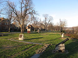 |
Pa. 68 (3rd St.) at Insurance St., Beaver 40.69479°N 80.30601°W |
Roadside | American Revolution, Forts, Military | |
| Harmony Society Cemetery | Church St., center of cemetery, Ambridge 40.59304°N 80.23217°W |
City | Religion | ||
| Harmony Society Church |  |
Church St. near Creese St., Ambridge 40.59605°N 80.23218°W |
City | Buildings, Religion | |
| Ingram-Richardson Manufacturing Co. | Ing-Rich Road 24th Street Extension and 31st Street Extension, Beaver Falls 40.7704°N 80.328°W |
Roadside | Business & Industry | ||
| King Beaver's Town Beaver, Pennsylvania Beaver is a borough in and the county seat of Beaver County, Pennsylvania, United States, at the confluence of the Beaver and Ohio Rivers. As of the 2000 census, the borough population was 4,775, having dropped from 5,641 in 1940.... |
 |
Pa. 68 (3rd St.) at Wilson Ave., Beaver 40.69742°N 80.29964°W |
Roadside | Cities & Towns, Government & Politics, Government & Politics 18th Century, Native American | |
| Legionville Legionville Legionville was the first formal United States military basic training facility, established by Major General Anthony Wayne, in 1792, near present-day Baden, Pennsylvania to train the soldiers of the Legion of the United States.-History:... |
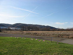 |
Duss Ave. at Anthony Wayne Dr. N of Ambridge 40.62488°N 80.22926°W |
Roadside | American Revolution, Cities & Towns, Military, Native American | |
| Legionville Legionville Legionville was the first formal United States military basic training facility, established by Major General Anthony Wayne, in 1792, near present-day Baden, Pennsylvania to train the soldiers of the Legion of the United States.-History:... |
Duss Ave. at Anthony Wayne Dr., N of Ambridge (Missing) °N °W |
Roadside | American Revolution, Military | ||
| Logstown Logstown The riverside village of Logstown was a significant Native American settlement in Western Pennsylvania and the site of the 1752 signing of the treaty of friendship between the Ohio Company and the Amerindians occupying the region in the years leading up to the... |
Duss Ave. (old Pa. 65) at Anthony Wayne Dr. N of Ambridge 40.62283°N 80.2265°W |
Roadside | Cities & Towns, Early Settlement, French & Indian War, Government & Politics, Government & Politics 18th Century, Native American | ||
| Logstown - PLAQUE Logstown The riverside village of Logstown was a significant Native American settlement in Western Pennsylvania and the site of the 1752 signing of the treaty of friendship between the Ohio Company and the Amerindians occupying the region in the years leading up to the... |
Lower end of Ambridge 40.6228°N 79.7734°W |
Plaque | Early Settlement, French & Indian War, Native American | ||
| Matthew S. Quay Matthew Quay Matthew Stanley Quay was an immensely powerful Pennsylvania political boss; "kingmaker" . "Boss" Quay's political principles and actions stood in contrast to an unusually attractive personality... |
 |
Pa. 68 (3rd St.) at Insurance St., Beaver 40.69464°N 80.30617°W |
Roadside | Government & Politics, Government & Politics 19th Century | |
| NLRB v. Jones & Laughlin Supreme Court Ruling National Labor Relations Board v. Jones & Laughlin Steel Corporation National Labor Relations Board v. Jones & Laughlin Steel Corporation, 301 U.S. 1 , was a United States Supreme Court case that declared that the National Labor Relations Act of 1935 was constitutional... |
Franklin Ave. & Route 51, Aliquippa 40.61964°N 80.2428°W |
Roadside | Government & Politics 20th Century, Labor | ||
| Old Economy Old Economy Village Old Economy Village is a historic settlement in Ambridge, Beaver County, Pennsylvania, United States. Administered by the Pennsylvania Historical and Museum Commission, it lies on the banks of the Ohio River and is surrounded by downtown Ambridge... |
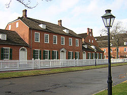 |
n/a | Pa. 65 in Ambridge, across from site 40.59565°N 80.23218°W |
Roadside | Religion |
| Old Economy Memorial Old Economy Village Old Economy Village is a historic settlement in Ambridge, Beaver County, Pennsylvania, United States. Administered by the Pennsylvania Historical and Museum Commission, it lies on the banks of the Ohio River and is surrounded by downtown Ambridge... |
 |
n/a | Old Economy, 13th & Church Sts., Ambridge 40.59585°N 80.23373°W |
Roadside | Religion |
| Pennsylvania Pennsylvania The Commonwealth of Pennsylvania is a U.S. state that is located in the Northeastern and Mid-Atlantic regions of the United States. The state borders Delaware and Maryland to the south, West Virginia to the southwest, Ohio to the west, New York and Ontario, Canada, to the north, and New Jersey to... |
 |
U.S. 30, .4 miles from state line (MISSING) °N °W |
Roadside | Government & Politics, Government & Politics 17th Century, William Penn | |
| Pennsylvania Pennsylvania The Commonwealth of Pennsylvania is a U.S. state that is located in the Northeastern and Mid-Atlantic regions of the United States. The state borders Delaware and Maryland to the south, West Virginia to the southwest, Ohio to the west, New York and Ontario, Canada, to the north, and New Jersey to... |
 |
Pa. 51 at state line (MISSING) °N °W |
Roadside | Government & Politics, Government & Politics 17th Century, William Penn | |
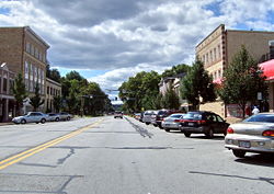
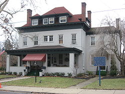
| White Cottage | 1221 3rd Ave., New Brighton 40.73084°N 80.31003°W |
City | Houses & Homesteads, Women, Writers |
See also
- List of Pennsylvania state historical markers
- National Register of Historic Places listings in Beaver County, PennsylvaniaNational Register of Historic Places listings in Beaver County, PennsylvaniaThis is a list of the National Register of Historic Places listings in Beaver County, Pennsylvania.This is intended to be a complete list of the properties and districts on the National Register of Historic Places in Beaver County, Pennsylvania, United States...