Langi Ghiran State Park
Encyclopedia
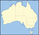
The Langi Ghiran State Park is 14 km east of Ararat
in the state of Victoria
, Australia
. The park covers an area of 2695 ha.
The park can be used for camping, walking and driving. It has steep granite peaks and gentle sloping open woodland sections. The name Langi Ghiran means 'home of the black cockatoo
' in the local Djab Wurrung
people's language.
Other parks nearby are Mount Buangor in the East and the Grampians in the distant West.
There are two reservoirs in the Park which were built from local granite blocks in the 1880s. The main reservoir forms part of Ararat
's water supply and is worth a visit.
A "spot mill" for extracting timber was built on the northern slopes in 1940 but was short lived. Today little evidence remains to remind us of the mill's past operation.
Ararat, Victoria
Ararat is a city in south-west Victoria, Australia, about west of Melbourne, on the Western Highway on the eastern slopes of the Ararat Hills and Cemetery Creek valley between Victoria's Western District and the Wimmera...
in the state of Victoria
Victoria (Australia)
Victoria is the second most populous state in Australia. Geographically the smallest mainland state, Victoria is bordered by New South Wales, South Australia, and Tasmania on Boundary Islet to the north, west and south respectively....
, Australia
Australia
Australia , officially the Commonwealth of Australia, is a country in the Southern Hemisphere comprising the mainland of the Australian continent, the island of Tasmania, and numerous smaller islands in the Indian and Pacific Oceans. It is the world's sixth-largest country by total area...
. The park covers an area of 2695 ha.
The park can be used for camping, walking and driving. It has steep granite peaks and gentle sloping open woodland sections. The name Langi Ghiran means 'home of the black cockatoo
Red-tailed Black Cockatoo
The Red-tailed Black Cockatoo , also known as Banksian- or Banks' Black Cockatoo, is a large cockatoo native to Australia. This species was known as Calyptorhynchus magnificus for many decades until the current scientific name was officially conserved in 1994. It is more common in the drier parts...
' in the local Djab Wurrung
Djab Wurrung
The Djab wurrung people are Indigenous Australians who occupy the volcanic plains of central Victoria from the Mount William Range of Gariwerd in the west to the Pyrenees range in the east encompassing the Wimmera River flowing north and the headwaters of the Hopkins River flowing south. The towns...
people's language.
Other parks nearby are Mount Buangor in the East and the Grampians in the distant West.
History
The first European to climb Mount Langi Ghiran was Major Thomas Mitchell, on his 1836 'Australia Felix' expedition. He named it Mount Mistake.There are two reservoirs in the Park which were built from local granite blocks in the 1880s. The main reservoir forms part of Ararat
Ararat, Victoria
Ararat is a city in south-west Victoria, Australia, about west of Melbourne, on the Western Highway on the eastern slopes of the Ararat Hills and Cemetery Creek valley between Victoria's Western District and the Wimmera...
's water supply and is worth a visit.
A "spot mill" for extracting timber was built on the northern slopes in 1940 but was short lived. Today little evidence remains to remind us of the mill's past operation.

