
Kontovazaina
Encyclopedia
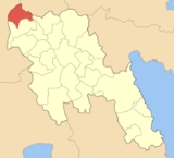
Kontovazaina is a village and a former municipality in Arcadia
, Peloponnese, Greece
. Since the 2011 local government reform it is part of the municipality Gortynia
, of which it is a municipal unit. Its 2001 population was 500 for the village and 2,048 for the municipality. Achaea
borders to the north and Elis to the west.
(Patras - Tripoli) and north of the GR-74
(Tripoli - (Ancient) Olympia - Pyrgos).
The village has about 10 km of paved road, 6 km of gravel road and has about 8 km of hydro and phone lines.
river to the south with its lake
near the municipal boundary.
and the Greek Civil War
, its buildings were rebuilt and emigration occurred at a higher rate until 1981, it became one of the few villages in mountainous Arto regain is population but once again lost. Kontovazena became connected with asphalt in the 2000s. Electricity, radio and automobiles were introduced in the mid-20th century, television in the late-20th century and computer and internet at the turn of the millennium. In 1997, the ex-community (now a village and a municipal district) joined to become the newly formed municipality of Kontovazena and became its seat.
). Its nearest lyceum is in Tropaia.
Today, it is a village with some inhabitants, it is mostly populated during the summer months. The population depends on olive and cattle productions.
Arcadia
Arcadia is one of the regional units of Greece. It is part of the administrative region of Peloponnese. It is situated in the central and eastern part of the Peloponnese peninsula. It takes its name from the mythological character Arcas. In Greek mythology, it was the home of the god Pan...
, Peloponnese, Greece
Greece
Greece , officially the Hellenic Republic , and historically Hellas or the Republic of Greece in English, is a country in southeastern Europe....
. Since the 2011 local government reform it is part of the municipality Gortynia
Gortynia
Gortynia is a municipality in the Arcadia peripheral unit, Peloponnese Periphery, Greece. The seat of the municipality is the town Dimitsana.-Municipality:...
, of which it is a municipal unit. Its 2001 population was 500 for the village and 2,048 for the municipality. Achaea
Achaea
Achaea is one of the regional units of Greece. It is part of the region of West Greece. It is situated in the northwestern part of the Peloponnese peninsula. The capital is Patras. The population exceeds 300,000 since 2001.-Geography:...
borders to the north and Elis to the west.
Subdivisions
The municipal unit Kontovazaina is subdivided into the following communities (constituent villages in brackets):- DimitraDimitra, ArcadiaDimitra is a village in the municipal unit of Kontovazaina, Arcadia, Greece. As of 2001, it had a population of 209 for the village, and 221 for the municipal district.-Nearest places:*Vlachia, east...
(Dimitra, Stavri) - KardaritsiKardaritsiKardaritsi is a mountainous village in the municipal unit of Kontovazaina in northwest Arcadia, Greece.The village is located some 60 kilometers north-east of Archea Olympia and 98 kilometers north-west of Tripoli....
- Kontovazaina
- Monastiraki (Monastiraki, Arsinaia, Peleki)
- Paralongoi (Paralongoi, Agios Nikolaos, Petas)
- Vachlia (Vachlia, Pera Vachlia)
- Velimachi (Velimachi, Aposkia, Soudeli)
- Vidiaki
- Voutsis
Population
| Year | Population village | Population municipality |
|---|---|---|
| 1991 | 622 | - |
| 2001 | 500 | 2,048 |
Location and transportation
Kontovazaina is located around 10 km southwest of the GR-33Greek National Road 33
Greek National Road 33 is a highway that runs from Patras, originally at Dimitris Gounaris Street, now begins at the beltway, and had a branch ending at Olympia, and ends near Vytina, and Levídi, and some think it still ends at Ellinikon near Andritsaina and Megalopolis...
(Patras - Tripoli) and north of the GR-74
Greek National Road 74
Greek National Road 74 is a highway linking Pyrgos, Olympia, Tripoli and GR-7/E65. The west to east highway runs in the western and the central part of the Peloponnese. The highway begins in Pyrgos and into the hills and Olympia and used to ran through narrow roads which now bypasses Pyrgos and...
(Tripoli - (Ancient) Olympia - Pyrgos).
The village has about 10 km of paved road, 6 km of gravel road and has about 8 km of hydro and phone lines.
Geography
Its geography are mainly forested with pine, cedars and spruces with some other trees including willow. Barren lands and farmlands also dominates the area especially in the mountainous areas. The Afrodisio mountains dominate the northg and the LadonLadon
Ladon may refer to:*Ladon , one of the dragons in Greek mythology*Ladon in Arcadia, Greece*Ladon, Loiret, a commune in the Loiret département of France*Ladon, the dragon god in the video game Breath of Fire III...
river to the south with its lake
Ladon Lake
The Ladon Lake or the Ladon Reservoir is an artificial lake in the upper part of Ladon River in the northwestern part of the Arcadia prefecture in Greece, it supplies water to the prefecture and not electricity and prevents flooding from the low lying areas especially with the Alfeios valley...
near the municipal boundary.
History
After World War IIWorld War II
World War II, or the Second World War , was a global conflict lasting from 1939 to 1945, involving most of the world's nations—including all of the great powers—eventually forming two opposing military alliances: the Allies and the Axis...
and the Greek Civil War
Greek Civil War
The Greek Civil War was fought from 1946 to 1949 between the Greek governmental army, backed by the United Kingdom and United States, and the Democratic Army of Greece , the military branch of the Greek Communist Party , backed by Bulgaria, Yugoslavia and Albania...
, its buildings were rebuilt and emigration occurred at a higher rate until 1981, it became one of the few villages in mountainous Arto regain is population but once again lost. Kontovazena became connected with asphalt in the 2000s. Electricity, radio and automobiles were introduced in the mid-20th century, television in the late-20th century and computer and internet at the turn of the millennium. In 1997, the ex-community (now a village and a municipal district) joined to become the newly formed municipality of Kontovazena and became its seat.
The village today
Kontovazaina has 13 churches,a school(dimotiko and gymnasium) a post office, and a square (plateiaPlateia
Plateia or platia is the Greek word for town square. Most Greek and Cypriot cities have several town squares which are a point of reference in travelling and guiding...
). Its nearest lyceum is in Tropaia.
Today, it is a village with some inhabitants, it is mostly populated during the summer months. The population depends on olive and cattle productions.
External links
- http://www.kontovazena.gov.gr/Default.aspx?tabid=325
- http://www.k-gortynia.gr/oikismoi/kontovazaina.html
| Northwest: Lampeia Lampeia Lampeia is a village and a former municipality in Elis, West Greece, Greece. Since the 2011 local government reform it is part of the municipality Archaia Olympia, of which it is a municipal unit. The village is also known as Divri. Its population is presently around 1,000. Lampeia is in a valley... |
North: Aroania Aroania Aroania is a village and a former municipality in Achaea, West Greece, Greece. Since the 2011 local government reform it is part of the municipality Kalavryta, of which it is a municipal unit. The population is 2,551 . The seat of administration was in the town Psofida... |
|
| West: Foloi Foloi Foloi is a village and a former municipality in Elis, West Greece, Greece. Since the 2011 local government reform it is part of the municipality Archaia Olympia, of which it is a municipal unit. The seat of the municipality was in the village Lalas... |
Kontovazaina | East: Kleitoria Kleitoria Kleitoria is a village in Achaea, West Greece, Greece. Since the 2011 local government reform it is part of the municipality Kalavryta.... |
| South: Tropaia Tropaia Tropaia is a village and a former municipality in Arcadia, Peloponnese, Greece. Since the 2011 local government reform it is part of the municipality Gortynia, of which it is a municipal unit. Population 4,660 .... |
Southeast: Lagkada Lagkada Lagkada may refer to several places in Greece:*Lagkada, Chios, a village in the Chios prefecture*Lagkada, Ioannina, a village in the Ioannina Prefecture*Lagkada, Itanos, a village in Lasithi, municipality Itanos... |