Koncheto
Encyclopedia

Pirin
The Pirin Mountains are a mountain range in southwestern Bulgaria, with Vihren the highest peak, situated at . The range extends about 40 km northwest-southeast, and about 25 km wide. Most of the range is protected in the Pirin National Park...
Mountains in Bulgaria
Bulgaria
Bulgaria , officially the Republic of Bulgaria , is a parliamentary democracy within a unitary constitutional republic in Southeast Europe. The country borders Romania to the north, Serbia and Macedonia to the west, Greece and Turkey to the south, as well as the Black Sea to the east...
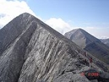
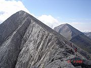
, at an altitude of approximately 2,780 meters, between the peaks Banski Suhodol
Banski Suhodol
Banski Suhodol is a peak in the Pirin mountain, south-western Bulgaria. It is located in the northern part of Pirin on the main ridge. Its height is 2,884 m which ranks it on third place in Pirin after Vihren and Kutelo....
(2,884 meters) and Kutelo
Kutelo
Kutelo is the second highest peak in Pirin, southwestern Bulgaria . Like Vihren, which towers to the south, Kutelo is marble but its slopes though sheer are not so rocky and it is not very difficult to climb. Kutelo is a double peak with a small saddle between the two parts, the lower being only...
(2,908 meters). There are steep slopes on either side: the northwestern side is almost vertical and approximately 300 meters deep, while the southwestern side is less steep (approximately 30 degrees) but deeper (800 meters). There is a steel cable stretched along the top of the ridge to help hikers across. It is said that some less experienced hikers go through Koncheto by saddling the ridge edge like a horse and slowly advancing, hence its name. It is not recommended for hikers with acrophobia
Acrophobia
Acrophobia is an extreme or irrational fear of heights. It belongs to a category of specific phobias, called space and motion discomfort that share both similar etiology and options for treatment.Most people experience a degree of natural fear when exposed to heights, especially if there is little...
.

