
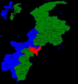
Kohat District
Encyclopedia
Kohat is a district
of the Khyber-Pakhtunkhwa province of Pakistan
, Kohat
city is the capital of the district. It is inhabited by various Pashtun tribes such as Afridi,Khattaks, Bangash and the Orakzaies. The main language of the district is Pashto.
, Afridi
and Khattak
. These people appear to have settled in the district, during 14th am 15th centuries. From 16th to 18th centuries, Kohat remained a part of Afghanistan
, administered by the Chiefs of two afore mentioned tribes. In the beginning of 19th century Kohat came under the control of Sikh
s who ultimately withdrew leaving to the administrative control of Khan of Teri
in 1836.
on 28 March 1849 with the rest of Punjab
and an Assistant Commissioner was posted here to run the administration and to look after the British interests. In the initial stages of the British administration, the locals of the area posed considerable problems. Later on some of the tribe joined with the British Government and helped them in running the area. Nevertheless, the Britishers were never at peace in this part of their Kingdom as resistance and opposition always cropped from one quarter or the other. But their tactics of "Divide and Rule" ultimately strengthened their hold over the region. They put one tribe against the other by giving preference to one against the other and finally succeeded in administration them. An example of unrest against the British in this area is the event of the brave Afridi Ajab Khan, who forced the entire British administration of the district to surrender to his demands.
s.
The district is represented in the provincial assembly by three elected MPAs who represent the following constituencies:
Districts of Pakistan
The Districts of Pakistan are the second order administrative divisions of Pakistan. Districts were the third order of administrative divisions, below provinces and "divisions", until the reforms of August 2000, when "divisions" were abolished...
of the Khyber-Pakhtunkhwa province of Pakistan
Pakistan
Pakistan , officially the Islamic Republic of Pakistan is a sovereign state in South Asia. It has a coastline along the Arabian Sea and the Gulf of Oman in the south and is bordered by Afghanistan and Iran in the west, India in the east and China in the far northeast. In the north, Tajikistan...
, Kohat
Kohat
Kohat is a medium sized town in Khyber Pakhtunkhwa province of Pakistan. It is located at 33°35'13N 71°26'29E with an altitude of 489 metres and is the capital of Kohat District. The town centres around a British-era fort, various bazaars, and a military cantonment. A British-built narrow gauge...
city is the capital of the district. It is inhabited by various Pashtun tribes such as Afridi,Khattaks, Bangash and the Orakzaies. The main language of the district is Pashto.
Mughal Era
From the early sixteenth century the history of Kohat revolves around three major tribes namely BangashBangash
Bangash is the name of a Pashtun clan. The Bangash clan inhabit regions within the Federally Administered Tribal Areas , the Kurram Agency, the Miranzai Valley bordering the Samana Range, Naryab, Tirah, Kohat and Peshawar within the Sarhad province...
, Afridi
Afridi
Afridi of rough hilly area in the eastern Safed Koh range, west of the Peshawar Valley and east of Torkham, and Maidan in Tirah, which can be accessed by the Kajurhi plains and the valleys of Bara and Churah in Pakistan...
and Khattak
Khattak
Khattak or Khatak , is the name of an Afghan tribe. speaking a variant of the Kandahari Pashto. They are accorded the status of being one of the original and true Afghans. The tribe is settled along the western bank of the river Indus from as north upwards as Sammah; modern day Lund Khwar & Sher...
. These people appear to have settled in the district, during 14th am 15th centuries. From 16th to 18th centuries, Kohat remained a part of Afghanistan
Afghanistan
Afghanistan , officially the Islamic Republic of Afghanistan, is a landlocked country located in the centre of Asia, forming South Asia, Central Asia and the Middle East. With a population of about 29 million, it has an area of , making it the 42nd most populous and 41st largest nation in the world...
, administered by the Chiefs of two afore mentioned tribes. In the beginning of 19th century Kohat came under the control of Sikh
Sikh
A Sikh is a follower of Sikhism. It primarily originated in the 15th century in the Punjab region of South Asia. The term "Sikh" has its origin in Sanskrit term शिष्य , meaning "disciple, student" or शिक्ष , meaning "instruction"...
s who ultimately withdrew leaving to the administrative control of Khan of Teri
Teri, NWFP
Teri is a village and Union Council in Karak District of Khyber Pakhtunkhwa, Pakistan. It is located at 33°18'0"N 71°6'0"E with an altitude of 634 metres ....
in 1836.
British Era
Kohat was finally annexed to the British dominionBritish Raj
British Raj was the British rule in the Indian subcontinent between 1858 and 1947; The term can also refer to the period of dominion...
on 28 March 1849 with the rest of Punjab
Punjab region
The Punjab , also spelled Panjab |water]]s"), is a geographical region straddling the border between Pakistan and India which includes Punjab province in Pakistan and the states of the Punjab, Haryana, Himachal Pradesh, Chandigarh and some northern parts of the National Capital Territory of Delhi...
and an Assistant Commissioner was posted here to run the administration and to look after the British interests. In the initial stages of the British administration, the locals of the area posed considerable problems. Later on some of the tribe joined with the British Government and helped them in running the area. Nevertheless, the Britishers were never at peace in this part of their Kingdom as resistance and opposition always cropped from one quarter or the other. But their tactics of "Divide and Rule" ultimately strengthened their hold over the region. They put one tribe against the other by giving preference to one against the other and finally succeeded in administration them. An example of unrest against the British in this area is the event of the brave Afridi Ajab Khan, who forced the entire British administration of the district to surrender to his demands.
Administration
Kohat district is divided into two TehsilTehsil
A Tehsil or Tahsil/Tahasil , also known as Taluk and Mandal, is an administrative division of some country/countries of South Asia....
s.
- KohatKohatKohat is a medium sized town in Khyber Pakhtunkhwa province of Pakistan. It is located at 33°35'13N 71°26'29E with an altitude of 489 metres and is the capital of Kohat District. The town centres around a British-era fort, various bazaars, and a military cantonment. A British-built narrow gauge...
- Lachi (Lachi is one of the largest village of Kohat. Situated on the southern border with Karak district)
The district is represented in the provincial assembly by three elected MPAs who represent the following constituencies:
- PF-37 (Kohat-1)
- PF-38 (Kohat-2)
- PF-39 (Kohat-3)