
Ketton Rural District
Encyclopedia
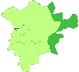
Ketton was a rural district
in Rutland
, England
from 1894 to 1974, covering the east of the county. The district was named after Ketton
.
The rural district was formed by the Local Government Act 1894
from the part of the Stamford
rural sanitary district
in Rutland. At the same time, the remainder of Stamford RSD, which lay in Lincolnshire
, Northamptonshire
and the Soke of Peterborough
became Uffington Rural District
, Easton on the Hill Rural District
and Barnack Rural District
respectively. The rural district council's offices remained in Stamford, Lincolnshire, outside the district.
In 1960 the Local Government Commission for England
proposed the abolition of the county of Rutland. The bulk of the county was to become part of Leicestershire, with Ketton RD transferred to a greatly enlarged Cambridgeshire
. The plans were not carried through, however and it was not until 1974 that the rural district was abolished by the Local Government Act 1972
and merged into a single Rutland district.
es:
Rural district
Rural districts were a type of local government area – now superseded – established at the end of the 19th century in England, Wales, and Ireland for the administration of predominantly rural areas at a level lower than that of the administrative counties.-England and Wales:In England...
in Rutland
Rutland
Rutland is a landlocked county in central England, bounded on the west and north by Leicestershire, northeast by Lincolnshire and southeast by Peterborough and Northamptonshire....
, England
England
England is a country that is part of the United Kingdom. It shares land borders with Scotland to the north and Wales to the west; the Irish Sea is to the north west, the Celtic Sea to the south west, with the North Sea to the east and the English Channel to the south separating it from continental...
from 1894 to 1974, covering the east of the county. The district was named after Ketton
Ketton
Ketton is a village and civil parish in the county of Rutland in the East Midlands of England. It is located about eight miles east of Oakham and three miles west of Stamford in Lincolnshire...
.
The rural district was formed by the Local Government Act 1894
Local Government Act 1894
The Local Government Act 1894 was an Act of the Parliament of the United Kingdom that reformed local government in England and Wales outside the County of London. The Act followed the reforms carried out at county level under the Local Government Act 1888...
from the part of the Stamford
Stamford, Lincolnshire
Stamford is a town and civil parish within the South Kesteven district of the county of Lincolnshire, England. It is approximately to the north of London, on the east side of the A1 road to York and Edinburgh and on the River Welland...
rural sanitary district
Sanitary district
Sanitary districts were established in England and Wales in 1875 and in Ireland in 1878. The districts were of two types, based on existing structures:*Urban sanitary districts in towns with existing local government bodies...
in Rutland. At the same time, the remainder of Stamford RSD, which lay in Lincolnshire
Lincolnshire
Lincolnshire is a county in the east of England. It borders Norfolk to the south east, Cambridgeshire to the south, Rutland to the south west, Leicestershire and Nottinghamshire to the west, South Yorkshire to the north west, and the East Riding of Yorkshire to the north. It also borders...
, Northamptonshire
Northamptonshire
Northamptonshire is a landlocked county in the English East Midlands, with a population of 629,676 as at the 2001 census. It has boundaries with the ceremonial counties of Warwickshire to the west, Leicestershire and Rutland to the north, Cambridgeshire to the east, Bedfordshire to the south-east,...
and the Soke of Peterborough
Soke of Peterborough
The Soke of Peterborough is an historic area of England that is traditionally associated with the City and Diocese of Peterborough, but considered part of Northamptonshire...
became Uffington Rural District
Uffington Rural District
Uffington was a rural district in Lincolnshire, Parts of Kesteven from 1894 to 1931.It was created in 1894 from that part of the Stamford rural sanitary district which was in Kesteven .It covered the following...
, Easton on the Hill Rural District
Easton on the Hill Rural District
Easton on the Hill was a rural district in Northamptonshire, England from 1894 to 1935. It was formed under the Local Government Act 1894 from that part of the Stamford rural sanitary district which was in Northamptonshire proper Easton on the Hill was a rural district in Northamptonshire, England...
and Barnack Rural District
Barnack Rural District
Barnack was a rural district in the Soke of Peterborough and later Huntingdon and Peterborough from 1894 to 1974.It was created in 1894 under the Local Government Act 1894, from that part of the Stamford rural sanitary district which was in the Soke Barnack was a rural district in the Soke of...
respectively. The rural district council's offices remained in Stamford, Lincolnshire, outside the district.
In 1960 the Local Government Commission for England
Local Government Commission for England (1958 - 1967)
The Local Government Commission for England was established by the Local Government Act 1958 to review the organisation of local government, and make "such proposals as are hereinafter authorised for effecting changes appearing to the Commissions desirable in the interests of effective and...
proposed the abolition of the county of Rutland. The bulk of the county was to become part of Leicestershire, with Ketton RD transferred to a greatly enlarged Cambridgeshire
Cambridgeshire
Cambridgeshire is a county in England, bordering Lincolnshire to the north, Norfolk to the northeast, Suffolk to the east, Essex and Hertfordshire to the south, and Bedfordshire and Northamptonshire to the west...
. The plans were not carried through, however and it was not until 1974 that the rural district was abolished by the Local Government Act 1972
Local Government Act 1972
The Local Government Act 1972 is an Act of Parliament in the United Kingdom that reformed local government in England and Wales on 1 April 1974....
and merged into a single Rutland district.
Parishes
The rural district consisted of nine civil parishCivil parish
In England, a civil parish is a territorial designation and, where they are found, the lowest tier of local government below districts and counties...
es:
- ClipshamClipshamClipsham is a village in the county of Rutland in the East Midlands of England.The village is well-known for its limestone quarries. Clipsham stone, part of the Upper Lincolnshire Limestone Formation, can be found in many of Britain's most famous buildings including King's College Chapel , the...
- EssendineEssendineEssendine is a village at the eastern end of the county of Rutland in the East Midlands of England. It lies on the West Glen, close by the earthworks of a small castle.-Geology:...
- Great CastertonGreat CastertonGreat Casterton is a village and civil parish in the county of Rutland in the East Midlands of England. It is located at the crossing of the Roman Ermine Street and the River Gwash.-Geography:...
- KettonKettonKetton is a village and civil parish in the county of Rutland in the East Midlands of England. It is located about eight miles east of Oakham and three miles west of Stamford in Lincolnshire...
- Little CastertonLittle CastertonLittle Casterton is a small village and civil parish in Rutland. It is about two miles north of Stamford on a minor road that runs to the south of the River Gwash between Great Casterton and Ryhall.The village has a church ....
- PickworthPickworth, RutlandPickworth is a civil parish and small hamlet in the county of Rutland in a region characterised by Rutland County Council as the clay woodlands of the Rutland Plateau ....
- RyhallRyhallRyhall is a village and civil parish in the county of Rutland in the East Midlands of England. It is located close to the eastern boundary of the county, about 2 miles north of Stamford.-The Village:...
- TinwellTinwellTinwell is a village and civil parish in the county of Rutland in the East Midlands of England.-Village:The village is just west of the A1 and within walking distance of the town of Stamford in Lincolnshire. The village has a small village hall, which was recently refurbished, and a beautiful church...
- Tixover