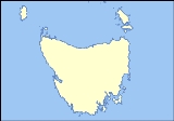
Kent Group
Overview
Bass Strait
Bass Strait is a sea strait separating Tasmania from the south of the Australian mainland, specifically the state of Victoria.-Extent:The International Hydrographic Organization defines the limits of the Bass Strait as follows:...
, Australia
Australia
Australia , officially the Commonwealth of Australia, is a country in the Southern Hemisphere comprising the mainland of the Australian continent, the island of Tasmania, and numerous smaller islands in the Indian and Pacific Oceans. It is the world's sixth-largest country by total area...
, north-west of the Furneaux Group. They form the Kent Group National Park.
The islands were named Kent's Group by Matthew Flinders
Matthew Flinders
Captain Matthew Flinders RN was one of the most successful navigators and cartographers of his age. In a career that spanned just over twenty years, he sailed with Captain William Bligh, circumnavigated Australia and encouraged the use of that name for the continent, which had previously been...
, "in honour of my friend captain William Kent, then commander of the Supply" when Flinders passed them on 7 February 1798 in the Francis (on her way to salvage the Sydney Cove
Sydney Cove (ship)
Sydney Cove was a sailing ship wrecked in 1797 on Preservation Island off Tasmania while on her way from Calcutta to Port Jackson. She was among the first ships wrecked on the east coast of Australia.- Voyage :...
). The largest island in the group is Deal Island
Deal Island (Tasmania)
Deal Island is a granite island, with an area of 1576.75 ha, in south-eastern Australia. It is the largest of Tasmania’s Kent Group, lying in northern Bass Strait between the Furneaux Group and Wilsons Promontory in Victoria. It is now part of the Kent Group National Park, Tasmania’s northernmost...
; the others, in order of descending size, are Erith Island
Erith Island (Tasmania)
Erith Island is a granite island, with an area of 323 ha, in south-eastern Australia. It is the second largest of Tasmania’s Kent Group, lying in northern Bass Strait between the Furneaux Group and Wilsons Promontory in Victoria. It is now part of the Kent Group National Park, Tasmania’s...
, Dover Island
Dover Island (Tasmania)
Dover Island is a densely vegetated granite island, with steep slopes and an area of 295 ha, in south-eastern Australia. It is the third largest of Tasmania’s Kent Group, lying in northern Bass Strait between the Furneaux Group and Wilsons Promontory in Victoria. It is now part of the Kent Group...
, North East Isle
North East Isle (Tasmania)
North East Isle is a granite island, with an area of 32.62 ha and a high point of 125 m, in south-eastern Australia. It is part of Tasmania’s Kent Group, lying in northern Bass Strait between the Furneaux Group and Wilsons Promontory in Victoria. It is now part of the Kent Group National Park,...
, South West Isle
South West Isle (Tasmania)
South West Isle is a granite island, with an area of 19.09 ha and a high point of 120 m, in south-eastern Australia. It is part of Tasmania’s Kent Group, lying in northern Bass Strait between the Furneaux Group and Wilsons Promontory in Victoria...
and Judgement Rocks
Judgement Rocks
Judgement Rocks is a small granite island , with an area of 0.39 ha, in south-eastern Australia. It is part of Tasmania’s Kent Group, lying in northern Bass Strait between the Furneaux Group and Wilsons Promontory in Victoria. It is part of the Kent Group National Park...
.
Murray Pass, named for the explorer John Murray
John Murray (Australian explorer)
John Murray was a seaman and explorer of Australia. He was the first European to discover Port Phillip, the bay on which the cities of Melbourne and Geelong are situated....
, between Deal and Erith Islands has long been used by ships to shelter from gales in Bass Strait, but it is a dangerous, partly open, roadstead
Roadstead
A roadstead is a place outside a harbor where a ship can lie at anchor. It is an enclosed area with an opening to the sea, narrower than a bay or gulf. It has a surface that cannot be confused with an estuary. It can be created artificially by jetties or dikes...
, and many ships have been wrecked after sudden changes in wind direction and speed.
Discussions

