
Kazabazua, Quebec
Encyclopedia
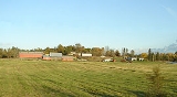
Kazabazua is a village and municipality in La Vallée-de-la-Gatineau Regional County Municipality, Quebec
, Canada. The village is about halfway between Maniwaki
and Hull
at the intersection of Route 105
and Route 301
, just west of the Gatineau River
.
The village and municipality are named after the Kazabazua River
which passes through it. Like many other Amerindian names, Kazabazua has had many spellings, such as Kazaluzu, Kasubasua, Cazabasua, Cazibazouis, Cazebalzuac, Cajibajouis. This word comes from the Algonquin word kachibadjiwan, from kach ("hidden") and djiwan ("current"), hence it means "underground river". This name is a reflection of the local topography because the Kazabazua River disappears underground and resurfaces a few dozen metres downstream. The river then flows through rapids and passes under a natural stone bridge.
The communities of Kazabazua Station, Aylwin, and Aylwin Station are also located within the municipality.
.
At the Kazabazua River, marble is calcitic and contains crystals of graphite and grossular garnet. The marble has been chemically and mechanically eroded by water from the river to form a karst
stone bridge
. The inclusion of gneiss
in the marble illustrates erosion differential.
The Kazabazua Plain is a geomorphological phenomena unique to Quebec. It is made up of metamorphic rocks which are covered with a network of ancient sand dunes and bogs within which many rare plant species and threatened species have been identified. The topography is the result of water and wind action since the withdrawal of the last glacier. After this withdrawal, the region was covered by the Champlain Sea
, which left a layer of marine clay. When the sea level lowered, the area was submerged under a postglacial delta which deposited large volumes of sand.
Circa 1835, the area began to be settled by Europeans and the community was originally called Hoganville, in memory of the first pioneers, the Hogan family, who were soon joined by the Gabie, Chamberlain, and Pritchard families.
In 1858, the Aylwin Township was formed, followed in 1862 by the township municipality with the same name. These were named after judge and politician Thomas Cushing Aylwin
(1806–1871). Also in 1862, the local post office opened, named Kazubazua. As evidenced by Lovell's Gazetteer of 1873, the village itself also began to be popularly known as Kazubazua.
In 1932, the name was changed to Kazabazua and the municipality legally took this name in 1976. It is often shortened to "Kaz" by locals.
Total private dwellings (excluding seasonal cottages): 378
Languages:
La Vallée-de-la-Gatineau Regional County Municipality, Quebec
La Vallée-de-la-Gatineau is a Regional County Municipality in the Outaouais region of western Quebec, Canada. The seat is in Gracefield. It is named for its location straddling the Gatineau River north of Low. It was incorporated on January 1, 1983.It consists of two cities, fifteen...
, Canada. The village is about halfway between Maniwaki
Maniwaki, Quebec
Maniwaki is a town north of Gatineau and located north-west of Montreal, in the province of Quebec, Canada. The town is situated on the Gatineau River, at the crossroads of Route 105 and Route 107, not far south of Route 117...
and Hull
Hull, Quebec
Hull is the central and oldest part of the city of Gatineau, Quebec, Canada. It is located on the west bank of the Gatineau River and the north shore of the Ottawa River, directly opposite Ottawa. As part of the Canadian National Capital Region, it contains offices for twenty thousand...
at the intersection of Route 105
Quebec route 105
Route 105 is a north-south highway in Quebec, Canada. It runs from Hull , where it is known as Boulevard Saint-Joseph , to Grand-Remous where it ends at Route 117....
and Route 301
Quebec Route 301
Route 301 is a provincial highway located in the Outaouais region in western Quebec. The route serves as a direct connection between the Pontiac region and the Upper Gatineau region...
, just west of the Gatineau River
Gatineau River
The Gatineau River is a river in western Quebec, Canada, which rises in lakes north of the Baskatong Reservoir and flows south to join the Ottawa River at the city of Gatineau, Quebec...
.
The village and municipality are named after the Kazabazua River
Kazabazua River
Kazabazua River is a tributary of the Gatineau River in western Quebec, Canada.The river gives its name to Kazabazua, a village in La Vallée-de-la-Gatineau Regional County Municipality. Derived from the Algonquin language, the name of this river has had many spellings including "Kazaluzu",...
which passes through it. Like many other Amerindian names, Kazabazua has had many spellings, such as Kazaluzu, Kasubasua, Cazabasua, Cazibazouis, Cazebalzuac, Cajibajouis. This word comes from the Algonquin word kachibadjiwan, from kach ("hidden") and djiwan ("current"), hence it means "underground river". This name is a reflection of the local topography because the Kazabazua River disappears underground and resurfaces a few dozen metres downstream. The river then flows through rapids and passes under a natural stone bridge.
The communities of Kazabazua Station, Aylwin, and Aylwin Station are also located within the municipality.
Geography
The bedrock of the region Kazabazua is composed predominantly of marble dating from the Precambrian Era and represent metamorphic sedimentary rocks from the Grenville orogenyGrenville orogeny
The Grenville Orogeny was a long-lived Mesoproterozoic mountain-building event associated with the assembly of the supercontinent Rodinia. Its record is a prominent orogenic belt which spans a significant portion of the North American continent, from Labrador to Mexico, as well as to Scotland...
.
At the Kazabazua River, marble is calcitic and contains crystals of graphite and grossular garnet. The marble has been chemically and mechanically eroded by water from the river to form a karst
KARST
Kilometer-square Area Radio Synthesis Telescope is a Chinese telescope project to which FAST is a forerunner. KARST is a set of large spherical reflectors on karst landforms, which are bowlshaped limestone sinkholes named after the Kras region in Slovenia and Northern Italy. It will consist of...
stone bridge
Natural arch
A natural arch or natural bridge is a natural geological formation where a rock arch forms, with an opening underneath. Most natural arches form as a narrow ridge, walled by cliffs, become narrower from erosion, with a softer rock stratum under the cliff-forming stratum gradually eroding out until...
. The inclusion of gneiss
Gneiss
Gneiss is a common and widely distributed type of rock formed by high-grade regional metamorphic processes from pre-existing formations that were originally either igneous or sedimentary rocks.-Etymology:...
in the marble illustrates erosion differential.
The Kazabazua Plain is a geomorphological phenomena unique to Quebec. It is made up of metamorphic rocks which are covered with a network of ancient sand dunes and bogs within which many rare plant species and threatened species have been identified. The topography is the result of water and wind action since the withdrawal of the last glacier. After this withdrawal, the region was covered by the Champlain Sea
Champlain Sea
The Champlain Sea was a temporary inlet of the Atlantic Ocean, a paratropical subsea or epeiric sea created by the retreating glaciers during the close of the last ice age...
, which left a layer of marine clay. When the sea level lowered, the area was submerged under a postglacial delta which deposited large volumes of sand.
History
This area is part of the Algonquin First Nation territory and has long been inhabited by that people.Circa 1835, the area began to be settled by Europeans and the community was originally called Hoganville, in memory of the first pioneers, the Hogan family, who were soon joined by the Gabie, Chamberlain, and Pritchard families.
In 1858, the Aylwin Township was formed, followed in 1862 by the township municipality with the same name. These were named after judge and politician Thomas Cushing Aylwin
Thomas Cushing Aylwin
Thomas Cushing Aylwin was a Quebec lawyer, judge and political figure.He was born in Quebec City in 1806, the grandson of Thomas Aylwin. Aylwin studied at Harvard University, then articled in law and was called to the bar in 1827. He entered the practice of law in partnership with Edward Short...
(1806–1871). Also in 1862, the local post office opened, named Kazubazua. As evidenced by Lovell's Gazetteer of 1873, the village itself also began to be popularly known as Kazubazua.
In 1932, the name was changed to Kazabazua and the municipality legally took this name in 1976. It is often shortened to "Kaz" by locals.
Demographics
Population:- Population in 2006: 839
- Population in 2001: 786
- 2001 to 2006 population change: 6.7 %
- Population in 1996: 759
- Population in 1991: 636
Total private dwellings (excluding seasonal cottages): 378
Languages:
- English as first language: 47 %
- French as first language: 50 %
- English and French as first language: 3 %