

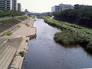
Kashio River
Encyclopedia
Kanagawa Prefecture
is a prefecture located in the southern Kantō region of Japan. The capital is Yokohama. Kanagawa is part of the Greater Tokyo Area.-History:The prefecture has some archaeological sites going back to the Jōmon period...
, Japan
Japan
Japan is an island nation in East Asia. Located in the Pacific Ocean, it lies to the east of the Sea of Japan, China, North Korea, South Korea and Russia, stretching from the Sea of Okhotsk in the north to the East China Sea and Taiwan in the south...
, about 50 kilometers southwest of Tokyo. It begins in Kashio, Totsuka-ku, Yokohama
Totsuka-ku, Yokohama
is one of the 18 wards of the city of Yokohama in Kanagawa Prefecture, Japan. As of 2010, the ward had an estimated population of 273,418 and a density of 7,640 persons per km². The total area was 35.70 km².-Geography:...
at the confluence of the Akuwa River (阿久和川) and the Hiradonagaya River (平戸永谷川) and flows for 11 kilometers to the city of Fujisawa
Fujisawa, Kanagawa
is a city located in Kanagawa, Japan. As of 2010, the city had an estimated population of 407,731 and a population density of 5,870 people per km². The total area is 69.51 km²-Geography:...
, where it merges with the Sakai River (境川) at the confluence known as Kawana (川名). The conjoined river, which is then known as the Katase River
Katase River
The is a segment of a river in Shonan, central Japan, about 50 kilometers southwest of Tokyo.The Katase is an approximately 3-kilometer-long segment of the river from Kawana , Fujisawa, where the Sakai River and Kashio River join, to a point at Enoshima Island, where the river flows into Sagami Bay...
, then flows into Sagami Bay
Sagami Bay
Sagami Bay , also known as the Sagami Gulf or Sagami Sea, lies south of Kanagawa Prefecture in Honshū, central Japan, contained within the scope of the Miura Peninsula, in Kanagawa, to the east, the Izu Peninsula, in Shizuoka Prefecture, to the west, and the Shōnan coastline to the north, while the...
at Enoshima
Enoshima
is a small island, about 4 km in circumference, at the mouth of the Katase River, which flows into Sagami Bay in Japan. Part of the city of Fujisawa, it is linked to the Katase section of the same city on the mainland by a 600 meter-long bridge...
Island.
The catchment basin of the Kashio River is approximately 84 sq. kilometers. Because the Kashio River is a short, meandering stream, with a minimal descent, it has long been notorious for flooding. The predecessor of the Kashio River was the shallow Ōfuna Estuary (大船入江), which existed from the end of the last ice age
Ice age
An ice age or, more precisely, glacial age, is a generic geological period of long-term reduction in the temperature of the Earth's surface and atmosphere, resulting in the presence or expansion of continental ice sheets, polar ice sheets and alpine glaciers...
to about 300 BC. Subsequently, earthquakes caused crustal uplift, which cut off the estuary from the bay, making it into a floodplain with the Kashio River at its center. As the river often flooded, it formed a lake that left behind a swamp as it drained. The early lake formed in the floodplain of the Kashio River is probably the lake mentioned in the Enoshima Engi
Enoshima Engi
The Enoshima Engi is a history of the temples and shrines on Enoshima Island in Sagami Bay. It was written in Chinese, the scholarly language of the time, by the Japanese Buddhist monk Kōkei in 1047 AD....
, a history of the area.