

Jigawa State
Encyclopedia
Location
Jigawa State is one of thirty-six statesStates of Nigeria
Nigeria is currently divided into 36 states and Abuja, the federal capital territory. The states are further divided into 774 Local Government Areas....
that constitute Federal Republic of Nigeria. It is situated in the north-western part of the country between latitudes 11.00oN to 13.00oN and longitudes 8.00oE to 10.15oE. Kano State
Kano State
Kano State is a state located in North-Western Nigeria. Created on May 27, 1967 from part of the Northern Region, Kano state borders Katsina State to the north-west, Jigawa State to the north-east, Bauchi State to the south-east and Kaduna State to the south-west...
and Katsina State
Katsina State
Katsina State is a state in northern Nigeria. Its capital is Katsina, and its governor is Ibrahim Shema, a member of the People's Democratic Party...
border Jigawa to the west, Bauchi State
Bauchi State
Bauchi State is a State in northern Nigeria. Its capital is the city of Bauchi. The state was formed in 1976 when the former North-Eastern State was broken up...
to the east and Yobe State
Yobe State
Yobe State is a state located in Northern Nigeria. A mainly agricultural state, it was created on August 27, 1991. Yobe state was carved out of present-day Borno State. The capital of Yobe state is Damaturu.-Geography:...
to the northeast. To the north, Jigawa shares an international border with Zinder Region in The Republic of Niger
Niger
Niger , officially named the Republic of Niger, is a landlocked country in Western Africa, named after the Niger River. It borders Nigeria and Benin to the south, Burkina Faso and Mali to the west, Algeria and Libya to the north and Chad to the east...
, which is a unique opportunity for cross-border trading activities. Government readily took advantage of this by initiating and establishing a Free-Trade Zone at the Border town of Maigatari
Maigatari
Maigatari is a Local Government Area in the north of Jigawa State, Nigeria, bordering on the Republic of Niger. Its headquarters are in the town of Maigatari.It has an area of 870 km² and a population of 179,715 at the 2006 census....
of country of Niger.
Topography
The state has a total land area of approximately 22,410 square kilometres. Its topography is characterized by undulating land, with sand dunes of various sizes spanning several kilometres in parts of the State. The southern part of Jigawa comprises the Basement ComplexBasement (geology)
In geology, the terms basement and crystalline basement are used to define the rocks below a sedimentary platform or cover, or more generally any rock below sedimentary rocks or sedimentary basins that are metamorphic or igneous in origin...
while the northeast is made up of sedimentary rocks of the Chad Formation. The main rivers are Hadejia
Hadejia River
The Hadejia River is a river in northern Nigeria and is a tributary of the Yobe River .Among the cities and towns that lie on or near its banks are Hadejia and Nguru....
, Kafin Hausa and Iggi Rivers with a number of tributaries feeding extensive marshlands in north-eastern part of the State. Hadejia – Kafin Hausa River traverses the State from west to east through the Hadejia-Nguru wetlands
Hadejia-Nguru wetlands
thumb|right|300px|[[Yobe River]] catchment area showing location of the Hadejia-Nguru wetlandsThe Hadejia-Nguru wetlands in Yobe State in northern Nigeria, which include Nguru Lake, are ecologically and economically important...
and empties into the Lake Chad
Lake Chad
Lake Chad is a historically large, shallow, endorheic lake in Africa, whose size has varied over the centuries. According to the Global Resource Information Database of the United Nations Environment Programme, it shrank as much as 95% from about 1963 to 1998; yet it also states that "the 2007 ...
Basin.
Vegetation
Most parts of Jigawa lie within the Sudan Savannah with elements of Guinea Savannah in the southern part. Total forest cover in the State is very much below national average of 14.8%[1]. Due to both natural and human factors, forest cover is being depleted, making northern part of the State highly vulnerable to desert encroachment. The State enjoys vast fertile arable land to which almost all tropical crops could adapt, thus constituting one of its highly prized natural resources. The Sudan Savannah vegetation zone is also made up of vast grazing lands suitable for livestock production.Population
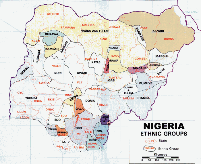
The socio-cultural situation in Jigawa State could be described as homogeneous: it is mostly populated by HausaHausa people
The Hausa are one of the largest ethnic groups in West Africa. They are a Sahelian people chiefly located in northern Nigeria and southeastern Niger, but having significant numbers living in regions of Cameroon, Ghana, Cote d'Ivoire, Chad and Sudan...
/Fulani, who can be found in all parts of the State. http://www.onlinenigeria.com/map.gif Kanuri are largely found in Hadejia Emirate, with some traces of Badawa mainly in its Northeastern parts. Even though each of the three dominant tribes have continued to maintain its ethnic identity, Islam and a long history of inter-marriages have continued to bind them together.
About 3.6 million people inhabit Jigawa State. Life expectancy as at 2001 was about 52 years with a total fertility rate of about 6.2 children per woman of childbearing age (a little above the national average). Although population of the State is predominantly rural (90%), the distribution in terms of sex is almost equal between male (50.8%) and female (49.2%). This pattern of population distribution is same across various constituencies in the State and between urban and rural areas. In terms of age distribution, the 2002 CWIQ Survey indicates that 45.2% of the population was made up of young people below the age of 15; 49.0% between the ages of 15 and 59 while 5.8% were people aged 60 and above. This survey reveals a dependency ratio of almost 1; meaning that there is almost one dependent to every economically active person in the population.
Average household size was about 6.7 almost all of which were headed by males. About 60% of household heads were self-employed with agriculture as their main occupation, and nearly two-thirds of these households were monogamous families. The overall literacy rate was about 37% in 2002 (22 percent for women and 51 percent for men). School enrolment ratio is fairly high with very good improvements in the last few years, even though there is still clear disparity between boys and girls.
Basic indicators for water supply sector show that access to potable water is over 90%, which is among the highest in the country. The 2002 CWIQ Survey however, indicated that while access to high quality safe drinking water (pipe born, hand pump boreholes and protected wells) is low at about 63%, nearly two-thirds of households have good means of sanitation. In terms of heath services, about two-fifths of the population have access to medical services which is, however, higher in urban areas where access was found to be about 55%. The CWIQ Survey found that an average of 70% of those who consulted a heath facility expressed satisfaction with the services provided.
Government
Jigawa State—created out of the old Kano State in August 1991—is one of the 36 States in Federal Republic of Nigeria. By the 1999 Constitution of Federal Republic of Nigeria, the state comprises 27 Local Government Councils, which are divided into 30 State Constituencies, grouped into 11 Federal Constituencies and 3 Senatorial Districts. These 27 Local Government Councils were further subdivided into 77 Development Areas per law No. 5 of 2004 of the State House of Assembly. In line with the democratic setting in the country, the governments at both the State and Local Government levels are elected, and comprise an Executive with a unicameral legislature. The State legislature has 30 elected members each representing one of the State Constituencies. To complete the State governance structure, there is an independent State Judiciary as the third arm of Government.The State Government administrative apparatus is organized into Ministries, Extra-ministerial Departments and Parastatals, which are located across the three Senatorial districts in the State since 1999. This decentralized approach to overnmental administrative structure was seen as a move towards stimulating economic activities socio-economic development and empowerment over a wider area since government is the largest employer, perhaps second only to agriculture. In addition, this was also seen as a way for spreading even development among major urban centers and a shift from “city-state syndrome” that obtained in the old Kano State.
Local Government Areas
Jigawa State has 27 LGAs namely:- AuyoAuyoAuyo is a Local Government Area of Jigawa State, Nigeria. Its headquarters are in the town of Auyo.It has an area of 512 km² and a population of 132,001 at the 2006 census.The postal code of the area is 731....
- BaburaBaburaBabura is a Local Government Area in the north of Jigawa State, Nigeria. Its headquarters are in the town of Babura.It has an area of 992 km² and a population of 208,101 at the 2006 census.The postal code of the area is 732....
- BiriniwaBiriniwaBiriniwa is a Local Government Area of Jigawa State, Nigeria. Its headquarters are in the town of Biriniwa.It has an area of 1,567 km² and a population of 142,329 at the 2006 census.The postal code of the area is 731....
- Birnin Kudu
- BujiBuji, NigeriaBuji is a Local Government Area of Jigawa State, Nigeria. Its headquarters are in the town of Gantsa.It has an area of 548 km² and a population of 97,371 at the 2006 census.The postal code of the area is 721....
- DutseDutseDutse is a city located in north central Nigeria. It is the capital city of Jigawa State.The Hussaini Adamu Federal Polytechnic has its College of Business and Management Studies at Dutse.- Geography :...
- GagarawaGagarawaGagarawa is a Local Government Area in the north of Jigawa State, Nigeria. Its headquarters are in the town of Gagarawa.It has an area of 654 km² and a population of 80,394 at the 2006 census.The postal code of the area is 732....
- GarkiGarki, NigeriaGarki is a Local Government Area of Jigawa State, Nigeria. Its headquarters are in the town of Garki.It has an area of 1,408 km² and a population of 152,233 at the 2006 census.The postal code of the area is 733....
- GumelGumelGumel or Gummel is a town and traditional emirate in Jigawa State, Nigeria.-Geography:Gumel is located 120 km northeast of Kano, and lies about 20 km south of Nigeria's northern border with Niger. As of 2007 the estimated population of Gumel was 44,158.-History:The emirate was founded...
- GuriGuri, NigeriaGuri is a Local Government Area of Jigawa State, Nigeria. Its headquarters are in the town of Guri.It has an area of 1,060 km² and a population of 115,018 at the 2006 census.The postal code of the area is 731....
- GwaramGwaramGwaram is a Local Government Area of Jigawa State, Nigeria. Its headquarters are in the town of Gwaram.It has an area of 1,912 km² and a population of 272,582 at the 2006 census.The postal code of the area is 721....
- GwiwaGwiwaGwiwa is a Local Government Area of Jigawa State, Nigeria. Its headquarters are in the town of Gwiwa.It has an area of 450 km² and a population of 124,517 at the 2006 census.The postal code of the area is 705....
- HadejiaHadejiaHadejia is a Hausa town in eastern Jigawa State, northern Nigeria. The population was approximately 47,400 . The people of Hadejia are largely Muslim, although some follow indigenous belief systems...
- JahunJahunJahun is a Local Government Area of Jigawa State, Nigeria. Its headquarters are in the town of Jahun.It has an area of 1,172 km² and a population of 229,094 at the 2006 census.The postal code of the area is 720....
- Kafin HausaKafin HausaKafin Hausa is a Local Government Area of Jigawa State, Nigeria. Its headquarters are in the town of Kafin Hausa.It has an area of 1,380 km² and a population of 271,058 at the 2006 census.The postal code of the area is 731....
- KaugamaKaugamaKaugama is a Local Government Area in the north of Jigawa State, Nigeria. Its headquarters are in the town of Kaugama.It has an area of 883 km² and a population of 127,956 at the 2006 census.The postal code of the area is 730....
- KazaureKazaureKazaure is an Emirate and a Local Government Area of Jigawa State, Nigeria. Its headquarters is in the ancient city of Kazaure.-Early history:The city of Kazaure has been the emirate’s headquarters since 1819...
- Kiri KasamaKiri KasamaKiri Kasama is a Local Government Area of Jigawa State, Nigeria. Its headquarters are in the town of Kiri Kasama.It has an area of 797 km² and a population of 191,523 at the 2006 census.The postal code of the area is 731....
- KiyawaKiyawaKiyawa is a town and Local Government Area in Jigawa State, Nigeria.-Geography:Kiyawa is located at and has an estimated population of 17,704...
- MaigatariMaigatariMaigatari is a Local Government Area in the north of Jigawa State, Nigeria, bordering on the Republic of Niger. Its headquarters are in the town of Maigatari.It has an area of 870 km² and a population of 179,715 at the 2006 census....
- Malam MadoriMalam MadoriMalam Madori is a Local Government Area in the north of Jigawa State, Nigeria. Its headquarters are in the town of Malam Maduri.It has an area of 766 km² and a population of 161,413 at the 2006 census.ABSTRACT...
- MigaMiga, NigeriaMiga is a Local Government Area of Jigawa State, Nigeria. Its headquarters are in the town of Miga.It has an area of 586 km² and a population of 128,424 at the 2006 census.The postal code of the area is 720....
- RingimRingimRingim is a Local Government Area of Jigawa State, Nigeria. Its headquarters are in the town of Ringim, the LGA has an area of 1,057 km² and a population of 192,024 at the 2006 census.HISTORY...
- RoniRoni, NigeriaRoni is a Local Government Area of Jigawa State, Nigeria. Its headquarters are in the town of Roni.It has an area of 322 km² and a population of 77,819 at the 2006 census.The postal code of the area is 705....
- Sule TankarkarSule TankarkarSule Tankarkar is a Local Government Area in the north of Jigawa State, Nigeria, bordering on the Republic of Niger. Its headquarters are in the town of Sule Tankarkar.It has an area of 1,283 km2 and a population of 130,849 at the 2006 census....
- TauraTaura, NigeriaTaura is a Local Government Area of Jigawa State, Nigeria. Its headquarters are in the town of Taura.It has an area of 653 km² and a population of 131,757 at the 2006 census.The postal code of the area is 733....
- YankwashiYankwashiYankwashi is a Local Government Area of Jigawa State, Nigeria. Its headquarters are in the town of Karkarna.It has an area of and a population of 95,759 at the 2006 census.The postal code of the area is 705....
Political Economy
The Economy of Jigawa State is largely characterized by informal sector activities with agriculture as the major economic activity. Over 80% of the population is engaged in subsistence farming and animal husbandry. Trade and commerce are undertaken on small and medium scale, especially in agric goods, livestock and other consumer goods. Other informal sector activities include blacksmithing, leather-works, tailoring services, auto repairs, metal works, carpentry, tanning, dyeing, food processing, masonry etc. Even though modern industrial sector is yet to gain a solid footing, the seed for their development was planted through establishment of small-scale industries particularly in areas of food processing and other agro-allied activities. These industries have been helped by the Information Communication Technology program initiated by the Saminu TurakiSaminu Turaki
Alhaji Ibrahim Saminu Turaki is a Nigerian politician and former governor of Jigawa State in Nigeria. He was a Jigawa state chairman of SDP and UNCP .-Background:...
, the states former governor. http://www.ngrguardiannews.com/policy_politics/article04
The Federal Office of Statistics, in 2001, classified Jigawa State among those with relatively high severity and incidence of poverty in the country, with a Gross Per Capita Income of N35, 000 per annum (US$290), which is below the National Average. However, the 2002 Core Welfare Indicators Questionnaire (CWIQ) Survey indicated that over two-fifths of the population do not consider themselves poor.
The State of infrastructure for economic development such as roads, electricity, telecommunication and information technology have recently witnessed tremendous improvements through massive rehabilitation and expansion works. With massive road rehabilitation projects already undertaken throughout the State during the last five years, coupled with efforts made towards power generation via Independent Power Platforms, and the Internet Broadband Project, investment climate in Jigawa State in terms of economic infrastructure is quite promising.