

Iturama
Encyclopedia
Minas Gerais
Minas Gerais is one of the 26 states of Brazil, of which it is the second most populous, the third richest, and the fourth largest in area. Minas Gerais is the Brazilian state with the largest number of Presidents of Brazil, the current one, Dilma Rousseff, being one of them. The capital is the...
. As of 2007 the population was 31,495 in a total area of 1,401 km². It became a municipality in 1948.
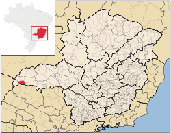
Location
Iturama belongs to the statistical micro-region of FrutalFrutal
Frutal is a municipality in the west of the Brazilian state of Minas Gerais. The population, measured in 2010 by the IBGE, is of 53,468 inhabitants. The city has an area of 2,427 km²...
. It is located in the rich region of western Minas Gerais known as the Triângulo Mineiro
Triângulo Mineiro
The Triangle Mineiro Portuguese pronunciation: [tɾiɐɡulu minejru] is an officer in the region west of the state of Minas Gerais, Brazil. The area is 93.500 km ² and is limited by the Serra da Canastra and Marcela, east, south of Sao Paulo, Goias in the north and west of the junction of the rivers...
at an elevation of 453 meters. Its southern municipal boundary is formed by the huge artificial lake of Represa de Água Vermelha
Água Vermelha Dam
The Água Vermelha Dam is an embankment dam on the Grande River near Iturama in Minas Gerais/São Paulo, Brazil. It was constructed for hydroelectric power production and flood control. Construction on the dam began in 1973 and it was completed and operational by 1978...
, which dams up the Rio Grande River. Neighboring municipalities are:
- West: CarneirinhoCarneirinhoCarneirinho is a municipality in the westernmost tip of the Brazilian state of Minas Gerais. Due to its location, it is the only municipality in Minas Gerais to border the state of Mato Grosso do Sul. As of 2008 the population was 9,129 in a total area of 2,060.720 km²...
- Northwest: Limeira do OesteLimeira do OesteLimeira do Oeste is a municipality in the west of the Brazilian state of Minas Gerais. As of 2007 the population was 6,492 in a total area of 1,318 km². It became a municipality in 1993.-Location:...
- North: União de MinasUnião de Minas-Location:União de Minas belongs to the statistical micro-region of Frutal. It is located at an elevation of 521 meters between the São Domingos River and the Grande River.Neighboring municipalities are:*North: Santa Vitória*West: Limeira do Oeste...
- Northeast: Campina VerdeCampina VerdeCampina Verde is a municipality in the north of the Brazilian state of Minas Gerais. As of 2007 the population was 18,680 in a total area of 3,663 km². It became a municipality in 1938.-Location:...
- East: São Francisco de SalesSão Francisco de SalesSão Francisco de Sales is a municipality in the west of the Brazilian state of Minas Gerais. As of 2007 the population was 5,167 in a total area of 1,129 km². It became a municipality in 1962.-Location:...
- South: ArabáArabaAraba may refer to one of the following places:*Álava, a province in northern Spain *Arabah, a section of the Great Rift Valley*Arraba, an Arab-Israeli town in Israel*Arrabah, a Palestinian village in the West Bank...
and Mira EstrelaMira EstrelaMira Estrela is a municipality in the state of São Paulo in Brazil. The population in 2004 is 2,560 and the area is 217.84 km². The elevation is 458 m....
Important distances are:
- Belo HorizonteBelo HorizonteBelo Horizonte is the capital of and largest city in the state of Minas Gerais, located in the southeastern region of Brazil. It is the third largest metropolitan area in the country...
: 764 km - UberabaUberabaUberaba is a city and municipality in the west of the state of Minas Gerais in Brazil. Its population is 296.000 with an area of 4529.7 km², giving a density of 60.71 people per km². It is located on a plateau at an elevation of 785 meters and is in the Uberaba River floodplain...
: 286 km - São Francisco de SalesSão Francisco de SalesSão Francisco de Sales is a municipality in the west of the Brazilian state of Minas Gerais. As of 2007 the population was 5,167 in a total area of 1,129 km². It became a municipality in 1962.-Location:...
: 49 km - FrutalFrutalFrutal is a municipality in the west of the Brazilian state of Minas Gerais. The population, measured in 2010 by the IBGE, is of 53,468 inhabitants. The city has an area of 2,427 km²...
: 145 km
Economic activities
The most important economic activities are cattle raising, commerce, and agriculture. The GDP in 2005 was R$ R$796 million. Iturama is in the top tier of municipalities in the state with regard to economic and social development. As of 2007 there were 05 banking agencies in the town. There was a well-developed retail infrastructure serving the surrounding area of cattle and agricultural lands. There were 5,803 automobiles in all of the municipality, about one for every 5 inhabitants—a high ratio for Brazil.Iturama is an important agricultural producer. In the rural area there were 528 establishments occupying 77,000 hectares. About 1,300 persons were employed in agriculture. 176 of the farms had tractors, a ratio of one in three. There were 87,000 head of cattle in 2006, of which 30,000 head were dairy cows. In permanent crops there were 4,000 ha. planted, while in perennial crops 3,500 ha. were planted (2006).
The crops with a planted area of more than 100 hectares were peanuts, rice, sugarcane, corn, and soybeans.
Health and education
In the health sector there were 7 public health clinics and 12 private health clinics. There was one private hospital with 70 beds. In the educational sector there were 14 primary schools and 05 middle school.- Municipal Human Development IndexHuman Development IndexThe Human Development Index is a composite statistic used to rank countries by level of "human development" and separate "very high human development", "high human development", "medium human development", and "low human development" countries...
: 0.803 (2000) - State ranking: 34 out of 853 municipalities as of 2000
- National ranking: 512 out of 5,138 municipalities as of 2000
- Literacy rate: 88%
- Life expectancy: 73 (average of males and females)
The highest ranking municipality in Minas Gerais in 2000 was Poços de Caldas
Poços de Caldas
Poços de Caldas is a city and municipality in south-western Minas Gerais state, Brazil, in the microregion of the same name. Its estimated population in 2009 was 151,449 inhabitants...
with 0.841, while the lowest was Setubinha
Setubinha
Setubinha is a municipality in the northeast of the Brazilian state of Minas Gerais. As of 2007 the population was 10,834 in a total area of 536 km². The elevation is 729 metres. It is part of the IBGE statistical microregion of Teófilo Otoni...
with 0.568. Nationally the highest was São Caetano do Sul
São Caetano do Sul
São Caetano do Sul is a city in São Paulo state in Brazil, located in the Greater São Paulo Metropolitan Area. It is the city with the highest per capita income in Brazil and it also has the highest Human Development Index .-Geography:São Caetano do Sul is located on a plateau that is part of the...
in São Paulo with 0.919, while the lowest was Setubinha. In more recent statistics (considering 5,507 municipalities) Manari in the state of Pernambuco
Pernambuco
Pernambuco is a state of Brazil, located in the Northeast region of the country. To the north are the states of Paraíba and Ceará, to the west is Piauí, to the south are Alagoas and Bahia, and to the east is the Atlantic Ocean. There are about of beaches, some of the most beautiful in the...
has the lowest rating in the country—0,467—putting it in last place.
See also
- List of municipalities in Minas Gerais