
Illinois Route 172
Encyclopedia
Illinois Route 172 is an inverted-'L' shaped highway in northwestern Illinois
, though it is marked as being a north–south highway on signage. It runs from Illinois Route 40
to Illinois Route 92
by way of Tampico
. This is a distance of 13.06 miles (21.02 km). Illinois 172 is also a part of the Ronald Reagan Trail
.
to Illinois 40. Illinois 172 is a two-lane surface road for its entire length. It is known as Main Street through Tampico, Tampico Road around Tampico, and Star Road for the east–west portion.
to Gurnee
; this became Illinois Route 63, and then Illinois Route 21
. In 1946 Illinois 172 was used on former Illinois Route 226, which in addition to its current route ran west to Prophetstown
, forming a 'T'-shaped route. The 'spur' to Prophetstown was dropped in 1974. There have been no changes since.
Illinois
Illinois is the fifth-most populous state of the United States of America, and is often noted for being a microcosm of the entire country. With Chicago in the northeast, small industrial cities and great agricultural productivity in central and northern Illinois, and natural resources like coal,...
, though it is marked as being a north–south highway on signage. It runs from Illinois Route 40
Illinois Route 40
Illinois Route 40 is a north–south route in central portion of the U.S. state of Illinois. It runs from Interstate 74 in East Peoria north to Illinois Route 78 at Mt. Carroll, just south of U.S. Route 52 and Illinois Route 64. This is a distance of ....
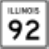
to Illinois Route 92
Illinois Route 92
Illinois Route 92 is an east–west state highway in northwest Illinois. It runs from Iowa Highway 92 at the Norbert F. Beckey Bridge across the Mississippi River to Muscatine, Iowa east to U.S. Route 34 in La Moille. This is a distance of ....
by way of Tampico
Tampico, Illinois
Tampico is a village located in Tampico Township, Whiteside County, Illinois, United States. As of the 2010 census the village had a total population of 790, up from 772 at the 2000 census. U.S. President Ronald Reagan was born there and lived there for two brief periods of his...
. This is a distance of 13.06 miles (21.02 km). Illinois 172 is also a part of the Ronald Reagan Trail
Ronald Reagan Trail
The Ronald Reagan Trail is a collection of highways in central Illinois that connect villages and cities that were of importance to former United States President Ronald Reagan...
.
Route description
Illinois 172 runs north from Illinois 92 through Tampico. It then runs east over a feeder for the Hennepin CanalHennepin Canal
The Hennepin Canal Parkway State Park, also just called the Hennepin Canal, is an abandoned waterway in northwest Illinois, between the Mississippi River at Rock Island and the Illinois River near Hennepin. The entire canal is listed on the National Register of Historic Places.Opened in 1907, the...
to Illinois 40. Illinois 172 is a two-lane surface road for its entire length. It is known as Main Street through Tampico, Tampico Road around Tampico, and Star Road for the east–west portion.
History
SBI Route 172 originally ran from LibertyvilleLibertyville, Illinois
Libertyville is an affluent northern suburb of Chicago in Lake County, Illinois, United States. It is located west of Lake Michigan on the Des Plaines River. The 2000 census population was 20,742; the 2005 estimate was 21,760...
to Gurnee
Gurnee, Illinois
Gurnee is a village in Lake County, Illinois, United States. The population was 28,834 at the 2000 census, and estimated to be 30,772 in 2005. The village borders the city of Waukegan and is considered a part of the Chicago metropolitan area. Gurnee is perhaps best known for being the location of...
; this became Illinois Route 63, and then Illinois Route 21
Illinois Route 21
Illinois Route 21 is an arterial north–south state highway in northeastern Illinois. It runs from Illinois Route 43 in Niles to U.S. Route 41 north of Gurnee. Illinois 21 is 28.13 miles long....
. In 1946 Illinois 172 was used on former Illinois Route 226, which in addition to its current route ran west to Prophetstown
Prophetstown, Illinois
Prophetstown is a city in Whiteside County, Illinois, United States. The population was 2,080 at the 2010 census, up from 2,023 at the 2000 census.-Geography:Prophetstown is located at ....
, forming a 'T'-shaped route. The 'spur' to Prophetstown was dropped in 1974. There have been no changes since.