
Illinois Route 131
Encyclopedia
Illinois Route 131 is a north–south state road in northeastern Illinois
. It extends south from Highway 31 and Lake CR A1/19 (128th Street) at the Illinois/Wisconsin
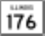
state line by Pleasant Prairie, south to Illinois Route 176
in Lake Bluff
, a distance of 15.15 miles (24.38 km).
communities to Evanston
, a distance of approximately 20 miles (32.2 km) south of Illinois 176. It is one of very few state routes whose named road is longer than the marked state road. Green Bay Road actually continues south to Old Elm Road (Lake CR 52) while there is a second segment of Green Bay Road that starts at a dead end in Highwood and ends at Ridge Avenue in Evanston.
The road parallels U.S. Route 41
(Skokie Highway), which is only a few miles to the west, and Illinois Route 137
(Amstutz Expressway), which is only a few miles to the east. It is the major north–south road between those two expressways.
to Greenup
in southeastern Illinois
. This was dropped in 1937 for Illinois Route 121
. The next year, Illinois 131 was used on a road that extended Highway 31 south into Illinois. This had formerly been Illinois Route 68
. Had Illinois 31 not already been in use, the road south of Wisconsin may have been designated Illinois 31 instead.
Illinois
Illinois is the fifth-most populous state of the United States of America, and is often noted for being a microcosm of the entire country. With Chicago in the northeast, small industrial cities and great agricultural productivity in central and northern Illinois, and natural resources like coal,...
. It extends south from Highway 31 and Lake CR A1/19 (128th Street) at the Illinois/Wisconsin
Wisconsin
Wisconsin is a U.S. state located in the north-central United States and is part of the Midwest. It is bordered by Minnesota to the west, Iowa to the southwest, Illinois to the south, Lake Michigan to the east, Michigan to the northeast, and Lake Superior to the north. Wisconsin's capital is...
state line by Pleasant Prairie, south to Illinois Route 176
Illinois Route 176
Illinois Route 176 is an east–west state route in northern Illinois. It runs from Illinois Route 23 in Marengo to the southern terminus of Illinois Route 131 in Lake Bluff. This is a distance of .- Route description :...
in Lake Bluff
Lake Bluff, Illinois
Lake Bluff is a village in Lake County, Illinois. It is the closest moderate-sized town near the Great Lakes Navy Base and is North of Lake Forest. The population is 6,056 according to the 2000 census. The town has a police department and volunteer fire department.-History:In 1836, John and...
, a distance of 15.15 miles (24.38 km).
Route description
Illinois 131 is called Green Bay Road for its entire length, but Green Bay Road becomes a residential street and extends south through various North ShoreNorth Shore (Chicago)
The North Shore is a term that refers to the generally affluent suburbs north of Chicago, Illinois bordering the shore of Lake Michigan.- History :Europeans settled the area sparsely after an 1833 treaty with local Native Americans...
communities to Evanston
Evanston, Illinois
Evanston is a suburban municipality in Cook County, Illinois 12 miles north of downtown Chicago, bordering Chicago to the south, Skokie to the west, and Wilmette to the north, with an estimated population of 74,360 as of 2003. It is one of the North Shore communities that adjoin Lake Michigan...
, a distance of approximately 20 miles (32.2 km) south of Illinois 176. It is one of very few state routes whose named road is longer than the marked state road. Green Bay Road actually continues south to Old Elm Road (Lake CR 52) while there is a second segment of Green Bay Road that starts at a dead end in Highwood and ends at Ridge Avenue in Evanston.
The road parallels U.S. Route 41
U.S. Route 41
U.S. Route 41 is a north–south United States Highway that runs from Miami, Florida to the Upper Peninsula of Michigan. Until 1949, the part in southern Florida, from Naples to Miami, was U.S...
(Skokie Highway), which is only a few miles to the west, and Illinois Route 137
Illinois Route 137
Illinois Route 137 is a state highway in northeast Illinois. It runs from the Wisconsin Border north of Winthrop Harbor south to North Chicago, west to Libertyville, and then back northwest to Grayslake, terminating at Illinois Route 83 just south of Illinois Route 120...
(Amstutz Expressway), which is only a few miles to the east. It is the major north–south road between those two expressways.
History
SBI Route 131 ran from MattoonMattoon, Illinois
Mattoon is a city in Coles County, Illinois, United States. The population was 18,555 as of the 2010 census. It is a principal city of the Charleston–Mattoon Micropolitan Statistical Area.Mattoon was the site of the "Mad Gasser" attacks of the 1940s....
to Greenup
Greenup, Illinois
Greenup is a village in Cumberland County, Illinois, United States, along the Embarras River. The population was 1,532 at the 2000 census. It is part of the Charleston–Mattoon Micropolitan Statistical Area....
in southeastern Illinois
Illinois
Illinois is the fifth-most populous state of the United States of America, and is often noted for being a microcosm of the entire country. With Chicago in the northeast, small industrial cities and great agricultural productivity in central and northern Illinois, and natural resources like coal,...
. This was dropped in 1937 for Illinois Route 121
Illinois Route 121
Illinois Route 121 is a major state road in central Illinois. Although it runs from northwest to southeast, it is marked as a north–south road. It runs from Illinois Route 130 in Greenup to Interstate 55 in Lincoln at the intersection of I-55 and Illinois Route 10...
. The next year, Illinois 131 was used on a road that extended Highway 31 south into Illinois. This had formerly been Illinois Route 68
Illinois Route 68
Illinois Route 68 is an east–west state highway in northeast Illinois. It runs east from Illinois Route 72 in the Dundee area to the Interstate 94/U.S. Route 41 concurrency in Glencoe. This is a distance of ....
. Had Illinois 31 not already been in use, the road south of Wisconsin may have been designated Illinois 31 instead.