
Illinois Route 126
Encyclopedia
Illinois Route 126 is an east–west state road in northern Illinois
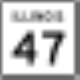
. It runs from Illinois Route 47
in Yorkville
to Interstate 55
between Plainfield
and Bolingbrook
. This is a distance of 17.25 miles (27.76 km).
and enters Plainfield as West Lockport Road. Immediately after crossing the DuPage River
, it turns northeast onto Main Street, bypassing Downtown Plainfield, and intersects concurrent Illinois Route 59
and US Route 30
at North Division Street. It continues northeastward out of Plainfield on Main Street until it ends at a junction with Interstate 55
. There is no access to Illinois 126 from northbound Interstate 55. Likewise, there is no southbound Interstate 55 access from Illinois 126.
For most of its length, Illinois 126 is an undivided two-lane surface road, until a high-speed ramp is used to access Northbound Interstate 55 at its east end.
Congestion in Plainfield is increasing substantially on this highway, Illinois 59, and U.S. 30 because of near-explosive growth in Plainfield, a southwest suburb of Chicago
.
.
The original State Bond Issue Route 126 was opened in 1930 to carry the then-new U.S. Route 66 from Springfield
to Litchfield
, bypassing the numerous towns along Illinois Route 4
. Initially this road was marked as both IL 126 and US 66. In 1935 the dual designation of IL 126 was removed, and this road was known only as US 66.
State Bond Issue Route 66 originally ran from Plainfield to Welco Corners
in present-day Bolingbrook
, where it intersected SBI 4. However by then Illinois SBI 4 was also designated as US 66, which created confusion with IL 66, so in 1935 Illinois 66 was given the route number 126, which had been removed from US 66 in southern Illinois, and the new IL 126 was extended west from Plainfield to Yorkville.
In 1940, US 66 was rerouted through Plainfield to bypass congestion in Joliet
, and IL 126 was truncated to run only from Yorkville to Plainfield, with US 66 taking over Illinois Route 126 (SBI 66) from Plainfield to Welco Corners.
When US 66 was rerouted in 1957 onto its new freeway alignment bypassing Plainfield, which would later become I-55, Route 126 was re-extended east from Plainfield along its pre-1940 route to meet US 66/I 55. This resulted in the section of the road from Plainfield to US 66/I 55 having had four route numbers in its history: 66, 126, 66(again), and 126(again).
Until US 30 was rerouted in 2008, IL 126 was concurrent with US 30 for a short distance approaching Plainfield from the west, between Lincoln Highway and IL 126's turn to the northeast onto Main Street.
Illinois
Illinois is the fifth-most populous state of the United States of America, and is often noted for being a microcosm of the entire country. With Chicago in the northeast, small industrial cities and great agricultural productivity in central and northern Illinois, and natural resources like coal,...
. It runs from Illinois Route 47
Illinois Route 47
Illinois Route 47 is a largely rural north–south state highway that runs from the Wisconsin state border at Highway 120 near Hebron, to Illinois Route 10, just south of Interstate 72 near Seymour. This is a distance of . Even though Route 47 is primarily rural, in several suburbs of Chicago,...
in Yorkville
Yorkville, Illinois
Yorkville is a city located in Kendall County, Illinois, United States. The population was 6,189 at the 2000 United States Census and is estimated to be 16,505, . It is the county seat of Kendall County...
to Interstate 55
Interstate 55
Interstate 55 is an Interstate Highway in the central United States. Its odd number indicates that it is a north–south Interstate Highway. I-55 goes from LaPlace, Louisiana at Interstate 10 to Chicago at U.S. Route 41 , at McCormick Place. A common nickname for the highway is "double...
between Plainfield
Plainfield, Illinois
Plainfield is a village in Will County, Illinois, United States. As of the 2007 special census, the population is 37,334.The Village includes land in Plainfield and Wheatland townships. Part of Plainfield is located in Kendall County...
and Bolingbrook
Bolingbrook, Illinois
Bolingbrook is a large village in Will and DuPage Counties in the U.S. state of Illinois. As of the 2010 US Census, the population is 73,366...
. This is a distance of 17.25 miles (27.76 km).
Route description
Illinois 126 begins at Illinois 47 in Yorkville, and runs as a rural two-lane road until it intersects historic Lincoln HighwayLincoln Highway
The Lincoln Highway was the first road across the United States of America.Conceived and promoted by entrepreneur Carl G. Fisher, the Lincoln Highway spanned coast-to-coast from Times Square in New York City to Lincoln Park in San Francisco, originally through 13 states: New York, New Jersey,...
and enters Plainfield as West Lockport Road. Immediately after crossing the DuPage River
DuPage River
The DuPage River is a tributary of the Des Plaines River in the U.S. state of Illinois.-Course:The river begins as two individual streams. The West Branch of the DuPage River, long, starts in Schaumburg at Campanelli Park in Cook County and continues southward through the entire county of DuPage,...
, it turns northeast onto Main Street, bypassing Downtown Plainfield, and intersects concurrent Illinois Route 59
Illinois Route 59
Illinois Route 59 is a north–south state highway in northeastern Illinois. It runs south from Illinois Route 83 in Antioch to Interstate Highway 55 in Shorewood, spanning the north–south width of Chicago's western suburbs...
and US Route 30
U.S. Route 30 in Illinois
In the state of Illinois, U.S. Route 30 is an east–west arterial surface road in northern Illinois. It runs from across the Mississippi River from Clinton, Iowa to Lynwood at the Indiana state line. This is a distance of ....
at North Division Street. It continues northeastward out of Plainfield on Main Street until it ends at a junction with Interstate 55
Interstate 55 in Illinois
In the U.S. state of Illinois, Interstate 55 is a major north–south Interstate Highway that connects the St. Louis, Missouri and Chicago metropolitan areas. It runs from the Poplar Street Bridge in East St. Louis to U.S. Route 41 near downtown Chicago...
. There is no access to Illinois 126 from northbound Interstate 55. Likewise, there is no southbound Interstate 55 access from Illinois 126.
For most of its length, Illinois 126 is an undivided two-lane surface road, until a high-speed ramp is used to access Northbound Interstate 55 at its east end.
Congestion in Plainfield is increasing substantially on this highway, Illinois 59, and U.S. 30 because of near-explosive growth in Plainfield, a southwest suburb of Chicago
Chicago
Chicago is the largest city in the US state of Illinois. With nearly 2.7 million residents, it is the most populous city in the Midwestern United States and the third most populous in the US, after New York City and Los Angeles...
.
History
The history of Illinois 126, in both of its incarnations, is tied closely to the history of U.S. Route 66U.S. Route 66 in Illinois
U.S. Route 66 connected St. Louis, Missouri and Chicago, Illinois. The highway had previously been Illinois Route 4 and the road has now been largely replaced with Interstate 55 . Parts of the road still carry traffic and sixseparate portions of the roadbed have been listed on the U.S...
.
The original State Bond Issue Route 126 was opened in 1930 to carry the then-new U.S. Route 66 from Springfield
Springfield, Illinois
Springfield is the third and current capital of the US state of Illinois and the county seat of Sangamon County with a population of 117,400 , making it the sixth most populated city in the state and the second most populated Illinois city outside of the Chicago Metropolitan Area...
to Litchfield
Litchfield, Illinois
Litchfield is a city in Montgomery County, Illinois, United States. The population was 6,815 at the 2000 census, and 6,588 in 2009. It is located in south central Illinois, south of Springfield and on the northern edge of the Greater St. Louis Metro-East area.-Attractions:The Ariston Cafe is one of...
, bypassing the numerous towns along Illinois Route 4
Illinois Route 4
Illinois Route 4 is a long state road that runs south from the Interstate 55 business loop around Springfield south to Illinois Route 13 just north of Murphysboro. This is a distance of .-Route description:...
. Initially this road was marked as both IL 126 and US 66. In 1935 the dual designation of IL 126 was removed, and this road was known only as US 66.
State Bond Issue Route 66 originally ran from Plainfield to Welco Corners
Welco Corners, Illinois
Welco Corners, Illinois is a populated place in northern Will County, Illinois.It is at the junction of Interstate 55 and Joliet Road, and is within the city limits and postal delivery zone of Bolingbrook, Illinois, though it existed before the founding of Bolingbrook.- History :Welco Corners was...
in present-day Bolingbrook
Bolingbrook, Illinois
Bolingbrook is a large village in Will and DuPage Counties in the U.S. state of Illinois. As of the 2010 US Census, the population is 73,366...
, where it intersected SBI 4. However by then Illinois SBI 4 was also designated as US 66, which created confusion with IL 66, so in 1935 Illinois 66 was given the route number 126, which had been removed from US 66 in southern Illinois, and the new IL 126 was extended west from Plainfield to Yorkville.
In 1940, US 66 was rerouted through Plainfield to bypass congestion in Joliet
Joliet, Illinois
Joliet is a city in Will and Kendall Counties in the U.S. state of Illinois, located southwest of Chicago. It is the county seat of Will County. As of the 2010 census, the city was the fourth-most populated in Illinois, with a population of 147,433. It continues to be Illinois' fastest growing...
, and IL 126 was truncated to run only from Yorkville to Plainfield, with US 66 taking over Illinois Route 126 (SBI 66) from Plainfield to Welco Corners.
When US 66 was rerouted in 1957 onto its new freeway alignment bypassing Plainfield, which would later become I-55, Route 126 was re-extended east from Plainfield along its pre-1940 route to meet US 66/I 55. This resulted in the section of the road from Plainfield to US 66/I 55 having had four route numbers in its history: 66, 126, 66(again), and 126(again).
Until US 30 was rerouted in 2008, IL 126 was concurrent with US 30 for a short distance approaching Plainfield from the west, between Lincoln Highway and IL 126's turn to the northeast onto Main Street.