

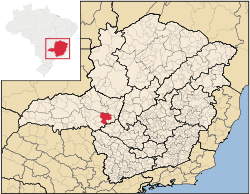
Ibiá
Encyclopedia
Minas Gerais
Minas Gerais is one of the 26 states of Brazil, of which it is the second most populous, the third richest, and the fourth largest in area. Minas Gerais is the Brazilian state with the largest number of Presidents of Brazil, the current one, Dilma Rousseff, being one of them. The capital is the...
. Its population as of 2007 was estimated to be 22,069 people living in a total area of 2,707 km². The city belongs to the mesoregion of Triângulo Mineiro and Alto Paranaíba and to the micro-region of Araxá. It became a municipality in 1923.
Location
Ibiá is located at an elevation of 895 meters, 55 km. east of AraxáAraxá
Araxá is a city and municipality in southwest Minas Gerais state, Brazil. The population was 87,764 inhabitants and the area of the municipality is 1,283 km², with 345 km² making up the urban perimeter.-Geography:...
just north of highway BR-216. The distance to the state capital, Belo Horizonte
Belo Horizonte
Belo Horizonte is the capital of and largest city in the state of Minas Gerais, located in the southeastern region of Brazil. It is the third largest metropolitan area in the country...
, is 324 km. Neighboring municipalities are: Serra do Salitre
Serra do Salitre
Serra do Salitre is a Brazilian municipality located in the northwest of the state of Minas Gerais. Its population as of 2007 was 10,224 people living in a total area of 1,298 km². The city belongs to the mesoregion of Triângulo Mineiro e Alto Paranaíba and to the microregion of Patrocínio...
and Rio Paranaíba
Rio Paranaíba
Rio Paranaíba is a Brazilian municipality located in the northwest of the state of Minas Gerais. Its population as of 2007 was 10,809 people living in a total area of 1,353 km². The city belongs to the mesoregion of Triângulo Mineiro e Alto Paranaíba and to the microregion of Patos de Minas...
(N), Campos Altos
Campos Altos
Campos Altos is a Brazilian municipality located in the west of the state of Minas Gerais. Its population as of 2007 was estimated to be 13,184 people living in a total area of 719 km². The city belongs to the mesoregion of Triângulo Mineiro and Alto Paranaíba and to the micro-region of Araxá. It...
(E), Pratinha
Pratinha
Pratinha is a Brazilian municipality located in the west of the state of Minas Gerais. Its population as of 2007 was 3,236 people living in a total area of 619 km². The city belongs to the meso-region of Triângulo Mineiro and Alto Paranaíba and to the micro-region of Araxá...
and Medeiros
Medeiros
Medeiros is a common surname in the Portuguese language, namely in Portugal and Brazil, meaning maize stacks.It may refer to:-Persons:*Elli Medeiros, Uruguayan singer and actress*Glenn Medeiros, American singer and songwriter...
(SE), Tapira (S) and Araxá
Araxá
Araxá is a city and municipality in southwest Minas Gerais state, Brazil. The population was 87,764 inhabitants and the area of the municipality is 1,283 km², with 345 km² making up the urban perimeter.-Geography:...
(W).
Ibiá is an important railroad junction and its history is tied to the railroad. The Ferrovia da Centro Atlântica, a railroad line used for cargo, passes through the town and divides into the Ibiá-Patrocínio-Brasília line and the Ibiá-Araxá-Uberaba-São Paulo line.
Meaning of the name
"Ibiá" is an indigenous name meaning "High Plateaus", due to the geographical location of the town.Economic activities
The GDP in 2005 was approximately R$426 million, with 129 million reais from services, 126 million reais from industry, and 141 million reais from agriculture. Ibiá ranks in the top positions nationally in milk production. In 2005 it was in first place with 104 million liters a year. There were 528 rural producers on 127,000 hectares of land. The land is very fertile and agricultural production is high. 195 farms had tractors (2006). Approximately 2,800 persons were dependent on agriculture. The main crops are coffee (3,500 hectares planted in 2006)) and sugarcane (2,500 hectares planted in 2006), while avocado, soybeans, potatoes, wheat, and corn were also grown. There were 121,000 head of cattle (2006).There were 4 banks (2007) and 3,523 automobiles (2007), giving a ratio of 6 inhabitants per automobile.
Working population (IBGE 2003)
- Agriculture: 3,268
- Industry; 1,289
- Commerce of merchandise: 1,284
- Services: 3,103
Health and education
In the health sector there were 16 public health clinics and 1 hospital with 33 beds (2005). Patients with more serious health conditions are transported to Araxá, which is connected by good roads. Educational needs were met by 20 primary schools, 4 middle school, and 19 pre-primary schools.- Municipal Human Development IndexHuman Development IndexThe Human Development Index is a composite statistic used to rank countries by level of "human development" and separate "very high human development", "high human development", "medium human development", and "low human development" countries...
: 0.797 (2000) - State ranking: 48 out of 853 municipalities as of 2000
- National ranking: 625 out of 5,138 municipalities as of 2000
- Literacy rate: 90%
- Life expectancy: 72 (average of males and females)
In 2000 the per capita monthly income of R$385.00 was above the state and national average of R$276.00 and R$297.00 respectively.
The highest ranking municipality in Minas Gerais in 2000 was Poços de Caldas
Poços de Caldas
Poços de Caldas is a city and municipality in south-western Minas Gerais state, Brazil, in the microregion of the same name. Its estimated population in 2009 was 151,449 inhabitants...
with 0.841, while the lowest was Setubinha
Setubinha
Setubinha is a municipality in the northeast of the Brazilian state of Minas Gerais. As of 2007 the population was 10,834 in a total area of 536 km². The elevation is 729 metres. It is part of the IBGE statistical microregion of Teófilo Otoni...
with 0.568. Nationally the highest was São Caetano do Sul
São Caetano do Sul
São Caetano do Sul is a city in São Paulo state in Brazil, located in the Greater São Paulo Metropolitan Area. It is the city with the highest per capita income in Brazil and it also has the highest Human Development Index .-Geography:São Caetano do Sul is located on a plateau that is part of the...
in São Paulo with 0.919, while the lowest was Setubinha. In more recent statistics (considering 5,507 municipalities) Manari in the state of Pernambuco
Pernambuco
Pernambuco is a state of Brazil, located in the Northeast region of the country. To the north are the states of Paraíba and Ceará, to the west is Piauí, to the south are Alagoas and Bahia, and to the east is the Atlantic Ocean. There are about of beaches, some of the most beautiful in the...
has the lowest rating in the country—0,467—putting it in last place.