
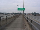
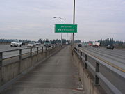
I-205 Bike Path
Encyclopedia
Interstate 205
Interstate 205 is the designation for two Interstate Highways in the United States, both of which are related to Interstate 5:*Interstate 205 , a connector in the San Francisco Bay Area...
from Vancouver, Washington
Vancouver, Washington
Vancouver is a city on the north bank of the Columbia River in the U.S. state of Washington. Incorporated in 1857, it is the fourth largest city in the state with a 2010 census population of 161,791 as of April 1, 2010...
to Oregon City, Oregon
Oregon City, Oregon
Oregon City was the first city in the United States west of the Rocky Mountains to be incorporated. It is the county seat of Clackamas County, Oregon...
, United States. It parallels the highway and the I-205 Transitway
I-205 Transitway
The I-205 Transitway was a partially built busway along the wide right-of-way of the Interstate 205 freeway in Portland, Oregon. Although it never opened as a busway, its right-of-way is now in use by light rail lines....
. It has a paved surface. It was constructed in the early 1980s, and is over 11 miles (17.7 km) long, running from SE Evergreen Highway and 120th Avenue on the Vancouver side of the Columbia River to a mile south of Clackamas Town Center
Clackamas Town Center
Clackamas Town Center is a shopping mall in Clackamas, Oregon . It opened in 1981. It is managed and co-owned by General Growth Properties and is currently anchored by J.C. Penney, Macy's , Nordstrom, and Sears...
. The multi-use path is managed by the Oregon Department of Transportation
Oregon Department of Transportation
The Oregon Department of Transportation is a department of the state government of the U.S. state of Oregon responsible for systems of transportation. It was first established in 1969. It had been preceded by the Oregon State Highway Department which, along with the Oregon State Highway...
.
The MAX Green Line
MAX Green Line
The MAX Green Line is a light rail route in the MAX Light Rail system in Portland, Oregon, United States, extending to Clackamas, Oregon. Construction began in early 2007, and the line opened on September 12, 2009. The average daily ridership in June 2010 was 19,500 increasing to 23,200 by April...
, which opened in fall 2009, parallels much of the I-205 Bike Path.
Highlights
| Feature | location |
|---|---|
| North end | 45.604491 °N 122.55602 °W |
| Government Island | 45.583132 °N 122.543714 °W |
| Marine Drive trail | 45.570634 °N 122.547904 °W |
| I-84 intersection I-205 | 45.547311 °N 122.559861 °W |
| Gateway Transit Center | 45.530405 °N 122.563876 °W |
| Powell Blvd | 45.498105 °N 122.566532 °W |
| Springwater Corridor Springwater Corridor The Springwater Corridor Trail is a bicycle and pedestrian rail trail in the Portland metropolitan area in Oregon, United States. It follows a former railway line of the same name in its route from Boring, through Gresham, to Portland, where it ends near the Eastbank Esplanade. A large segment... |
45.472441 °N 122.566009 °W |
| SE Fuller Rd Max Station | 45.453478 °N 122.57368 °W |
| Clackamas Town Center Mall | 45.435388 °N 122.56779 °W |
| Clackamas Promenade | 45.432017 °N 122.566985 °W |
| South end | 45.418664 °N 122.571507 °W |