
Hurricane Hilda
Encyclopedia
Hurricane Hilda was the third hurricane to make landfall in the United States
during the 1964 Atlantic hurricane season
. Originating near Cuba, the cyclone
intensified while moving through the Gulf of Mexico, and became a Category 4 hurricane in the Gulf of Mexico
before striking Louisiana
in early October. In combination with a frontal zone
located across the Southeast United States
, the hurricane spread heavy rains through the South through the Carolinas into the Mid-Atlantic States
. Hilda led to significant damage to oil platforms in the Gulf of Mexico, as well as US$126 million (1964 dollars) in damage, and 38 deaths.
. On the morning of September 28, a weak cyclonic circulation formed just off of Cuba
and intensified as it moved westward. It became a storm after passing the western tip of Cuba.
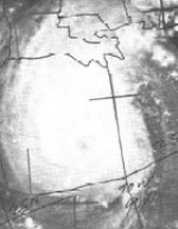
Hilda moved at about 9 mph (14 km/h) and entered the Gulf of Mexico, intensifying steadily. The storm reached hurricane status, reaching its peak intensity on October 1 of 150 mph (240 km/h) and a minimal pressure of 941 mbar (27.8 inHg). Hilda turned northward on October 1 at an average speed of 6 mph (10 km/h) for two days. Hilda made landfall in the central Louisiana coast on the evening of October 3. A decrease in intensity had occurred the day prior to landfall, but Hilda was still a major hurricane when it reached the Gulf Coast. After the eye moved inland, Hilda weakened rapidly, moving towards Baton Rouge, Louisiana
. The storm was forced eastward due to cold air and strong pressure rises.
Soon after the eastward turn, Hilda fell to tropical storm status and continued to weaken as cold air continued to enter the storm. Hilda became an extratropical low on October 5 over Mississippi
. The low passed over Jacksonville, Florida
and entered the Atlantic Ocean
.
at hand.

es spawned by the storm as it approached the coast. One twister at Larose, Louisiana
, killed 22 and injured 200 people. Three other tornadoes caused much damage in the New Orleans
metropolitan area but no deaths. In the town of Erath, Louisiana
, 8 deaths were attributed to the collapse of the town's water tower onto their city hall, the eight men killed were volunteer civil defense workers. A tornado in Golden Meadow damaged several buildings and knocked down utility lines. The tornado damage, in combination with the crop damage from rainfall, caused a total of $126,000,000 in damage (1964 dollars). The highest rainfall report measured during Hilda was five miles northwest of Jeanerette, where 17.71 inches/449.8 mm fell. Damage totaled $3 million.
and the adjacent North Carolina
. The rains caused tributaries in Sanatee River System to start rapidly rising. The main effect in the Carolinas was some flash flooding in South Carolina
. Moderate to heavy rains fell in south-central Virginia
as well.
though it remains in use in the Pacific basin.
United States
The United States of America is a federal constitutional republic comprising fifty states and a federal district...
during the 1964 Atlantic hurricane season
1964 Atlantic hurricane season
The 1964 Atlantic hurricane season officially began on June 15, 1964, and lasted until November 15, 1964. These dates conventionally delimit the period of each year when most tropical cyclones form in the Atlantic basin...
. Originating near Cuba, the cyclone
Cyclone
In meteorology, a cyclone is an area of closed, circular fluid motion rotating in the same direction as the Earth. This is usually characterized by inward spiraling winds that rotate anticlockwise in the Northern Hemisphere and clockwise in the Southern Hemisphere of the Earth. Most large-scale...
intensified while moving through the Gulf of Mexico, and became a Category 4 hurricane in the Gulf of Mexico
Gulf of Mexico
The Gulf of Mexico is a partially landlocked ocean basin largely surrounded by the North American continent and the island of Cuba. It is bounded on the northeast, north and northwest by the Gulf Coast of the United States, on the southwest and south by Mexico, and on the southeast by Cuba. In...
before striking Louisiana
Louisiana
Louisiana is a state located in the southern region of the United States of America. Its capital is Baton Rouge and largest city is New Orleans. Louisiana is the only state in the U.S. with political subdivisions termed parishes, which are local governments equivalent to counties...
in early October. In combination with a frontal zone
Weather front
A weather front is a boundary separating two masses of air of different densities, and is the principal cause of meteorological phenomena. In surface weather analyses, fronts are depicted using various colored lines and symbols, depending on the type of front...
located across the Southeast United States
United States
The United States of America is a federal constitutional republic comprising fifty states and a federal district...
, the hurricane spread heavy rains through the South through the Carolinas into the Mid-Atlantic States
Mid-Atlantic States
The Mid-Atlantic states, also called middle Atlantic states or simply the mid Atlantic, form a region of the United States generally located between New England and the South...
. Hilda led to significant damage to oil platforms in the Gulf of Mexico, as well as US$126 million (1964 dollars) in damage, and 38 deaths.
Meteorological history
Hilda originated from a slow-moving easterly wave that was moving westward through the Caribbean SeaCaribbean Sea
The Caribbean Sea is a sea of the Atlantic Ocean located in the tropics of the Western hemisphere. It is bounded by Mexico and Central America to the west and southwest, to the north by the Greater Antilles, and to the east by the Lesser Antilles....
. On the morning of September 28, a weak cyclonic circulation formed just off of Cuba
Cuba
The Republic of Cuba is an island nation in the Caribbean. The nation of Cuba consists of the main island of Cuba, the Isla de la Juventud, and several archipelagos. Havana is the largest city in Cuba and the country's capital. Santiago de Cuba is the second largest city...
and intensified as it moved westward. It became a storm after passing the western tip of Cuba.
Hilda moved at about 9 mph (14 km/h) and entered the Gulf of Mexico, intensifying steadily. The storm reached hurricane status, reaching its peak intensity on October 1 of 150 mph (240 km/h) and a minimal pressure of 941 mbar (27.8 inHg). Hilda turned northward on October 1 at an average speed of 6 mph (10 km/h) for two days. Hilda made landfall in the central Louisiana coast on the evening of October 3. A decrease in intensity had occurred the day prior to landfall, but Hilda was still a major hurricane when it reached the Gulf Coast. After the eye moved inland, Hilda weakened rapidly, moving towards Baton Rouge, Louisiana
Baton Rouge, Louisiana
Baton Rouge is the capital of the U.S. state of Louisiana. It is located in East Baton Rouge Parish and is the second-largest city in the state.Baton Rouge is a major industrial, petrochemical, medical, and research center of the American South...
. The storm was forced eastward due to cold air and strong pressure rises.
Soon after the eastward turn, Hilda fell to tropical storm status and continued to weaken as cold air continued to enter the storm. Hilda became an extratropical low on October 5 over Mississippi
Mississippi
Mississippi is a U.S. state located in the Southern United States. Jackson is the state capital and largest city. The name of the state derives from the Mississippi River, which flows along its western boundary, whose name comes from the Ojibwe word misi-ziibi...
. The low passed over Jacksonville, Florida
Jacksonville, Florida
Jacksonville is the largest city in the U.S. state of Florida in terms of both population and land area, and the largest city by area in the contiguous United States. It is the county seat of Duval County, with which the city government consolidated in 1968...
and entered the Atlantic Ocean
Atlantic Ocean
The Atlantic Ocean is the second-largest of the world's oceanic divisions. With a total area of about , it covers approximately 20% of the Earth's surface and about 26% of its water surface area...
.
Preparations
Over 2000 personnel from offshore oil rigs were evacuated on September 30 or October 1. About fourteen men decided to ride out the storm on the oil rig "Ocean Driller". In coastal areas of Louisiana, Civil Defense records indicate that 150,000 people evacuated on October 1 or October 2, as Hilda approached. People in the area between Freeport and Sabine, Texas boarded up their homes and evacuated to higher ground on October 1 with the memory of Hurricane CarlaHurricane Carla
Hurricane Carla was one of two Category 5 tropical cyclones during the 1961 Atlantic hurricane season. It struck the Texas coast as a Category 4 hurricane, becoming one of the most powerful storms to ever strike the United States. Hurricane Carla was the second most intense storm to ever...
at hand.
Gulf of Mexico
Hilda was the most damaging tropical cyclone to the offshore oil industry, at the time of its impact. More than US$100 million in losses were incurred, when 13 oil platforms were destroyed, with an additional 5 more damaged beyond repair.Gulf Coast
Louisiana
Almost a complete evacuation of the entire Louisiana coast accounted for the low death toll of 38, most of which were caused by tornadoTornado
A tornado is a violent, dangerous, rotating column of air that is in contact with both the surface of the earth and a cumulonimbus cloud or, in rare cases, the base of a cumulus cloud. They are often referred to as a twister or a cyclone, although the word cyclone is used in meteorology in a wider...
es spawned by the storm as it approached the coast. One twister at Larose, Louisiana
Larose, Louisiana
Larose is a census-designated place in Lafourche Parish, Louisiana, United States. The population was 7,306 at the 2000 census. It is part of the Houma–Bayou Cane–Thibodaux Metropolitan Statistical Area.-Geography:...
, killed 22 and injured 200 people. Three other tornadoes caused much damage in the New Orleans
New Orleans, Louisiana
New Orleans is a major United States port and the largest city and metropolitan area in the state of Louisiana. The New Orleans metropolitan area has a population of 1,235,650 as of 2009, the 46th largest in the USA. The New Orleans – Metairie – Bogalusa combined statistical area has a population...
metropolitan area but no deaths. In the town of Erath, Louisiana
Erath, Louisiana
Erath is a town in Vermilion Parish, Louisiana, United States. The population was 2,187 at the 2000 census. It is part of the Abbeville Micropolitan Statistical Area.Erath is home of the Acadian Museum....
, 8 deaths were attributed to the collapse of the town's water tower onto their city hall, the eight men killed were volunteer civil defense workers. A tornado in Golden Meadow damaged several buildings and knocked down utility lines. The tornado damage, in combination with the crop damage from rainfall, caused a total of $126,000,000 in damage (1964 dollars). The highest rainfall report measured during Hilda was five miles northwest of Jeanerette, where 17.71 inches/449.8 mm fell. Damage totaled $3 million.
Georgia
Rains were excessive in Georgia due to Hilda. The rains and resulting flooding caused extensive damage to roads, bridges, culverts, farmland and other property in several portions of the state. The heaviest damage from Hilda was in the northern mountainous towns where eight inches fell and following rains. Damage in Rabun County alone was $100,000 (1964 USD).Texas
The only effects on Texas by Hilda were rough seas and high tides. No deaths or injuries were reported and slight damage occurred. A few piers and secondary roads received slight damage. State Highway 87 near the Bolivar Peninsula in the Gilcrest and High Island area were covered with four foot tides.Mid-Atlantic United States
Heavy rains fell in the Carolinas ranging from 5-10 inches in South CarolinaSouth Carolina
South Carolina is a state in the Deep South of the United States that borders Georgia to the south, North Carolina to the north, and the Atlantic Ocean to the east. Originally part of the Province of Carolina, the Province of South Carolina was one of the 13 colonies that declared independence...
and the adjacent North Carolina
North Carolina
North Carolina is a state located in the southeastern United States. The state borders South Carolina and Georgia to the south, Tennessee to the west and Virginia to the north. North Carolina contains 100 counties. Its capital is Raleigh, and its largest city is Charlotte...
. The rains caused tributaries in Sanatee River System to start rapidly rising. The main effect in the Carolinas was some flash flooding in South Carolina
South Carolina
South Carolina is a state in the Deep South of the United States that borders Georgia to the south, North Carolina to the north, and the Atlantic Ocean to the east. Originally part of the Province of Carolina, the Province of South Carolina was one of the 13 colonies that declared independence...
. Moderate to heavy rains fell in south-central Virginia
Virginia
The Commonwealth of Virginia , is a U.S. state on the Atlantic Coast of the Southern United States. Virginia is nicknamed the "Old Dominion" and sometimes the "Mother of Presidents" after the eight U.S. presidents born there...
as well.
Retirement
The name Hilda was later retired in the Atlantic basinAtlantic Basin
The Atlantic Basin is the Atlantic Ocean.Atlantic Basin may also refer to:* Atlantic Basin Iron Works, an ironworks that operated in Brooklyn, New York, in the early to mid-20th century...
though it remains in use in the Pacific basin.
See also
- List of Atlantic hurricanes
- List of wettest tropical cyclones in Louisiana