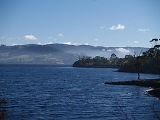
Huon River
Encyclopedia

River
A river is a natural watercourse, usually freshwater, flowing towards an ocean, a lake, a sea, or another river. In a few cases, a river simply flows into the ground or dries up completely before reaching another body of water. Small rivers may also be called by several other names, including...
in Tasmania
Tasmania
Tasmania is an Australian island and state. It is south of the continent, separated by Bass Strait. The state includes the island of Tasmania—the 26th largest island in the world—and the surrounding islands. The state has a population of 507,626 , of whom almost half reside in the greater Hobart...
, Australia
Australia
Australia , officially the Commonwealth of Australia, is a country in the Southern Hemisphere comprising the mainland of the Australian continent, the island of Tasmania, and numerous smaller islands in the Indian and Pacific Oceans. It is the world's sixth-largest country by total area...
. It is 170 km in length, and runs through the fertile Huon Valley
Huon Valley
The Huon Valley Council is a Local Government Area of Tasmania. It is the southern-most local government area in Australia.It encompasses the town of Huonville, on the Huon River, some surrounding towns, and many protected areas and forestry plantations...
. From Scotts Peak Dam
Scotts Peak Dam
The Scotts Peak Dam was one of the three component dams in the flooding of the original Lake Pedder in South West Tasmania, Australia. Completed in 1973, the dam is high, long, spanning across the upper reaches of the Huon River....
at Lake Pedder
Lake Pedder
Lake Pedder was once a natural lake, located in the southwest of Tasmania, Australia but the name is now used in an official sense to refer to the much larger artificial impoundment and diversion lake formed when the original lake was expanded by damming in 1972 by the Hydro Electric Commission of...
where it begins, it flows south-east to the Tahune Airwalk, where the Picton River joins, before heading through the rural township of Glen Huon where, just to the south, flows down rapids to merge with the sea water and become tidal. From there it then travels through Huonville
Huonville, Tasmania
Huonville is a town on the Huon River, in the south-east of Tasmania, Australia. The town lies within the Huon Valley Council area. It lies 38 km south of Hobart on the Huon Highway. At the 2006 census, Huonville had a population of 1,806....
, Franklin
Franklin, Tasmania
Franklin is a small township on the western side of the Huon River in the south-east of Tasmania, between Huonville and Geeveston. At the 2006 census, Franklin had a population of 453....
, and Cygnet
Cygnet, Tasmania
Cygnet is a small town 55 kilometres south west of Hobart, in the Huon Valley in Tasmania. At the 2006 census, Cygnet had a population of 839.-History:...
(Port Cygnet). When the river meets the Tasman Sea
Tasman Sea
The Tasman Sea is the large body of water between Australia and New Zealand, approximately across. It extends 2,800 km from north to south. It is a south-western segment of the South Pacific Ocean. The sea was named after the Dutch explorer Abel Janszoon Tasman, the first recorded European...
near Surveyors Bay, it is more than 3.1 miles (5 km) wide. In the lower reaches, the average depth of wide river is 10 feet (3 m) and maximum depth is 39 feet (11.9 m).
Water source
After the formation on the new flooded Lake Pedder, the Scotts Peak Dam was built to change the flow of water to the Gordon DamGordon Dam
The Gordon Dam , is a double curvature arch dam on the Gordon River in Tasmania, Australia. The dam has a length of , and a height of , making it the tallest dam in Tasmania and the fifth-tallest in Australia....
.

