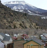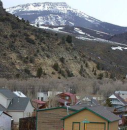
Hot Sulphur Springs, Colorado
Encyclopedia
The Town of Hot Sulphur Springs is a Statutory Town that is the county seat
of Grand County
, Colorado
, United States
. The town population was 521 at the U.S. Census 2000 and is at an elevation of 7,680 feet (2341 m).
who came for the hot springs
. When Grand County was formed, it was the first county seat from 1874 to 1882, after which it moved to Grand Lake
. The county seat returned in 1888 and has been here ever since. This town was established in 1860 making it the oldest town in the county and originally named Saratoga West and sometimes called Warm Springs. In 1863 the name was changed to reflect the hot springs in the area that were used for medicinal purposes. The town site was bought by William Newton Byers, founder of the Rocky Mountain News
, in 1864. He wished to make it a spa and resort so surveyed, platted and named the streets to the city. It was incorporated April 1, 1903. William Byers original family cabin is located at 204 Byers Avenue, along what is now Highway 40 and still exists to this day. The building is currently the county's only mortuary.
The first winter carnival in Hot Sulphur Springs was held on Dec. 31st, 1911. The success of this event led to a 3-day carnival which took place on Feb. 10-12, 1912. The following winter; a second annual winter carnival was planned in Hot Sulphur Springs, and it was planned in conjunction with the first Steamboat Springs Winter Sports Carnival. This series of events led to the creation of Howelson Hill in Steamboat Springs, and is credited with playing a large role in the birth of the Colorado ski industry.
Pay day in Hot Sulphur Springs was always the last day of the month and was considered a dangerous day because of the many gunfights that occurred. Because Halloween is October 31st, the last day of the month, the people of the town celebrated Halloween on the 30th to keep children safe. Staying true to its "wild west" heritage, Hot Sulphur Springs still celebrates Halloween the night before Halloween.
According to the United States Census Bureau
, the town has a total area of 0.8 square miles (2.1 km²), all of it land.
of 2000, there were 521 people, 196 households, and 131 families residing in the town. The population density
was 674.5 people per square mile (261.2/km²). There were 227 housing units at an average density of 293.9 per square mile (113.8/km²). The racial makeup of the town was 94.82% White, 0.38% African American, 1.92% Native American, 2.11% from other races
, and 0.77% from two or more races. Hispanic or Latino of any race were 7.10% of the population.
There were 196 households out of which 32.1% had children under the age of 18 living with them, 57.7% were married couples
living together, 5.1% had a female householder with no husband present, and 32.7% were non-families. 25.5% of all households were made up of individuals and 7.1% had someone living alone who was 65 years of age or older. The average household size was 2.45 and the average family size was 2.98.
 In the town the population was spread out with 24.4% under the age of 18, 9.0% from 18 to 24, 34.7% from 25 to 44, 25.7% from 45 to 64, and 6.1% who were 65 years of age or older. The median age was 36 years. For every 100 females there were 122.6 males. For every 100 females age 18 and over, there were 134.5 males.
The median income for a household in the town was $39,306, and the median income for a family was $46,000. Males had a median income of $42,431 versus $20,208 for females. The per capita income
for the town was $24,012. About 2.3% of families and 5.7% of the population were below the poverty line, including 4.0% of those under age 18 and 9.1% of those age 65 or over.
County seat
A county seat is an administrative center, or seat of government, for a county or civil parish. The term is primarily used in the United States....
of Grand County
Grand County, Colorado
Grand County is the 21st largest of the 64 counties of the State of Colorado of the United States. The county population was 12,442 at U.S. Census 2000...
, Colorado
Colorado
Colorado is a U.S. state that encompasses much of the Rocky Mountains as well as the northeastern portion of the Colorado Plateau and the western edge of the Great Plains...
, United States
United States
The United States of America is a federal constitutional republic comprising fifty states and a federal district...
. The town population was 521 at the U.S. Census 2000 and is at an elevation of 7,680 feet (2341 m).
History
Hot Sulphur Springs was originally a summer campground for IndiansNative Americans in the United States
Native Americans in the United States are the indigenous peoples in North America within the boundaries of the present-day continental United States, parts of Alaska, and the island state of Hawaii. They are composed of numerous, distinct tribes, states, and ethnic groups, many of which survive as...
who came for the hot springs
Hot Springs
Hot Springs may refer to:* Hot Springs, Arkansas** Hot Springs National Park, Arkansas*Hot Springs, California**Hot Springs, Lassen County, California**Hot Springs, Modoc County, California**Hot Springs, Placer County, California...
. When Grand County was formed, it was the first county seat from 1874 to 1882, after which it moved to Grand Lake
Grand Lake, Colorado
The Town of Grand Lake is a Statutory Town located in Grand County, Colorado, United States. The population was 447 at the 2000 census....
. The county seat returned in 1888 and has been here ever since. This town was established in 1860 making it the oldest town in the county and originally named Saratoga West and sometimes called Warm Springs. In 1863 the name was changed to reflect the hot springs in the area that were used for medicinal purposes. The town site was bought by William Newton Byers, founder of the Rocky Mountain News
Rocky Mountain News
The Rocky Mountain News was a daily newspaper published in Denver, Colorado, United States from April 23, 1859, until February 27, 2009. It was owned by the E. W. Scripps Company from 1926 until its closing. As of March 2006, the Monday-Friday circulation was 255,427...
, in 1864. He wished to make it a spa and resort so surveyed, platted and named the streets to the city. It was incorporated April 1, 1903. William Byers original family cabin is located at 204 Byers Avenue, along what is now Highway 40 and still exists to this day. The building is currently the county's only mortuary.
The first winter carnival in Hot Sulphur Springs was held on Dec. 31st, 1911. The success of this event led to a 3-day carnival which took place on Feb. 10-12, 1912. The following winter; a second annual winter carnival was planned in Hot Sulphur Springs, and it was planned in conjunction with the first Steamboat Springs Winter Sports Carnival. This series of events led to the creation of Howelson Hill in Steamboat Springs, and is credited with playing a large role in the birth of the Colorado ski industry.
Pay day in Hot Sulphur Springs was always the last day of the month and was considered a dangerous day because of the many gunfights that occurred. Because Halloween is October 31st, the last day of the month, the people of the town celebrated Halloween on the 30th to keep children safe. Staying true to its "wild west" heritage, Hot Sulphur Springs still celebrates Halloween the night before Halloween.
Geography
Hot Sulphur Springs is located at 40°4′24"N 106°6′5"W (40.073318, -106.101470).According to the United States Census Bureau
United States Census Bureau
The United States Census Bureau is the government agency that is responsible for the United States Census. It also gathers other national demographic and economic data...
, the town has a total area of 0.8 square miles (2.1 km²), all of it land.
Demographics
As of the censusCensus
A census is the procedure of systematically acquiring and recording information about the members of a given population. It is a regularly occurring and official count of a particular population. The term is used mostly in connection with national population and housing censuses; other common...
of 2000, there were 521 people, 196 households, and 131 families residing in the town. The population density
Population density
Population density is a measurement of population per unit area or unit volume. It is frequently applied to living organisms, and particularly to humans...
was 674.5 people per square mile (261.2/km²). There were 227 housing units at an average density of 293.9 per square mile (113.8/km²). The racial makeup of the town was 94.82% White, 0.38% African American, 1.92% Native American, 2.11% from other races
Race (United States Census)
Race and ethnicity in the United States Census, as defined by the Federal Office of Management and Budget and the United States Census Bureau, are self-identification data items in which residents choose the race or races with which they most closely identify, and indicate whether or not they are...
, and 0.77% from two or more races. Hispanic or Latino of any race were 7.10% of the population.
There were 196 households out of which 32.1% had children under the age of 18 living with them, 57.7% were married couples
Marriage
Marriage is a social union or legal contract between people that creates kinship. It is an institution in which interpersonal relationships, usually intimate and sexual, are acknowledged in a variety of ways, depending on the culture or subculture in which it is found...
living together, 5.1% had a female householder with no husband present, and 32.7% were non-families. 25.5% of all households were made up of individuals and 7.1% had someone living alone who was 65 years of age or older. The average household size was 2.45 and the average family size was 2.98.

The median income for a household in the town was $39,306, and the median income for a family was $46,000. Males had a median income of $42,431 versus $20,208 for females. The per capita income
Per capita income
Per capita income or income per person is a measure of mean income within an economic aggregate, such as a country or city. It is calculated by taking a measure of all sources of income in the aggregate and dividing it by the total population...
for the town was $24,012. About 2.3% of families and 5.7% of the population were below the poverty line, including 4.0% of those under age 18 and 9.1% of those age 65 or over.

