
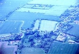
Horham
Encyclopedia


County
A county is a jurisdiction of local government in certain modern nations. Historically in mainland Europe, the original French term, comté, and its equivalents in other languages denoted a jurisdiction under the sovereignty of a count A county is a jurisdiction of local government in certain...
of Suffolk
Suffolk
Suffolk is a non-metropolitan county of historic origin in East Anglia, England. It has borders with Norfolk to the north, Cambridgeshire to the west and Essex to the south. The North Sea lies to the east...
, in the East Anglia
East Anglia
East Anglia is a traditional name for a region of eastern England, named after an ancient Anglo-Saxon kingdom, the Kingdom of the East Angles. The Angles took their name from their homeland Angeln, in northern Germany. East Anglia initially consisted of Norfolk and Suffolk, but upon the marriage of...
region of eastern England
England
England is a country that is part of the United Kingdom. It shares land borders with Scotland to the north and Wales to the west; the Irish Sea is to the north west, the Celtic Sea to the south west, with the North Sea to the east and the English Channel to the south separating it from continental...
, United Kingdom
United Kingdom
The United Kingdom of Great Britain and Northern IrelandIn the United Kingdom and Dependencies, other languages have been officially recognised as legitimate autochthonous languages under the European Charter for Regional or Minority Languages...
. The village contains a church, St. Mary of Horham. Horham is on the B1117 road, approximately halfway between Eye
Eye, Suffolk
Eye is a small market town in the county of Suffolk, East Anglia, England, south of Diss, and on the River Dove.Eye is twinned with the town of Pouzauges in the Vendée Departement of France.-History:An island...
and Stradbroke
Stradbroke
Stradbroke is a village in Suffolk, England, United Kingdom. It is in the Mid Suffolk District and part of the East of England Region of England. Stradbroke is near to the small Suffolk town of Eye and the larger Norfolk market town of Diss...
.
History
The village is old; some say it was a Viking settlement. There are some houses that are known to have been built in the 15th century. The old Dragon Inn - now known as Dragon House - is believed to date back to about 1525.Railways
The Mid-Suffolk Light RailwayMid-Suffolk Light Railway
The Mid-Suffolk Light Railway is a heritage railway in Suffolk, which in its heyday it was a branch line which ran for just from Haughley to Laxfield, Suffolk. The line became part of the London and North Eastern Railway in 1924 and the last trains ran on 26 July 1952...
was built at the turn the last century to serve the villages, and agriculture, of Mid Suffolk. The terminus of the MLSR, or ‘Middy’ as it was affectionately called, was at Haughley Junction, where the station was enlarged in 1903 to cope with this additional role. The MLSR was a standard gauge railway built to take light traffic from Haughley to Mendlesham, Brockford, Kenton, Aspall, Horham and Laxfield. The railway opened in 1904 and was extended for freight only to Cratfield in 1906. The original idea was to push the line across to Southwold, providing a link from the Midlands through to the North Sea at Southwold. It was also to join with the East Suffolk Railway, which ran via Debenham and Otley to Ipswich, but these links were never built.
Originally there were cattle docks provided at every station except Haughley, but these also fell into disuse as agriculture turned from cattle to corn. In World War l, part of the link to Kenton and Debenham, which had been started, was lifted because the materials were more urgently needed elsewhere and this effectively ended any hopes of completing the original scheme. The line was never to be a profitable enterprise and when, along with the Great Eastern Railway, it was swallowed up by the London and North Eastern Railway (LNER) in 1924, it remained virtually independent within the new grouping, simply because the LNER did not want to take it on. The only economy that they did eventually insist on was the closure of the MLSR Haughley East Station and the centralisation of the operation on the old GER station in November 1939. The original MLSR station was flattened.
Wartime
A World War IIWorld War II
World War II, or the Second World War , was a global conflict lasting from 1939 to 1945, involving most of the world's nations—including all of the great powers—eventually forming two opposing military alliances: the Allies and the Axis...
airfield, RAF Horham
RAF Horham
RAF Horham is a World War II era airfield in England. The field is located next to the village of Horham, England, and 4 miles SE of Eye in Suffolk. The large site straddled the parishes of Denham, Horham and Hoxne.-USAAF use:...
, was located at Horham. The U.S. Eighth Air Force
Eighth Air Force
The Eighth Air Force is a numbered air force of the United States Air Force Global Strike Command . It is headquartered at Barksdale Air Force Base, Louisiana....
, 95th Bomb Group
95th Bomb Group
The 95st Bomb Group was an air combat unit of the United States Army Air Forces during the Second World War. Classified as a heavy bombardment group, the 95th operated B-17 Flying Fortress aircraft.-Organization of the 95th Bomb Group :...
, and the 334th Bomb Squadron flew from Horham. A portion of the runway is still visible. The Red Feather Club has been restored and a World War II
World War II
World War II, or the Second World War , was a global conflict lasting from 1939 to 1945, involving most of the world's nations—including all of the great powers—eventually forming two opposing military alliances: the Allies and the Axis...
museum is in the same building. Also, there is another museum which was formerly the hospital.
External links
- Diss Express - village's local newspaper website
- Horham Airbase of the 95th Bomb Group web site