
Hindmarsh Island
Encyclopedia
Hindmarsh Island is an island
in the lower Murray River
near the town of Goolwa, South Australia
. Located on the Fleurieu Peninsula
, it is a popular tourist destination, which has increased in popularity since the Hindmarsh Island bridge
was opened in 2001. The majority of the island is agricultural in nature
 The first European to set foot on Hindmarsh Island was Captain Charles Sturt
in 1830. Sturt used the Island as a viewing point and from there he sighted the Murray Mouth
. The following year (1831) Captain Collet Barker
surveyed the Murray Mouth but was killed by Indigenous Australians
after swimming across the mouth.
The island was named by Captain John William Dundas Blenkinsop in 1837 after South Australia's first Governor, Sir John Hindmarsh
.
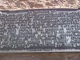
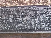
In 1849 Doctor Rankine was granted an occupational licence to become the island's first grazier. In 1853 Charles Price purchased section 20 (80 acres)on the island.
In the 1850s a flour mill was constructed. In 1857 a signal mast was erected at Barker Knoll to convey safe passage condition messages to vessels wishing to pass through the mouth. A public ferry began operations between Goolwa and the island in 1858. In the same year the first inter colonial telegraph line passed through the island to link Adelaide with Melbourne. In 1861 the cemetery was surveyed. In 1900 a cheese factory was built.
Hereford cattle and Shropshire sheep arrived in South Australia
in 1868, when Charles Price introduced them onto the island.
Hindmarsh Island today has fresh water on its northern shore and salt water on the southern shores. The waters being separated by a series of barrages. As early as 1914 an experimental barrage was constructed to link Hindmarsh Island with Mundoo Island. Construction of the permanent barrages took place between 1935-1940 with the aim of maintaining a consistent water level around the river Port of Goolwa and keeping salt water from the northern shore improving agricultural opportunities.
Mains electricity arrived on the island 1965.
The area to the east of the Murray Mouth
of Hindmarsh Island is the beginning of the Coorong National Park
.
In November 1985 approximately 1,405 square kilometres of area around the island was designated as a Ramsar wetland site of international importance to promote the conservation and sustainable use of wetland areas. In 2001, approximately a third of the island, the 10.81 km² Wyndgate property, was added to the Coorong National Park.
As of 2005 the Hindmarsh Island Marina boasts the title of the largest freshwater marina in the Southern Hemisphere.
 March 4, 2001 saw the official opening of the Hindmarsh Island Bridge linking the island to Goolwa
. The bridge became a focus of national controversy when a group of local Indigenous people (the Ngarrindjeri
) and some landowners objected to its construction. It was alleged that the Ngarrindjeri objectors fabricated the cultural significance of the island (the Secret Women's Business) in order to help fight the development.
A later Royal Commission decided that the Secret Women's Business was made up. Construction was blocked by the Keating Government
but given the go-ahead by the Howard Government
in 1996 (for more information, see Hindmarsh Island bridge controversy
). Documents released after the event prove the claims were true.
Five years after the Royal Commission findings, the Ngarrindjeri who had stated the bridge desecrated sites sacred to women were vindicated. The Reasons for Decision by Federal Court Judge, Mr Justice John von Doussa,[Chapman v Luminis Pty Ltd (No 5)[2001] FCA 1106 (21 August 2001)] explain, "the evidence received by the Court on this topic is significantly different to that which was before the Royal Commission. Upon the evidence before this Court I am not satisfied that the restricted women's knowledge was fabricated or that it was not part of genuine Aboriginal tradition' (paragraph 12). Further Justice von Doussa found the nine Ngarrindjeri women who testified about their beliefs to be 'credible witnesses who genuinely hold the beliefs and recollections expressed by them' (paragraph 317).
Island
An island or isle is any piece of sub-continental land that is surrounded by water. Very small islands such as emergent land features on atolls can be called islets, cays or keys. An island in a river or lake may be called an eyot , or holm...
in the lower Murray River
Murray River
The Murray River is Australia's longest river. At in length, the Murray rises in the Australian Alps, draining the western side of Australia's highest mountains and, for most of its length, meanders across Australia's inland plains, forming the border between New South Wales and Victoria as it...
near the town of Goolwa, South Australia
South Australia
South Australia is a state of Australia in the southern central part of the country. It covers some of the most arid parts of the continent; with a total land area of , it is the fourth largest of Australia's six states and two territories.South Australia shares borders with all of the mainland...
. Located on the Fleurieu Peninsula
Fleurieu Peninsula
The Fleurieu Peninsula is a peninsula located south of Adelaide in South Australia, Australia. It was named after the French explorer and hydrographer Charles Pierre Claret de Fleurieu by the French explorer Nicolas Baudin as he mapped the south coast of Australia in 1802.Towns of interest in the...
, it is a popular tourist destination, which has increased in popularity since the Hindmarsh Island bridge
Bridge
A bridge is a structure built to span physical obstacles such as a body of water, valley, or road, for the purpose of providing passage over the obstacle...
was opened in 2001. The majority of the island is agricultural in nature
History
Charles Sturt
Captain Charles Napier Sturt was an English explorer of Australia, and part of the European Exploration of Australia. He led several expeditions into the interior of the continent, starting from both Sydney and later from Adelaide. His expeditions traced several of the westward-flowing rivers,...
in 1830. Sturt used the Island as a viewing point and from there he sighted the Murray Mouth
Murray Mouth
Murray Mouth is the point at which the River Murray meets the southern Southern Ocean. The Murray Mouth's location is changeable. Historical records show that the channel out to sea moves along the sand dunes over time...
. The following year (1831) Captain Collet Barker
Collet Barker
Collet Barker was a British military officer and explorer. He explored areas of South Australia, Western Australia and Cobourg Peninsula, Northern Territory-History:Barker was born in Hackney, he lived in Newbury as a child...
surveyed the Murray Mouth but was killed by Indigenous Australians
Indigenous Australians
Indigenous Australians are the original inhabitants of the Australian continent and nearby islands. The Aboriginal Indigenous Australians migrated from the Indian continent around 75,000 to 100,000 years ago....
after swimming across the mouth.
The island was named by Captain John William Dundas Blenkinsop in 1837 after South Australia's first Governor, Sir John Hindmarsh
John Hindmarsh
Rear-Admiral Sir John Hindmarsh KH RN was a naval officer and the first Governor of South Australia, from 28 December 1836 to 16 July 1838.-Early life:...
.
In 1849 Doctor Rankine was granted an occupational licence to become the island's first grazier. In 1853 Charles Price purchased section 20 (80 acres)on the island.
In the 1850s a flour mill was constructed. In 1857 a signal mast was erected at Barker Knoll to convey safe passage condition messages to vessels wishing to pass through the mouth. A public ferry began operations between Goolwa and the island in 1858. In the same year the first inter colonial telegraph line passed through the island to link Adelaide with Melbourne. In 1861 the cemetery was surveyed. In 1900 a cheese factory was built.
Hereford cattle and Shropshire sheep arrived in South Australia
South Australia
South Australia is a state of Australia in the southern central part of the country. It covers some of the most arid parts of the continent; with a total land area of , it is the fourth largest of Australia's six states and two territories.South Australia shares borders with all of the mainland...
in 1868, when Charles Price introduced them onto the island.
Hindmarsh Island today has fresh water on its northern shore and salt water on the southern shores. The waters being separated by a series of barrages. As early as 1914 an experimental barrage was constructed to link Hindmarsh Island with Mundoo Island. Construction of the permanent barrages took place between 1935-1940 with the aim of maintaining a consistent water level around the river Port of Goolwa and keeping salt water from the northern shore improving agricultural opportunities.
Mains electricity arrived on the island 1965.
The area to the east of the Murray Mouth
Murray Mouth
Murray Mouth is the point at which the River Murray meets the southern Southern Ocean. The Murray Mouth's location is changeable. Historical records show that the channel out to sea moves along the sand dunes over time...
of Hindmarsh Island is the beginning of the Coorong National Park
Coorong National Park
The Coorong is a national park and lagoon ecosystem in South Australia , 156 km southeast of Adelaide. Its name is thought to be a corruption of the local Aboriginal people's word kurangh, meaning "long neck"; a reference to the shape of the lagoon system...
.
In November 1985 approximately 1,405 square kilometres of area around the island was designated as a Ramsar wetland site of international importance to promote the conservation and sustainable use of wetland areas. In 2001, approximately a third of the island, the 10.81 km² Wyndgate property, was added to the Coorong National Park.
As of 2005 the Hindmarsh Island Marina boasts the title of the largest freshwater marina in the Southern Hemisphere.
The Hindmarsh Island Bridge
Goolwa, South Australia
Goolwa is a historic river port on the Murray River near the Murray Mouth in South Australia, and joined by a bridge to Hindmarsh Island. The name "Goolwa" means "elbow" in Ngarrindjeri, the local Aboriginal language....
. The bridge became a focus of national controversy when a group of local Indigenous people (the Ngarrindjeri
Ngarrindjeri
The Ngarrindjeri are a nation of eighteen "tribes" consisting of numerous family clans who speak similar dialects of the Ngarrindjeri language and are the traditional Aboriginal people of the lower Murray River, western Fleurieu Peninsula, and the Coorong of southern, central...
) and some landowners objected to its construction. It was alleged that the Ngarrindjeri objectors fabricated the cultural significance of the island (the Secret Women's Business) in order to help fight the development.
A later Royal Commission decided that the Secret Women's Business was made up. Construction was blocked by the Keating Government
Paul Keating
Paul John Keating was the 24th Prime Minister of Australia, serving from 1991 to 1996. Keating was elected as the federal Labor member for Blaxland in 1969 and came to prominence as the reformist treasurer of the Hawke Labor government, which came to power at the 1983 election...
but given the go-ahead by the Howard Government
John Howard
John Winston Howard AC, SSI, was the 25th Prime Minister of Australia, from 11 March 1996 to 3 December 2007. He was the second-longest serving Australian Prime Minister after Sir Robert Menzies....
in 1996 (for more information, see Hindmarsh Island bridge controversy
Hindmarsh Island bridge controversy
The Hindmarsh Island bridge controversy was a 1990s Australian legal and political controversy that involved the clash of Indigenous Australian religious beliefs and property rights...
). Documents released after the event prove the claims were true.
Five years after the Royal Commission findings, the Ngarrindjeri who had stated the bridge desecrated sites sacred to women were vindicated. The Reasons for Decision by Federal Court Judge, Mr Justice John von Doussa,[Chapman v Luminis Pty Ltd (No 5)[2001] FCA 1106 (21 August 2001)] explain, "the evidence received by the Court on this topic is significantly different to that which was before the Royal Commission. Upon the evidence before this Court I am not satisfied that the restricted women's knowledge was fabricated or that it was not part of genuine Aboriginal tradition' (paragraph 12). Further Justice von Doussa found the nine Ngarrindjeri women who testified about their beliefs to be 'credible witnesses who genuinely hold the beliefs and recollections expressed by them' (paragraph 317).