

Highway 138 (Ontario)
Encyclopedia
King's Highway 138, commonly referred to as Highway 138, is a provincially maintained highway in eastern Ontario
. It extends from the former Highway 2
in Cornwall
, north to Highway 417 east of Casselman
. Highway 138 provides access to the Seaway International Bridge
, connecting Cornwall with Massena, New York
. The highway is 38.7 km (24 mi) in length.
Highway 138 was first established in 1967, connecting Highway 2, now Vincent Massey Drive, with Highway 43 in Monkland. By the mid-1970s, the route had been extended north to meet with the newly opened Highway 417. Since then it has remained unchanged.
 Highway 138 is a 36 kilometres (22.4 mi) highway that crosses the Laurentian Valley in eastern Ontario, connecting Highway 401 in Cornwall with Highway 417 east of Casselman.
The route begins at 9th Street West, which was Highway 2
until the late 90s, and proceeds north along the western side of Cornwall; this section is maintained under a Connecting Link
agreement and is locally known as Brookdale Avenue.
After crossing Highway 401, at which there is an interchange
, the route encounters Cornwall Centre Road, onto which it turns east. After following it for a brief distance, the highway turns north onto St. Andrews Road; the Connecting Link agreement ends at this junction.
Over the next two kilometres (1.25 mi), the highway exits the fringes of Cornwall, passing through the neighbourhood of Churchill Heights. After passing Headline Road (County Road 44), the route divides a forest and then enters an agricultural area before coming upon the community of St. Andrews West. It crosses the Raisin River
and continues north through a mix of farmland and forests.
at the Seaway International Bridge and Highway 43.
With the construction of Highway 417 planned and progressing eastward from Ottawa
, Highway 138 was extended north to its present terminus east of Casselman in 1971 or 1972.
Its route remained unchanged from then until the mass downloading of highways, during which the southern end was truncated to Highway 401.
Ontario
Ontario is a province of Canada, located in east-central Canada. It is Canada's most populous province and second largest in total area. It is home to the nation's most populous city, Toronto, and the nation's capital, Ottawa....
. It extends from the former Highway 2
Ontario Highway 2
King's Highway 2, usually referred to simply as Highway 2 is a provincially maintained highway in Ontario. Once the primary east–west route across the southern end of the province, Highway 2 became mostly redundant in the 1960s following the completion of Highway 401, which more or less...
in Cornwall
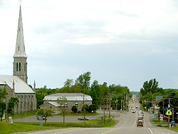
Cornwall, Ontario
Cornwall is a city in Eastern Ontario, Canada and the seat of the United Counties of Stormont, Dundas and Glengarry, Ontario. Cornwall is Ontario's easternmost city, located on the St...
, north to Highway 417 east of Casselman
Casselman, Ontario
Casselman is a village in eastern Ontario, Canada, in the United Counties of Prescott and Russell on the South Nation River.It is a village on the Trans-Canada Highway 417 between Ottawa and Montreal at the crossroads of Regional Road 7, about 55 km southeast of downtown Ottawa. Highway 138 to...
. Highway 138 provides access to the Seaway International Bridge
Seaway International Bridge
The Three Nations Crossing is a border crossing connecting the city of Cornwall, Ontario in Canada to Rooseveltown, New York, a neighbourhood within the town of Massena, in the United States. The crossing is traversed by the Seaway International Bridge, which crosses the St...
, connecting Cornwall with Massena, New York
Massena (village), New York
Massena is a village in St. Lawrence County, New York, United States. The population was 13,589 at the 2000 census. The village is named after Andre Massena, one of Napoleon's generals....
. The highway is 38.7 km (24 mi) in length.
Highway 138 was first established in 1967, connecting Highway 2, now Vincent Massey Drive, with Highway 43 in Monkland. By the mid-1970s, the route had been extended north to meet with the newly opened Highway 417. Since then it has remained unchanged.
Route description
The route begins at 9th Street West, which was Highway 2
Ontario Highway 2
King's Highway 2, usually referred to simply as Highway 2 is a provincially maintained highway in Ontario. Once the primary east–west route across the southern end of the province, Highway 2 became mostly redundant in the 1960s following the completion of Highway 401, which more or less...
until the late 90s, and proceeds north along the western side of Cornwall; this section is maintained under a Connecting Link
Connecting Link
The Connecting Link program is a provincial subsidy provided to municipalities to assist with road construction, maintenance and repairs in the Canadian province of Ontario. Roads which are designated as connecting links form the portions of provincial highways through built-up communities which...
agreement and is locally known as Brookdale Avenue.
After crossing Highway 401, at which there is an interchange
Interchange (road)
In the field of road transport, an interchange is a road junction that typically uses grade separation, and one or more ramps, to permit traffic on at least one highway to pass through the junction without directly crossing any other traffic stream. It differs from a standard intersection, at which...
, the route encounters Cornwall Centre Road, onto which it turns east. After following it for a brief distance, the highway turns north onto St. Andrews Road; the Connecting Link agreement ends at this junction.
Over the next two kilometres (1.25 mi), the highway exits the fringes of Cornwall, passing through the neighbourhood of Churchill Heights. After passing Headline Road (County Road 44), the route divides a forest and then enters an agricultural area before coming upon the community of St. Andrews West. It crosses the Raisin River
Raisin River (Ontario)
The Raisin River is a river in South Stormont and South Glengarry, Stormont, Dundas and Glengarry United Counties in eastern Ontario, Canada, with the watershed encompassing portions of North Stormont, North Glengarry and the city of Cornwall as well...
and continues north through a mix of farmland and forests.
History
Highway 138 was established by the Department of Highways on May 1, 1967, following existing Stormont County roads between Highway 2Ontario Highway 2
King's Highway 2, usually referred to simply as Highway 2 is a provincially maintained highway in Ontario. Once the primary east–west route across the southern end of the province, Highway 2 became mostly redundant in the 1960s following the completion of Highway 401, which more or less...
at the Seaway International Bridge and Highway 43.
With the construction of Highway 417 planned and progressing eastward from Ottawa
Ottawa
Ottawa is the capital of Canada, the second largest city in the Province of Ontario, and the fourth largest city in the country. The city is located on the south bank of the Ottawa River in the eastern portion of Southern Ontario...
, Highway 138 was extended north to its present terminus east of Casselman in 1971 or 1972.
Its route remained unchanged from then until the mass downloading of highways, during which the southern end was truncated to Highway 401.
Major intersections
The entirety of Highway 138 is located in Stormont, Dundas and Glengarry United Counties.| Location | km | Destinations | Notes |
|---|---|---|---|
| Cornwall Cornwall, Ontario Cornwall is a city in Eastern Ontario, Canada and the seat of the United Counties of Stormont, Dundas and Glengarry, Ontario. Cornwall is Ontario's easternmost city, located on the St... |
0.0 | 9th Street West | Beginning of Cornwall Connecting Link Connecting Link The Connecting Link program is a provincial subsidy provided to municipalities to assist with road construction, maintenance and repairs in the Canadian province of Ontario. Roads which are designated as connecting links form the portions of provincial highways through built-up communities which... agreement; beginning of former Highway 2 Ontario Highway 2 King's Highway 2, usually referred to simply as Highway 2 is a provincially maintained highway in Ontario. Once the primary east–west route across the southern end of the province, Highway 2 became mostly redundant in the 1960s following the completion of Highway 401, which more or less... concurrency Concurrency (road) A concurrency, overlap, or coincidence in a road network is an instance of one physical road bearing two or more different highway, motorway, or other route numbers... |
| 0.5 | Vincent Massey Drive | End of former Highway 2 concurrency | |
| 2.7 | Exit 789 | ||
| 4.3 | Cornell Centre Road | End of Connecting Link agreement | |
| Saint Andrews | 8.9 | ||
| Monkland | 21.8 | Formerly Highway 43 | |
| North Stormont North Stormont, Ontario North Stormont is a lower tier township in eastern Ontario, Canada in the United Counties of Stormont, Dundas and Glengarry. The township was incorporated on January 1, 1998 by amalgamating the former townships of Finch and Roxborough with the independent village of Finch.-Communities:The township... |
30.6 | McNeil Road / | |
| 32.1 | |||
| 38.7 |