
Hempstead, near Holt, Norfolk
Encyclopedia
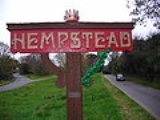
Hempstead is a village and civil parish in the north of the English county of Norfolk
. The village is 2.7 miles south-southeast of the town of Holt
, and 11.2 miles west of Cromer
. Hempstead is within the area covered by North Norfolk District Council. In the last Census, carried out in 2001, the population of Hempstead was counted as 179.
has a thatched roof, the main part of the roof being of pantile. At the western end of the church is a red-brick built, short tower which was rebuilt in 1744.
www.hempsteadhall.co.uk gives details of quality Bed & Breakfast accommodation in the village.Hempstead Hall is a 19th century farmhouse set in beautiful surroundings on an arable farm.
Norfolk
Norfolk is a low-lying county in the East of England. It has borders with Lincolnshire to the west, Cambridgeshire to the west and southwest and Suffolk to the south. Its northern and eastern boundaries are the North Sea coast and to the north-west the county is bordered by The Wash. The county...
. The village is 2.7 miles south-southeast of the town of Holt
Holt, Norfolk
Holt is a market town and civil parish in the English county of Norfolk. The town is north of the city of Norwich, west of Cromer and east of King's Lynn. The town is on the route of the A148 King's Lynn to Cromer road. The nearest railway station is in the town of Sheringham where access to the...
, and 11.2 miles west of Cromer
Cromer
Cromer is a coastal town and civil parish in north Norfolk, England. The local government authority is North Norfolk District Council, whose headquarters is in Holt Road in the town. The town is situated 23 miles north of the county town, Norwich, and is 4 miles east of Sheringham...
. Hempstead is within the area covered by North Norfolk District Council. In the last Census, carried out in 2001, the population of Hempstead was counted as 179.
The Parish Church
The parish church is called All Saints’ and is unusual in the fact that the apseApse
In architecture, the apse is a semicircular recess covered with a hemispherical vault or semi-dome...
has a thatched roof, the main part of the roof being of pantile. At the western end of the church is a red-brick built, short tower which was rebuilt in 1744.
www.hempsteadhall.co.uk gives details of quality Bed & Breakfast accommodation in the village.Hempstead Hall is a 19th century farmhouse set in beautiful surroundings on an arable farm.