
Hardwick, Massachusetts
Encyclopedia
Hardwick is a town in Worcester County
, Massachusetts
, United States
, about 20 miles (32.2 km) west of the city of Worcester
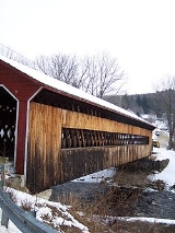
. It had a population of 2,990 at the 2010 census. It includes the villages of Hardwick, Gilbertville
, Wheelwright
and Old Furnace
.
of New England, introduced the Hardwick Fair, now the oldest annual fair in the United States. During the late 1800s, Hardwick experienced an expansion of its manufacturing industry, textile and paper mills, both of which left the area by the 1930s. The town has retained its agricultural roots, a long-standing tradition in the region. Hardwick is the home of Eagle Hill School, founded in 1967.
, the town has a total area of 40.8 square miles (105.7 km²), of which 38.6 square miles (100 km²) is land and 2.2 square miles (5.7 km²), or 5.51%, is water. Hardwick was one of the towns which gained lands (though lost some land area) by the building of the Quabbin Reservoir
. The reservoir's waters extend into the town along the former East Branch of the Swift River, which once ran through the northwest corner of town. Thanks to the disincorporation of the towns which the Quabbin Reservoir and its reservation lands now lie on, Hardwick gained a small portion of the former town of Greenwich
along the northwest corner of town, though it is the smallest portion of land gained by any of the towns surrounding the reservoir. The town lies along the edge of the former Swift River Valley, with Muddy Brook and the former East Branch of the Swift River draining the western part of town, and the Ware River
draining the eastern portion. The lands along the Ware, especially in the far eastern part of town, are marshy. The town has some open areas, and a portion of the lands not already protected as part of the Quabbin Reservation are part of the Muddy Brook Wildlife Management Area.
Hardwick lies along the western edge of Worcester County, bordered by Hampshire County
to the southwest. It is bordered by Petersham
to the northwest, Barre
to the northeast, New Braintree
to the southeast and Ware
to the southwest. From its town center, Hardwick lies 24 miles (38.6 km) west-northwest of Worcester
, 31 miles (49.9 km) northeast of Springfield
, and 64 miles (103 km) west of Boston
.
Hardwick has no interstates or limited access highways within town, lying approximately halfway between Interstate 90
, also known as the Massachusetts Turnpike, to the south and Route 2 to the north. The southern neighborhood of Gilbertville is the location of the intersection of Route 32 and the southern terminus of Route 32A, with Route 32 coming from Ware heading northeast towards Barre, and Route 32A heading due north through the town's center towards the center of Petersham, where its northern end lies. The Massachusetts Central Railroad
line passes through the town from Palmer
towards Barre, roughly following the path of Route 32. It does not carry passenger rail, however, not having done so since the early twentieth century. The nearest private airport is the Tanner-Hiller Airport
in New Braintree, and the nearest national air service can be reached at Bradley International Airport
in Connecticut.
of 2000, there were 2,622 people, 997 households, and 689 families residing in the town. The population density
was 67.9 people per square mile (26.2/km²). There were 1,086 housing units at an average density of 28.1 per square mile (10.9/km²). The racial makeup of the town was 97.79% White, 0.53% African American, 0.15% Native American, 0.11% Asian, 0.19% from other races
, and 1.22% from two or more races. Hispanic or Latino of any race were 0.88% of the population.
There were 997 households out of which 34.9% had children under the age of 18 living with them, 56.4% were married couples
living together, 8.3% had a female householder with no husband present, and 30.8% were non-families. 25.8% of all households were made up of individuals and 13.2% had someone living alone who was 65 years of age or older. The average household size was 2.57 and the average family size was 3.08.
In the town the population was spread out with 28.0% under the age of 18, 6.9% from 18 to 24, 28.6% from 25 to 44, 22.7% from 45 to 64, and 13.7% who were 65 years of age or older. The median age was 38 years. For every 100 females there were 94.9 males. For every 100 females age 18 and over, there were 95.0 males.
The median income for a household in the town was $45,742, and the median income for a family was $54,667. Males had a median income of $37,763 versus $30,057 for females. The per capita income
for the town was $20,824. About 5.5% of families and 7.5% of the population were below the poverty line, including 5.7% of those under age 18 and 10.9% of those age 65 or over.
Worcester County, Massachusetts
-Demographics:In 1990 Worcester County had a population of 709,705.As of the census of 2000, there were 750,963 people, 283,927 households, and 192,502 families residing in the county. The population density was 496 people per square mile . There were 298,159 housing units at an average density...
, Massachusetts
Massachusetts
The Commonwealth of Massachusetts is a state in the New England region of the northeastern United States of America. It is bordered by Rhode Island and Connecticut to the south, New York to the west, and Vermont and New Hampshire to the north; at its east lies the Atlantic Ocean. As of the 2010...
, United States
United States
The United States of America is a federal constitutional republic comprising fifty states and a federal district...
, about 20 miles (32.2 km) west of the city of Worcester
Worcester, Massachusetts
Worcester is a city and the county seat of Worcester County, Massachusetts, United States. Named after Worcester, England, as of the 2010 Census the city's population is 181,045, making it the second largest city in New England after Boston....
. It had a population of 2,990 at the 2010 census. It includes the villages of Hardwick, Gilbertville
Gilbertville, Massachusetts
Gilbertville is an unincorporated village in the town of Hardwick, Worcester County, Massachusetts, United States, about 20 miles west of the city of Worcester.-External links:*...
, Wheelwright
Wheelwright, Massachusetts
Wheelwright is a village in the town of Hardwick, Worcester County, Massachusetts, United States, about 20 miles northwest of the city of Worcester, Massachusetts. Named after George W. Wheelwright who owned the paper mill around the turn of the 20th century...
and Old Furnace
Old Furnace, Massachusetts
Old Furnace is a village in the town of Hardwick, Worcester County, Massachusetts, United States, about 20 miles northwest of the city of Worcester.-External links:*...
.
History
Hardwick was first settled in 1737 and was officially incorporated in 1739, named in honor of Lord Hardwicke, an English nobleman. In 1762, General Timothy Ruggles, one of the leading ToriesLoyalist (American Revolution)
Loyalists were American colonists who remained loyal to the Kingdom of Great Britain during the American Revolutionary War. At the time they were often called Tories, Royalists, or King's Men. They were opposed by the Patriots, those who supported the revolution...
of New England, introduced the Hardwick Fair, now the oldest annual fair in the United States. During the late 1800s, Hardwick experienced an expansion of its manufacturing industry, textile and paper mills, both of which left the area by the 1930s. The town has retained its agricultural roots, a long-standing tradition in the region. Hardwick is the home of Eagle Hill School, founded in 1967.
Geography and Transportation
According to the United States Census BureauUnited States Census Bureau
The United States Census Bureau is the government agency that is responsible for the United States Census. It also gathers other national demographic and economic data...
, the town has a total area of 40.8 square miles (105.7 km²), of which 38.6 square miles (100 km²) is land and 2.2 square miles (5.7 km²), or 5.51%, is water. Hardwick was one of the towns which gained lands (though lost some land area) by the building of the Quabbin Reservoir
Quabbin Reservoir
The Quabbin Reservoir is the largest inland body of water in the Commonwealth of Massachusetts and was built between 1930 and 1939. Today along with the Wachusett Reservoir, it is the primary water supply for Boston, some to the east, as well as 40 other communities in Greater Boston...
. The reservoir's waters extend into the town along the former East Branch of the Swift River, which once ran through the northwest corner of town. Thanks to the disincorporation of the towns which the Quabbin Reservoir and its reservation lands now lie on, Hardwick gained a small portion of the former town of Greenwich
Greenwich, Massachusetts
Greenwich was a town in Hampshire County, Massachusetts.It was established in 1739 as Quabbin, incorporated as Quabbin Parish in 1754 and became the town of Greenwich in 1754. It was located along the East and Middle branches of the Swift River...
along the northwest corner of town, though it is the smallest portion of land gained by any of the towns surrounding the reservoir. The town lies along the edge of the former Swift River Valley, with Muddy Brook and the former East Branch of the Swift River draining the western part of town, and the Ware River
Ware River
The Ware River is a river in central Massachusetts. It has two forks, the longest of which begins near Hubbardston, Massachusetts...
draining the eastern portion. The lands along the Ware, especially in the far eastern part of town, are marshy. The town has some open areas, and a portion of the lands not already protected as part of the Quabbin Reservation are part of the Muddy Brook Wildlife Management Area.
Hardwick lies along the western edge of Worcester County, bordered by Hampshire County
Hampshire County, Massachusetts
-Demographics:As of the census of 2000, there were 152,251 people, 55,991 households, and 33,818 families residing in the county. The population density was 288 people per square mile . There were 58,644 housing units at an average density of 111 per square mile...
to the southwest. It is bordered by Petersham
Petersham, Massachusetts
Petersham is a town in Worcester County, Massachusetts, United States. The population was 1,234 at the 2010 census. Petersham is home to a considerable amount of conservation land, including the Quabbin Reservation, Harvard Forest, the Swift River Reservation, and Federated Women's Club State...
to the northwest, Barre
Barre, Massachusetts
Barre is a town in Worcester County, Massachusetts, United States. The population was 5,398 at the 2010 census.-History:Originally called the Northwest District of Rutland, it was first settled in 1720. The town was incorporated on June 17, 1774, as Hutchinson after Thomas Hutchinson, colonial...
to the northeast, New Braintree
New Braintree, Massachusetts
New Braintree is a town in Worcester County, Massachusetts, United States. The population was 999 at the 2010 census.- History :New Braintree was first settled in 1709 and was officially incorporated in 1751....
to the southeast and Ware
Ware, Massachusetts
Ware is a town in Hampshire County, Massachusetts, United States. The population was 9,707 at the 2000 census. It is part of the Springfield, Massachusetts Metropolitan Statistical Area.Part of the town comprises the census-designated place of Ware....
to the southwest. From its town center, Hardwick lies 24 miles (38.6 km) west-northwest of Worcester
Worcester, Massachusetts
Worcester is a city and the county seat of Worcester County, Massachusetts, United States. Named after Worcester, England, as of the 2010 Census the city's population is 181,045, making it the second largest city in New England after Boston....
, 31 miles (49.9 km) northeast of Springfield
Springfield, Massachusetts
Springfield is the most populous city in Western New England, and the seat of Hampden County, Massachusetts, United States. Springfield sits on the eastern bank of the Connecticut River near its confluence with three rivers; the western Westfield River, the eastern Chicopee River, and the eastern...
, and 64 miles (103 km) west of Boston
Boston
Boston is the capital of and largest city in Massachusetts, and is one of the oldest cities in the United States. The largest city in New England, Boston is regarded as the unofficial "Capital of New England" for its economic and cultural impact on the entire New England region. The city proper had...
.
Hardwick has no interstates or limited access highways within town, lying approximately halfway between Interstate 90
Massachusetts Turnpike
The Massachusetts Turnpike is the easternmost stretch of Interstate 90. The Turnpike begins at the western border of Massachusetts in West Stockbridge connecting with the Berkshire Connector portion of the New York State Thruway...
, also known as the Massachusetts Turnpike, to the south and Route 2 to the north. The southern neighborhood of Gilbertville is the location of the intersection of Route 32 and the southern terminus of Route 32A, with Route 32 coming from Ware heading northeast towards Barre, and Route 32A heading due north through the town's center towards the center of Petersham, where its northern end lies. The Massachusetts Central Railroad
Massachusetts Central Railroad
The Massachusetts Central Railroad is a short line railroad in western Massachusetts, USA. It was established in 1979 to provide railroad transportation services between Palmer and South Barre on the old Right of Way of the Ware River Railroad....
line passes through the town from Palmer
Palmer, Massachusetts
The Town of Palmer is a city in Hampden County, Massachusetts, United States. The population was 12,140 as of the 2000 census. It is part of the Springfield, Massachusetts Metropolitan Statistical Area...
towards Barre, roughly following the path of Route 32. It does not carry passenger rail, however, not having done so since the early twentieth century. The nearest private airport is the Tanner-Hiller Airport
Tanner-Hiller Airport
Tanner-Hiller Airport, in Barre, Massachusetts, is a public airport owned by the Leonard A. Tanner Estate. It has one runway, averages 29 flights per week, and has approximately 4 aircraft based on its field....
in New Braintree, and the nearest national air service can be reached at Bradley International Airport
Bradley International Airport
Bradley International Airport is a joint civil-military public airport located in Windsor Locks on the border with East Granby and Suffield, in Hartford County, Connecticut, United States. It is owned by the State of Connecticut....
in Connecticut.
Demographics
As of the censusCensus
A census is the procedure of systematically acquiring and recording information about the members of a given population. It is a regularly occurring and official count of a particular population. The term is used mostly in connection with national population and housing censuses; other common...
of 2000, there were 2,622 people, 997 households, and 689 families residing in the town. The population density
Population density
Population density is a measurement of population per unit area or unit volume. It is frequently applied to living organisms, and particularly to humans...
was 67.9 people per square mile (26.2/km²). There were 1,086 housing units at an average density of 28.1 per square mile (10.9/km²). The racial makeup of the town was 97.79% White, 0.53% African American, 0.15% Native American, 0.11% Asian, 0.19% from other races
Race (United States Census)
Race and ethnicity in the United States Census, as defined by the Federal Office of Management and Budget and the United States Census Bureau, are self-identification data items in which residents choose the race or races with which they most closely identify, and indicate whether or not they are...
, and 1.22% from two or more races. Hispanic or Latino of any race were 0.88% of the population.
There were 997 households out of which 34.9% had children under the age of 18 living with them, 56.4% were married couples
Marriage
Marriage is a social union or legal contract between people that creates kinship. It is an institution in which interpersonal relationships, usually intimate and sexual, are acknowledged in a variety of ways, depending on the culture or subculture in which it is found...
living together, 8.3% had a female householder with no husband present, and 30.8% were non-families. 25.8% of all households were made up of individuals and 13.2% had someone living alone who was 65 years of age or older. The average household size was 2.57 and the average family size was 3.08.
In the town the population was spread out with 28.0% under the age of 18, 6.9% from 18 to 24, 28.6% from 25 to 44, 22.7% from 45 to 64, and 13.7% who were 65 years of age or older. The median age was 38 years. For every 100 females there were 94.9 males. For every 100 females age 18 and over, there were 95.0 males.
The median income for a household in the town was $45,742, and the median income for a family was $54,667. Males had a median income of $37,763 versus $30,057 for females. The per capita income
Per capita income
Per capita income or income per person is a measure of mean income within an economic aggregate, such as a country or city. It is calculated by taking a measure of all sources of income in the aggregate and dividing it by the total population...
for the town was $20,824. About 5.5% of families and 7.5% of the population were below the poverty line, including 5.7% of those under age 18 and 10.9% of those age 65 or over.