
Gleasondale, Massachusetts
Encyclopedia
Gleasondale, formerly known as Rockbottom or Rock Bottom, is a village in the towns of Hudson
and Stow
in Middlesex County
, Massachusetts
, United States
. It could be considered to start where Main Street in Hudson becomes Wilkins Street, and runs until the intersection of Gleasondale Road and Great Road in Stow. According to the Geographic Names Information System (GNIS)
, Gleasondale is a "populated place" and is named after Benjamin W. Gleason and Samuel J. Dale. It has an elevation of 187 feet, or 57 meters.
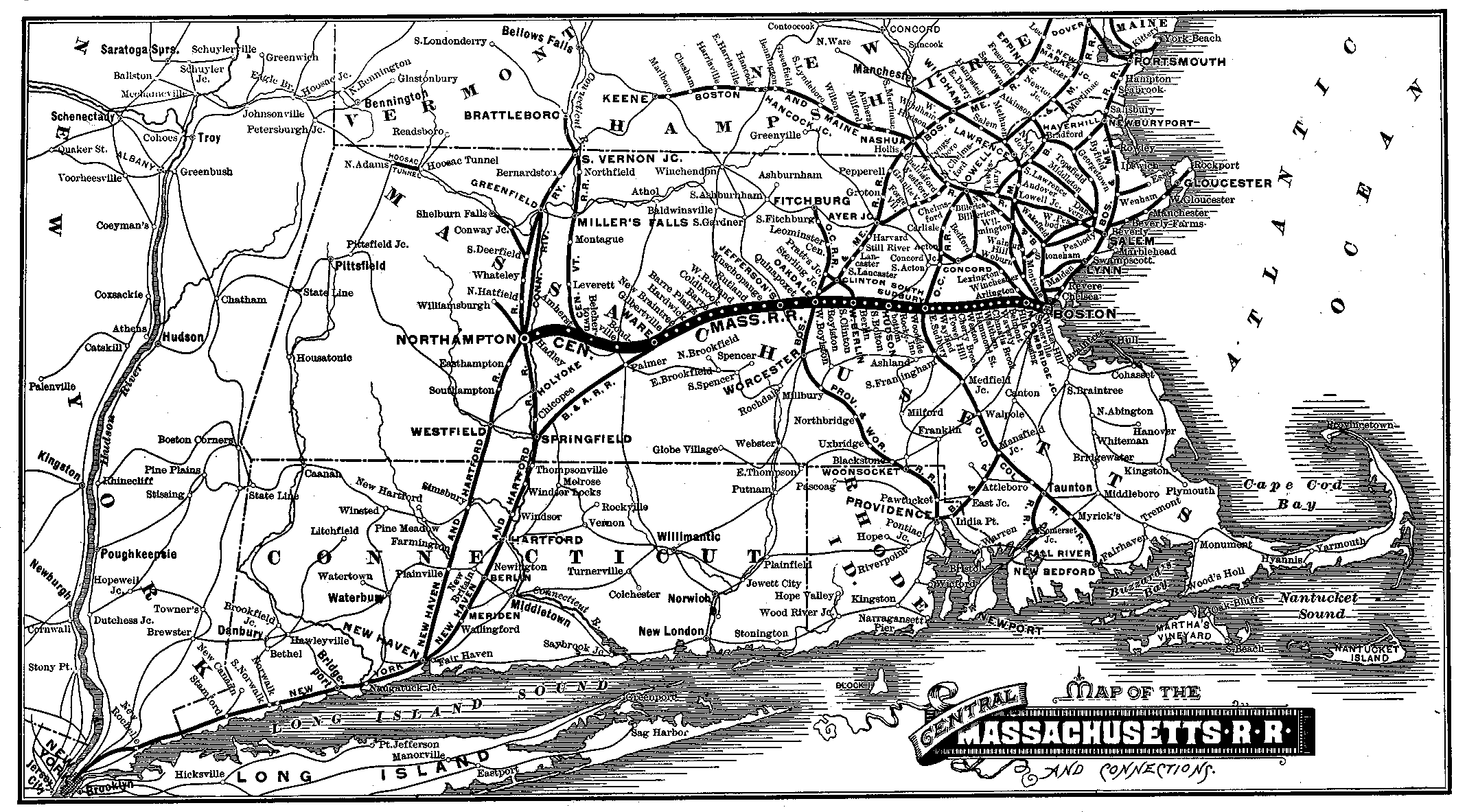 Until its closure in 1965, the Gleasondale Station — one of two train stations in Hudson — served the village. It was originally operated by the Central Massachusetts Railroad Company
, and later by Boston & Maine. The station's name is printed as "Rocky-bottom" in the 1888 map of the Central Massachusetts Railroad's route at right.
Today, Gleasondale has a few residential buildings, plus a small industrial complex. It does not a have a large enough population to boast its own post office, instead using the same zip code as Stow: 01775.
Hudson, Massachusetts
Hudson is a town in Middlesex County, Massachusetts, United States. The population was 19,063 at the 2010 census. The town is located in central Massachusetts, about a 40-minute drive, or about , west of Boston, and about a 20-minute drive, or about , northeast of Worcester.Before its...
and Stow
Stow, Massachusetts
Stow is a town in Middlesex County, Massachusetts, United States. The population was 6,590 at the 2010 census.- History :Stow was first settled c. 1660 by Matthew Boon and John Kettell...
in Middlesex County
Middlesex County, Massachusetts
-National protected areas:* Assabet River National Wildlife Refuge* Great Meadows National Wildlife Refuge* Longfellow National Historic Site* Lowell National Historical Park* Minute Man National Historical Park* Oxbow National Wildlife Refuge...
, Massachusetts
Massachusetts
The Commonwealth of Massachusetts is a state in the New England region of the northeastern United States of America. It is bordered by Rhode Island and Connecticut to the south, New York to the west, and Vermont and New Hampshire to the north; at its east lies the Atlantic Ocean. As of the 2010...
, United States
United States
The United States of America is a federal constitutional republic comprising fifty states and a federal district...
. It could be considered to start where Main Street in Hudson becomes Wilkins Street, and runs until the intersection of Gleasondale Road and Great Road in Stow. According to the Geographic Names Information System (GNIS)
Geographic Names Information System
The Geographic Names Information System is a database that contains name and locative information about more than two million physical and cultural features located throughout the United States of America and its territories. It is a type of gazetteer...
, Gleasondale is a "populated place" and is named after Benjamin W. Gleason and Samuel J. Dale. It has an elevation of 187 feet, or 57 meters.
Central Massachusetts Railroad
The Central Massachusetts Railroad was a railroad running west from Boston, Massachusetts, USA, as a parallel competitor to the Boston and Albany Railroad and Fitchburg Railroad...
, and later by Boston & Maine. The station's name is printed as "Rocky-bottom" in the 1888 map of the Central Massachusetts Railroad's route at right.
Today, Gleasondale has a few residential buildings, plus a small industrial complex. It does not a have a large enough population to boast its own post office, instead using the same zip code as Stow: 01775.