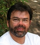
Gilberto Camara
Encyclopedia
Gilberto Câmara is Director of Brazil's National Institute for Space Research (INPE)
for the period 2006 to 2013. Previously, he was head of INPE’s Image Processing
Division from 1991 to 1996 and Director for Earth Observation from 2001 to 2005.
He is a researcher in the areas of Geographical Information Science, Spatial Database
s, Spatial Analysis and Environmental Modelling. According to data available in Google Scholar, his number of citations is 1123, as March 2007. Gilberto is the principal investigator on the area of Spatial Databases and Spatial Environmental Models in the GEOMA research network for Environmental Modelling of Amazonia. He is responsible for setting up data policies for CBERS images in Brazil and abroad, and for creating INPE’s Remote Sensing Data Center, which has put 30 years of imagery on-line. He was also responsible for setting up a system for real-time detection of deforestation in Amazonia and for making PRODES deforestation
maps available on the Internet.
He is a professor in INPE’s graduate programs in remote sensing
and computer science
, a member of Scientific Steering Committee of the Global Land Project
and of the editorial board of the Journal of Earth Science Informatics. In 2011, he received an honorary doctorate from the University of Münster
.
National Institute for Space Research
The National Institute for Space Research is a research unit of the Brazilian Ministry of Science and Technology, whose main goals are fostering scientific research and technological applications and qualifying personnel in the fields of space and atmospheric sciences, space engineering, and space...
for the period 2006 to 2013. Previously, he was head of INPE’s Image Processing
Image processing
In electrical engineering and computer science, image processing is any form of signal processing for which the input is an image, such as a photograph or video frame; the output of image processing may be either an image or, a set of characteristics or parameters related to the image...
Division from 1991 to 1996 and Director for Earth Observation from 2001 to 2005.
He is a researcher in the areas of Geographical Information Science, Spatial Database
Spatial Database
A spatial database is a database that is optimized to store and query data that is related to objects in space, including points, lines and polygons. While typical databases can understand various numeric and character types of data, additional functionality needs to be added for databases to...
s, Spatial Analysis and Environmental Modelling. According to data available in Google Scholar, his number of citations is 1123, as March 2007. Gilberto is the principal investigator on the area of Spatial Databases and Spatial Environmental Models in the GEOMA research network for Environmental Modelling of Amazonia. He is responsible for setting up data policies for CBERS images in Brazil and abroad, and for creating INPE’s Remote Sensing Data Center, which has put 30 years of imagery on-line. He was also responsible for setting up a system for real-time detection of deforestation in Amazonia and for making PRODES deforestation
Deforestation
Deforestation is the removal of a forest or stand of trees where the land is thereafter converted to a nonforest use. Examples of deforestation include conversion of forestland to farms, ranches, or urban use....
maps available on the Internet.
He is a professor in INPE’s graduate programs in remote sensing
Remote sensing
Remote sensing is the acquisition of information about an object or phenomenon, without making physical contact with the object. In modern usage, the term generally refers to the use of aerial sensor technologies to detect and classify objects on Earth by means of propagated signals Remote sensing...
and computer science
Computer science
Computer science or computing science is the study of the theoretical foundations of information and computation and of practical techniques for their implementation and application in computer systems...
, a member of Scientific Steering Committee of the Global Land Project
Global Land Project
The Global Land Project is a research initiative of the International Geosphere-Biosphere Programme and the International Human Dimensions Programme . It aims to understand the changes of the land systems given the prospects of rapid and massive global environmental change...
and of the editorial board of the Journal of Earth Science Informatics. In 2011, he received an honorary doctorate from the University of Münster
University of Münster
The University of Münster is a public university located in the city of Münster, North Rhine-Westphalia in Germany. The WWU is part of the Deutsche Forschungsgemeinschaft, a society of Germany's leading research universities...
.

