Geographical centre of Switzerland
Encyclopedia


Sachseln
Sachseln is a municipality in the canton of Obwalden in Switzerland.-Geography:Sachseln has an area, , of . Of this area, 45.4% is used for agricultural purposes, while 39.4% is forested...
, Obwalden
Obwalden
Obwalden is a canton of Switzerland. It is located in the centre of Switzerland. The population is 33,997 of which 4,043 are foreigners. Its capital is Sarnen. The canton contains the geographical centre of Switzerland.-History:...
. The point is the centre of mass
Center of mass
In physics, the center of mass or barycenter of a system is the average location of all of its mass. In the case of a rigid body, the position of the center of mass is fixed in relation to the body...
determined in 1988 by Swisstopo
Swisstopo
Swisstopo is the official name for the Swiss Federal Office of Topography , Switzerland's national mapping agency.The current pseudo-English name was made official in 2002...
.
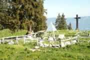
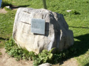
As the point is difficult to access, a stone was set 500 m further south-east on Älggi Alp (1645 m). This symbolizes the centre of Switzerland and is located at 46°47′54"N 8°13′55"E (Swiss Grid: 660557/183338). A plaque on the stone commemorates the winner of the "Swiss of the Year" award.

