
Florida State Road 39
Encyclopedia
State Road 39 is a north–south highway in eastern Pasco and Hillsborough County, Florida
, United States
. Between Plant City and Zephyrhills, the road is named Paul S. Buchman Highway. North of Zephyrhills, Florida
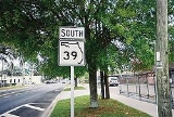
the road is a secret state designation for U.S. Route 301 until the southern terminus of the concurrency with U.S. Route 98 south of Dade City, Florida
.
 In 2007, a resurfacing project of US 98-301 in Dade City led to the exposure of the road's status as State Road 39, as detour signs popped up around downtown. This was also part of an effort to realign US 98-301 to the truck route. SRs 35
& 700 remain hidden state roads in this segment.
near Duette. The road is known as Kickliter Road from SR 62 to Florida State Road 674
in Fort Lonesome
, and Plant City-Picnic Road from SR 674 to SR 60.
, Former SR 39 ran along what is today US 98(SR 700) and old SR 50 to Croom-Rital Road. It then broke away from US 98/SR 50 and was the designation for Croom-Rital Road, a street which runs along what today is the Withlacoochee State Trail
, until reaching the unincorporated hamlet of Croom. North of Croom Road, SR 39 went onto Nobleton Road, which is a dirt road that also follows the Withlacoochee State Trail until it becomes the paved Edgewater Avenue, and crosses the trail heading into scenic Nobleton
, where it terminates and used to turns west to overlap Hernando CR 476. In Istachatta
, another former section exists as Hernando County Road 439, then crosses into Citrus County.
 When the road crosses into Pineola in Citrus County, it resumes its designation as County Road 39, however the designation exists in two sections. It winds along the Withlacoochee State Trail
, but eventually the trail moves to the northwest. After running across Bradley Lake, it finally terminates at Citrus County Road 48. The journey of former SR 39 doesn't end there though, as it secretly overlaps westbound along CR 48 towards Floral City, Florida
. North of Floral City, former SR 39 runs along Old Floral City Avenue, where it runs along the Withlacoochee State Trail past Citrus County Road 39A, and Fort Cooper State Park
, before entering Inverness South
.
Again between Stoke's Ferry at State Road 200 and US 41 in Citrus Springs, Florida
, Citrus County Road 39 winds along the south side of the Withlacoochee River as the Withlacoochee Trail.
Hillsborough County, Florida
As of the census of 2000, there were 998,948 people, 391,357 households, and 255,164 families residing in the county. The population density was 951 people per square mile . There were 425,962 housing units at an average density of 405 per square mile...
, United States
United States
The United States of America is a federal constitutional republic comprising fifty states and a federal district...
. Between Plant City and Zephyrhills, the road is named Paul S. Buchman Highway. North of Zephyrhills, Florida
Zephyrhills, Florida
Zephyrhills is a city in Pasco County, Florida. The population was 10,833 at the 2000 census. According to the U.S. Census Bureau's 2004 estimates, the city had a population of 11,854. It is a suburb of the Tampa Bay Metropolitan Statistical Area...
the road is a secret state designation for U.S. Route 301 until the southern terminus of the concurrency with U.S. Route 98 south of Dade City, Florida
Dade City, Florida
Dade City is a city in Pasco County, Florida. The population was 6,188 at the 2000 census. It is the county seat of Pasco County. Dade City is a suburb of the Tampa-St. Petersburg-Clearwater, Florida Metropolitan Statistical Area. As of 2004, the population recorded by the U.S...
.
Route description
Florida State Road 35
State Road 35 is a north–south state highway in the western counties of the U.S. state of Florida.-Route Description:It is mainly signed as a hidden route along U.S. Highways:*U.S. Route 17: Punta Gorda to Bartow....
& 700 remain hidden state roads in this segment.
Hillsborough and Manatee Counties
South of SR 60 former State Road 39 continues as Hillsborough County Road 39, through Manatee County into SR 62Florida State Road 62
State Road 62 extends through unincorporated Manatee and Hardee counties, and passes through Florida scrubland, from Parrish to near Bowling Green. The paved road is only two lanes wide over its entire route. It also cuts through the Manatee River basin. The road crosses Horse Creek and the North...
near Duette. The road is known as Kickliter Road from SR 62 to Florida State Road 674
Florida State Road 674
State Road 674 begins in Ruskin, Hillsborough County, Florida. The road runs east/west and is also known as College Avenue and Sun City Center Boulevard.-Major intersections:-References:*...
in Fort Lonesome
Fort Lonesome, Florida
Fort Lonesome is an unincorporated, rural ghost town located in southeastern Hillsborough County, Florida, United States, 36 miles southeast of Tampa. Its location is also west of the Little Manatee River State Park. A sawmill briefly revived the area with a few houses and three stores in the early...
, and Plant City-Picnic Road from SR 674 to SR 60.
Hernando County
In and around Ridge ManorRidge Manor, Florida
Ridge Manor is a census-designated place in Hernando County, Florida, United States. The population was 4,108 at the 2000 census.-Geography:Ridge Manor is located at ....
, Former SR 39 ran along what is today US 98(SR 700) and old SR 50 to Croom-Rital Road. It then broke away from US 98/SR 50 and was the designation for Croom-Rital Road, a street which runs along what today is the Withlacoochee State Trail
Withlacoochee State Trail
Withlacoochee State Trail is a long paved, multi-use, non-motorized rail trail in Florida located in Citrus, Hernando and Pasco counties.-The route:The southern terminus is at U.S. 98/301 south of Trilby, then runs north where it crosses over U.S...
, until reaching the unincorporated hamlet of Croom. North of Croom Road, SR 39 went onto Nobleton Road, which is a dirt road that also follows the Withlacoochee State Trail until it becomes the paved Edgewater Avenue, and crosses the trail heading into scenic Nobleton
Nobleton, Florida
Nobleton is a census-designated place in Hernando County, Florida, United States. The population was 160 at the 2000 census.-Geography:Nobleton is located at ....
, where it terminates and used to turns west to overlap Hernando CR 476. In Istachatta
Istachatta, Florida
Istachatta is a census-designated place in Hernando County, Florida, United States. The population was 65 at the 2000 census.-Geography:Istachatta is located at ....
, another former section exists as Hernando County Road 439, then crosses into Citrus County.
Citrus County Road 39
Withlacoochee State Trail
Withlacoochee State Trail is a long paved, multi-use, non-motorized rail trail in Florida located in Citrus, Hernando and Pasco counties.-The route:The southern terminus is at U.S. 98/301 south of Trilby, then runs north where it crosses over U.S...
, but eventually the trail moves to the northwest. After running across Bradley Lake, it finally terminates at Citrus County Road 48. The journey of former SR 39 doesn't end there though, as it secretly overlaps westbound along CR 48 towards Floral City, Florida
Floral City, Florida
Floral City is a census-designated place in Citrus County, Florida, United States. The population was 4,989 at the 2000 census.-Geography:Floral City is located at 28°44′N 82°18′W ....
. North of Floral City, former SR 39 runs along Old Floral City Avenue, where it runs along the Withlacoochee State Trail past Citrus County Road 39A, and Fort Cooper State Park
Fort Cooper State Park
Fort Cooper State Park is a historic site in Inverness, Florida, United States. It is located two miles south of Inverness, on U.S. 41 on South Old Floral City Road. On June 13, 1972, it was added to the U.S. National Register of Historic Places...
, before entering Inverness South
Inverness South
Inverness South was a provincial electoral district in Nova Scotia, Canada, that elected one member of the Nova Scotia House of Assembly. It existed from 1981 to 1993....
.
Again between Stoke's Ferry at State Road 200 and US 41 in Citrus Springs, Florida
Citrus Springs, Florida
Citrus Springs is a census-designated place in Citrus County, Florida, United States. The population was 4,157 at the 2000 census.-Geography:Citrus Springs is located at ....
, Citrus County Road 39 winds along the south side of the Withlacoochee River as the Withlacoochee Trail.
Former proposals
In the early 20th century, a connection between County Road 48 and SR 200 was planned to run along the west-north side of the Withlacoochee River. This is why there are two sections of CR 39 in Citrus County. It was proposed to end at US 41.Major intersections
| County | Location | Mile | Destinations | Notes |
|---|---|---|---|---|
| Hillsborough Hillsborough County, Florida As of the census of 2000, there were 998,948 people, 391,357 households, and 255,164 families residing in the county. The population density was 951 people per square mile . There were 425,962 housing units at an average density of 405 per square mile... |
0.00 | Southern Terminus of SR-39; Northern Terminus of CR-39 | ||
| Plant City Plant City, Florida Plant City is a city in Hillsborough County, Florida, in the United States, approximately midway between Brandon and Lakeland along Interstate 4. The population was 34,721 at the 2010 census.... |
5.43 |   |
||
| 5.64 |  |
|||
| 6.86 | Exit 21 on I-4 | |||
| Pasco Pasco County, Florida Pasco County is a county located in the U.S. state of Florida. As of 2000, the population was 344,765. The July 1, 2007 census estimate according to the U.S. Census Bureau for the county is 462,715. Its county seat is Dade City, Florida which is in the northeast part of the county - somewhat... |
Zephyrhills Zephyrhills, Florida Zephyrhills is a city in Pasco County, Florida. The population was 10,833 at the 2000 census. According to the U.S. Census Bureau's 2004 estimates, the city had a population of 11,854. It is a suburb of the Tampa Bay Metropolitan Statistical Area... |
19.91 | Northern Terminus of SR-39 |