
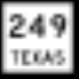
Farm to Market Road 149
Encyclopedia
Farm to Market Road 149 is a farm to market road
in the U.S. state
of Texas
. It runs approximately 48.3 miles (77.7 km) in Montgomery
and Grimes counties, connecting the county seats of Montgomery
and Anderson
.
at the current north end of , where that road transitions into toward Magnolia
. The route travels north through unincorporated Montgomery County
before entering the county seat of Montgomery
, where it crosses . FM 149 then passes to the west of Lake Conroe
and enters the Sam Houston National Forest
, where it beings to turn to the west. The highway crosses into Grimes County, where it is signed as a west–east route, and passes through Richards
before turning to the southwest. In the county seat of Anderson
, FM 149 has a one-block concurrency with before resuming its westward course. FM 149 ends at an intersection with approximately 4 miles (6.4 km) west of Anderson.
FM 149 has one spur route, FM Spur 149, in Montgomery County. The spur route is approximately 1.4 miles (2.3 km) in length, and allows movement between northbound FM 149 and eastbound .
and Richards
inside Grimes County. Later that year, it was extended twice, first to the Montgomery County
line and then to Deckers Prairie. The designation was extended down the Tomball Road to (later ) in Houston
by 1949. In 1957, the route was extended beyond Anderson to its current western terminus (now ). The spur connection to was added in 1968. The road was truncated to its current length in 1988, when the section from the southern terminus at to Interstate 45 was transferred to .
Farm to Market Road
In the United States, a farm-to-market road or ranch-to-market road is a state road or county road which serves to connect rural or agricultural areas to market towns...
in the U.S. state
U.S. state
A U.S. state is any one of the 50 federated states of the United States of America that share sovereignty with the federal government. Because of this shared sovereignty, an American is a citizen both of the federal entity and of his or her state of domicile. Four states use the official title of...
of Texas
Texas
Texas is the second largest U.S. state by both area and population, and the largest state by area in the contiguous United States.The name, based on the Caddo word "Tejas" meaning "friends" or "allies", was applied by the Spanish to the Caddo themselves and to the region of their settlement in...
. It runs approximately 48.3 miles (77.7 km) in Montgomery
Montgomery County, Texas
Montgomery County is a county located in the U.S. state of Texas within the Houston–Sugar Land–Baytown metropolitan area. The county was created by an act of the Congress of the Republic of Texas on December 14, 1837. The county was named for the town of Montgomery, Texas. In 2000, its...
and Grimes counties, connecting the county seats of Montgomery
Montgomery, Texas
Montgomery is a city located in Montgomery County, Texas. As of the 2000 census, the city had a total population of 489. It is the birthplace of the Lone Star Flag of Texas.-History:...
and Anderson
Anderson, Texas
Anderson is a city in Grimes County, Texas, United States. The population was 280 in 2009. It is the county seat. The city and its surroundings are listed on the National Register of Historic Places as the Anderson Historic District.-Geography:...
.
Route description
FM 149 has a southern terminus in PinehurstPinehurst, Montgomery County, Texas
Pinehurst is a census-designated place in Montgomery County, Texas, United States. The population was 4,266 at the 2000 census.-Geography:Pinehurst is located at ....
at the current north end of , where that road transitions into toward Magnolia
Magnolia, Texas
Magnolia is a city in southwestern Montgomery County, Texas, United States outside Houston and right next to The Woodlands. The population was 1,111 at the 2000 census. Settled in the late 1840s, the town has gone by several names including "Mink's Prairie" and "Mink".-Geography:Magnolia is located...
. The route travels north through unincorporated Montgomery County
Montgomery County, Texas
Montgomery County is a county located in the U.S. state of Texas within the Houston–Sugar Land–Baytown metropolitan area. The county was created by an act of the Congress of the Republic of Texas on December 14, 1837. The county was named for the town of Montgomery, Texas. In 2000, its...
before entering the county seat of Montgomery
Montgomery, Texas
Montgomery is a city located in Montgomery County, Texas. As of the 2000 census, the city had a total population of 489. It is the birthplace of the Lone Star Flag of Texas.-History:...
, where it crosses . FM 149 then passes to the west of Lake Conroe
Lake Conroe
Lake Conroe is a 21,000 acre lake in Montgomery County, Texas, United States. Even though it is named Lake Conroe, only a small portion of the lake is in Conroe, Texas. Most of the lake is in Montgomery, Texas and Willis, Texas. The lake lies on the West Fork of the San Jacinto River just west of...
and enters the Sam Houston National Forest
Sam Houston National Forest
The Sam Houston National Forest, one of four National Forests in Texas, is located 50 miles north of Houston. The forest is administered together with the other three United States National Forests and two National Grasslands located entirely in Texas, from common offices in Lufkin, Texas...
, where it beings to turn to the west. The highway crosses into Grimes County, where it is signed as a west–east route, and passes through Richards
Richards, Texas
Richards is an unincorporated community in Grimes County, Texas, United States located on Farm roads 1486 and 149 and the Burlington-Rock Island line in east central Grimes County.-Education:...
before turning to the southwest. In the county seat of Anderson
Anderson, Texas
Anderson is a city in Grimes County, Texas, United States. The population was 280 in 2009. It is the county seat. The city and its surroundings are listed on the National Register of Historic Places as the Anderson Historic District.-Geography:...
, FM 149 has a one-block concurrency with before resuming its westward course. FM 149 ends at an intersection with approximately 4 miles (6.4 km) west of Anderson.
FM 149 has one spur route, FM Spur 149, in Montgomery County. The spur route is approximately 1.4 miles (2.3 km) in length, and allows movement between northbound FM 149 and eastbound .
History
FM 149 was created in 1945 as a short spur between AndersonAnderson, Texas
Anderson is a city in Grimes County, Texas, United States. The population was 280 in 2009. It is the county seat. The city and its surroundings are listed on the National Register of Historic Places as the Anderson Historic District.-Geography:...
and Richards
Richards, Texas
Richards is an unincorporated community in Grimes County, Texas, United States located on Farm roads 1486 and 149 and the Burlington-Rock Island line in east central Grimes County.-Education:...
inside Grimes County. Later that year, it was extended twice, first to the Montgomery County
Montgomery County, Texas
Montgomery County is a county located in the U.S. state of Texas within the Houston–Sugar Land–Baytown metropolitan area. The county was created by an act of the Congress of the Republic of Texas on December 14, 1837. The county was named for the town of Montgomery, Texas. In 2000, its...
line and then to Deckers Prairie. The designation was extended down the Tomball Road to (later ) in Houston
Houston, Texas
Houston is the fourth-largest city in the United States, and the largest city in the state of Texas. According to the 2010 U.S. Census, the city had a population of 2.1 million people within an area of . Houston is the seat of Harris County and the economic center of , which is the ...
by 1949. In 1957, the route was extended beyond Anderson to its current western terminus (now ). The spur connection to was added in 1968. The road was truncated to its current length in 1988, when the section from the southern terminus at to Interstate 45 was transferred to .