

Eyres Monsell
Encyclopedia
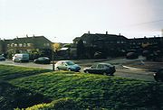
Eyres Monsell is an electoral ward
and administrative division of the city of Leicester
, England
, comprising the southern Leicester suburb of Eyres Monsell.
districts of Blaby
and Oadby and Wigston
.
, UK
. The area is defined by Saffron Lane to the east, the Birmingham to Peterborough railway
to the south, Lutterworth Road to the west, and Glenhills Way to the north. Although located in the far south-west corner of suburban Leicester, the area is under the administration of the city council
rather than the county council
as many of its neighbouring estates are.
The land was purchased by the corporation of Leicester for housing development purposes for £40,500 by compulsory purchase order
in the early 1950s. The area takes its name from the previous land owner, Bolton Eyres Monsell
. The largely rural area was purchased with an aim to avoid the spatial limitations that had led to the foreboding tower blocks and intimidating alleyways of inner city developments and to provide a greener and more open plan estate. Eyres Monsell would become Leicester's second largest estate to be built after World War Two.
 Today, Eyres Monsell has a population of approximately 11230 people over 4669 homesteads. Proportionately more council homes in Eyres Monsell have been bought by their owners than in any other part of the city. Although, almost 50% of homes in the area are still rented from the city council.
It is also noteworthy that as a suburb of Leicester, one of the most multi-racial cities in the UK, the population of Eyres Monsell is almost 95% white British according to 2001 Census data.
Service 40 (Circle Line) and First Leicester Services 88/88A.
Wards of the United Kingdom
A ward in the United Kingdom is an electoral district at sub-national level represented by one or more councillors. It is the primary unit of British administrative and electoral geography .-England:...
and administrative division of the city of Leicester
Leicester
Leicester is a city and unitary authority in the East Midlands of England, and the county town of Leicestershire. The city lies on the River Soar and at the edge of the National Forest...
, England
England
England is a country that is part of the United Kingdom. It shares land borders with Scotland to the north and Wales to the west; the Irish Sea is to the north west, the Celtic Sea to the south west, with the North Sea to the east and the English Channel to the south separating it from continental...
, comprising the southern Leicester suburb of Eyres Monsell.
Geography
Eyres Monsell is bounded to the north by the wards of Aylestone, Freemen and Knighton. South and west of the area are the LeicestershireLeicestershire
Leicestershire is a landlocked county in the English Midlands. It takes its name from the heavily populated City of Leicester, traditionally its administrative centre, although the City of Leicester unitary authority is today administered separately from the rest of Leicestershire...
districts of Blaby
Blaby
Blaby is a village in central Leicestershire, England, some five miles south of Leicester city centre. It has population of around 6,240 , and its proximity to the city causes it to form part of the Leicester Urban Area....
and Oadby and Wigston
Oadby and Wigston
Oadby and Wigston is a local government district and borough in the English county of Leicestershire.-Geography:It is composed of the areas of Oadby, Wigston Magna and South Wigston. It is predominantly urban, and runs directly into Leicester, to the north-west...
.
History
Eyres Monsell is a former council estate in the southern suburbs of LeicesterLeicester
Leicester is a city and unitary authority in the East Midlands of England, and the county town of Leicestershire. The city lies on the River Soar and at the edge of the National Forest...
, UK
United Kingdom
The United Kingdom of Great Britain and Northern IrelandIn the United Kingdom and Dependencies, other languages have been officially recognised as legitimate autochthonous languages under the European Charter for Regional or Minority Languages...
. The area is defined by Saffron Lane to the east, the Birmingham to Peterborough railway
Birmingham to Peterborough Line
The Birmingham to Peterborough Line is a cross-country railway line in the United Kingdom, linking Birmingham to Peterborough, via Nuneaton and Leicester....
to the south, Lutterworth Road to the west, and Glenhills Way to the north. Although located in the far south-west corner of suburban Leicester, the area is under the administration of the city council
Leicester City Council
Leicester City Council is a unitary authority responsible for local government in the city of Leicester, England. It consists of 54 councillors, representing 22 wards in the city, overseen by a directly elected mayor. It is currently controlled by the Labour Party and has been led by Mayor Sir...
rather than the county council
Leicestershire County Council
Leicestershire County Council is the county council for the English non-metropolitan county of Leicestershire. It was originally formed in 1889 by the Local Government Act 1888. The county is divided into 52 electoral divisions, which return a total of 55 councillors. The council is controlled by...
as many of its neighbouring estates are.
The land was purchased by the corporation of Leicester for housing development purposes for £40,500 by compulsory purchase order
Compulsory purchase order
A compulsory purchase order is a legal function in the United Kingdom and the Republic of Ireland that allows certain bodies which need to obtain land or property to do so without the consent of the owner. It may be enforced if a proposed development is considered one for public betterment - for...
in the early 1950s. The area takes its name from the previous land owner, Bolton Eyres Monsell
Bolton Eyres-Monsell, 1st Viscount Monsell
Bolton Meredith Eyres-Monsell, 1st Viscount Monsell, GBE, PC was a British Conservative Party politician who served as Chief Whip until 1931 and then as First Lord of the Admiralty.His parents were Lt.Col...
. The largely rural area was purchased with an aim to avoid the spatial limitations that had led to the foreboding tower blocks and intimidating alleyways of inner city developments and to provide a greener and more open plan estate. Eyres Monsell would become Leicester's second largest estate to be built after World War Two.
Demographics
It is also noteworthy that as a suburb of Leicester, one of the most multi-racial cities in the UK, the population of Eyres Monsell is almost 95% white British according to 2001 Census data.
Transport
Eyres Monsell is served by Arriva Leicester Services 47/48, 86/87, CentrebusCentrebus
Centrebus is a privately owned company that operate a number of services around Leicester and Leicestershire, Grantham, Hertfordshire and Bedfordshire, mainly in areas where Arriva has scaled down its bus operations. Centrebus also competes with Arriva on some routes in Leicester, Luton and Stevenage...
Service 40 (Circle Line) and First Leicester Services 88/88A.