
Enterprise, Kansas
Encyclopedia
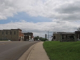
Enterprise is a city in Dickinson County
, Kansas
, United States
. As of the 2010 census, the city population was 855.
In 1887, Atchison, Topeka and Santa Fe Railway
built a branch line from Neva (3 miles west of Strong City
) through Enterprise to Superior, Nebraska
. In 1996, the Atchison, Topeka and Santa Fe Railway
merged with Burlington Northern Railroad
and renamed to the current BNSF Railway
. Most locals still refer to this railroad as the "Santa Fe".
, the city has a total area of 0.7 square miles (1.8 km²), of which, 0.6 square miles (1.6 km²) of it is land and 1.49% is water.
of 2000, there were 836 people, 299 households, and 218 families residing in the city. The population density
was 1,276.4 people per square mile (496.6/km²). There were 334 housing units at an average density of 509.9 per square mile (198.4/km²). The racial makeup of the city was 96.77% White, 0.24% African American, 0.84% Native American, 0.12% Asian, and 2.03% from two or more races. Hispanic or Latino of any race were 0.84% of the population.
There were 299 households out of which 37.1% had children under the age of 18 living with them, 59.5% were married couples
living together, 9.7% had a female householder with no husband present, and 26.8% were non-families. 23.7% of all households were made up of individuals and 12.0% had someone living alone who was 65 years of age or older. The average household size was 2.64 and the average family size was 3.11.
In the city the population was spread out with 27.6% under the age of 18, 7.3% from 18 to 24, 23.9% from 25 to 44, 21.5% from 45 to 64, and 19.6% who were 65 years of age or older. The median age was 38 years. For every 100 females there were 82.1 males. For every 100 females age 18 and over, there were 80.6 males.
The median income for a household in the city was $36,613, and the median income for a family was $39,479. Males had a median income of $28,214 versus $20,357 for females. The per capita income
for the city was $15,619. About 7.8% of families and 8.5% of the population were below the poverty line, including 7.0% of those under age 18 and 11.3% of those age 65 or over.
473.
Schools
Historical
Maps
Dickinson County, Kansas
Dickinson County is a county located in Central Kansas, in the Central United States. As of the 2010 census, the county population was 19,754. Its county seat and most populous city is Abilene. It was named in honor of Daniel S. Dickinson.-19th century:In 1887, Mr. Herington successfully got...
, Kansas
Kansas
Kansas is a US state located in the Midwestern United States. It is named after the Kansas River which flows through it, which in turn was named after the Kansa Native American tribe, which inhabited the area. The tribe's name is often said to mean "people of the wind" or "people of the south...
, United States
United States
The United States of America is a federal constitutional republic comprising fifty states and a federal district...
. As of the 2010 census, the city population was 855.
History
On January 10, 1883, the Enterprise Town Company, capital $50,000, was organized. The following officers were elected: V. P. Wilson, president; John Johntz, vice-president; C. Hoffman, treasurer; T. C. Henry, secretary.In 1887, Atchison, Topeka and Santa Fe Railway
Atchison, Topeka and Santa Fe Railway
The Atchison, Topeka and Santa Fe Railway , often abbreviated as Santa Fe, was one of the larger railroads in the United States. The company was first chartered in February 1859...
built a branch line from Neva (3 miles west of Strong City
Strong City, Kansas
Strong City is a city in Chase County, Kansas, United States. It is named after William Barstow Strong, former president of the Atchison, Topeka and Santa Fe Railway. As of the 2010 census, the city population was 485.-19th century:...
) through Enterprise to Superior, Nebraska
Superior, Nebraska
Superior is a city in Nuckolls County, Nebraska, United States. As of the 2010 census, the city population was 1,957.Superior bills itself as the "Victorian Capital of Nebraska", and holds an annual Victorian Festival...
. In 1996, the Atchison, Topeka and Santa Fe Railway
Atchison, Topeka and Santa Fe Railway
The Atchison, Topeka and Santa Fe Railway , often abbreviated as Santa Fe, was one of the larger railroads in the United States. The company was first chartered in February 1859...
merged with Burlington Northern Railroad
Burlington Northern Railroad
The Burlington Northern Railroad was a United States-based railroad company formed from a merger of four major U.S. railroads. Burlington Northern operated between 1970 and 1996....
and renamed to the current BNSF Railway
BNSF Railway
The BNSF Railway is a wholly owned subsidiary of Berkshire Hathaway Inc., and is headquartered in Fort Worth, Texas. It is one of seven North American Class I railroads and the second largest freight railroad network in North America, second only to the Union Pacific Railroad, its primary...
. Most locals still refer to this railroad as the "Santa Fe".
Geography
Enterprise is located at 38°54′9"N 97°7′5"W (38.902485, -97.118172). According to the United States Census BureauUnited States Census Bureau
The United States Census Bureau is the government agency that is responsible for the United States Census. It also gathers other national demographic and economic data...
, the city has a total area of 0.7 square miles (1.8 km²), of which, 0.6 square miles (1.6 km²) of it is land and 1.49% is water.
Demographics
As of the censusCensus
A census is the procedure of systematically acquiring and recording information about the members of a given population. It is a regularly occurring and official count of a particular population. The term is used mostly in connection with national population and housing censuses; other common...
of 2000, there were 836 people, 299 households, and 218 families residing in the city. The population density
Population density
Population density is a measurement of population per unit area or unit volume. It is frequently applied to living organisms, and particularly to humans...
was 1,276.4 people per square mile (496.6/km²). There were 334 housing units at an average density of 509.9 per square mile (198.4/km²). The racial makeup of the city was 96.77% White, 0.24% African American, 0.84% Native American, 0.12% Asian, and 2.03% from two or more races. Hispanic or Latino of any race were 0.84% of the population.
There were 299 households out of which 37.1% had children under the age of 18 living with them, 59.5% were married couples
Marriage
Marriage is a social union or legal contract between people that creates kinship. It is an institution in which interpersonal relationships, usually intimate and sexual, are acknowledged in a variety of ways, depending on the culture or subculture in which it is found...
living together, 9.7% had a female householder with no husband present, and 26.8% were non-families. 23.7% of all households were made up of individuals and 12.0% had someone living alone who was 65 years of age or older. The average household size was 2.64 and the average family size was 3.11.
In the city the population was spread out with 27.6% under the age of 18, 7.3% from 18 to 24, 23.9% from 25 to 44, 21.5% from 45 to 64, and 19.6% who were 65 years of age or older. The median age was 38 years. For every 100 females there were 82.1 males. For every 100 females age 18 and over, there were 80.6 males.
The median income for a household in the city was $36,613, and the median income for a family was $39,479. Males had a median income of $28,214 versus $20,357 for females. The per capita income
Per capita income
Per capita income or income per person is a measure of mean income within an economic aggregate, such as a country or city. It is calculated by taking a measure of all sources of income in the aggregate and dividing it by the total population...
for the city was $15,619. About 7.8% of families and 8.5% of the population were below the poverty line, including 7.0% of those under age 18 and 11.3% of those age 65 or over.
Primary and secondary education
Enterprise is part of Unified School DistrictUnified school district
A unified school district or unit school district is a school district which includes both primary school and high school under the same district control....
473.
Further reading
- Kansas : A Cyclopedia of State History, Embracing Events, Institutions, Industries, Counties, Cities, Towns, Prominent Persons, Etc; 3 Volumes; Frank W. Blackmar; Standard Publishing Co; 944 / 955 / 824 pages; 1912. (Volume1 - Download 54MB PDF eBook), (Volume2 - Download 53MB PDF eBook), (Volume3 - Download 33MB PDF eBook)
External links
CitySchools
- USD 473, local school district
Historical
Maps
- Enterprise City Map, KDOT
- Dickinson County Map, KDOT