
Encanto, San Diego, California
Encyclopedia
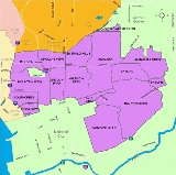
Southeast San Diego
Southeast San Diego is the southeastern portion of the City of San Diego, generally represented by the urban neighborhoods directly east of Downtown San Diego, bordered by Interstate 5 and south of the Martin Luther King Jr...
part of San Diego, California
California
California is a state located on the West Coast of the United States. It is by far the most populous U.S. state, and the third-largest by land area...
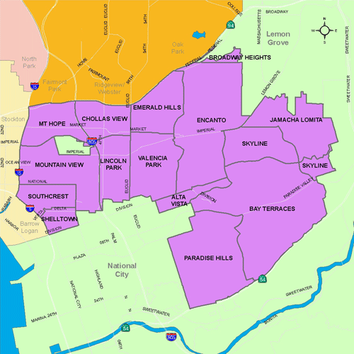
. The neighborhood of Encanto is split into two sections, North Encanto (which lies north of Broadway), and South Encanto (which lies south of Broadway).
The name Encanto usually refers to the neighborhood of Encanto, but it can also refer to the Encanto Neighborhoods planning area, which consists of Chollas View, Lincoln Park
Lincoln Park, San Diego
Lincoln Park is a community in the southeastern section of San Diego, California. It is bordered by Chollas View and the San Diego Trolley on the north, Mountain View and Interstate 805 on the west, Valencia Park and Euclid Avenue on the east, and National City, California on the south...
, Emerald Hills
Emerald Hills, San Diego
Emerald Hills is a community in the southeastern section of the city of San Diego. It is bordered by Oak Park and California State Route 94 on the north, Chollas View and Euclid Avenue on the west, Encanto on the east, and Valencia Park and Market Street on the south...
, Valencia Park, Encanto, South Encanto, Broadway Heights, and Alta Vista.
Encanto is a predominantly a low-density residential community, with commercial and industrial businesses located near major streets. Encanto and the adjacent neighborhoods are going through revitalization with such programs as the Chollas Creek
Chollas Creek
Chollas Creek is an urban creek in the city of San Diego that drains to the San Diego Bay. It is also the name of a populated area of City Heights, San Diego, California.Chollas Creek arises in Lemon Grove and La Mesa, where its four branches begin...
Enhancement Program, which focuses on open space and restoring native vegetation.
Geography
Encanto's borders include: the San Diego neighborhood of Broadway HeightsBroadway Heights, San Diego
Broadway Heights is a small community in the southeastern section of the city of San Diego. It is bordered on the north, east, and west by Lemon Grove, and on the south by Encanto and Mallard Street. The predominantly African-American community has 629 residents and zero businesses within its seven...
and Martin Luther King Jr. Freeway (SR 94)
California State Route 94
State Route 94 in the U.S. state of California is the Martin Luther King Jr. Freeway from Interstate 5 in Downtown San Diego to the end of the freeway portion past Route 125 in Spring Valley; the non-freeway segment of SR 94 is Campo Road....
on the north, the neighborhood of Alta Vista on the south, the neighborhoods of Emerald Hills
Emerald Hills, San Diego
Emerald Hills is a community in the southeastern section of the city of San Diego. It is bordered by Oak Park and California State Route 94 on the north, Chollas View and Euclid Avenue on the west, Encanto on the east, and Valencia Park and Market Street on the south...
and Valencia Park on the west, and the neighborhoods of Skyline and Jamacha, and the city of Lemon Grove on the east.